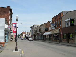
Coraopolis is a borough in Allegheny County, Pennsylvania, United States, along the Ohio River. The population was 5,559 at the 2020 census.

Neville Township is a township in Allegheny County, Pennsylvania, United States. Its land area consists entirely of Neville Island, which is an island on the Ohio River. The population was 1,108 at the 2020 census.

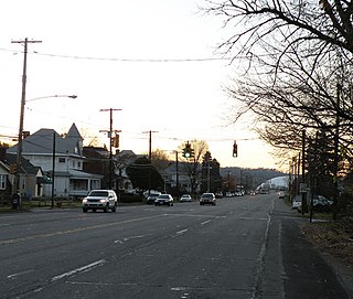
Stowe Township is a township in Allegheny County, Pennsylvania, United States. The population was 6,362 at the 2010 census.

The Roberto Clemente Bridge, also known as the Sixth Street Bridge, spans the Allegheny River in downtown Pittsburgh, Pennsylvania, United States.

The Coraopolis Bridge[1] is a girder bridge over the back channel of the Ohio River connecting Grand Avenue on Neville Island to Ferree Street in Coraopolis, Pennsylvania. It opened in 1995 to replace a structure of historic significance. The original Pratt/Bowstring/Pennsylvania[2] through truss spans, designed by Theodore Cooper, were formerly the (third) Sixth Street Bridge, spanning the Allegheny River, in downtown Pittsburgh, and were built in 1892 by the Union Bridge Company. They were floated downstream by the Foundation Company in 1927 rather than being demolished when the bridge was removed to enable construction of the present (fourth) Three Sisters (Pittsburgh) Sixth Street Self-anchored suspension bridge. However, by the late 1980s, the old bridge could no longer support traffic volumes and was replaced by a newer structure.

Pennsylvania Route 28 is a major state highway, which runs for 98 miles (158 km) from Anderson Street in Pittsburgh to U.S. Route 219 (US 219) in Brockway in Pennsylvania in the United States.

The Sewickley Bridge is a steel continuous truss bridge spanning the Ohio River between Sewickley and Moon Township, Pennsylvania, carrying State Route 4025 and the Orange Belt. It was built by American Bridge Company and opened on October 21, 1981.

The South Tenth Street Bridge, most often called the Tenth Street Bridge, but officially dubbed the Philip Murray Bridge, is a suspension bridge that spans the Monongahela River in Downtown Pittsburgh, Pennsylvania.

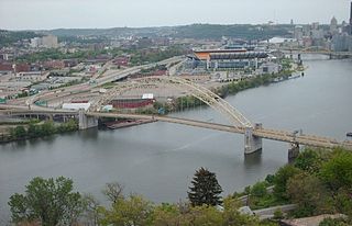
The West End Bridge is a steel tied-arch bridge over the Ohio River in Pittsburgh, Pennsylvania, approximately 1 mile (1.6 km) below the confluence of the Allegheny and Monongahela Rivers. It connects the West End to the Chateau neighborhood on the North Side of Pittsburgh.

The Rachel Carson Bridge, also known as the Ninth Street Bridge, spans the Allegheny River in Downtown Pittsburgh, Pennsylvania in the United States.

The Neville Island Bridge is a tied arch bridge which carries Interstate 79 and the Yellow Belt across the Ohio River and over Neville Island, west of Pittsburgh, Pennsylvania.

Pennsylvania Route 51 is a major state highway that is located in Western Pennsylvania in the United States. It runs for 89 miles (143 km) from Uniontown to the Ohio state line near Darlington, where it connects with Ohio State Route 14.

The Panther Hollow Bridge is an American steel, three-hinged, deck arch bridge that carries Panther Hollow Road over Panther Hollow in Schenley Park in Pittsburgh, Pennsylvania.

The Jonathon Hulton Bridge, built in 1908, was the first major bridge designed by Allegheny County, Pennsylvania. Spanning the Allegheny River, it connected the eastern Pittsburgh suburbs of Oakmont and Harmarville, Pennsylvania.

The Herr's Island Railroad Bridge, also known as the West Penn Railroad Bridge, is a truss bridge across the Allegheny River in the United States between the Pittsburgh neighborhoods of Troy Hill and Herrs Island.

The Senator Robert D. Fleming Bridge, commonly known as the 62nd Street Bridge, is a truss bridge that carries Pennsylvania Route 8 across the Allegheny River between the Pittsburgh neighborhoods of Morningside and Lawrenceville and Sharpsburg, Pennsylvania.

The PC&Y Railroad Bridge carries a single railroad track over the Ohio River, between Stowe Township, Pennsylvania and Neville Island, Pennsylvania.

Coraopolis station is a disused train station in Coraopolis, Pennsylvania. The train station was built in 1896 by the Pittsburgh and Lake Erie Railroad, and designed by architects Shepley, Rutan and Coolidge in Richardsonian Romanesque style.

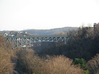
The Charles Anderson Memorial Bridge is a steel deck truss bridge located in Pittsburgh, Pennsylvania, United States. The bridge carries the four-lane roadway of Boulevard of the Allies across a ravine known as Junction Hollow, connecting the neighborhoods of Central Oakland and South Oakland with Schenley Park. The bridge also spans the Junction Hollow Trail and P&W Subdivision railroad tracks which run along the bottom of the valley.


