 North portal | |
| Overview | |
|---|---|
| Location | Stowe Township, Pennsylvania |
| Coordinates |
|
| Operation | |
| Opened | 1909 |
| Owner | PennDOT |
| Technical | |
| Length | 495 feet (estimated) |
| No. of lanes | 2 |
| Tunnel clearance |
|

The Stowe Tunnel is a road tunnel in Stowe Township, Pennsylvania.
| North portal | |
| Overview | |
|---|---|
| Location | Stowe Township, Pennsylvania |
| Coordinates |
|
| Operation | |
| Opened | 1909 |
| Owner | PennDOT |
| Technical | |
| Length | 495 feet (estimated) |
| No. of lanes | 2 |
| Tunnel clearance |
|
The Stowe Tunnel is a road tunnel in Stowe Township, Pennsylvania.
The Stowe Tunnel was built in 1909 and was significantly renovated in 1940 and 2021. [1]
The tunnel has been plagued with issues since its construction, in 1929 the tunnel was closed to vehicles due to deteriorating conditions. The tunnel continued to be used for pedestrian traffic especially to Stowe Township High School. When the tunnel was closed to pedestrian traffic students tore down the barricades. The tunnel was successfully closed in 1938 with a student strike ensuing. The effort to return the tunnel to service began in 1940. A partial tunnel collapse in Nov. 7, 1940 claimed the lives of five people, Haywood Turner, Charles Rosborough, Harper Fair, George Russell, and John Wright. [2]
The Pennsylvania Turnpike, sometimes shortened to Penna Turnpike or PA Turnpike, is a controlled-access toll road that is operated by the Pennsylvania Turnpike Commission (PTC) in the Commonwealth of Pennsylvania in the United States. It runs for 360 miles (580 km) across the state, connecting Pittsburgh in Western Pennsylvania with Philadelphia in eastern Pennsylvania, and passes through four tunnels as it crosses the Appalachian Mountains in central Pennsylvania.

The Blackwall Tunnel is a pair of road tunnels underneath the River Thames in east London, England, linking the London Borough of Tower Hamlets with the Royal Borough of Greenwich, and part of the A102 road. The northern portal lies just south of the East India Dock Road (A13) in Blackwall; the southern entrances are just south of The O2 on the Greenwich Peninsula. The road is managed by Transport for London (TfL).
A chicane is a serpentine curve in a road, added by design rather than dictated by geography. Chicanes add extra turns and are used both in motor racing and on roads and streets to slow traffic for safety. For example, one form of chicane is a short, shallow S-shaped turn that requires the driver to turn slightly left and then slightly right to continue on the road, requiring the driver to reduce speed. The word chicane is derived from the French verb chicaner, which means "to create difficulties" or "to dispute pointlessly", "quibble", which is also the root of the English noun chicanery. The Spanish verb chicanear also means "to use trickery".

Pedestrian zones are areas of a city or town restricted to use by people on foot or human-powered transport such as bicycles, with non-emergency motor traffic not allowed. Converting a street or an area to pedestrian-only use is called pedestrianisation.
The Bayonne Bridge is an arch bridge that spans the Kill Van Kull between Staten Island, New York and Bayonne, New Jersey. It carries New York State Route 440 and New Jersey Route 440, with the two roads connecting at the state border at the river’s center. It has the sixth-longest steel arch mainspan in the world, the longest in the world at the time of its completion. The bridge is also one of four connecting New Jersey with Staten Island; the other two roadway bridges are the Goethals Bridge in Elizabeth and Outerbridge Crossing in Perth Amboy, and the rail-only span is the Arthur Kill Vertical Lift Bridge, all of which cross the Arthur Kill.
The Queens–Midtown Tunnel is a vehicular tunnel under the East River in New York City, connecting the boroughs of Manhattan and Queens. The tunnel consists of a pair of tubes, each carrying two lanes. The west end of the tunnel is located on the East Side of Midtown Manhattan, while the east end of the tunnel is located in Long Island City in Queens. Interstate 495 (I-495) runs the entire length of the tunnel; I-495's western terminus is at the Manhattan portal of the tunnel.
Columbia University in New York City has an extensive tunnel system underneath its Morningside Heights campus connecting many of its buildings, used by the university as conduits for steam, electricity, telecommunications, and other infrastructure. Throughout their history, the tunnels have also been used for other purposes, mostly centering around transportation. During the first half of the 20th century, they were used by students to avoid aboveground traffic. When the university housed the Manhattan Project, they were allegedly used to move radioactive material between buildings. During the Columbia University protests of 1968, students used the tunnels to facilitate their occupation of buildings on campus.

Thane Creek, previously Thana Creek, is an estuary of the Arabian Sea and one of the two main distributaries of the Ulhas River, in Konkan division of Maharashtra, India. The Ulhas splits at the northeast corner of Salsette island into its two main distributaries, the other one being the Vasai Creek, both of which empty into the Arabian Sea. The creek forms the eastern boundary of Salsette island and separates the island from mainland of Konkan. It gets its name from the city of Thane, previously Thana, located on eastern banks of the creek.

Gibraltar International Airport, previously known as North Front Airport, is the civilian airport that serves the British overseas territory of Gibraltar. The runway and aerodrome is owned by the Ministry of Defence (MoD), and operated by the Royal Air Force (RAF) as RAF Gibraltar. Civilian operators use the civilian-operated terminal. National Air Traffic Services (NATS) hold the contract for provision of air navigation services at the airport.

The Clyde Tunnel is a crossing beneath the River Clyde in Glasgow, Scotland for road traffic, cyclists and pedestrians. Two parallel tunnel tubes connect the districts of Whiteinch to the north and Govan to the south in the west of the city.

Queensway is the name of a number of roads in central Birmingham, England, but most often refers to the Queensway tunnel, part of the A38. Queensway is the suffix of several other roads and circuses, such as Smallbrook Queensway and Colmore Circus Queensway; all of which were once part of the historic A4400 Inner Ring Road, often called collectively the Queensway.

A subway, also known as an underpass, is a grade-separated pedestrian crossing running underneath a road or railway in order to entirely separate pedestrians and cyclists from motor or train traffic.

The Canal Street station is a local station on the IRT Broadway–Seventh Avenue Line of the New York City Subway, located at the intersection of Canal and Varick Streets in the TriBeCa and SoHo neighborhoods of Manhattan, it is served by the 1 train at all times and by the 2 train during late nights.

Storrow Drive, officially James Jackson Storrow Memorial Drive, is a major crosstown parkway in Boston, Massachusetts, running east–west along the southern bank of the Charles River. It is restricted to cars; trucks and buses are not permitted on it, while pedestrian access is available via walking paths on the Charles River side of the road. Boston drivers use the route for quick access to downtown locations.

A street running train is a train which runs on a track built on public streets. The rails are embedded in the roadway, and the train shares the street with other users, such as pedestrians, cars and cyclists, thus often being referred to as running in mixed traffic. Tram and light rail systems frequently run on streets, with light rail lines typically separated from other traffic.

The Mount Baker Tunnel or Mount Baker Ridge Tunnel carries Interstate 90 under the Mount Baker neighborhood of Seattle, Washington. It is actually a group of three tubes that carry eight lanes of freeway traffic, plus a separate path for bicycles and pedestrians. The original tubes are twin tunnel bores completed in 1940 and rehabilitated in 1993. The new Mount Baker Tunnel was built north of the original tunnels and opened in June 1989. The tunnel has a double-decked roadway with the bicycle/pedestrian path above the traffic lanes.

Floating Bridge is a pontoon bridge located in Dubai, United Arab Emirates. The bridge is the first of its kind in the region and was built to try to reduce traffic congestion on the Al Garhoud and Al Maktoum Bridges. The Floating Bridge is the fifth crossing on Dubai Creek, the others being Al Shindagha Tunnel, Al Maktoum Bridge, Al Garhoud Bridge, Infinity Bridge and Business Bay Crossing.

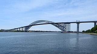
The Fleming Park Bridge is a through truss bridge which spans the back channel of the Ohio River, between Neville Island and Stowe Township, PA. Although the Ohio River's back channel is only 590 feet wide, roughly 660 feet of this newer bridge was erected over water due to the unique 65-degree angle of the structure's trajectory.
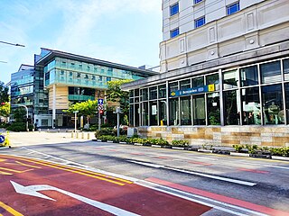
Bencoolen MRT station is an underground Mass Rapid Transit (MRT) station on the Downtown Line (DTL) in Singapore. Located under Bencoolen Street, the station serves primarily the Nanyang Academy of Fine Arts (NAFA), Singapore Management University and surrounding developments. At 43 metres (141 ft) below street level, Bencoolen is the deepest station in Singapore.
| | This article related to a building or structure in Pittsburgh is a stub. You can help Wikipedia by expanding it. |
| | This article about transportation in Pennsylvania is a stub. You can help Wikipedia by expanding it. |
This United States tunnel–related article is a stub. You can help Wikipedia by expanding it. |