Old Shawneetown, Illinois

Last updated

Old Shawneetown, Illinois
Shawneetown court house.jpg
Old Shawneetown Court House in 1937
Gallatin County Illinois Incorporated and Unincorporated areas Old Shawneetown Highlighted.svg
Location of Old Shawneetown in Gallatin County, Illinois.
Illinois in United States (US48).svg
Location of Illinois in the United States
Coordinates: 37°41′54″N88°8′13″W / 37.69833°N 88.13694°W / 37.69833; -88.13694
CountryUnited States
StateIllinois
County Gallatin
Area
[1]
  Total0.51 sq mi (1.32 km2)
  Land0.51 sq mi (1.32 km2)
  Water0.00 sq mi (0.00 km2)
Elevation
[2]
348 ft (106 m)
Population
 (2020)
  Total113
  Density221.57/sq mi (85.51/km2)
Time zone UTC-6 (CST)
  Summer (DST) UTC-5 (CDT)
ZIP Code(s)
62984
Area code 618
FIPS code 17-55756
GNIS ID2399569 [2]
Wikimedia CommonsOld Shawneetown, Illinois

Old Shawneetown is a village in Gallatin County, Illinois, United States. As of the 2020 census, the village had a population of 113, [3] down from 193 at the 2010 census. [4] Located along the Ohio River, Shawneetown served as an important United States government administrative center for the Northwest Territory. The village was devastated by the Ohio River flood of 1937. The village's population was moved several miles inland to New Shawneetown.

Contents

1937 flood Shawneetown Illinois refugees 1937 flood Shawneetown Illinois refugees.jpg
1937 flood Shawneetown Illinois refugees

History

At least one record suggests that a village was established here by the Pekowi Shawnee led by Peter Chartier about 1758. [5] :216–217 In early November 1803, Lewis and Clark are believed to have stopped at Old Shawneetown on their way to Fort Massac, just down the Ohio River. [6]

After the American Revolution, Shawneetown served as an important United States government administrative center for the Northwest Territory. Shawneetown and Washington, D.C., share the distinction of being the only towns chartered by the United States government.

Old Shawneetown is the site of the first bank chartered in Illinois, in 1816. [7] Originally in a log cabin, it was replaced in 1822 with a brick structure (only the second one in the town) now known as the John Marshall House. [8]

Local legend states that the Shawneetown Bank refused to buy the first bonds issued by the city of Chicago on the grounds that no city located that far from a navigable river could survive.

Another historic bank building, the Bank of Illinois, was constructed in 1839-41 to house the offices of the Bank of Illinois at Shawneetown. It later housed numerous other financial institutions before it was closed in the 1930s. This fine example of Greek Revival architecture survives as the Shawneetown Bank State Historic Site.

Residents long remembered the visit by Gilbert du Motier, Marquis de Lafayette of France to the city on May 8, 1825, as a high point for the early community's social history. [9]

After the Great Flood of 1937, many residents moved to the current location of Shawneetown. The old courthouse was torn down and a new Gallatin County Courthouse was constructed in 1939. [10]

Geography

Old Shawneetown is located in southeastern Gallatin County at 37°41′54″N88°8′13″W / 37.69833°N 88.13694°W / 37.69833; -88.13694 (37.698197, -88.136857), [11] on the northwest bank of the Ohio River. Illinois Route 13 passes through the village. To the east it crosses the Shawneetown Bridge over the Ohio, becoming Kentucky Route 56 and leading 13 miles (21 km) to Morganfield, Kentucky. To the west, IL 13 leads 3 miles (5 km) to Shawneetown, the Gallatin County seat, and 23 miles (37 km) to Harrisburg.

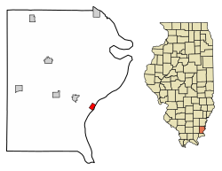
According to the 2021 census gazetteer files, Old Shawneetown has a total area of 0.51 square miles (1.32 km2), all land. [12]

In 2019, Old Shawneetown was featured on PBS NewsHour in a segment on communities subjected to repeated flooding. [13] Because of the town's historically flood-prone location, it is prohibitively difficult to insure, and some researchers have recommended a total relocation of the remaining residents as a preventative policy.

Demographics

Historical population
CensusPop.Note
1830 446
1840 1,900326.0%
1850 1,764−7.2%
1860 1,115−36.8%
1870 1,30917.4%
1880 1,85141.4%
1890 1,570−15.2%
1900 1,6988.2%
1910 1,8639.7%
1920 1,368−26.6%
1930 1,4405.3%
1940 1,357−5.8%
1950 578−57.4%
1960 433−25.1%
1970 342−21.0%
1980 39615.8%
1990 356−10.1%
2000 278−21.9%
2010 193−30.6%
2020 113−41.5%
U.S. Decennial Census [14]

As of the 2020 census [3] there were 113 people, 40 households, and 21 families residing in the village. The population density was 221.57 inhabitants per square mile (85.55/km2). There were 65 housing units at an average density of 127.45 per square mile (49.21/km2). The racial makeup of the village was 92.92% White, 1.77% from other races, and 5.31% from two or more races. Hispanic or Latino of any race were 1.77% of the population.

There were 40 households, out of which 32.5% had children under the age of 18 living with them, 17.50% were married couples living together, 15.00% had a female householder with no husband present, and 47.50% were non-families. 47.50% of all households were made up of individuals, and 30.00% had someone living alone who was 65 years of age or older.

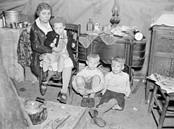
Below the poverty line was 75% of those under the age of 18 and 8.3% of those age 65 or over.

Notable people

See also

Related Research Articles

<span class="mw-page-title-main">White County, Illinois</span> County in Illinois, United States

White County is a county located in the U.S. state of Illinois. According to the 2020 census, it had a population of 13,877. Its county seat is Carmi. It is located in the southern portion of Illinois known locally as "Little Egypt".

<span class="mw-page-title-main">Gallatin County, Illinois</span> County in Illinois, United States

Gallatin County is a county located in the U.S. state of Illinois. According to the 2020 census, it has a population of 4,946, making it the third-least populous county in Illinois. Its county seat is Shawneetown. It is located in the southern portion of Illinois known locally as Little Egypt. Located at the mouth of the Wabash River, Gallatin County, along with neighboring Posey County, Indiana, and Union County, Kentucky form the tri-point of the Illinois-Indiana-Kentucky Tri-State Area.

<span class="mw-page-title-main">Equality, Illinois</span> Village in Illinois, United States

Equality is a village in Gallatin County, Illinois, United States. The population was 539 at the 2020 census. Near the village are two points of interest, the Crenshaw House and the Garden of the Gods Wilderness. Equality was the county seat of Gallatin County from 1826–1851.

<span class="mw-page-title-main">Junction, Illinois</span> Village in Illinois, United States

Junction is a village in Gallatin County, Illinois, United States. The population was 56 at the 2020 census.

<span class="mw-page-title-main">New Haven, Illinois</span> Village in Illinois, United States

New Haven is a village in Gallatin County, Illinois, United States, along the Little Wabash River near its mouth at the Wabash River. The population was 399 at the 2020 United States Census, down from 433 at the 2010 United States Census.

<span class="mw-page-title-main">Omaha, Illinois</span> Village in Illinois, United States

Omaha is a village in Gallatin County, Illinois, United States. The population was 209 at the 2020 census.

<span class="mw-page-title-main">Ridgway, Illinois</span> Village in Illinois, United States

Ridgway is a village in Gallatin County, Illinois, United States. As of the 2020 census, the population was 851. As of 2018, Rebecca Mitchell was the town mayor.

<span class="mw-page-title-main">Shawneetown, Illinois</span> City in Illinois, United States

Shawneetown is a city in Gallatin County, Illinois, United States. The population was 1,054 at the 2020 United States Census. It is the county seat of Gallatin County.

<span class="mw-page-title-main">Elizabethtown, Illinois</span> Village in Illinois, United States

Elizabethtown is a village in and the county seat of Hardin County, Illinois, United States, along the Ohio River. The population was 299 at the 2010 census, down from 348 at the 2000 census. It is the least-populous county seat in the state.

<span class="mw-page-title-main">Galatia, Illinois</span> Village in Illinois, United States

Galatia is a village in Saline County, Illinois, in the United States. As of the 2010 census, the village population was 933.

<span class="mw-page-title-main">Cahokia, Illinois</span> Village in the United States

Cahokia is a settlement and former village in St. Clair County, Illinois, United States, founded as a colonial French mission in 1689. Located east of the Mississippi River in the Greater St. Louis metropolitan area, as of the 2010 census, 15,241 people lived in the village. On May 6, 2021, the village was incorporated into the new city of Cahokia Heights.

<span class="mw-page-title-main">Mill Shoals, Illinois</span> Village in Illinois, United States

Mill Shoals is a village in Wayne and White counties in the U.S. State of Illinois. The population was 235 at the 2000 census, down to 176 at the 2020 census. In Fall 2022, Drew Lane Consultants LLC conducted a village-wide survey that totaled population at 157. The Village of Mill Shoals is located 4 hours and 14 minutes driving directly south of the City of Chicago, 58 minutes driving directly northwest of Evansville, Indiana, 2 hours and 9 minutes driving directly west of Louisville, Kentucky, and 1 hour and 42 minutes directly east of St. Louis, Missouri. The Village is home to a U.S. Post Office, community center, private grain elevator, and two churches. Residents are active members of the 4-H, FFA, and Ruritans.

<span class="mw-page-title-main">Warsaw, Kentucky</span> City in Kentucky, United States

Warsaw is a home rule-class city in and the county seat of Gallatin County, Kentucky, United States, located along the Ohio River. The name was suggested by a riverboat captain, who was reading Thaddeus of Warsaw, by Jane Porter, when the city was being founded.

<span class="mw-page-title-main">Carrsville, Kentucky</span> City in Kentucky, United States

Carrsville is a home rule-class city beside the Ohio River in Livingston County, Kentucky, in the United States. The population was 50 at the 2010 census, declining from 64 as of 2000. It is part of the Paducah, KY-IL Metropolitan Statistical Area. It is situated just west of the junction of where Buck Creek empties into the Ohio River.

<span class="mw-page-title-main">Saline River (Illinois)</span> River in Illinois, United States

The Saline River is a tributary of the Ohio River, approximately 27 miles (43 km) long, in the Southern Illinois region of the U.S. state of Illinois. The river drains a large section of southeast Illinois, with a drainage basin of 1,762 square miles (4,564 km2). The major tributaries include the South Fork, Middle Fork and North Fork, all lying within the Saline Valley. The once meandering swampy river was important among Native Americans and early settlers as a source of salt from numerous salt springs where it was commercially extracted in the early 19th century.

<span class="mw-page-title-main">Bowlesville Township, Gallatin County, Illinois</span> Township in Illinois, United States

Bowlesville Township is one of ten townships in Gallatin County, Illinois, USA. As of the 2020 census, its population was 132 and it contained 72 housing units.

<span class="mw-page-title-main">Equality Township, Gallatin County, Illinois</span> Township in Illinois, United States

Equality Township is one of ten townships in Gallatin County, Illinois, United States. As of the 2020 census, its population was 765 and it contained 389 housing units.

<span class="mw-page-title-main">Shawnee Township, Gallatin County, Illinois</span> Township in Illinois, United States

Shawnee Township is one of ten townships in Gallatin County, Illinois, USA. As of the 2020 census, its population was 168 and it contained 97 housing units.

The Silkwood Inn is a historic building in Mulkeytown, Illinois.

<span class="mw-page-title-main">Gallatin County Courthouse (Illinois)</span> Local government building in the United States

The Gallatin County Courthouse is a government building in Shawneetown, the county seat of Gallatin County, Illinois, United States. Built in 1939, it is at least the third Shawneetown building to serve as the county courthouse, but the only one following Shawneetown's complete relocation to avoid flooding on the Ohio River.

References

  1. "2020 U.S. Gazetteer Files". United States Census Bureau. Retrieved March 15, 2022.
  2. 1 2 U.S. Geological Survey Geographic Names Information System: Old Shawneetown, Illinois
  3. 1 2 "Explore Census Data". data.census.gov. Retrieved June 28, 2022.
  4. "G001 - Geographic Identifiers - 2010 Census Summary File 1". United States Census Bureau. Archived from the original on February 13, 2020. Retrieved December 25, 2015.
  5. Thwaites, Reuben Gold. The French Regime in Wisconsin and the Northwest, Vol I 1634-1760. State Historical Society of Wisconsin, 1908
  6. The Journals of Lewis and Clark, Nov. 11, 1803.
  7. "Tidbits". Ludington Daily News. August 4, 2001. p. 33. Retrieved October 15, 2015.
  8. Christiana Holmes Tillson; Milo Milton Quaife, ed. 1919, Reprint 1995. A Woman's Story of Pioneer Illinois. Carbondale, Ill.: Southern Illinois University Press. 49-65.
  9. 1887. History of Gallatin, Saline, Hamilton, Franklin and Williamson Counties, Illinois. Chicago: Goodspeed Publishing Company. 96-97.
  10. Weiser 2009, p. 53.
  11. "US Gazetteer files: 2010, 2000, and 1990". United States Census Bureau. February 12, 2011. Retrieved April 23, 2011.
  12. Bureau, US Census. "Gazetteer Files". Census.gov. Retrieved June 29, 2022.
  13. Cat Wise (May 28, 2019). "The radical approach these communities have taken to flooding". PBS NewsHour . Retrieved May 29, 2019.
  14. "Census of Population and Housing". Census.gov. Retrieved June 4, 2015.

Further reading