List of bridges of Pittsburgh

Last updated

Eighteen of Pittsburgh's large bridges are visible in this aerial photo Pittsburgh, Pennsylvania.jpg
Eighteen of Pittsburgh's large bridges are visible in this aerial photo

The bridges of Pittsburgh play an important role in the city's transportation system. Without bridges, the Pittsburgh region would be a series of fragmented valleys, hillsides, river plains, and isolated communities. [1]

Contents

A 2006 study [2] determined that, at the time, Pittsburgh had 446 bridges, though that number has been disputed. [3] With its proximity to three major rivers and countless hills and ravines, Pittsburgh is known as "The City of Bridges". [4]

History

Pittsburgh's first river bridges, made of wood and long since replaced, opened in 1818 at Smithfield Street and 1819 at Sixth Street (then St. Clair Street). The city's oldest in-service bridge is the current Smithfield Street Bridge, which opened in 1883; it was designated a National Historic Landmark in 1976. [5] Pittsburgh waged a massive road and bridge building campaign from 1924 to 1940; most of Pittsburgh's oldest major bridges date from this period. The coming of the Interstate Highway System triggered more construction in the second half of the twentieth century, as vehicular speed and throughput requirements increased. The result of more than 100 years of bridge building is a collection of most of the major types of bridge (suspension, cantilever, arch, etc.), mostly built from locally produced steel, including about forty river spans.

Many of the bridges in the Downtown area are colored Aztec Gold, [6] either constructed as such or painted afterward, to match the city's official colors of black and gold. A few old and out-of-service bridges, such as the Hot Metal Bridge (which stood dormant until reopening as a passenger bridge in the year 2000), are exceptions to this rule.

Degrading bridge conditions

According to a 2011 study by Transportation for America, 1,194 bridges in the Pittsburgh area—or 30.4%—were deficient, the highest proportion in the nation. [7] [8]

On February 8, 2008, the Birmingham Bridge suffered a failure of its rocker bearings, causing the deck to drop eight inches, prompting a closure of the bridge. The bridge was repaired and fully reopened on September 8, 2008. [9]

On January 28, 2022, the Fern Hollow Bridge across Frick Park collapsed, forcing the closure of Forbes Avenue through the park. The bridge was covered with snow when it collapsed at 6:39 a.m. local time as it was being crossed by several cars and a bus. [10] The bridge was rebuilt and reopened on December 22, 2022. [11]

Major bridges

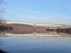
This table lists all bridges crossing the Allegheny, Monongahela and Ohio rivers in the City of Pittsburgh limits. Other large or notable bridges are also included.

Monongahela River

CrossingCarriesImageCoordinates
Fort Pitt Bridge I-376.svgTruck plate.svg
US 19.svg
US 22.svgUS 30.svg I-376  / US 19 Truck  / US 22  / US 30
FortPittBridge.jpg 40°26′20″N80°00′40″W / 40.4388°N 80.0111°W / 40.4388; -80.0111
Smithfield Street Bridge Smithfield Street SmithfieldBridge-Szmurlo.jpg 40°26′06″N80°00′07″W / 40.4351°N 80.0020°W / 40.4351; -80.0020
Panhandle Bridge Pittsburgh Regional Transit T Light Rail Line Panhandlebridge111.jpg 40°25′59″N79°59′53″W / 40.43306°N 79.99806°W / 40.43306; -79.99806
Liberty Bridge Connects Liberty Tunnel to Downtown Pittsburgh Liberty Bridge.jpg 40°25′58″N79°59′48″W / 40.4328°N 79.9968°W / 40.4328; -79.9968
South Tenth Street Bridge South Tenth Street Pittsburgh Tenth Street Bridge from Bluff downsteam.JPG 40°25′57″N79°59′21″W / 40.43250°N 79.98917°W / 40.43250; -79.98917
Birmingham Bridge Connects Fifth and Forbes avenues to East Carson Street BirminghamBridgePittsburgh.JPG 40°26′00″N79°58′25″W / 40.433361°N 79.973499°W / 40.433361; -79.973499
Hot Metal Bridge Great Allegheny Passage/Three Rivers Heritage Trail,

Hot Metal Street

Pittsburgh Hot Metal Bridge2.jpg
Glenwood Bridge PA-885.svg PA 885 Glenwoodbridge.jpg
Glenwood B&O Railroad Bridge Allegheny Valley Railroad AVRRbridge.jpg
Homestead Grays Bridge (Homestead High Level Bridge) Pittsburgh PA Blue Belt shield.svg Blue Belt Homestead Grays Bridge river reflection.jpg

Allegheny River

CrossingCarriesImageCoordinates
Fort Duquesne Bridge I-279.svgTruck plate.svg
US 19.svg
I-279  / US 19 Truck
FortDuquesneBridge.jpg 40°26′39″N80°00′33″W / 40.4443°N 80.0093°W / 40.4443; -80.0093
Roberto Clemente Bridge 6th Street Roberto Clemente bridge.jpg 40°26′44″N80°00′12″W / 40.4456°N 80.0033°W / 40.4456; -80.0033
Andy Warhol Bridge 7th Street AndyWarholBridgePittsburgh.JPG 40°26′46″N80°00′05″W / 40.44611°N 80.00139°W / 40.44611; -80.00139
Rachel Carson Bridge 9th Street Pittsburgh Ninth Street Bridge.jpg 40°26′48″N79°59′59″W / 40.4467°N 79.9998°W / 40.4467; -79.9998
Fort Wayne Railroad Bridge Allegheny Valley Railroad, Capitol Limited (Amtrak train), Norfolk Southern Railway Fort Wayne Line Ft Wayne RR Bridge Pittsb jeh.jpg 40°26′54″N79°59′46″W / 40.4482°N 79.9962°W / 40.4482; -79.9962
Veterans Bridge I-579.svg Interstate 579 Veterans Bridge (Pittsburgh).jpg 40°27′00″N79°59′36″W / 40.4499°N 79.9934°W / 40.4499; -79.9934
David McCullough Bridge 16th Street 16th st from the strip.jpg 40°27′06″N79°59′27″W / 40.4517°N 79.9909°W / 40.4517; -79.9909
Herr's Island Railroad Bridge (West Penn Bridge)
(rails removed, crosses back channel only)
Three Rivers Heritage Trail Herr's Island Railroad Bridge.jpg
30th Street Bridge (crosses back channel only) 30th Street 30thstpgh.jpg
William Raymond Prom Memorial Bridge / 31st Street Bridge 31st Street 31st Street Bridge, Pittsburgh.jpg 40°27′47″N79°58′33″W / 40.4630°N 79.9758°W / 40.4630; -79.9758
33rd Street Railroad Bridge 33rd Street / Allegheny Valley Railroad P&W Subdivision 33rd St. RR Bridge.JPG 40°27′57″N79°58′25″W / 40.4657°N 79.9736°W / 40.4657; -79.9736
Washington Crossing Bridge / 40th Street Bridge 40th Street FortiethStreetBridge.jpg 40°28′22″N79°58′07″W / 40.4728°N 79.9686°W / 40.4728; -79.9686
Senator Robert D. Fleming Bridge / 62nd Street Bridge PA Route 8 / 62nd Street Bridge Senator Robert D. Fleming Bridge.jpg 40°29′28″N79°56′17″W / 40.4912°N 79.9381°W / 40.4912; -79.9381
Highland Park Bridge Blue Belt / Highland Park Bridge USACE Lock and Dam 2 Allegheny.jpg 40°29′21″N79°54′43″W / 40.4891°N 79.9120°W / 40.4891; -79.9120
Brilliant Branch Railroad Bridge Allegheny Valley Railroad Brilliant Branch / Brilliant Branch Railroad Bridge Allegheny River from Highland Park, Pittsburgh, Pa. (det.4a19425).tif 40°29′12″N79°54′19″W / 40.4866°N 79.9053°W / 40.4866; -79.9053

Ohio River

CrossingCarriesImageCoordinates
McKees Rocks Bridge PA QR 3104.svg SR 3104 / Blue Belt McKeesRocksBridge.jpg 40°28′38″N80°02′54″W / 40.47722°N 80.04833°W / 40.47722; -80.04833
Ohio Connecting Railroad Bridge Norfolk Southern Railway Fort Wayne Line OhioConnectingRRBridgeandMcKeesRocksBridge.jpg 40°27′46″N80°02′35″W / 40.46278°N 80.04306°W / 40.46278; -80.04306
West End Bridge US 19.svg U.S. Route 19 Allegheny Monongahela Ohio.jpg

Other bridges

This table lists some other major bridges within the City of Pittsburgh limits.

BridgeCarriesOverImage
Bloomfield Bridge Liberty Avenue Bloomfleld Bridge - Pittsburgh P&W Subdivision , East Busway , Pittsburgh Line Bloomfield Bridge PGH.jpg
Brilliant Cutoff Viaduct Brilliant Branch Silver Lake Drive Pennsylvania Railroad Company Brilliant Cutoff Viaduct (Pittsburgh, PA).jpg
Charles Anderson Memorial Bridge Boulevard of the Allies [12] Junction Hollow , P&W Subdivision , Three Rivers Heritage Trail Panther Hollow (7767440).jpg
Commercial Street BridgeI-376.svgUS 22.svgUS 30.svg I-376  / US 22  / US 30 Nine Mile Run, Commercial Street Commercial Street Bridge (721622931).jpg
Fern Hollow Bridge Forbes Avenue Fern Hollow Creek, Fern Hollow Fhb (23609633444).jpg
Forbes Avenue Bridge Forbes Avenue Junction Hollow , P&W Subdivision Forbes Av bridge (31497552461).jpg
Frazier Street BridgeI-376.svgUS 22.svgUS 30.svg I-376  / US 22  / US 30 Junction Hollow , P&W Subdivision , Swinburne Bridge Frazier Street Bridge from Oakland end.jpg
Greenfield Bridge Greenfield Road / Beechwood Boulevard Four Mile Run, I-376 (PA).svg I-376 Greenfield Bridge 2019.jpeg
Larimer Avenue BridgeLarimer Avenue PA-8.svg PA 8 (Washington Boulevard) General view to south, from Orphan Street. - Larimer Avenue Bridge, Spanning Washington Boulevard at Larimer Avenue (State Route 8), Pittsburgh, Allegheny County, PA HAER PA,2-PITBU,73-1.tif
Lincoln Avenue BridgeLincoln Avenue PA-8.svg PA 8 (Washington Boulevard) View looking due east along Hamilton Avenue. - Pennsylvania Railroad, Brilliant Cut-Off, South Wye, Linden Avenue at Frankstown Avenue, Pittsburgh, Allegheny County, PA HAER PA,2-PITBU,75-1.tif
Meadow Street BridgeMeadow StreetNegley Run Boulevard Meadow street bridge (23610733163).jpg
Murray Avenue BridgeMurray AvenueBeechwood Boulevard Pgh IMG 20150826 161826 (30791578183).jpg
Palm Garden Trestle South Busway , Red Line , Blue Line , Silver Line Saw Mill Run , Pennsylvania Route 51 , Pittsburgh Subdivision, U.S. Route 19 Truck Palm Garden Trestle over Saw Mill Run valley.jpg
Panther Hollow Bridge Panther Hollow Road Panther Hollow , Panther Hollow Run PantherHollow Bridge Pittsburgh.jpg
Schenley Bridge Schenley Drive Junction Hollow , P&W Subdivision Schenley Bridge from South Oakland 3.jpg
Swinburne BridgeFrazier Street P&W Subdivision , Four Mile Run Bridge (31563828246).jpg
Swindell Bridge North Charles Street / Essen Street Interstate 279, East Street East Street Bridge (715.3113046.CP).jpg

See also

Related Research Articles

<span class="mw-page-title-main">Downtown Pittsburgh</span> Neighborhood in Allegheny County, Pennsylvania, United States

Downtown Pittsburgh, colloquially referred to as the Golden Triangle, and officially the Central Business District, is the urban downtown center of Pittsburgh, Pennsylvania, United States. It is located at the confluence of the Allegheny River and the Monongahela River whose joining forms the Ohio River. The triangle is bounded by the two rivers.

<span class="mw-page-title-main">Great Allegheny Passage</span> Rail trail connecting Cumberland, Maryland and Pittsburgh, Pennsylvania

The Great Allegheny Passage (GAP) is a 150-mile (240 km) rail trail between Pittsburgh, Pennsylvania and Cumberland, Maryland. Together with the C&O Canal towpath, the GAP is part of a 335 mi (539 km) route between Pittsburgh and Washington, D.C., that is popular with through hikers and cyclists.

<span class="mw-page-title-main">Allegheny County belt system</span> Allegheny County belt system

The Allegheny County Belt System color codes various county roads to form a unique system of routes in Allegheny County, Pennsylvania, and around the city of Pittsburgh.

<span class="mw-page-title-main">Swisshelm Park</span> Neighborhood of Pittsburgh in Allegheny County, Pennsylvania, United States

Swisshelm Park is a neighborhood located in the southeast corner of Pittsburgh, Pennsylvania. It is represented on the Pittsburgh City Council by Barbara Warwick. Swisshelm Park houses PBF 19 Engine, and is covered by PBP Zone 4 and the Bureau of EMS Medic 7.

<span class="mw-page-title-main">Smithfield Street Bridge</span> Bridge over the Monongahela River in Pittsburgh, Pennsylvania

The Smithfield Street Bridge is a lenticular truss bridge crossing the Monongahela River in Pittsburgh, Pennsylvania, USA.

<span class="mw-page-title-main">Fort Pitt Bridge</span> Bridge over the Monongahela River in Pittsburgh, Pennsylvania

The Fort Pitt Bridge is a steel, double-decked bowstring arch bridge that spans the Monongahela River near its confluence with the Allegheny River in Pittsburgh, Pennsylvania. It carries Interstate 376 between the Fort Pitt Tunnel and Downtown Pittsburgh. Opened in June 1959 as a replacement for the Point Bridge, the Fort Pitt Bridge was the world's first computer-designed bowstring arch bridge and double-decked bowstring arch bridge. The bridge is known for its difficult lane changes, especially on the lower level, often requiring people to go from the extreme left lane across two lanes to the extreme right lane in only 300 feet. The upper level is more forgiving for some routes but still requires a full span lane change in 300 feet to get from the south side entrance to the downtown exits.

<span class="mw-page-title-main">Monongahela Incline</span> Funicular railway in Pittsburgh, Pennsylvania

The Monongahela Incline is a funicular located near the Smithfield Street Bridge in Pittsburgh, Pennsylvania. Designed and built by Prussian-born engineer John Endres in 1870, it is the oldest continuously operating funicular in the United States.

<span class="mw-page-title-main">Liberty Bridge (Pittsburgh)</span> Bridge in Pittsburgh, Pennsylvania

The Liberty Bridge, which was completed in 1928, connects downtown Pittsburgh, Pennsylvania, to the Liberty Tunnels and the South Hills neighborhoods beyond. It crosses the Monongahela River and intersects Interstate 579 at its northern terminus.

<span class="mw-page-title-main">South Tenth Street Bridge</span> Bridge in Pittsburgh, Pennsylvania

The South Tenth Street Bridge, most often called the Tenth Street Bridge, but officially dubbed the Philip Murray Bridge, is a suspension bridge that spans the Monongahela River in Downtown Pittsburgh, Pennsylvania.

<span class="mw-page-title-main">Birmingham Bridge</span> Bridge in Pittsburgh, Pennsylvania

The Birmingham Bridge is a bowstring arch bridge that is located in Pittsburgh, Pennsylvania and spans the Monongahela River.

<span class="mw-page-title-main">Hot Metal Bridge</span> Bridge over the Monongahela River in Pittsburgh, Pennsylvania

The Hot Metal Bridge is a truss bridge in Pittsburgh, Pennsylvania, that crosses the Monongahela River. The bridge consists of two parallel spans on a single set of piers: the former Monongahela Connecting Railroad Bridge, built in 1887, on the upstream side and the former Hot Metal Bridge, built in 1900, on the downstream side. The Monongahela Connecting Railroad Bridge carried conventional railroad traffic, while the Hot Metal Bridge connected parts of the J&L Steel mill, carrying crucibles of molten iron from the blast furnaces in ladle transfer cars to the open hearth furnaces on the opposite bank to be converted to steel. During World War II 15% of America's steel making capacity crossed over the Hot Metal Bridge, up to 180 tons per hour. The upstream span was converted to road use after a $14.6 million restoration, and opened by Mayor Tom Murphy with a ceremony honoring former steel workers on June 23, 2000. The bridge connects 2nd Avenue at the Pittsburgh Technology Center in South Oakland with Hot Metal Street in the South Side. The downstream span reopened for pedestrian and bicycle use in late 2007 after two years of work. The Great Allegheny Passage hiker/biker trail passes over this bridge as it approaches Pittsburgh's Golden Triangle area.

<span class="mw-page-title-main">West End Bridge</span> Bridge in Pittsburgh, Pennsylvania

The West End Bridge is a steel tied-arch bridge over the Ohio River in Pittsburgh, Pennsylvania, approximately 1 mile (1.6 km) below the confluence of the Allegheny and Monongahela Rivers. It connects the West End to the Chateau neighborhood on the North Side of Pittsburgh.

<span class="mw-page-title-main">Frick Park</span> Park in Pittsburgh, Pennsylvania

Frick Park is the largest municipal park in Pittsburgh, Pennsylvania, United States, covering 644 acres (1.006 sq mi). It is one of Pittsburgh's four historic large parks.

<span class="mw-page-title-main">Transportation in Pittsburgh</span> Transportation in Pittsburgh, Pennsylvania, United States

Transportation in Pittsburgh, Pennsylvania is different than in many other major American cities. A large metropolitan area that is surrounded by rivers and hills, Pittsburgh has an infrastructure system that has been built out over the years to include roads, tunnels, bridges, railroads, inclines, bike paths, and stairways; however, the hills and rivers still form many barriers to transportation within the city.

<span class="mw-page-title-main">Forbes Avenue</span>

Forbes Avenue is one of the longest streets in Pittsburgh, Pennsylvania, United States. It runs along an east–west route for a length of approximately 7 mi (11 km).

<span class="mw-page-title-main">Three Rivers Heritage Trail</span>

The Three Rivers Heritage Trail is an urban rail trail paralleling the riverbanks in Pittsburgh, Pennsylvania and Allegheny County for about 33 miles (53 km), often on both sides of the rivers, and offering views of the city. The trail is promoted and maintained in part by the 'Friends of the Riverfront'.

<span class="mw-page-title-main">Washington Crossing Bridge (Pittsburgh)</span> Bridge in Pittsburgh and Millvale

The Washington Crossing Bridge, commonly known as the Fortieth Street Bridge, is an arch bridge that carries vehicular traffic across the Allegheny River between the Pittsburgh neighborhood of Lawrenceville and the suburb of Millvale. The bridge is decorated with the seals representing the original 13 colonies of the US and that of Allegheny county.

<span class="mw-page-title-main">Brilliant Branch Railroad Bridge</span> Bridge in Pittsburgh and Aspinwall

The Brilliant Branch Railroad Bridge is a truss bridge that carries Allegheny Valley Railroad's Brilliant Branch across the Allegheny River between the Pittsburgh neighborhood of Highland Park and the borough of Aspinwall, Pennsylvania.

The Fern Hollow Bridge is the name used for one of a series of three bridges in the East End of Pittsburgh, Pennsylvania, United States; each bridge carried Forbes Avenue over a large ravine in Frick Park. The first Fern Hollow Bridge opened in 1901 as a steel deck arch, and was demolished in 1972 while the second bridge was being built. The second bridge opened in 1973 and collapsed on January 28, 2022. Construction of the third bridge began on May 9, 2022, and the third bridge was dedicated on December 20, 2022.

<span class="mw-page-title-main">Charles Anderson Memorial Bridge</span> Bridge in Pittsburgh

The Charles Anderson Memorial Bridge is a steel deck truss bridge located in Pittsburgh, Pennsylvania, United States. The bridge carries the four-lane roadway of Boulevard of the Allies across a ravine known as Junction Hollow, connecting the neighborhoods of Central Oakland and South Oakland with Schenley Park. The bridge also spans the Junction Hollow Trail and P&W Subdivision railroad tracks which run along the bottom of the valley.

References

  1. Kidney, Walter C. (1999). Pittsburgh's Bridges: Architecture and Engineering. Pittsburgh, PA: Pittsburgh History & Landmarks Foundation. ISBN   978-0916670214.
  2. "Just How Many Bridges Are There In Pittsburgh?". thePittsburghchannel.com. September 13, 2006. Archived from the original on February 4, 2010. Retrieved January 30, 2010.
  3. Houser, Mark (March 16, 2022). "Does Pittsburgh Really Have More Bridges Than Any Other City?". Pittsburgh Magazine (published April 2022). Retrieved March 21, 2023.
  4. Smith, Brady. "Pittsburgh: The City of Bridges". The Heinz History Center. Retrieved January 28, 2022.
  5. "Listing of National Historic Landmarks by State: Pennsylvania" (PDF). National Park Service. June 2013. p. 5. Archived (PDF) from the original on November 5, 2012. Retrieved August 7, 2013.
  6. Potter, Chris. "Why are the bridges in Pittsburgh painted yellow?". pghcitypaper.com. Archived from the original on February 22, 2014.
  7. Schmitz, Jon (October 19, 2011). "Bridges in Pittsburgh labeled the worst". Pittsburgh Post-Gazette . Archived from the original on November 22, 2011. Retrieved November 28, 2011.
  8. "The Fix We're In For: The State of Our Nation's Busiest Bridges" (PDF). Metropolitan Bridge Rankings. Transportation for America. October 2011. Archived from the original (PDF) on November 12, 2011. Retrieved November 28, 2011.
  9. Simmons, Matt (February 8, 2021). "ON THIS DAY: February 8, 2008, Birmingham Bridge closed after deck drops 8 inches". WPXI. Retrieved January 28, 2022.
  10. "Frick Park Bridge Collapse: 10 People Injured, 4 Sent To Hospital". CBS Local. Retrieved August 6, 2022.
  11. Felton, Julia (December 22, 2022). "Pittsburgh's new Fern Hollow Bridge reopens to traffic". TribLIVE.com. Retrieved May 22, 2023.
  12. Error: Unable to display the reference properly. See the documentation for details.