Boulevard of the Allies

Last updated
Boulevard of the Allies
Skyline Boulevard of the Allies.jpg
Skyline of downtown Pittsburgh, as seen from the Boulevard of the Allies.
Maintained by City of Pittsburgh, PennDOT
Length3.32 mi (5.34 km)
Component
highways
PA-885.svg PA 885 from I-579.svg I-579 to Bates Street
Location Downtown PittsburghOakland, Pennsylvania, U.S.
West endCommonwealth Place in Pittsburgh
Major
junctions
Stanwix Street in Pittsburgh
I-376.svgUS 22.svgUS 30.svg I-376  / US 22  / US 30 (Penn-Lincoln Parkway) / Grant Street / 2nd Avenue / Court Place in Pittsburgh

I-579.svg I-579 (Crosstown Boulevard) in Pittsburgh
I-376.svgUS 22.svgUS 30.svg I-376  / US 22  / US 30 (Penn-Lincoln Parkway) in Pittsburgh

Contents

South plate.svg
PA-885.svg
PA 885 south in Pittsburgh
East endPanther Hollow Road in Pittsburgh
NorthThird Avenue/Fourth Avenue
South Fort Pitt Boulevard

The Boulevard of the Allies is a mostly four-lane road in the U.S. state of Pennsylvania, connecting Downtown Pittsburgh with the Oakland neighborhood of the city. Because of its lengthy name, locals sometimes refer to it as simply "The Boulevard".

Some sections are part of Pennsylvania Route 885. The road begins in Downtown Pittsburgh at its intersection with Commonwealth Place and an offramp from Interstate 279. The road continues east through Downtown passing Point Park University and the former Art Institute of Pittsburgh building to Grant Street where it becomes elevated to transition from the flat plain of Downtown to the bluff that Oakland sits on. Before reaching Oakland, it passes by Duquesne University and Mercy Hospital along the edge of a cliff several hundred feet above the Monongahela River with views of the city's South Side neighborhood and includes partial interchanges with Interstate 579 and Interstate 376. At its interchange with I-579, the road is split; westbound traffic must exit from the road onto I-579 or the Liberty Bridge. The second westbound portion of Boulevard of the Allies is only accessible via an entrance ramp from the Liberty Bridge. Upon reaching Oakland, it cuts through the southern portion of the neighborhood and leads into Schenley Park just bypassing the University of Pittsburgh and Carnegie Mellon University. Upon entering the park across the Anderson Bridge, the road's name changes to Panther Hollow Road (named after Panther Hollow) and continues through the park to become Hobart Street in the Squirrel Hill neighborhood east of Schenley Park.

The road is named in honor of the Allies of World War I. The Boulevard of the Allies was rededicated on June 29, 2008 as part of the celebration of Pittsburgh's 250th anniversary. As part of the rededication, American flags have been added on both sides of the boulevard as it elevates toward the Liberty Bridge ramp and thirty temporary banners celebrating the Allies of World War I have been affixed, following the road to its end.

History

Construction of Boulevard of the Allies, 1922 Boulevard of the Allies Wall Construction (715.226635.CP).png
Construction of Boulevard of the Allies, 1922

The boulevard was first proposed in 1913 in order to alleviate traffic on Bigelow Boulevard (then known as Grant Boulevard), which was a major, though not very direct, route for automobile traffic between Downtown, Oakland, and Schenley Park. The proposed route, carved out of the Bluff above the Monongahela River, would connect the same areas over a distance about 1 mile (1.6 km) shorter. [1] Like Pittsburgh's other boulevards, the new route would be off-limits to streetcars, wagons, and other slow-moving vehicles. [2] In 1919, the Pittsburgh City Council selected "Boulevard of the Allies" as the name of the proposed roadway, previously known as Monongahela Boulevard. [3]

Boulevard of the Allies viaduct at the Brady Street Bridge, shortly after completion in 1922 Viaduct No. 2 (715.226704.CP).png
Boulevard of the Allies viaduct at the Brady Street Bridge, shortly after completion in 1922

Work began with the widening of Second Avenue to a width of 70 feet (20 m) between Liberty Avenue and Grant Street in 1920–21. [4] The boulevard itself was built on an elevated viaduct beginning at Second Avenue and Grant Street and climbing over the Panhandle Route tracks onto the Bluff, where the roadway then followed the cliff edge eastward to Oakland. The project was an engineering challenge requiring extensive grading and numerous retaining walls and viaducts. Prior to completion, the cost was reported as $1.6 million per mile, said to be the most expensive road in the world at the time. [5] The first section of the boulevard from Downtown to the intersection with Forbes Avenue at the edge of West Oakland opened on October 2, 1922, and was formally dedicated a month later on Armistice Day. [6] The remainder of the route, extending to Schenley Park partly along the existing Emily and Wilmot Streets, was completed in 1930. [7]

In 1923, an experimental synchronized traffic signal system which allowed a central operator to coordinate signal changes at multiple intersections was tested on the downtown section of the Boulevard. [8] Another novel system was installed in 1931 which signaled a protected left turn automatically when a turning vehicle was detected. [9] In 1924, the Boulevard became part of an alternate bypass route of the Lincoln Highway, whose original route used Bigelow Boulevard into downtown; this left the Boulevard at Forbes Avenue (its original terminus), following Beeler Street, Wilkins Avenue, and Dallas Avenue to the main route on Penn Avenue near East Liberty. [10] [11] The Boulevard at Grant Street was once home to Pittsburgh's Chinatown until the 1950s. [12]

View of Boulevard of the Allies in downtown Pittsburgh Near Empty Blvd of Allies (3639325683).jpg
View of Boulevard of the Allies in downtown Pittsburgh

U.S. Route 22 and U.S. Route 30 were designated along the William Penn and Lincoln Highways through Pittsburgh in 1926; the Boulevard of the Allies bypass alignment was chosen for both routes. [13] The portion of the road east from Forbes Avenue to Bates Street, still known as Wilmot Street, became a part of Pennsylvania Route 885 by 1940. [14] With the completion of the Penn-Lincoln Parkway East in the late 1950s, US 22 and US 30 were moved off the Boulevard, and PA 885 was extended west a short distance to the interchange near the Birmingham Bridge. The construction of I-579 in the early 1960s cut the path of westbound Boulevard traffic into downtown; [15] eventually the PA 885 designation was continued west to this interchange.

Major junctions

The entire route is in Pittsburgh, Allegheny County.

mikmDestinationsNotes
0.000.00Commonwealth Place to
North plate blue.svg
I-279.svg
North plate.svg
Truck plate.svg
US 19.svg
West plate blue.svg
I-376.svg
West plate.svg
US 22.svg
West plate.svg
US 30.svg
Airport Sign.svg I-279 north / US 19 Truck north / I-376 west / US 22 west / US 30 west (Penn-Lincoln Parkway) Point State Park, Fort Duquesne Bridge, Fort Pitt Bridge, Pittsburgh International Airport, Heinz Field, PNC Park
Western terminus; entrance from I-376 east / US 22 east / US 30 east
0.110.18Pittsburgh PA Purple Belt shield.svg Purple Belt (Stanwix Street) Allegheny Center Western end of concurrency with Purple Belt
0.290.47Wood Street to East plate blue.svg
I-376.svg
East plate.svg
US 22.svg
East plate.svg
US 30.svg
I-376 east / US 22 east / US 30 east (Penn-Lincoln Parkway) Monroeville, Station Square, Smithfield Street Bridge, South Side
No left turns eastbound onto Wood Street
0.410.66Pittsburgh PA Purple Belt shield.svg Purple Belt (Smithfield Street)Eastern end of concurrency with Purple Belt for eastbound Boulevard of the Allies traffic (no left turns onto Grant Street)
0.510.82I-376.svgUS 22.svgUS 30.svgPittsburgh PA Purple Belt shield.svgAirport Sign.svg I-376  / US 22  / US 30 (Penn-Lincoln Parkway) / Purple Belt (Grant Street) / 2nd Avenue / Court Place Fort Pitt Bridge, Pittsburgh International Airport, Monroeville, Eliza Furnace Trail, PPG Paints Arena, Duquesne University, South Side Eastern end of concurrency with Purple Belt for westbound Boulevard of the Allies traffic; no left turns from either direction; 2nd Avenue / Court Place exit and entrance ramps, respectively, to Ross Street; access to I-376 west / US 22 west / US 30 west via Grant Street
0.731.17North plate blue.svg
I-579.svg
To plate blue.svg
North plate blue.svg
I-279.svg
To plate.svg
North plate.svg
Truck plate.svg
US 19.svg
I-579 north (Crosstown Boulevard) to I-279 north / US 19 Truck north Veterans Bridge, PNC Park, Heinz Field, Convention Center
To plate.svg
US 19.svg
To plate.svg
PA-51.svg
To US 19  / PA 51  Liberty Bridge
PA-885.svg PA 885 end
Northern end of concurrency with PA 885; northern terminus of PA 885; westbound traffic must exit and has no access to westbound Boulevard of the Allies west of interchange; no eastbound exit to I-579; southern terminus of I-579
1.201.93Bluff Street Duquesne University Westbound exit only
1.272.04Marion Street Hospital sign.svg UPMC Mercy, PPG Paints Arena Westbound exit and entrance only; right-in/right-out
1.632.62Jumonville Street Birmingham Bridge, South Side
1.832.95East plate blue.svg
I-376.svg
East plate.svg
US 22.svg
East plate.svg
US 30.svg
I-376 east / US 22 east / US 30 east (Penn-Lincoln Parkway) Monroeville
Eastbound exit only
1.893.04West plate blue.svg
I-376.svg
West plate.svg
US 22.svg
West plate.svg
US 30.svg
I-376 west / US 22 west / US 30 west (Penn-Lincoln Parkway) Downtown, Fort Pitt Bridge
Exit 72B (I-376 west / US 22 west / US 30 west); westbound exit and entrance only
2.093.36 Fifth Avenue Westbound entrance only
2.143.44 Forbes Avenue Oakland Eastbound exit only
2.774.46South plate.svg
PA-885.svg
To plate blue.svg
East plate blue.svg
I-376.svg
To plate.svg
East plate.svg
US 22.svg
To plate.svg
East plate.svg
US 30.svg
PA 885 south (Bates Street) to I-376 east / US 22 east / US 30 east (Penn-Lincoln Parkway) Glenwood, Monroeville
Eastern end of concurrency with PA 885; no left turns at intersection
3.325.34Panther Hollow Road Phipps Conservatory and Botanical Gardens, Flagstaff Hill, Oakland, Squirrel Hill, Schenley Park Eastern terminus; interchange
1.000 mi = 1.609 km; 1.000 km = 0.621 mi

Related Research Articles

<span class="mw-page-title-main">Downtown Pittsburgh</span> Neighborhood in Allegheny County, Pennsylvania, United States

Downtown Pittsburgh, colloquially referred to as the Golden Triangle, and officially the Central Business District, is the urban downtown center of Pittsburgh, Pennsylvania, United States. It is located at the confluence of the Allegheny River and the Monongahela River whose joining forms the Ohio River. The triangle is bounded by the two rivers.

<span class="mw-page-title-main">Interstate 376</span> Highway in Pennsylvania

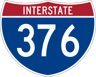
Interstate 376 (I-376) is a major auxiliary route of the Interstate Highway System in the US state of Pennsylvania, located within the Allegheny Plateau. It runs from I-80 near Sharon south and east to a junction with the Pennsylvania Turnpike in Monroeville, after having crossed the Pennsylvania Turnpike at an interchange in Big Beaver. The route serves Pittsburgh and its surrounding areas and is the main access road to Pittsburgh International Airport (PIT). Portions of the route are known as the Beaver Valley Expressway, Southern Expressway, and Airport Parkway. Within Allegheny County, the route runs along the majority of the Penn-Lincoln Parkway, known locally as Parkway West and Parkway East. It is currently the ninth-longest auxiliary Interstate route in the system and second only to I-476 within Pennsylvania.

<span class="mw-page-title-main">Interstate 579</span> Highway in Pennsylvania

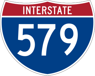
Interstate 579 (I-579) is a north–south Interstate Highway entirely within Pittsburgh, Pennsylvania. The highway is 2.73 miles (4.39 km) long. I-579 is also known as the Crosstown Boulevard since it crosses the backside of Downtown Pittsburgh.

A one-way pair, one-way couple, or couplet refers to that portion of a bi-directional traffic facility – such as a road, bus, streetcar, or light rail line – where its opposing flows exist as two independent and roughly parallel facilities.

<span class="mw-page-title-main">Reversible lane</span> Lane in which traffic may travel in either direction

A reversible lane is a managed lane in which traffic may travel in either direction, depending on certain conditions. Typically, it is meant to improve traffic flow during rush hours, by having overhead traffic lights and lighted street signs notifying drivers which lanes are open or closed to driving or turning.

<span class="mw-page-title-main">Allegheny County belt system</span> Allegheny County belt system

The Allegheny County Belt System color codes various county roads to form a unique system of routes in Allegheny County, Pennsylvania, and around the city of Pittsburgh.

<span class="mw-page-title-main">Pennsylvania Route 28</span> State highway in Pennsylvania, US

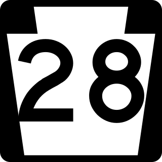
Pennsylvania Route 28 is a major state highway, which runs for 98 miles (158 km) from Anderson Street in Pittsburgh to U.S. Route 219 (US 219) in Brockway in Pennsylvania in the United States.

Note: A fully interactive online map of the Lincoln Highway and all of its re-alignments, markers, monuments and historic points of interest can be viewed at the Lincoln Highway Association Official Map website.

<span class="mw-page-title-main">U.S. Route 30 in Pennsylvania</span> Highway in Pennsylvania

U.S. Route 30 (US 30) is a U.S. Highway that runs east–west across the southern part of Pennsylvania, passing through Pittsburgh and Philadelphia on its way from the West Virginia state line east to the Benjamin Franklin Bridge over the Delaware River into New Jersey.

<span class="mw-page-title-main">Transportation in Pittsburgh</span> Transportation in Pittsburgh, Pennsylvania, United States

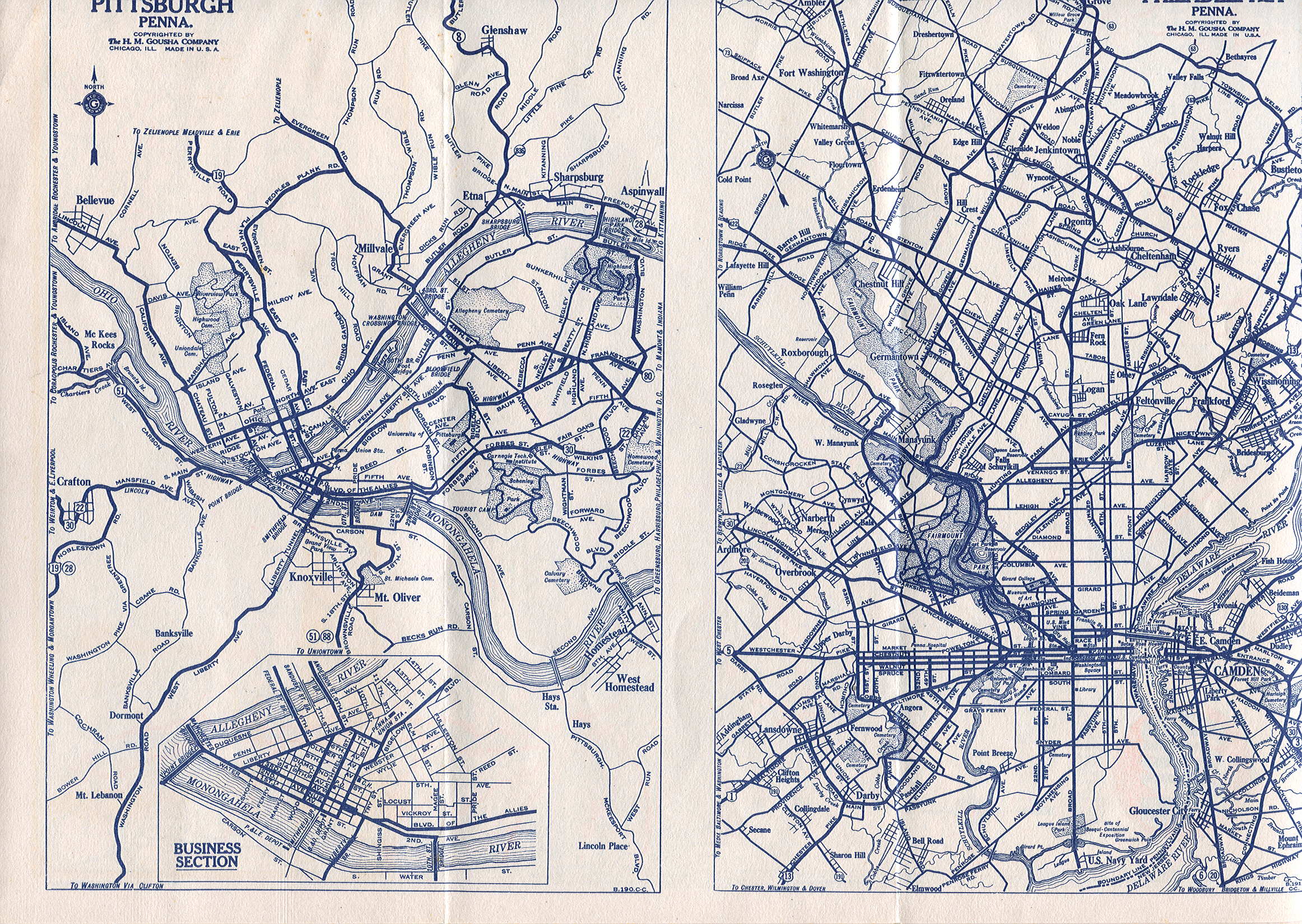
A large metropolitan area that is surrounded by rivers and hills, Pittsburgh has an infrastructure system that has been built out over the years to include roads, tunnels, bridges, railroads, inclines, bike paths, and stairways; however, the hills and rivers still form many barriers to transportation within the city.

<span class="mw-page-title-main">Interstate 70 in Pennsylvania</span> Section of Interstate highway in Pennsylvania, United States

Interstate 70 (I-70) is a state highway that is located in the Commonwealth of Pennsylvania in the United States. It runs east to west across the southwest part of Pennsylvania and serves the southern fringe of the Pittsburgh metropolitan area.

<span class="mw-page-title-main">Pennsylvania Route 51</span> State highway in Pennsylvania

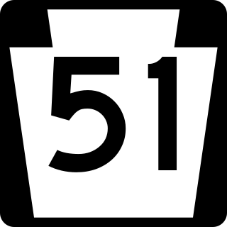
Pennsylvania Route 51 is a major state highway that is located in Western Pennsylvania in the United States. It runs for 89 miles (143 km) from Uniontown to the Ohio state line near Darlington, where it connects with Ohio State Route 14.

<span class="mw-page-title-main">U.S. Route 22 in Pennsylvania</span> Highway in Pennsylvania

U.S. Route 22 (US 22) is an east–west United States Numbered Highway that stretches from Cincinnati, Ohio, in the west, to Newark, New Jersey, in the east. In Pennsylvania, the route runs for 338.20 miles (544.28 km) between the West Virginia state line in Washington County, where it is a freeway through the western suburbs of Pittsburgh, and then runs east to Easton and the Pennsylvania–New Jersey state line in the Lehigh Valley region of eastern Pennsylvania.

<span class="mw-page-title-main">Pennsylvania Route 380</span> State highway in Pennsylvania, US

Pennsylvania Route 380, also known as J.F. Bonetto Memorial Highway and within the city of Pittsburgh Bigelow Boulevard, Baum Boulevard and Frankstown Road, is a 32.80-mile-long (52.8 km) state highway in western portions of the U.S. state of Pennsylvania. The western terminus of the route is at Interstate 579 in downtown Pittsburgh near PPG Paints Arena. The eastern terminus is at Pennsylvania Route 286 in Bell Township, near the hamlet of Wakena.

<span class="mw-page-title-main">Pennsylvania Route 885</span> State highway in Allegheny County, Pennsylvania, US

Pennsylvania Route 885 is a 14.1-mile-long (22.69 km) north–south state highway in the U.S. state of Pennsylvania. It runs from Pennsylvania Route 837 in Clairton north to Interstate 579 in Pittsburgh. The route is entirely within Allegheny County and serves as a connector between the city of Pittsburgh and its southern suburbs.

<span class="mw-page-title-main">Pennsylvania Route 837</span> State highway in Washington and Allegheny counties in Pennsylvania, US

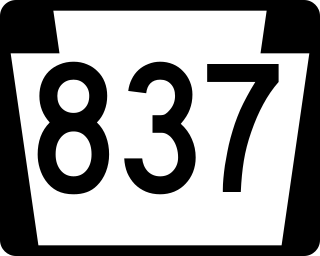
Pennsylvania Route 837 is a state route located in western Pennsylvania. The southern terminus of the route is at Pennsylvania Route 88 in the Carroll Township hamlet of Wickerham Manor. The northern terminus is at U.S. Route 19 and PA 51 near downtown Pittsburgh at the junction of the Ohio, Allegheny and Monongahela rivers. The highway parallels the Monongahela River for all of its route with the exceptions of its extreme north and south ends. Popular amusement park Kennywood is located along this route.

<span class="mw-page-title-main">U.S. Route 19 Truck (Pittsburgh)</span> Highway in Pennsylvania

U.S. Route 19 Truck is a truck route of US 19 located in Western Pennsylvania in Greater Pittsburgh that has a length of 19.4 miles (31.2 km). It is a loop off US 19; the southern terminus located in Mt. Lebanon and the northern terminus in McCandless, connecting to US 19 at both ends. The route is notable for a large, unorthodox interchange with the Penn–Lincoln Parkway just west of the Fort Pitt Tunnel, where the route joins the parkway and forms several wrong-way concurrencies, including one with its own opposing directions. North of Pittsburgh, US 19 Truck is called McKnight Road and south of Pittsburgh it carries West Liberty Avenue and Washington Road.

<span class="mw-page-title-main">U.S. Route 322 in Pennsylvania</span> Highway in Pennsylvania

U.S. Route 322 is a spur of US 22, running from Cleveland, Ohio, east to Atlantic City, New Jersey. In the U.S. state of Pennsylvania, the route runs from the Ohio state line in West Shenango Township southeast to the Commodore Barry Bridge over the Delaware River in Chester, at which point the route crosses into New Jersey, meeting the New Jersey Turnpike at exit 2. The route passes near or through several cities, including Meadville, DuBois, State College, and Harrisburg. US 322 in Pennsylvania is named the 28th Division Highway in honor of the 28th Infantry Division.

<span class="mw-page-title-main">Charles Anderson Memorial Bridge</span> Bridge in Pittsburgh

The Charles Anderson Memorial Bridge is a steel deck truss bridge located in Pittsburgh, Pennsylvania, United States. The bridge carries the four-lane roadway of Boulevard of the Allies across a ravine known as Junction Hollow, connecting the neighborhoods of Central Oakland and South Oakland with Schenley Park. The bridge also spans the Junction Hollow Trail and P&W Subdivision railroad tracks which run along the bottom of the valley.

References

  1. "River Boulevard Proposed by Commission". Pittsburgh Gazette Times. January 27, 1913. Clippings of the first and second pages via Newspapers.com. Accessed February 11, 2022.
  2. Davis, Kathleen J. (August 23, 2018). "Boulevard Of The Allies Isn't So Much A Memorial To War Heroes As The End Of The Streetcar". 90.5 WESA. Retrieved February 11, 2022.
  3. "'Boulevard of Allies' Council's Name for Highway to Oakland". Pittsburgh Post. March 4, 1919. Retrieved February 11, 2022 via Newspapers.com.
  4. American Historical Society, History of Pittsburgh and Environs, Volume III, 1922, p. 697
  5. Lorant, Stefan; Commager, Henry Steele (1999). Pittsburgh: The Story of an American City. Esselmont Books. p. 695. ISBN   978-0-9674103-0-2.
  6. "Officials Open New Boulevard of the Allies". Pittsburgh Gazette Times. October 3, 1922. Clippings of the first and second pages via Newspapers.com. Accessed February 11, 2022.
  7. "Boulevard Addition Opened to Traffic". Pittsburgh Press. September 20, 1930. Retrieved February 11, 2022 via Newspapers.com.
  8. "Synchronized Traffic Signal Test Is Made". Pittsburgh Gazette Times. November 14, 1923. Clippings of the first and second pages via Newspapers.com. Accessed February 11, 2022.
  9. "Vehicles Operate Traffic Signals on Boulevard". Pittsburgh Post-Gazette. October 28, 1931. Retrieved February 11, 2022 via Newspapers.com.
  10. Lincoln Highway Resource Guide, Appendix A – Lincoln Highway Chronology Archived 2007-08-10 at the Wayback Machine
  11. Mixer's motor maps and tours. New England Hotels Pub. Corp. 1 January 1925. Retrieved 3 October 2010.
  12. "Inn to the past: Downtown Cantonese restaurant points back to city's vanished Chinatown". Archived from the original on 2012-05-16.
  13. Gulf Refining Company, Map No. 4: Automobile Roads in Pennsylvania (H.M. Gousha Company), 1928
  14. Pennsylvania Department of Highways, Official Road Map of Pennsylvania, 1940
  15. Pennsylvania Department of Highways, General Highway Map: Allegheny County, Pennsylvania [ permanent dead link ], 1964

40°26′20″N80°00′11″W / 40.438775°N 80.003044°W / 40.438775; -80.003044