Pittsburgh Regional Transit (PRT) is the second-largest public transit agency in Pennsylvania and the 20th-largest in the United States. PRT operates an integrated system of bus, light rail and funicular services in Pittsburgh and Allegheny County, with limited service to three adjacent counties in the Greater Pittsburgh region. The agency was founded in 1956 as the Port Authority of Allegheny County, and began operating transit service in 1964. PRT pioneered bus rapid transit in the United States with the opening of the South Busway in 1977, and continues to operate bus rapid transit services as a core part of its network. In 2023, the system had a ridership of 39,730,300.

The Pittsburgh Light Rail is a 26.2-mile (42.2 km) light rail system in Pittsburgh, Pennsylvania, and surrounding suburbs. It operates as a deep-level subway in Downtown Pittsburgh, but runs mostly at-grade in the suburbs south of the city. The system is largely linear in a north-south direction, with one terminus near Pittsburgh's central business district and two termini in the South Hills. The system is owned and operated by Pittsburgh Regional Transit.

The Red Line is a line on the Pittsburgh Light Rail system that runs between South Hills Village and Downtown Pittsburgh via the Beechview neighborhood. The companion route, the Blue Line, branches off north of Martin Villa – which closed in 2012 – and runs through Overbrook. In March 2007, the closure of the Palm Garden Bridge for refurbishment suspended the Red Line for five months; it resumed service in September.

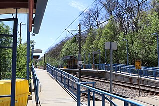
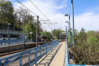
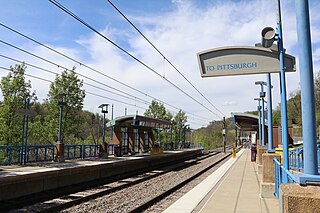
Willow is a station on the Overbrook branch of Pittsburgh Regional Transit's light rail network. It is located in Castle Shannon, Pennsylvania. It is a transfer point between the Red Line and the Blue and Silver Lines. The station's name was derived from Willow Avenue, the street that runs parallel with and across the light rail. No parking is available at the site and because park and ride commuters can more conveniently reach the nearby Memorial Hall station, Willow almost exclusively serves nearby apartments and individuals switching trains.
Mine 3 was a station on the Port Authority of Allegheny County's light rail network, located in Bethel Park, Pennsylvania. The small station was located directly adjacent to an industrial park and was designed mainly to provide access for workers at the associated businesses.

Dorchester is a station on the Port Authority of Allegheny County's light rail network, located in Bethel Park, Pennsylvania. The street level stop was added to the route to serve the nearby Dorchester Apartment complex, for which the stop was named. A variety of apartment blocks have been located near the stop, as part of a transit village model designed to encourage public transit as the primary form of transportation for residents.

Highland is a station on the Port Authority of Allegheny County's light rail network, located in Bethel Park, Pennsylvania. Located in a railroad cut, the stop is designed as a small commuter stop, serving area residents who walk to the train so they can be taken toward Downtown Pittsburgh. A staircase to each platform is available from Highland Road, which crosses over the line on an overpass. In addition, access to the outbound platform is available through a walkway which leads to Santa Fe Drive. There is no grade crossing for passengers at the station.

Memorial Hall is a station on the Overbrook branch of the Port Authority of Allegheny County's light rail network. It is located in Castle Shannon, Pennsylvania. The station serves primarily as a park and ride center, with 340 spaces available for commuters. A variety of residents also walk directly to the station. The stop's name comes from the nearby VFW post. The Port Authority does not own the parking facility but leases it from the nearby Castle Shannon Volunteer Fire Department.
Killarney is a station on the Overbrook branch of the Port Authority of Allegheny County's light rail network. It is located in Castle Shannon, Pennsylvania. The station features no parking and connecting buses, but is located in a crowded residential neighborhood and provides easy access for local residents travelling to Downtown Pittsburgh.

McNeilly is a station on the Overbrook branch of the Port Authority of Allegheny County's light rail network. It is located in Baldwin Township, Pennsylvania. The station features no parking or connecting buses, but is located on a crowded strip of small businesses and many area residents are within walking distance of the station, providing easy access to Downtown.
South Bank is a station on the Overbrook branch of the Port Authority of Allegheny County's light rail network. It is located in the Overbrook neighborhood of Pittsburgh, Pennsylvania. The station is a major transit facility, serving as not only a light rail stop but also as a bus stop along the South Busway, a bus rapid transit route. The station is also designed to serve the crowded and mostly residential community that surrounds the site.
Denise is a station on the Overbrook branch of the Port Authority of Allegheny County's light rail network. It is located in the Carrick neighborhood of Pittsburgh, Pennsylvania. It serves a somewhat blighted commercial corridor along Saw Mill Run Boulevard and a slopeside residential area which extends from the west side of the station.

Poplar is a station on the Port Authority of Allegheny County's light rail network, located in Mount Lebanon, Pennsylvania. The street level stop is located in a densely populated residential area. Its primary purpose is to serve commuters within walking distance, providing access toward Downtown Pittsburgh, South Hills Village, or Library.

Stevenson is a station on the Port Authority of Allegheny County's light rail network, located in Dormont, Pennsylvania. The street level stop is located in a highly populated residential area that features many medium density multi-unit facilities. It serves commuters within walking distance, providing access toward Downtown Pittsburgh or South Hills Village.

Hampshire is a station on the Port Authority of Allegheny County's light rail network, located in the Beechview neighborhood of Pittsburgh, Pennsylvania. The T travels along former streetcar tracks on Broadway Avenue through the area. The inbound stop is located on a small island platform in the middle of the road, while the outbound stop is just a sign, with no platform. The station serves a densely populated residential area and also the neighborhood's small but crowded business district. It is located in an area where bus service is limited because of the hilly terrain.

Westfield station is a station on the Port Authority of Allegheny County's light rail network, located in the Beechview neighborhood of Pittsburgh, Pennsylvania. The street level stop serves a densely populated residential area through which bus service is limited because of the hilly terrain.

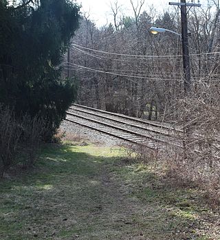
Pennant was a station on the Port Authority of Allegheny County's light rail network, located in the Beechview neighborhood of Pittsburgh, Pennsylvania. The street level stop was located in an especially hilly portion of a neighborhood known for its rolling terrain, and providing access to commuters within walking distance.

The PATrain, also known as Mon Valley Commuter Rail, was a commuter rail service owned by the Port Authority of Allegheny County in the Monongahela Valley in the US state of Pennsylvania. Service began in 1975 when the Port Authority assumed ownership of the Pittsburgh–McKeesport–Versailles commuter trains operated by the Baltimore and Ohio Railroad (B&O) with the support of PennDOT. The Port Authority discontinued the service in 1989.