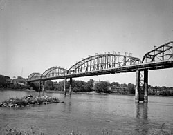
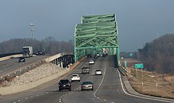
Crossing Carries Location Coordinates Mouth of Missouri River
38°49′01″N 90°07′18″W / 38.81694°N 90.12167°W / 38.81694; -90.12167 (Mouth of Missouri River ) Lewis Bridge US 67 Spanish Lake and West Alton 38°50′33″N 90°14′08″W / 38.84250°N 90.23556°W / 38.84250; -90.23556 (Lewis Bridge ) Bellefontaine Bridge BNSF Railway Hannibal Subdivision 38°50′37″N 90°14′11″W / 38.84361°N 90.23639°W / 38.84361; -90.23639 (Bellefontaine Bridge ) Discovery Bridge Route 370 Bridgeton and Saint Charles 38°47′53″N 90°28′01″W / 38.79806°N 90.46694°W / 38.79806; -90.46694 (Discovery Bridge ) Wabash Bridge Norfolk Southern Railway St. Louis District Wabash Railroad ) 38°47′51″N 90°28′02″W / 38.79750°N 90.46722°W / 38.79750; -90.46722 (Wabash Bridge ) Old St. Charles Bridge (demolished) US 40 Route 115 38°47′00″N 90°28′36″W / 38.78333°N 90.47667°W / 38.78333; -90.47667 (Old St. Charles Bridge ) Blanchette Memorial Bridge I-70 Maryland Heights and Saint Charles 38°45′52″N 90°28′57″W / 38.76444°N 90.48250°W / 38.76444; -90.48250 (Blanchette Memorial Bridge ) Veterans Memorial Bridge Route 364 38°44′11″N 90°31′19″W / 38.73639°N 90.52194°W / 38.73639; -90.52194 (Veterans Memorial Bridge ) Daniel Boone Bridge I-64 US 40 US 61 Chesterfield and Weldon Spring 38°41′13″N 90°39′46″W / 38.68694°N 90.66278°W / 38.68694; -90.66278 (Daniel Boone Bridge ) Washington Bridge (old bridge was replaced in 2018) Route 47 Washington and Three Creeks 38°33′27″N 90°59′54″W / 38.55750°N 90.99833°W / 38.55750; -90.99833 (Washington Bridge ) Christopher S. Bond Bridge Route 19 Hermann and Loutre Township 38°42′34″N 91°26′20″W / 38.70944°N 91.43889°W / 38.70944; -91.43889 (Christopher S. Bond Bridge ) Hermann Bridge (demolished) 38°42′34″N 91°26′18″W / 38.70944°N 91.43833°W / 38.70944; -91.43833 (Hermann Bridge (demolished) ) Senator Roy Blunt Bridge US 54 US 63 Jefferson City 38°35′15″N 92°10′42″W / 38.58750°N 92.17833°W / 38.58750; -92.17833 (Senator Roy Blunt Bridge ) Rocheport Bridge I-70 Saline Township and Katy Township 38°57′35″N 92°32′41″W / 38.95972°N 92.54472°W / 38.95972; -92.54472 (Rocheport Interstate 70 Bridge ) Boonslick Bridge US 40 Route 5 Route 87 Boonville and Franklin Township 38°58′51″N 92°44′45″W / 38.98083°N 92.74583°W / 38.98083; -92.74583 (Boonslick Bridge ) Missouri-Kansas-Texas (MKT) Bridge abandoned, formerly Missouri–Kansas–Texas Railroad 38°58′45″N 92°45′16″W / 38.97917°N 92.75444°W / 38.97917; -92.75444 (Missouri-Kansas-Texas (MKT) Bridge ) Glasgow Bridge (old bridge was replaced in 2009) Route 240 Cambridge Township and Glasgow 39°13′21″N 92°51′00″W / 39.22250°N 92.85000°W / 39.22250; -92.85000 (Glasgow Bridge ) Glasgow Railroad Bridge Kansas City Southern Railway Mexico Subdivision 39°13′22″N 92°51′03″W / 39.22278°N 92.85083°W / 39.22278; -92.85083 (Glasgow Railroad Bridge ) Miami Bridge (Old bridge was replaced in 2010) Route 41 Miami and Eugene Township 39°19′45″N 93°13′31″W / 39.32917°N 93.22528°W / 39.32917; -93.22528 (Miami Bridge ) Waverly Bridge (old bridge was replaced in 2005) US 24 US 65 Waverly and Sugartree Township 39°12′54″N 93°30′56″W / 39.21500°N 93.51556°W / 39.21500; -93.51556 (Waverly Bridge ) Ike Skelton Bridge Route 13 Lexington Township and Crooked River Township 39°12′35″N 93°51′48″W / 39.20972°N 93.86333°W / 39.20972; -93.86333 (Ike Skelton Bridge ) Lexington Bridge (demolished) Lexington and Richmond Township 39°11′13″N 93°53′47″W / 39.18694°N 93.89639°W / 39.18694; -93.89639 (Lexington Bridge ) Sibley Railroad Bridge BNSF Railway Marceline Subdivision Fort Osage Township and Orrick Township 39°10′48″N 94°10′45″W / 39.18000°N 94.17917°W / 39.18000; -94.17917 (Sibley Railroad Bridge ) Liberty Bend Bridge Route 291 Sugar Creek and River Bend 39°10′06″N 94°23′43″W / 39.16833°N 94.39528°W / 39.16833; -94.39528 (Liberty Bend Bridge ) Harry S. Truman Bridge Union Pacific Trenton Subdivision Canadian Pacific Kansas City Subdivision Kansas City 39°08′41″N 94°29′05″W / 39.14472°N 94.48472°W / 39.14472; -94.48472 (Harry S. Truman Bridge ) Eastern I-435 Bridge I-435 Kansas City and Randolph 39°09′04″N 94°29′54″W / 39.15111°N 94.49833°W / 39.15111; -94.49833 (I-435 Bridge ) Chouteau Bridge Route 269 Kansas City and North Kansas City 39°08′42″N 94°32′03″W / 39.14500°N 94.53417°W / 39.14500; -94.53417 (Chouteau Freeway Bridge ) Christopher S. Bond Bridge I-29 I-35 US 71 39°07′21″N 94°33′59″W / 39.12250°N 94.56639°W / 39.12250; -94.56639 (Christopher S. Bond Bridge ) Paseo Bridge (Demolished) 39°07′22″N 94°33′58″W / 39.12278°N 94.56611°W / 39.12278; -94.56611 (Paseo Bridge ) Heart of America Bridge Route 9 39°06′59″N 94°34′47″W / 39.11639°N 94.57972°W / 39.11639; -94.57972 (Heart of America Bridge ) ASB Bridge BNSF Railway 39°07′02″N 94°34′44″W / 39.11722°N 94.57889°W / 39.11722; -94.57889 (ASB Bridge ) Hannibal Bridge (demolished) Hannibal & St. Joseph Railroad BNSF Railway 39°06′46″N 94°35′20″W / 39.11278°N 94.58889°W / 39.11278; -94.58889 (Hannibal Bridge (demolished) ) Second Hannibal Bridge BNSF Railway St. Joseph Subdivision 39°06′46″N 94°35′20″W / 39.11278°N 94.58889°W / 39.11278; -94.58889 (Second Hannibal Bridge ) New Buck O'Neil Bridge US 169 Old Buck O'Neil Bridge / Broadway Bridge (demolished) 39°06′43″N 94°35′22″W / 39.11194°N 94.58944°W / 39.11194; -94.58944 (Broadway Bridge ) US 69 Missouri River Bridge US 69 Kansas City and Riverside 39°09′23″N 94°37′24″W / 39.15639°N 94.62333°W / 39.15639; -94.62333 (US 69 Missouri River Bridge ) Fairfax and Platte Purchase Bridges (demolished) 39°09′23″N 94°37′23″W / 39.15639°N 94.62306°W / 39.15639; -94.62306 (Platte Purchase Bridge ) 39°09′23″N 94°37′24″W / 39.15639°N 94.62333°W / 39.15639; -94.62333 (Fairfax Bridge (demolished) ) I-635 Bridge I-635 39°09′14″N 94°39′03″W / 39.15389°N 94.65083°W / 39.15389; -94.65083 (I-635 Bridge ) Western I-435 Bridge I-435 Kansas City and Parkville 39°11′31″N 94°46′13″W / 39.19194°N 94.77028°W / 39.19194; -94.77028 (I-435 Bridge ) Terminal Bridge (demolished) railway Leavenworth and Lee Township 39°19′02″N 94°54′24″W / 39.31722°N 94.90667°W / 39.31722; -94.90667 (Terminal Bridge ) Centennial Bridge K-92 / Route 92 39°19′47″N 94°54′32″W / 39.32972°N 94.90889°W / 39.32972; -94.90889 (Centennial Bridge ) Kansas and Missouri Bridge (demolished) 39°20′59″N 94°54′38″W / 39.34972°N 94.91056°W / 39.34972; -94.91056 (Kansas and Missouri Bridge ) Amelia Earhart Bridge US 59 Atchison and Rush Township 39°33′35″N 95°06′48″W / 39.55972°N 95.11333°W / 39.55972; -95.11333 (Amelia Earhart Bridge ) Atchison Rail Bridge BNSF Railway 39°33′37″N 95°06′47″W / 39.56028°N 95.11306°W / 39.56028; -95.11306 (Atchison Rail Bridge ) Pony Express Bridge US 36 Elwood and St. Joseph 39°44′56″N 94°51′34″W / 39.74889°N 94.85944°W / 39.74889; -94.85944 (Pony Express Bridge ) St. Joseph Swing Bridge Union Pacific 39°44′57″N 94°51′34″W / 39.74917°N 94.85944°W / 39.74917; -94.85944 (St. Joseph Swing Bridge ) Rulo Bridge (Old Bridge was replaced in 2013) US 159 Rulo and Minton Township 40°03′15″N 95°25′15″W / 40.05417°N 95.42083°W / 40.05417; -95.42083 (Rulo Bridge ) Rulo Rail Bridge BNSF Railway St. Joseph Subdivision 40°03′16″N 95°25′15″W / 40.05444°N 95.42083°W / 40.05444; -95.42083 (Rulo Rail Bridge ) Brownville Bridge US 136 Brownville and Templeton Township 40°23′57″N 95°39′06″W / 40.39917°N 95.65167°W / 40.39917; -95.65167 (Brownville Bridge ) Nebraska City Bridge N-2 / Iowa 2 Nebraska City and Benton Township 40°40′14″N 95°49′51″W / 40.67056°N 95.83083°W / 40.67056; -95.83083 (Nebraska City Bridge ) Railroad bridge (demolished) Waubonsie Bridge (demolished) Pontoon bridge (demolished) Plattsmouth Bridge Livingston Road/Lambert Avenue (formerly US 34 ) Plattsmouth and Plattville Township 41°00′03″N 95°52′01″W / 41.00083°N 95.86694°W / 41.00083; -95.86694 (Plattsmouth Bridge ) Plattsmouth Rail Bridge BNSF Railway Creston Subdivision (formerly Burlington and Missouri River Railroad ) 41°00′06″N 95°52′02″W / 41.00167°N 95.86722°W / 41.00167; -95.86722 (Burlington and Missouri River Railroad Bridge ) Plattsmouth Pipeline Bridge 41°00′10″N 95°52′06″W / 41.00278°N 95.86833°W / 41.00278; -95.86833 (Pipeline Bridge ) U.S. Route 34 Missouri River Bridge US 34 LaPlatte I Precinct and Plattville Township Bellevue Bridge Mission Avenue (formerly N-370 / Iowa 370 ) Bellevue and St. Marys Township 41°08′19″N 95°52′46″W / 41.13861°N 95.87944°W / 41.13861; -95.87944 (Bellevue Bridge ) South Omaha Veterans Memorial Bridge (Old bridge was replaced in 2010) US 275 N-92 / Iowa 92 Omaha and Council Bluffs 41°12′40″N 95°55′35″W / 41.21111°N 95.92639°W / 41.21111; -95.92639 (South Omaha Veterans Memorial Bridge ) Interstate 80 Missouri River Bridge I-80 41°13′54″N 95°54′39″W / 41.23167°N 95.91083°W / 41.23167; -95.91083 (Interstate 80 Bridge ) Union Pacific Missouri River Bridge Union Pacific Railroad Omaha Subdivision 41°14′59″N 95°55′02″W / 41.24972°N 95.91722°W / 41.24972; -95.91722 (Union Pacific Missouri River Bridge ) Ak-Sar-Ben Bridge (demolished) 41°15′32″N 95°55′17″W / 41.25889°N 95.92139°W / 41.25889; -95.92139 (Ak-Sar-Ben Bridge ) Grenville Dodge Memorial Bridge I-480 (Gerald R. Ford Freeway) US 6
41°15′35″N 95°55′18″W / 41.25972°N 95.92167°W / 41.25972; -95.92167 (Grenville Dodge Memorial Bridge ) Bob Kerrey Pedestrian Bridge 41°15′17″N 95°55′31″W / 41.25472°N 95.92528°W / 41.25472; -95.92528 (Bob Kerrey Pedestrian Bridge ) Illinois Central Missouri River Bridge abandoned 41°16′41″N 95°53′28″W / 41.27806°N 95.89111°W / 41.27806; -95.89111 (Illinois Central Missouri River Bridge ) Mormon Bridge I-680 Omaha and Crescent Township 41°20′44″N 95°57′26″W / 41.34556°N 95.95722°W / 41.34556; -95.95722 (Mormon Bridge ) Blair Bridge (Abraham Lincoln Memorial Bridge) US 30 Blair and Cincinnati Township 41°33′04″N 96°05′44″W / 41.55111°N 96.09556°W / 41.55111; -96.09556 (Blair Bridge ) Blair Bridge Union Pacific Railroad Blair Subdivision 41°33′05″N 96°05′44″W / 41.55139°N 96.09556°W / 41.55139; -96.09556 (Blair Railroad Bridge ) Burt County Missouri River Bridge N-51 / Iowa 175 Decatur and Lincoln Township 42°00′24″N 96°14′31″W / 42.00667°N 96.24194°W / 42.00667; -96.24194 (Burt County Missouri River Bridge ) Sergeant Floyd Memorial Bridge I-129 US 20 US 75 South Sioux City and Sioux City 42°26′49″N 96°22′48″W / 42.44694°N 96.38000°W / 42.44694; -96.38000 (Sergeant Floyd Memorial Bridge ) Sioux City Rail Bridge BNSF Railway Sioux City Subdivision 42°28′29″N 96°23′07″W / 42.47472°N 96.38528°W / 42.47472; -96.38528 (Rail Bridge ) Siouxland Veterans Memorial Bridge US 77 42°29′15″N 96°24′49″W / 42.48750°N 96.41361°W / 42.48750; -96.41361 (Siouxland Veterans Memorial Bridge ) Vermillion-Newcastle Bridge N-15 / SD 19 Hooker Township and Vermillion Township 42°43′08″N 96°57′06″W / 42.71889°N 96.95167°W / 42.71889; -96.95167 (Vermillion-Newcastle Bridge ) Meridian Highway Bridge pedestrians (formerly US 81 ) South Yankton and Yankton 42°51′53″N 97°23′38″W / 42.86472°N 97.39389°W / 42.86472; -97.39389 (Meridian Highway Bridge ) Discovery Bridge US 81 42°51′56″N 97°23′49″W / 42.86556°N 97.39694°W / 42.86556; -97.39694 (Discovery Bridge ) Gavins Point Dam Crest Road Cedar County Precinct 2 and West Yankton 42°51′45″N 97°29′06″W / 42.86250°N 97.48500°W / 42.86250; -97.48500 (Gavins Point Bridge ) Chief Standing Bear Memorial Bridge N-14 / SD 37 Niobrara Township and Running Water 42°46′00″N 97°59′15″W / 42.76667°N 97.98750°W / 42.76667; -97.98750 (Chief Standing Bear Memorial Bridge ) Fort Randall Dam US 18 US 281 Southeast Gregory County and White Swan Township , near Pickstown 43°04′01″N 98°33′10″W / 43.06694°N 98.55278°W / 43.06694; -98.55278 (Fort Randall Dam ) Platte–Winner Bridge SD 44 North Gregory County and La Roche Township 43°23′12″N 99°07′56″W / 43.38667°N 99.13222°W / 43.38667; -99.13222 (SD 44 Bridge ) Chamberlain Rail Bridge Ringneck and Western Railroad (formerly Dakota Southern Railway ) Oacoma and Chamberlain Township 43°47′56″N 99°21′33″W / 43.79889°N 99.35917°W / 43.79889; -99.35917 (Rail Bridge ) Lewis and Clark Memorial Bridge I-90 Oacoma and Chamberlain 43°48′06″N 99°21′12″W / 43.80167°N 99.35333°W / 43.80167; -99.35333 (Lewis and Clark Memorial Bridge ) Chamberlain Bridge I-90 BL US 16 ) 43°48′48″N 99°20′33″W / 43.81333°N 99.34250°W / 43.81333; -99.34250 (Chamberlain Bridge ) Big Bend Dam SD 47 Lower Brule and Fort Thompson 44°02′53″N 99°26′53″W / 44.04806°N 99.44806°W / 44.04806; -99.44806 (Big Bend Dam ) John C. Waldron Memorial Bridge US 14 US 83 SD 34 Fort Pierre and Pierre 44°22′15″N 100°22′10″W / 44.37083°N 100.36944°W / 44.37083; -100.36944 (South Dakota Highway 34 Bridge ) Chicago and North Western Railroad Bridge Rapid City, Pierre and Eastern Railroad 44°22′25″N 100°22′10″W / 44.37361°N 100.36944°W / 44.37361; -100.36944 (Chicago and North Western Railroad Bridge ) Oahe Dam SD 1804 North Stanley County and West Hughes County , near Oahe Acres 44°27′00″N 100°24′13″W / 44.45000°N 100.40361°W / 44.45000; -100.40361 (Oahe Dam ) U.S. Route 212 Missouri River Bridge US 212 South Dewey County near Swift Bird , and Forest City 45°01′04″N 100°17′41″W / 45.01778°N 100.29472°W / 45.01778; -100.29472 (U.S. Route 212 Bridge ) U.S. Route 12 Missouri River Bridge US 12 SD 20 East Corson County and West Walworth County , near Mobridge 45°33′55″N 100°28′08″W / 45.56528°N 100.46889°W / 45.56528; -100.46889 (South Dakota Highway 20 Bridge ) Mobridge Rail Bridge BNSF Railway Mobridge Subdivision 45°34′10″N 100°27′33″W / 45.56944°N 100.45917°W / 45.56944; -100.45917 (Rail Bridge ) Bismarck Expressway Bridge ND 810 (Bismarck Expressway) Mandan and Bismarck 46°47′47″N 100°49′12″W / 46.79639°N 100.82000°W / 46.79639; -100.82000 (Expressway Bridge ) New Liberty Memorial Bridge (Open; Under Construction) I-94 BL 46°48′28″N 100°49′09″W / 46.80778°N 100.81917°W / 46.80778; -100.81917 (New Liberty Memorial Bridge ) Liberty Memorial Bridge (demolished October 29, 2008) [ 1] [ 2] I-94 BL 46°48′29″N 100°49′10″W / 46.80806°N 100.81944°W / 46.80806; -100.81944 (Liberty Memorial Bridge ) Bismarck Rail Bridge BNSF Railway Jamestown Subdivision 46°49′05″N 100°49′37″W / 46.81806°N 100.82694°W / 46.81806; -100.82694 (BNSF Rail Bridge ) Grant Marsh Bridge I-94 46°49′24″N 100°49′49″W / 46.82333°N 100.83028°W / 46.82333; -100.83028 (Grant Marsh Bridge ) Washburn Bridge ND 200A East Oliver County and Washburn 47°17′19″N 101°02′33″W / 47.28861°N 101.04250°W / 47.28861; -101.04250 (North Dakota Highway 200A Bridge ) Garrison Dam ND 200 Pick City and Riverdale 47°29′53″N 101°24′38″W / 47.49806°N 101.41056°W / 47.49806; -101.41056 (Garrison Dam ) Four Bears Bridge ND 23 Four Bears Village and New Town 47°58′46″N 102°33′42″W / 47.97944°N 102.56167°W / 47.97944; -102.56167 (Four Bears Bridge ) Williston Bridge US 85 Judson Township near Williston , and Tri Township 48°06′31″N 103°43′00″W / 48.10861°N 103.71667°W / 48.10861; -103.71667 (U.S. Route 85 Bridge ) Buford Bridge ND 58 Yellowstone Township and Buford 47°59′02″N 104°00′56″W / 47.98389°N 104.01556°W / 47.98389; -104.01556 (North Dakota Highway 58 Bridge ) source [ 3] Burlington Northern Rail Bridge (also known as Snowden Bridge , Nohly Bridge, and Great Northern Railroad Bridge) [ 4] BNSF Railway , originally Great Northern Railway (U.S.) Nohly 48°00′00″N 104°05′45″W / 48.00000°N 104.09583°W / 48.00000; -104.09583 (Burlington Northern Rail Bridge ) Culbertson Bridge MT 16 Culbertson 48°07′29″N 104°28′29″W / 48.12472°N 104.47472°W / 48.12472; -104.47472 (Culbertson Bridge ) Highway Bridge Roosevelt Co. Rd. 480 South of Sprole 48°03′53″N 105°01′55″W / 48.06472°N 105.03194°W / 48.06472; -105.03194 (Roosevelt County 480 Bridge ) Lewis and Clark Bridge MT 13 East of Wolf Point 48°03′54″N 105°01′54″W / 48.06500°N 105.03167°W / 48.06500; -105.03167 (Lewis and Clark Bridge ) Fort Peck Dam MT 24 17 miles southeast of Glasgow 48°00′13″N 106°24′41″W / 48.00361°N 106.41139°W / 48.00361; -106.41139 (Fort Peck Dam ) Highway Bridge US 191 72 miles south of Malta 47°37′52″N 108°41′04″W / 47.63111°N 108.68444°W / 47.63111; -108.68444 (U.S. Route 191 Bridge ) McClelland Ferry Blaine Co. Rd. Road 300 / Fergus Co. Rd. 101 12 miles north of Winifred 47°44′15″N 109°23′29″W / 47.73750°N 109.39139°W / 47.73750; -109.39139 (McClelland Ferry ) Highway Bridge S-236 64 miles southeast of Big Sandy 47°44′20″N 109°37′33″W / 47.73889°N 109.62583°W / 47.73889; -109.62583 (Montana Highway 236 Bridge ) Virgelle Ferry Chouteau Co. Rd. 430 Virgelle 48°00′04″N 110°15′14″W / 48.00111°N 110.25389°W / 48.00111; -110.25389 (Virgelle Ferry ) Loma Bridge Chouteau Co. Rd. 303 Loma 47°55′17″N 110°29′43″W / 47.92139°N 110.49528°W / 47.92139; -110.49528 (Loma Bridge ) Ft. Benton Old Bridge Pedestrian Bridge Ft. Benton 47°49′02″N 110°39′58″W / 47.81722°N 110.66611°W / 47.81722; -110.66611 (Ft. Benton Old Bridge ) Chouteau County Memorial Bridge MT 80 47°48′54″N 110°40′02″W / 47.81500°N 110.66722°W / 47.81500; -110.66722 (Chouteau County Memorial Bridge ) Carter Ferry Chouteau Co. Rd. 100 5 miles southeast of Carter 47°45′37″N 110°53′46″W / 47.76028°N 110.89611°W / 47.76028; -110.89611 (Carter Ferry ) Moroney Dam 15 miles northeast of Great Falls 47°34′53″N 111°03′36″W / 47.58139°N 111.06000°W / 47.58139; -111.06000 (Moroney Dam ) Ryan Dam 12 miles northeast of Great Falls 47°34′11″N 111°07′29″W / 47.56972°N 111.12472°W / 47.56972; -111.12472 (Ryan Dam ) Cochrane Dam 10 miles northeast of Great Falls 47°33′12″N 111°08′57″W / 47.55333°N 111.14917°W / 47.55333; -111.14917 (Cochrane Dam ) Rainbow Dam 8 miles east of Great Falls 47°32′05″N 111°12′17″W / 47.53472°N 111.20472°W / 47.53472; -111.20472 (Rainbow Dam ) Rail Bridge BNSF Railway Just above Rainbow Dam 47°32′06″N 111°12′18″W / 47.53500°N 111.20500°W / 47.53500; -111.20500 (Rail Bridge ) Black Eagle Dam Just north of Great Falls 47°31′11″N 111°15′49″W / 47.51972°N 111.26361°W / 47.51972; -111.26361 (Black Eagle Dam ) 15th Street Bridge US 87 Great Falls 47°31′14″N 111°16′54″W / 47.52056°N 111.28167°W / 47.52056; -111.28167 (15th Street Bridge ) Historic 10th Street Bridge Pedestrian Bridge 47°31′14″N 111°17′26″W / 47.52056°N 111.29056°W / 47.52056; -111.29056 (Historic 10th Street Bridge ) 9th Street Bridge 47°31′14″N 111°17′28″W / 47.52056°N 111.29111°W / 47.52056; -111.29111 (9th Street Bridge ) Central Avenue Bridge 47°30′26″N 111°18′46″W / 47.50722°N 111.31278°W / 47.50722; -111.31278 (Central Avenue Bridge ) Railroad Bridge BNSF Railway 47°30′9″N 111°18′43″W / 47.50250°N 111.31194°W / 47.50250; -111.31194 (Railroad Bridge ) Interstate Bridge I-315 US 89 MT 3 MT 200 47°29′36″N 111°18′48″W / 47.49333°N 111.31333°W / 47.49333; -111.31333 (Interstate 315 Bridge ) Highway Bridge S-330 Ulm 47°25′49″N 111°30′09″W / 47.43028°N 111.50250°W / 47.43028; -111.50250 (Montana Secondary Highway 330 Bridge ) Highway Bridge S-330 Cascade 47°16′11″N 111°41′46″W / 47.26972°N 111.69611°W / 47.26972; -111.69611 (Montana Secondary Highway 330 Bridge ) Freeway Bridge I-15 1 mile south of Hardy 47°10′40″N 111°48′45″W / 47.17778°N 111.81250°W / 47.17778; -111.81250 (Interstate 15 Bridge ) Hardy Bridge Former US 91 2.5 miles south of Hardy 47°10′02″N 111°50′05″W / 47.16722°N 111.83472°W / 47.16722; -111.83472 (Hardy Bridge ) Freeway Bridge I-15 2 miles north of Dearborn Exit 47°08′19″N 111°51′40″W / 47.13861°N 111.86111°W / 47.13861; -111.86111 (Interstate 15 Bridge ) Freeway Bridges I-15 3/4 miles north of Dearborn Exit 47°07′54″N 111°52′28″W / 47.13167°N 111.87444°W / 47.13167; -111.87444 (Interstate 15 Bridge ) Freeway Bridges I-15 1/4 mile north of Dearborn Exit 47°07′58″N 111°53′11″W / 47.13278°N 111.88639°W / 47.13278; -111.88639 (Interstate 15 Bridge ) Freeway Bridge I-15 1½ miles south of Dearborn Exit, at mouth of Dearborn River 47°07′41″N 111°54′41″W / 47.12806°N 111.91139°W / 47.12806; -111.91139 (Interstate 15 Bridge ) Freeway Bridge I-15 2½ miles north of Craig 47°06′02″N 111°56′58″W / 47.10056°N 111.94944°W / 47.10056; -111.94944 (Interstate 15 Bridge ) Highway Bridge Lewis and Clark Co. Rd. 13 B Craig 47°04′28″N 111°57′41″W / 47.07444°N 111.96139°W / 47.07444; -111.96139 (Lewis and Clark County 13B Bridge ) Missouri River Bridge Craig Frontage Road US 91 3½ miles northeast of Wolf Creek 47°01′08″N 112°00′44″W / 47.01889°N 112.01222°W / 47.01889; -112.01222 (Craig Frontage Road Bridge ) Holter Dam 4 miles southeast of Wolf CreekGates of the Mountains Wilderness 46°59′28″N 112°00′17″W / 46.99111°N 112.00472°W / 46.99111; -112.00472 (Holter Dam ) Hauser Dam 6 miles north of the east end of S-453 46°45′54″N 111°53′13″W / 46.76500°N 111.88694°W / 46.76500; -111.88694 (Hauser Dam ) Trout Creek Canyon Bridge York Road / S-280 15 miles northeast of Helena 46°42′48″N 111°48′23″W / 46.71333°N 111.80639°W / 46.71333; -111.80639 (Trout Creek Canyon Bridge ) Canyon Ferry Dam S-284 19 miles east of Helena 46°38′55″N 111°43′41″W / 46.64861°N 111.72806°W / 46.64861; -111.72806 (Canyon Ferry Dam ) Highway Bridge US 12 US 287 1 mile north of Townsend 46°20′07″N 111°31′54″W / 46.33528°N 111.53167°W / 46.33528; -111.53167 (U.S. Route 12 Bridge ) Railroad Bridge Montana RailLink 1 mile north of Townsend 46°20′05″N 111°31′58″W / 46.33472°N 111.53278°W / 46.33472; -111.53278 (Montana RailLink Bridge ) Highway Bridge US 287 1/2 mile north of Toston 46°10′27″N 111°26′45″W / 46.17417°N 111.44583°W / 46.17417; -111.44583 (U.S. Route 287 Bridge ) Toston Bridge Broadwater Co. Rd. 415C (formerly US 287) Toston 46°10′19″N 111°26′38″W / 46.17194°N 111.44389°W / 46.17194; -111.44389 (Toston Bridge ) Toston Dam 8 miles south of Toston 46°07′12″N 111°24′30″W / 46.12000°N 111.40833°W / 46.12000; -111.40833 (Toston Dam ) Abandoned Rail Bridge Old Milwaukee Road Line At mouth of Sixteen Mile Creek 46°06′21″N 111°24′01″W / 46.10583°N 111.40028°W / 46.10583; -111.40028 (Abandoned Rail Bridge ) Mouth of Gallatin River
45°56′19″N 111°29′35″W / 45.93861°N 111.49306°W / 45.93861; -111.49306 (Mouth of the Gallatin River ) Confluence of the Jefferson and the Madison Rivers
45°55′36″N 111°30′18″W / 45.92667°N 111.50500°W / 45.92667; -111.50500 (Confluence of the Jefferson and Madison Rivers )