Rush Township | |
|---|---|
 | |
| Coordinates: 39°33′51″N95°03′39″W / 39.5642745°N 95.0607628°W | |
| Country | |
| State | |
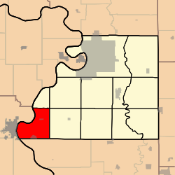
| County | Buchanan |
| Area | |
• Total | 27.71 sq mi (71.8 km2) |
| • Land | 26.36 sq mi (68.3 km2) |
| • Water | 1.35 sq mi (3.5 km2) 4.87% |
| Elevation | 791 ft (241 m) |
| Population | |
• Total | 710 |
| • Density | 26.9/sq mi (10.4/km2) |
| FIPS code | 29-02163542 [1] |
| GNIS feature ID | 766344 [2] |
Rush Township is a township in Buchanan County, Missouri, United States. [2] At the 2020 census, its population was 710. [3]
Contents
Rush Township was established in the 1840s. [4]
