Bloomington Township | |
|---|---|
 | |
| Coordinates: 39°34′40″N94°56′31″W / 39.5777796°N 94.9418638°W | |
| Country | |
| State | |
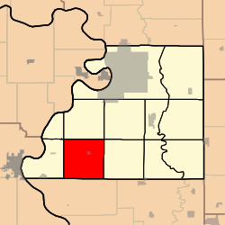
| County | Buchanan |
| Area | |
• Total | 91.6 km2 (35.37 sq mi) |
| • Land | 91.5 km2 (35.33 sq mi) |
| • Water | 0.1 km2 (0.04 sq mi) 0.11% |
| Elevation | 315 m (1,033 ft) |
| Population | |
• Total | 695 |
| • Density | 7.6/km2 (19.7/sq mi) |
| FIPS code | 29-02106418 [1] |
| GNIS feature ID | 766337 [2] |
Bloomington Township is a township in Buchanan County, Missouri, United States. [2] At the 2020 census, its population was 695. [3]
Contents
Bloomington Township was organized in 1839; the name Bloomington is an old variant name of De Kalb. [4]
