
Council Bluffs is a city in and the county seat of Pottawattamie County, Iowa, United States. The population was 62,799 at the 2020 census, making it the state's tenth most populous city, and the most populous city in Southwest Iowa. The Omaha metropolitan region of which Council Bluffs is a part, is the 58th largest in the United States, with an estimated population of 983,969 (2023). It is located on the east bank of the Missouri River, across from Omaha, Nebraska. Until about 1853 Council Bluffs was known as Kanesville. Kanesville was the historic starting point of the Mormon Trail. Kanesville is also the northernmost anchor town of the other emigrant trails because there was a steam-powered boat which ferried the settlers' wagons and cattle across the Missouri River. In 1869, the first transcontinental railroad to California was connected to the existing U.S. rail network at Council Bluffs.

Interstate 80 (I-80) is an east–west transcontinental freeway that crosses the United States from San Francisco, California, to Teaneck, New Jersey, in the New York metropolitan area. The highway was designated in 1956 as one of the original routes of the Interstate Highway System; its final segment was opened in 1986. The second-longest Interstate Highway in the United States after I-90, it runs through many major cities, including Oakland, Sacramento, Reno, Salt Lake City, Omaha, Des Moines, and Toledo and passes within 10 miles (16 km) of Chicago, Cleveland, and New York City.

U.S. Route 75 is a north–south U.S. Highway that runs 1,239 miles (1,994 km) in the central United States. The highway's northern terminus is located at the Canadian border near Noyes, Minnesota, at a now-closed border crossing. From this point, the highway once continued farther north as Manitoba Highway 75. Its southern terminus is located at Interstate 345 (I-345) and Texas State Highway Spur 366 in Dallas, Texas, where US 75 is known as North Central Expressway.
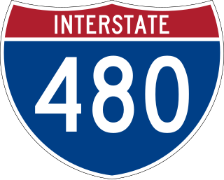
Interstate 480 (I-480) is a 4.9-mile-long (7.9 km) auxiliary Interstate Highway that connects I-80 in Downtown Omaha, Nebraska, with I-29 in Council Bluffs, Iowa. The portion of I-480 in Nebraska has been named the Gerald R. Ford Expressway, named in honor of the former president, who was a native of Omaha. For most of its length, I-480 is overlapped by a US Highway: for two miles (3.2 km) with US Highway 75 (US 75) and for one mile (1.6 km) with US 6. I-480 includes the Grenville Dodge Memorial Bridge over the Missouri River.
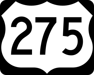
U.S. Route 275 (US 275) is a north–south United States highway that is a branch of US 75. It originally terminated at US 75 in Council Bluffs, Iowa. The highway's northern terminus is in O'Neill, Nebraska, at an intersection with U.S. Highway 20 and U.S. Highway 281. Its southern terminus is near Rock Port, Missouri, at an intersection with U.S. Highway 136.

Interstate 680 (I-680) in Nebraska and Iowa is the northern bypass of the Omaha–Council Bluffs metropolitan area. I-680 spans 16.49 miles (26.54 km) from its southern end in western Omaha, Nebraska, to its eastern end near Crescent, Iowa. The freeway passes through a diverse range of scenes and terrains—the urban setting of Omaha, the Missouri River and its valley, the rugged Loess Hills, and the farmland of Pottawattamie County, Iowa.
The Union Pacific Missouri River Bridge is a rail truss bridge across the Missouri River between Council Bluffs, Iowa, and Omaha, Nebraska.

The Bob Kerrey Pedestrian Bridge is a 3,000-foot (910 m) footbridge across the Missouri River between Council Bluffs, Iowa, and Omaha, Nebraska. It opened on September 28, 2008.
The Knights of Ak-Sar-Ben Foundation is a 501(c)(3) civic and philanthropic organization in Omaha, Nebraska.

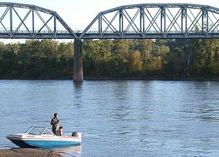
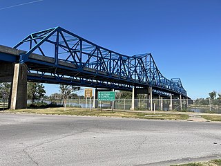
The South Omaha Veterans Memorial Bridge was a continuous warren through truss bridge over the Missouri River connecting Omaha, Nebraska with Council Bluffs, Iowa via U.S. Highway 275.
The Mormon Bridge is a bridge composed of two cantilevers that crosses the Missouri River connecting Pottawattamie County, Iowa with the Florence neighborhood of Omaha, Nebraska via Interstate 680 (Iowa-Nebraska). The bridge is officially called the Mormon Pioneer Memorial Bridge due to its location on the historic Mormon Trail, which passed nearby.

Nebraska Highway 133 (N-133) is a state highway in Douglas and Washington counties in Nebraska, United States, that conencts U.S. Route 6 (US 6) in Omaha with U.S. Route 30 (US 30) in Blair. For its entire length, N-133 is a four-lane divided highway.
Interstate 80 (I-80) in the US state of Nebraska runs east from the Wyoming state border across the state to Omaha. Construction of the stretch of I-80 spanning the state was completed on October 19, 1974. Nebraska was the first state in the nation to complete its mainline Interstate Highway System.

In the US state of Iowa, Interstate 29 (I-29) is a north–south Interstate Highway which closely parallels the Missouri River. I-29 enters Iowa from Missouri near Hamburg and heads to the north-northwest through the Omaha–Council Bluffs and the Sioux City areas. It exits the state by crossing the Big Sioux River into South Dakota. For its entire distance through the state, it runs on the flat land between the Missouri River and the Loess Hills.
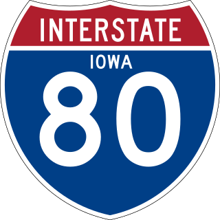
Interstate 80 (I-80) is a transcontinental Interstate Highway in the United States, stretching from San Francisco, California, to Teaneck, New Jersey. In Iowa, the highway travels west to east through the center of the state. It enters the state at the Missouri River in Council Bluffs and heads east through the southern Iowa drift plain. In the Des Moines metropolitan area, I-80 meets up with I-35 and the two routes bypass Des Moines together. On the northern side of Des Moines, the Interstates split and I-80 continues east. In eastern Iowa, it provides access to the University of Iowa in Iowa City. Northwest of the Quad Cities in Walcott is Iowa 80, the world's largest truck stop. I-80 passes along the northern edge of Davenport and Bettendorf and leaves Iowa via the Fred Schwengel Memorial Bridge over the Mississippi River into Illinois.

Transportation in Omaha, Nebraska, includes most major modes, such as pedestrian, bicycle, automobile, bus, train and airplane. While early transportation consisted of ferries, stagecoaches, steamboats, street railroads, and railroads, the city's transportation systems have evolved to include the Interstate Highway System, parklike boulevards and a variety of bicycle and pedestrian trails. The historic head of several important emigrant trails and the First transcontinental railroad, its center as a national transportation hub earned Omaha the nickname "Gate City of the West" as early as the 1860s.
The Omaha and Council Bluffs Railway and Bridge Company, known as O&CB, was incorporated in 1886 in order to connect Omaha, Nebraska with Council Bluffs, Iowa over the Missouri River. With a sanctioned monopoly over streetcar service in the two cities, the O&CB was among the earliest major electric street railway systems in the nation, and was one of the last streetcar operators in the U.S., making its last run in 1955.
U.S. Route 75 was a part of the United States Numbered Highway System that runs for 1,239 miles (1,994 km) from Dallas, Texas to Kittson County, Minnesota where it ends just short of the Canada–United States border. Within the State of Nebraska it is a state highway that enters Nebraska on the Kansas state line about 9 miles (14 km) south of Dawson and travels north across the extreme eastern portion of the state, to the Nebraska–Iowa border in South Sioux City where it crosses the Missouri River along a concurrency with Interstate 129. The northern 210 miles (340 km) of the route generally travels parallel to the Missouri River. The 87.32-mile (140.53 km) section between the I-680 interchange in Omaha and the Interstate 129 interchange is designated the Lewis & Clark Scenic Byway, one of nine scenic byways in the state.
The Gibson Bend of the Missouri River is a meander located in Pottawattamie County, Iowa and Douglas County, Nebraska, located at 41°11′15″N95°55′15″W. The Gibson neighborhood is a community area in Omaha, Nebraska abutting the Gibson Bend.
U.S. Highway 75 (US 75) is a United States Highway in northwestern Iowa. It begins at the Missouri River on a bridge with Interstate 129 (I-129) and US 20. Immediately upon landing in Iowa from Nebraska, I-129 ends at an interchange with I-29. US 20 and US 75 continue around Sioux City on a four-lane expressway until US 20 exits to the east. US 75 heads to the north-northeast, parallel to the Floyd River, until Le Mars. There, Iowa Highway 60 (Iowa 60) continues northeastward on the expressway while US 75 heads due north. Near Hull, it is briefly overlapped by US 18. It leaves the state and enters Minnesota north of Rock Rapids.

