Related Research Articles

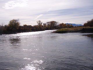
The Missouri River is the longest river in the United States. Rising in the Eastern Centennial Mountains of the Bitteroot Range of the Rocky Mountains of Southwestern Montana, the Missouri flows east and south for 2,341 miles (3,767 km) before entering the Mississippi River north of St. Louis, Missouri. The river drains a sparsely populated, semi-arid watershed of more than 500,000 square miles (1,300,000 km2), which includes parts of ten U.S. states and two Canadian provinces. Although a tributary of the Mississippi, the Missouri River is slightly longer and carries a comparable volume of water. When combined with the lower Mississippi River, it forms the world's fourth longest river system.

Milk River is a tributary of the Missouri River, 729 miles (1,173 km) long, in the U.S. state of Montana and the Canadian province of Alberta. Rising in the Rocky Mountains, the river drains a sparsely populated, semi-arid watershed of 23,800 square miles (62,000 km2), ending just east of Fort Peck, Montana.

The Yellowstone River is a tributary of the Missouri River, approximately 692 miles (1,114 km) long, in the Western United States. Considered the principal tributary of upper Missouri, via its own tributaries it drains an area with headwaters across the mountains and high plains of southern Montana and northern Wyoming, and stretching east from the Rocky Mountains in the vicinity of Yellowstone National Park. It flows northeast to its confluence with the Missouri River on the North Dakota side of the border, about 25 miles west of present-day Williston.

The Little Missouri River is a tributary of the Missouri River, 560 miles (900 km) long, in the northern Great Plains of the United States. Rising in northeastern Wyoming, in western Crook County about 15 miles (24 km) west of Devils Tower, it flows northeastward, across a corner of southeastern Montana, and into South Dakota. In South Dakota, it flows northward through the Badlands into North Dakota, crossing the Little Missouri National Grassland and both units of Theodore Roosevelt National Park. In the north unit of the park, it turns eastward and flows into the Missouri in Dunn County at Lake Sakakawea, where it forms an arm of the reservoir 30 miles (48 km) long called Little Missouri Bay and joins the main channel of the Missouri about 25 miles (40 km) northeast of Killdeer.
The Jefferson River is a tributary of the Missouri River, approximately 83 miles (134 km) long, in the U.S. state of Montana. The Jefferson River and the Madison River form the official beginning of the Missouri at Missouri Headwaters State Park near Three Forks. It is joined 0.6 miles (1.0 km) downstream (northeast) by the Gallatin.

The Marias River is a tributary of the Missouri River, approximately 210 mi (338 km) long, in the U.S. state of Montana. It is formed in Glacier County, in northwestern Montana, by the confluence of the Cut Bank Creek and the Two Medicine River. It flows east, through Lake Elwell, formed by the Tiber Dam, then southeast, receiving the Teton River at Loma, 2 mi. (3.2 km) above its confluence with the Missouri.

The Cut Bank Creek is a tributary of the Marias River in the Missouri river basin watershed, approximately 75 mi (123 km) long, in northwestern Montana in the United States, which having deeply eroded steep cliff banks eponymously gives name to the cut bank formal terrain term of geological science.

The Sun River is a tributary of the Missouri River in the Great Plains, approximately 130 mi (209 km) long, in Montana in the United States.

The Redwater River is a tributary of the Missouri River, approximately 110 mi (177 km), in eastern Montana in the United States.

Poplar River is a tributary of the Missouri River, approximately 167 miles (269 km) long in Saskatchewan in Canada and Montana in the United States. The river is composed of three main forks – West, Middle, and East Polar Rivers – that have their source in the Wood Mountain Hills of the Missouri Coteau.

The Heart River is a tributary of the Missouri River, approximately 180 miles (290 km) long, in western North Dakota, United States.

The Cheyenne River, also written Chyone, referring to the Cheyenne people who once lived there, is a tributary of the Missouri River in the U.S. states of Wyoming and South Dakota. It is approximately 295 miles (475 km) long and drains an area of 24,240 square miles (62,800 km2). About 60% of the drainage basin is in South Dakota and almost all of the remainder is in Wyoming.

The Niobrara River is a tributary of the Missouri River, approximately 568 miles (914 km) long, running through the U.S. states of Wyoming and Nebraska. The river drains one of the most arid sections of the Great Plains, and has a low flow for a river of its length. The Niobrara's watershed includes the northern tier of Nebraska Sandhills, a small south-central section of South Dakota, as well as a small area of eastern Wyoming.

The Neosho River is a tributary of the Arkansas River in eastern Kansas and northeastern Oklahoma in the United States. Its tributaries also drain portions of Missouri and Arkansas. The river is about 463 miles (745 km) long. Via the Arkansas, it is part of the Mississippi River watershed. Its name is an Osage word meaning "clear water." The lower section is also known as the Grand River.
The Lamine River is a 63.8-mile-long (102.7 km) tributary of the Missouri River in central Missouri in the United States. It is formed in northern Morgan County, about 4 miles (6 km) southeast of Otterville by the confluence of Flat and Richland creeks, and flows generally northwardly through Cooper and Pettis counties. In northwestern Cooper County the Lamine collects the Blackwater River and flows into the Missouri River northeast of Lamine and 6 miles (10 km) west of Boonville. At Clifton City, the river has a mean annual discharge of 455 cubic feet per second. Below the mouth of the Blackwater River, its discharge averages 1,279 cubic feet per second

The Platte River is a tributary of the Missouri River, about 200 miles (320 km) long, in southwestern Iowa and northwestern Missouri in the United States. It is sometimes known as the Little Platte River to distinguish it from the larger Platte River, also a tributary of the Missouri, in nearby Nebraska; the Platte River of Missouri itself has a tributary known as the "Little Platte River".

Mondak is a ghost town in Roosevelt County, Montana, United States, which flourished c. 1903–1919, in large measure by selling alcohol to residents of North Dakota, then a dry state.

Snowden Bridge is a high-clearance, vertical-lift railroad bridge, built in 1913, that spans the Missouri River between Roosevelt and Richland Counties in Montana, USA, between Bainville and Fairview, Montana, and near Fort Union Trading Post National Historic Site and the ghost town of Mondak near Montana's eastern border with North Dakota. Snowden Bridge is a near twin of the Fairview Bridge, which crosses the Yellowstone River in North Dakota, both bridges having been built by Montana Eastern Railway within 10 miles (16 km) of each other over different rivers in different states.

The Salt River is a tributary of the Mississippi River in eastern Missouri in the United States. The river is approximately 55 miles (89 km) long and drains an area of 2,518 sq mi (6,520 km2) in parts of twelve Missouri counties.
References
- ↑ U.S. Geological Survey Geographic Names Information System: Nohly, Montana
- ↑ "Snowden Bridge, Spanning Missouri River, Nohly, Richland County, MT". Library of Congress.
- ↑ "USGS 06185650 Missouri R No. 5 at Nohly, MT". USGS North Dakota Water Science Center.
- ↑ Michels, Holly (December 6, 2015). "Tiny cemetery meticulously maintained through labor of love". Billings Gazette . Retrieved March 9, 2020.
- ↑ U.S. Geological Survey Geographic Names Information System: Nohly Cemetery
- ↑ U.S. Geological Survey Geographic Names Information System: Nohly School (historical)
- ↑ U.S. Geological Survey Geographic Names Information System: Nohly Post Office (historical)