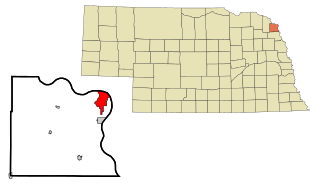
South Sioux City is a city in Dakota County, Nebraska, United States. It is located immediately across the Missouri River from Sioux City, Iowa, and is part of the Sioux City, IA-NE-SD Metropolitan Statistical Area. As of the 2010 census, the city population was 13,353, making it the 14th largest city in Nebraska.
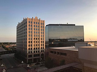
Sioux City is a city in Woodbury and Plymouth counties in the northwestern part of the U.S. state of Iowa. The population was 85,797 in the 2020 census, making it the fourth-largest city in Iowa. The bulk of the city is in Woodbury County, of which it is the county seat, though a small portion is in Plymouth County. Sioux City is located at the navigational head of the Missouri River. The city is home to several cultural points of interest including the Sioux City Public Museum, Sioux City Art Center and Sergeant Floyd Monument, which is a National Historic Landmark. The city is also home to Chris Larsen Park, commonly referred to as "the Riverfront", which includes the Anderson Dance Pavilion, Sergeant Floyd Riverboat Museum and Lewis and Clark Interpretive Center. Sioux City is the primary city of the five-county Sioux City, IA–NE–SD Metropolitan Statistical Area (MSA), with a population of 149,940 in the 2020 Census. The Sioux City–Vermillion, IA–NE–SD Combined Statistical Area had a population of 175,638 as of 2020.
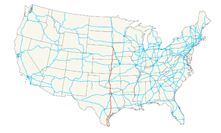
U.S. Route 77 is a major north–south United States Numbered Highway which extends for 1,305 miles (2,100 km) in the central United States. As of 2005, Its southern terminus is in Brownsville, Texas, at Veteran's International Bridge on the Mexican border, where it connects with both Mexican Federal Highway 101 and Mexican Federal Highway 180, and the highway's northern terminus is in Sioux City, Iowa, at an interchange with Interstate 29 (I-29).
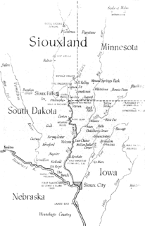
Siouxland is a vernacular region that encompasses the entire Big Sioux River drainage basin in the U.S. states of South Dakota, Minnesota, Nebraska and Iowa. The demonym for a resident of Siouxland is Siouxlander.
Veterans' Memorial Bridge may refer to:

The Rock Island Centennial Bridge, officially the Master Sargeant Stanley W. Talbot Memorial Bridge, connects Rock Island, Illinois, and Davenport, Iowa. The bridge is 3,850 feet (1,173 m) long and stands 170 feet (52 m) above water level.
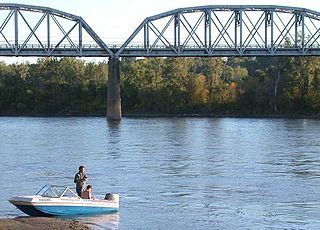
The Union Pacific Missouri River Bridge is a rail truss bridge across the Missouri River between Council Bluffs, Iowa, and Omaha, Nebraska.
U.S. Highway 20 in Iowa is a major east–west artery which runs across the state, separating the northern third of Iowa from the southern two-thirds. It enters Iowa from Nebraska, concurrent with Interstate 129 and U.S Route 75, crossing the Missouri River at Sioux City. US 20 runs in a more-or-less straight line across Iowa, paralleling 42° 27' N. It leaves Iowa in Dubuque by crossing the Mississippi River into Illinois. Since October 2018, US 20 is a four-lane divided highway for its entire length in Iowa.
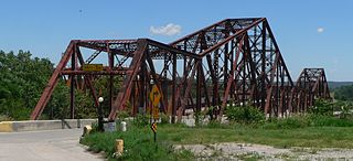
The Plattsmouth Bridge is a truss bridge over the Missouri River connecting Cass County, Nebraska, and Mills County, Iowa at Plattsmouth, Nebraska. Until 2014, it carried U.S. Highway 34 across the river.

The South Omaha Veterans Memorial Bridge was a continuous warren through truss bridge over the Missouri River connecting Omaha, Nebraska with Council Bluffs, Iowa via U.S. Highway 275.

The Mormon Bridge is a bridge composed of two cantilevers that crosses the Missouri River connecting Pottawattamie County, Iowa with the Florence neighborhood of Omaha, Nebraska via Interstate 680 (Iowa-Nebraska). The bridge is officially called the Mormon Pioneer Memorial Bridge due to its location on the historic Mormon Trail, which passed nearby.
Dodge Street is the main east–west street in Omaha, Nebraska. Numbered as U.S. Route 6 (US 6), the street starts in Downtown Omaha and connects to West Dodge Road just west of 78th Street. From there, it continues westward through the remainder of Douglas County.

The Blair Bridge carries the Union Pacific Railroad's Blair Subdivision between the U.S. states of Nebraska and Iowa, across the Missouri River near Blair, Nebraska. It was built in 1883 by the Sioux City and Pacific Rail Road, replacing a car ferry. Automobile traffic crosses via the parallel Blair Bridge.

The Blair Bridge or Abraham Lincoln Memorial Bridge carries U.S. Route 30 between the U.S. states of Nebraska and Iowa, across the Missouri River near Blair, Nebraska. Rail traffic crosses via the parallel Blair Bridge.

U.S. Highway 77 in the state of Nebraska runs south–north across the eastern portion of the state, emerging from Kansas in Gage County south of Wymore, and ending in Dakota County north of South Sioux City, before making a brief entrance into Iowa.
U.S. Highway 77 (US 77) is the shortest U.S. Highway in the state of Iowa. It crosses into Iowa over the Missouri River from South Sioux City, Nebraska, at Sioux City and runs approximately three-tenths mile (500 m) to an interchange with Interstate 29 where the road continues north as Wesley Parkway. Like all other state highways in Iowa, the route is maintained by the Iowa Department of Transportation.
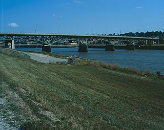
The Jefferson Street Viaduct is an historic structure located in Ottumwa, Iowa, United States. The riveted Warren deck truss bridge was completed in 1936. It was listed on the National Register of Historic Places in 1998 as a part of the Highway Bridges of Iowa MPS.
The Okoboji Bridge is located southwest of Milford, Iowa, United States. The 83-foot (25 m) span carried traffic on 180th Avenue over a branch of the Little Sioux River. The Dickinson County Board of Supervisors hired a local contractor to build a bridge across the straits between East and West Okoboji Lakes in 1859. The wooden structures had to be rebuilt in 1874–1875. There was a desire for a drawbridge at this point to allow for steamboats to navigate between the lakes. Three different swing spans were built at this location in the 19th century. When the third span deteriorated the board of supervisors contracted with the Clinton Bridge and Iron Works of Clinton, Iowa to build a permanent span here in June 1909. The Pratt/Warren pony truss structure was completed later that year for $1,550. The bridge and the road were incorporated into the U.S. Highway System, and it was placed under the aegis of the Iowa State Highway Commission. In 1929 it was replaced with a fixed-span concrete girder structure. At that time the 1909 truss span was moved to Okoboji Township to span a branch of the Little Sioux River. It was listed on the National Register of Historic Places in 1998. The span has subsequently been abandoned.

The Winnebago River Bridge was a historic structure located north of Mason City, Iowa, United States. The span carried U.S. Route 65 over the Winnebago River for 122 feet (37 m). This is the second span at this location. The stone abutments from the previous bridge were utilized in this one. They were sheathed in concrete by the Concrete Engineering Company, and William Henkel of Mason City constructed the bridge. It is composed of three concrete spans with a 70 feet (21 m) center span cantilevered from shorter anchor spans. It was listed on the National Register of Historic Places in 1998. A second span has subsequently been built to the east in 1969.


