Loma, Montana

Last updated

Loma, Montana
Loma, Montana.JPG
Loma, Montana
Chouteau County Montana Incorporated and Unincorporated areas Loma Highlighted.svg
Location of Loma, Montana
Coordinates: 47°56′14″N110°29′59″W / 47.93722°N 110.49972°W / 47.93722; -110.49972
Country United States
State Montana
County Chouteau
Area
[1]
  Total3.44 sq mi (8.92 km2)
  Land3.44 sq mi (8.92 km2)
  Water0.00 sq mi (0.00 km2)
Elevation
2,575 ft (785 m)
Population
 (2020)
  Total65
  Density18.87/sq mi (7.29/km2)
Time zone UTC-7 (Mountain (MST))
  Summer (DST) UTC-6 (MDT)
ZIP code
59460
Area code 406
FIPS code 30-44800
GNIS feature ID0773566

Loma is a census-designated place (CDP) in Chouteau County, Montana, United States. The population was 85 at the 2010 census. [2]

Contents

History

James Kipp, of the American Fur Company founded the first community here in 1831. The Blackfeet laid siege to the fort, and inhabitants quickly abandoned the site. The next year, the American Fur Company established another trading post, Fort McKenzie, a few miles upstream of the old site. [3] During the 1860s, businessmen built a townsite near the confluence of the Marias and the Missouri rivers, called Ophir. On May 25, 1865, the Blackfeet killed 10 men in the developing town. [3]

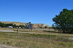
Geography and climate

Loma is located in central Chouteau County at the confluence of the Marias and Missouri rivers. U.S. Route 87 passes through the community, leading southwest 10 miles (16 km) to Fort Benton, the Chouteau County seat, and northeast 60 miles (97 km) to Havre.

According to the United States Census Bureau, the CDP has a total area of 3.42 square miles (8.86 km2), all land. [2]

The Loma area's dry climate supports a natural vegetation of low shrubs and grass. Trees, mostly cottonwood, grow on developed land and in floodplains.

World record temperature change

Loma is the location of the most extreme recorded temperature change in a 24-hour period in the United States. On January 15, 1972, the temperature rose from −54 °F (−47.8 °C) to 49 °F (9.4 °C), an extreme example of the regional Chinook wind in action. [4]

Climate data for Loma, Montana, 19912020 normals, extremes 1950present
MonthJanFebMarAprMayJunJulAugSepOctNovDecYear
Record high °F (°C)72
(22)
76
(24)
84
(29)
95
(35)
100
(38)
107
(42)
108
(42)
111
(44)
104
(40)
94
(34)
80
(27)
71
(22)
111
(44)
Mean maximum °F (°C)59.4
(15.2)
60.9
(16.1)
70.8
(21.6)
80.0
(26.7)
86.6
(30.3)
93.6
(34.2)
101.0
(38.3)
100.4
(38.0)
94.6
(34.8)
83.8
(28.8)
68.9
(20.5)
59.3
(15.2)
102.3
(39.1)
Mean daily maximum °F (°C)34.1
(1.2)
38.3
(3.5)
48.7
(9.3)
59.4
(15.2)
69.0
(20.6)
77.2
(25.1)
87.6
(30.9)
86.5
(30.3)
75.6
(24.2)
60.7
(15.9)
46.2
(7.9)
36.3
(2.4)
60.0
(15.6)
Daily mean °F (°C)20.6
(−6.3)
24.3
(−4.3)
34.1
(1.2)
44.6
(7.0)
54.1
(12.3)
62.4
(16.9)
70.1
(21.2)
68.5
(20.3)
58.4
(14.7)
45.1
(7.3)
32.4
(0.2)
22.9
(−5.1)
44.8
(7.1)
Mean daily minimum °F (°C)7.2
(−13.8)
10.2
(−12.1)
19.5
(−6.9)
29.9
(−1.2)
39.2
(4.0)
47.6
(8.7)
52.7
(11.5)
50.5
(10.3)
41.2
(5.1)
29.5
(−1.4)
18.7
(−7.4)
9.5
(−12.5)
29.6
(−1.3)
Mean minimum °F (°C)−23.8
(−31.0)
−17.0
(−27.2)
−2.8
(−19.3)
14.4
(−9.8)
25.7
(−3.5)
36.6
(2.6)
42.1
(5.6)
38.1
(3.4)
27.5
(−2.5)
10.7
(−11.8)
−5.9
(−21.1)
−16.0
(−26.7)
−31.9
(−35.5)
Record low °F (°C)−54
(−48)
−50
(−46)
−38
(−39)
−12
(−24)
13
(−11)
28
(−2)
36
(2)
30
(−1)
15
(−9)
−17
(−27)
−33
(−36)
−54
(−48)
−54
(−48)
Average precipitation inches (mm)0.53
(13)
0.37
(9.4)
0.50
(13)
1.37
(35)
2.01
(51)
2.53
(64)
1.19
(30)
1.17
(30)
1.12
(28)
0.99
(25)
0.61
(15)
0.40
(10)
12.79
(325)
Average snowfall inches (cm)8.4
(21)
5.4
(14)
5.0
(13)
1.9
(4.8)
0.8
(2.0)
0.0
(0.0)
0.0
(0.0)
0.0
(0.0)
0.0
(0.0)
1.6
(4.1)
6.1
(15)
7.1
(18)
36.3
(92)
Average precipitation days (≥ 0.01 in)5.35.25.07.79.510.26.35.45.45.75.25.176.0
Average snowy days (≥ 0.1 in)4.34.22.50.80.30.00.00.00.00.72.74.119.6
Source 1: NOAA [5]
Source 2: National Weather Service [6]

Demographics

Historical population
CensusPop.Note
2010 85
2020 65−23.5%
U.S. Decennial Census [7]

As of the census [8] of 2000, there were 92 people, 40 households, and 25 families residing in the CDP. The population density was 26.6 inhabitants per square mile (10.3/km2). There were 47 housing units at an average density of 13.6 per square mile (5.3/km2). The racial makeup of the CDP was 97.83% White and 2.17% Native American.

There were 40 households, out of which 32.5% had children under the age of 18 living with them, 47.5% were married couples living together, 7.5% had a female householder with no husband present, and 37.5% were non-families. 37.5% of all households were made up of individuals, and 15.0% had someone living alone who was 65 years of age or older. The average household size was 2.30 and the average family size was 3.00.

In the CDP, the population was spread out, with 28.3% under the age of 18, 8.7% from 18 to 24, 27.2% from 25 to 44, 23.9% from 45 to 64, and 12.0% who were 65 years of age or older. The median age was 39 years. For every 100 females, there were 109.1 males. For every 100 females age 18 and over, there were 106.3 males.

The median income for a household in the CDP was $25,208, and the median income for a family was $26,875. Males had a median income of $18,750 versus $11,250 for females. The per capita income for the CDP was $12,885. There were 13.0% of families and 17.1% of the population living below the poverty line, including no under eighteens and 27.8% of those over 64.

See also

Related Research Articles

<span class="mw-page-title-main">Chouteau County, Montana</span> County in Montana, United States

Chouteau County is a county located in the North-Central region of the U.S. state of Montana. As of the 2020 census, the population was 5,895. Its county seat is Fort Benton. The county was established in 1865 as one of the original nine counties of Montana, and named in 1882 after Pierre Chouteau Jr., a fur trader who established a trading post that became Fort Benton, which was once an important port on the Missouri River.

<span class="mw-page-title-main">Fort Smith, Montana</span> Census-designated place in Montana, United States

Fort Smith is a census-designated place (CDP) in Big Horn County, Montana, United States. The population was 161 at the 2010 census. The town is named for the former Fort C.F. Smith. The North District of Bighorn Canyon National Recreation Area is accessed at Fort Smith.

<span class="mw-page-title-main">Fort Shaw, Montana</span> CDP in Montana, United States

Fort Shaw is a census-designated place (CDP) in Cascade County, Montana, United States. The population was 280 at the 2010 census. Named for a former United States military outpost, it is part of the Great Falls, Montana Metropolitan Statistical Area.

<span class="mw-page-title-main">Sun River, Montana</span> CDP in Montana, United States

Sun River is a census-designated place (CDP) in Cascade County, Montana, United States. The population was 124 at the 2010 census. It is part of the Great Falls, Montana Metropolitan Statistical Area.

<span class="mw-page-title-main">Boneau, Montana</span> Census-designated place in Montana, United States

Boneau is a census-designated place (CDP) in Chouteau County, Montana, United States. The population was 380 at the 2010 census, up from 190 in 2000.

<span class="mw-page-title-main">Carter, Montana</span> Census-designated place in Montana, United States

Carter is a census-designated place (CDP) in Chouteau County, Montana, United States. The population was 58 at the 2010 census.

<span class="mw-page-title-main">Fort Benton, Montana</span> City in Montana, United States

Fort Benton is a city in and the county seat of Chouteau County, Montana, United States. Established in 1846, Fort Benton is the oldest continuously occupied settlement in Montana. Fort Benton was the most upstream navigable port on the Mississippi River System, and is considered "the world’s innermost port".

<span class="mw-page-title-main">Highwood, Montana</span> Census-designated place in Montana, United States

Highwood is an unincorporated community and census-designated place (CDP) in Chouteau County, Montana, United States. The population was 176 at the 2010 census.

<span class="mw-page-title-main">Browning, Montana</span> Former town in Montana, United States

Browning is a former town in Glacier County, Montana, United States. It is the headquarters for the Blackfeet Indian Reservation and was the only incorporated town on the Reservation. The population was 1,018 at the 2020 census.

<span class="mw-page-title-main">East Glacier Park Village, Montana</span> CDP in Montana, United States

East Glacier Park is an unincorporated community and census-designated place (CDP) in Glacier County, Montana, United States. As of the 2020 census, it had a population of 354.

<span class="mw-page-title-main">North Browning, Montana</span> Census-designated place in Montana, United States

North Browning is a census-designated place (CDP) in Glacier County, Montana, United States. The population was 2,408 at the 2010 census.

<span class="mw-page-title-main">South Browning, Montana</span> Census-designated place in Montana, United States

South Browning is a census-designated place (CDP) in Glacier County, Montana, United States. The population was 1,785 at the 2010 census. South Browning is a rural village on the Blackfeet Indian Reservation. It is bordered to the north by the town of Browning.

<span class="mw-page-title-main">Starr School, Montana</span> Census-designated place in Montana, United States

Starr School is a census-designated place (CDP) in Glacier County, Montana, United States. The population was 252 at the 2010 census.

<span class="mw-page-title-main">Sangrey, Montana</span> Census-designated place in Montana, United States

Sangrey is a census-designated place (CDP) in Hill County, Montana, United States. The population was 306 at the 2010 census, up from 263 in 2000.

<span class="mw-page-title-main">St. Pierre, Montana</span> Census-designated place in Montana, United States

St. Pierre is a census-designated place (CDP) in Hill County, Montana, United States, within the Rocky Boy Indian Reservation. The population of St. Pierre was 350 at the 2010 census, up from 289 in 2000.

<span class="mw-page-title-main">Wilsall, Montana</span> CDP in Montana, United States

Wilsall is a census-designated place (CDP) in Park County, Montana, United States. The population was 237 at the 2000 census.

<span class="mw-page-title-main">Heart Butte, Montana</span> Census–designated place in Pondera County, Montana

Heart Butte is a census-designated place (CDP) in Pondera County, Montana, United States. The population was 698 at the 2000 census. The town is on the Blackfeet Indian Reservation.

<span class="mw-page-title-main">Pin Oak Acres, Oklahoma</span> CDP in Oklahoma, United States

Pin Oak Acres is a census-designated place (CDP) in Mayes County, Oklahoma, United States. The population was 427 at the 2000 census.

<span class="mw-page-title-main">Fort Pierre, South Dakota</span> City in South Dakota, United States

Fort Pierre is a city in Stanley County, South Dakota, United States. It is part of the Pierre, South Dakota micropolitan area and the county seat of Stanley County. The population was 2,115 at the 2020 census.

<span class="mw-page-title-main">Parker School, Montana</span> Census-designated place in Montana, United States

Parker School is a census-designated place (CDP) in Hill and Chouteau counties in the U.S. state of Montana. The population was 340 at the 2010 census.

References

  1. "ArcGIS REST Services Directory". United States Census Bureau. Retrieved September 5, 2022.
  2. 1 2 "Geographic Identifiers: 2010 Demographic Profile Data (G001): Loma CDP, Montana". U.S. Census Bureau, American Factfinder. Archived from the original on February 12, 2020. Retrieved October 9, 2014.
  3. 1 2 "Loma". Montana Place Names Companion. Montana Historical Society. Retrieved April 5, 2021.
  4. Andrew H. Horvitz, et al. A National Temperature Record at Loma, Montana, National Weather Service, 2002. Accessed 2008-11-02.
  5. "U.S. Climate Normals Quick Access – Station: Loma, MT". National Oceanic and Atmospheric Administration. Retrieved March 29, 2023.
  6. "NOAA Online Weather Data – NWS Great Falls". National Weather Service. Retrieved March 29, 2023.
  7. "Census of Population and Housing". Census.gov. Retrieved June 4, 2016.
  8. "U.S. Census website". United States Census Bureau . Retrieved January 31, 2008.

Commons-logo.svg Media related to Loma, Montana at Wikimedia Commons