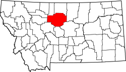
Geraldine, Montana | |
---|---|
Coordinates: 47°36′9″N110°16′4″W / 47.60250°N 110.26778°W | |
Country | United States |
State | Montana |
County | Chouteau |
Area | |
• Total | 0.58 sq mi (1.50 km2) |
• Land | 0.57 sq mi (1.48 km2) |
• Water | 0.00 sq mi (0.01 km2) |
Elevation | 3,136 ft (956 m) |
Population (2020) | |
• Total | 207 |
• Density | 361.26/sq mi (139.39/km2) |
Time zone | UTC-7 (Mountain (MST)) |
• Summer (DST) | UTC-6 (MDT) |
ZIP code | 59446 |
Area code | 406 |
FIPS code | 30-30400 |
GNIS feature ID | 0771740 |
Website | archive |
Geraldine is a town in Chouteau County, Montana, United States. The population was 207 at the 2020 census. [2] The area around the town is an agricultural, largely wheat-producing, region.
Geraldine was originally created as a stop on the Milwaukee Railroad. It was named for Almira Geraldine Rockefeller (or perhaps her daughter, Ethel Geraldine Rockefeller Dodge), the wife of William Rockefeller, the director of the railroad at the time. [3] [4]
The Milwaukee Road built a branch line from Harlowton to Great Falls in 1916. The town's wood-constructed railroad depot, also built in 1916, has been restored in recent years, now contains displays on the history of the area, and is a Montana Historic Site which is on the National Register of Historic Places. [5] The Central Montana Rail runs a tourist train from Lewistown to Geraldine in the summer and passengers get to tour the restored depot.
Geraldine is located at 47°36′9″N110°16′4″W / 47.60250°N 110.26778°W (47.602384, -110.267779). [6] Montana Highway 80 cuts through town. It is near both Kingsbury Lake and Big Lake.
According to the United States Census Bureau, the town has a total area of 0.52 square miles (1.35 km2), all land. [7]
Census | Pop. | Note | %± |
---|---|---|---|
1920 | 354 | — | |
1930 | 279 | −21.2% | |
1940 | 262 | −6.1% | |
1950 | 374 | 42.7% | |
1960 | 364 | −2.7% | |
1970 | 370 | 1.6% | |
1980 | 305 | −17.6% | |
1990 | 299 | −2.0% | |
2000 | 284 | −5.0% | |
2010 | 261 | −8.1% | |
2020 | 207 | −20.7% | |
U.S. Decennial Census [8] [2] |
As of the census [9] of 2010, there were 261 people, 110 households, and 69 families residing in the town. The population density was 501.9 inhabitants per square mile (193.8/km2). There were 140 housing units at an average density of 269.2 per square mile (103.9/km2). The racial makeup of the town was 96.9% White, 0.4% Native American, 0.4% from other races, and 2.3% from two or more races. Hispanic or Latino of any race were 2.3% of the population.
There were 110 households, of which 31.8% had children under the age of 18 living with them, 45.5% were married couples living together, 10.0% had a female householder with no husband present, 7.3% had a male householder with no wife present, and 37.3% were non-families. 33.6% of all households were made up of individuals, and 18.2% had someone living alone who was 65 years of age or older. The average household size was 2.37 and the average family size was 3.06.
The median age in the town was 45.3 years. 29.9% of residents were under the age of 18; 4.2% were between the ages of 18 and 24; 15.2% were from 25 to 44; 30.7% were from 45 to 64; and 19.9% were 65 years of age or older. The gender makeup of the town was 47.1% male and 52.9% female.
As of the census [10] of 2000, there were 284 people, 115 households, and 79 families residing in the town. The population density was 547.0 inhabitants per square mile (211.2/km2). There were 141 housing units at an average density of 271.6 per square mile (104.9/km2). The racial makeup of the town was 99.65% White, and 0.35% from two or more races. Hispanic or Latino of any race were 1.06% of the population.
There were 115 households, out of which 37.4% had children under the age of 18 living with them, 60.9% were married couples living together, 5.2% had a female householder with no husband present, and 31.3% were non-families. 29.6% of all households were made up of individuals, and 13.9% had someone living alone who was 65 years of age or older. The average household size was 2.47 and the average family size was 3.09.
In the town, the population was spread out, with 29.9% under the age of 18, 5.3% from 18 to 24, 25.7% from 25 to 44, 17.6% from 45 to 64, and 21.5% who were 65 years of age or older. The median age was 38 years. For every 100 females there were 97.2 males. For every 100 females age 18 and over, there were 97.0 males.
The median income for a household in the town was $30,893, and the median income for a family was $36,429. Males had a median income of $25,833 versus $16,250 for females. The per capita income for the town was $15,403. About 2.4% of families and 6.5% of the population were below the poverty line, including 10.2% of those under the age of eighteen and 4.4% of those 65 or over.
Geraldine School District educates students from kindergarten through 12th grade. [11] They are known as the Tigers. [12] Geraldine High School is a Class C school.
Choteau County Library, headquartered in Fort Benton, has a branch in Geraldine. [13]
Geraldine Airport is a public use airport. [14] It is primarily used by agricultural spraying aircraft. [15]
Stoneham is a town in Oxford County, Maine, United States. The population was 261 at the 2020 census.
Lima is a town in Beaverhead County, Montana, United States. As of the 2020 census, the population was 212.
Sun Prairie is a census-designated place (CDP) in Cascade County, Montana, United States. The population was 1,630 at the 2010 census. It is part of the Great Falls Metropolitan Statistical Area and may have evolved as a remote suburb of Great Falls.
Carter is a census-designated place (CDP) in Chouteau County, Montana, United States. The population was 58 at the 2010 census.
Grass Range is a town in Fergus County, Montana, United States. The population was 110 in both the 2010 census and 2020 census.
Winifred is a small town in rural north-central Fergus County, Montana, United States. It was founded in 1913 and provides services for its region's populace. The town population was 172 at the 2020 census. The current mayor is Travis Willson.
Gildford is an unincorporated community and census-designated place (CDP) in Hill County, Montana, United States. The population was 179 at the 2010 census.
Hingham is a town in Hill County, Montana, United States. Its economy is largely agricultural. The population was 131 at the 2020 census.
Inverness is a census-designated place (CDP) in Hill County, Montana, United States. The population was 55 at the 2010 census. It was named after a city in Scotland.
Kremlin is an unincorporated community and census-designated place (CDP) in Hill County, Montana, United States. The population was 98 at the 2010 census, down from 126 in 2000.
Finley Point is a census-designated place (CDP) in Lake County, Montana, United States. As of the 2010 census the population was 480.
Superior is a town in, and the county seat of, Mineral County, Montana, United States. The population was 830 at the 2020 census.
Evaro is a census-designated place (CDP) in Missoula County, Montana, United States, and part of the Missoula Metropolitan Statistical Area. It is located on the southernmost tip of the Flathead Indian Reservation, approximately 12 miles (19 km) north of downtown Missoula and is served by US Highway 93. In 2010, Evaro had a population of 322, a decrease from 329 in 2000.
Clyde Park is a town in Park County, Montana, United States. The population was 332 at the 2020 census. Originally known as Sunnyside, the town was renamed in the 1890s.
Broadview is a town in Yellowstone County, Montana, United States. The population was 139 at the 2020 census.
Parkwood is a census-designated place (CDP) in Kitsap County, Washington, United States. The population was 7,126 at the 2010 census.
Elmer City is a town in Okanogan County, Washington, United States. The population was 238 at the 2010 census.
Ellenboro is a town in Ritchie County, West Virginia, United States. The population was 222 at the 2020 census. The town is located at the junction of U.S. Route 50 and West Virginia Route 16; the North Bend Rail Trail also passes through the town. The town was named for Ellen Mariah Williamson, the eldest daughter of the family that granted a right of way for the Baltimore and Ohio Railroad to build their line through the town; an earlier name for the community was Shumley. Ellenboro was incorporated in 1903.
Odanah is an unincorporated community and census-designated place (CDP) in Ashland County, Wisconsin, in the town of Sanborn, United States, on the banks of the Bad River. The population was 47 at the 2020 census.
Box Elder is an unincorporated community and census-designated place (CDP) in Hill County in the U.S. state of Montana. The population was 87 at the 2010 census. The population was 794 at the 2000 census, but before 2010 the Box Elder CDP was split into the current much-smaller Box Elder CDP, while most of the former CDP area went into the new Rocky Boy West CDP. Box Elder is the headquarters of the Chippewa-Cree tribe.