
Hill County is a county located in the U.S. state of Montana. As of the 2020 census, the population was 16,309. Its county seat is Havre. It lies along the United States border with Canada, abutting Alberta and Saskatchewan.

Chouteau County is a county located in the North-Central region of the U.S. state of Montana. As of the 2020 census, the population was 5,895. Its county seat is Fort Benton. The county was established in 1865 as one of the original nine counties of Montana, and named in 1882 after Pierre Chouteau Jr., a fur trader who established a trading post that became Fort Benton, which was once an important port on the Missouri River.

Vaughn is a census-designated place (CDP) in Cascade County, Montana, United States. The population was 737 at the 2020 census, compared to 658 at the 2010 census. It is part of the Great Falls, Montana Metropolitan Statistical Area. It is named for Montana pioneer Robert Vaughn, whose homestead on the Vaughn Ranch encompassed part of the town.

Boneau is a census-designated place (CDP) in Chouteau County, Montana, United States. The population was 380 at the 2010 census, up from 190 in 2000.

Carter is a census-designated place (CDP) in Chouteau County, Montana, United States. The population was 58 at the 2010 census.

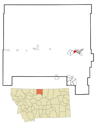
Highwood is an unincorporated community and census-designated place (CDP) in Chouteau County, Montana, United States. The population was 165 at the 2020 Dicennial Census.

Loma is a census-designated place (CDP) in Chouteau County, Montana, United States. The population was 85 at the 2010 census.

Sangrey is a census-designated place (CDP) in Hill County, Montana, United States. The population was 306 at the 2010 census, up from 263 in 2000.

St. Pierre is a census-designated place (CDP) in Hill County, Montana, United States, within the Rocky Boy Indian Reservation. The population of St. Pierre was 350 at the 2010 census, up from 289 in 2000.
West Havre is a census-designated place (CDP) in Hill County, Montana, United States. The population was 316 at the 2010 census, up from 284 in 2000.

Rocky Point is a census-designated place (CDP) in Lake County, Montana, United States. The population was 97 at the 2010 census.

Azure is a census-designated place (CDP) in Hill County, Montana, United States. The population was 286 at the 2010 census.

Jette is a census-designated place (CDP) in Lake County, Montana, United States. The population was 253 at the 2010 census.
Box Elder is an unincorporated community and census-designated place (CDP) in Hill County in the U.S. state of Montana. The population was 87 at the 2010 census. The population was 794 at the 2000 census, but before 2010 the Box Elder CDP was split into the current much-smaller Box Elder CDP, while most of the former CDP area went into the new Rocky Boy West CDP. Box Elder is the headquarters of the Chippewa-Cree tribe.

Parker School is a census-designated place (CDP) in Hill and Chouteau counties in the U.S. state of Montana. The population was 340 at the 2010 census.
Spokane Creek is a census-designated place (CDP) in Broadwater County, Montana, United States. The population was 355 at the 2010 census.

The Silos is a census-designated place (CDP) in Broadwater County, Montana, United States. The population was 506 at the 2010 census.
Lake Mary Ronan is a census-designated place (CDP) in Lake County, Montana, United States. The population was 65 at the 2010 census. The CDP is in northwestern Lake County, along the northern and eastern shores of Lake Mary Ronan, and includes the populated places of Lake Mary Ronan, Melton, and Sipes, as well as Lake Mary Ronan State Park. It is 8 miles (13 km) northwest of U.S. Route 93 at Dayton, and 30 miles (48 km) northwest of Polson, the Lake county seat.
Sunnybrook Colony is a Hutterite community and census-designated place (CDP) in Chouteau County, Montana, United States. It is in the northern part of the county, 32 miles (51 km) north of Fort Benton and 34 miles (55 km) south-southeast of Chester.
Twin Hills Colony is a Hutterite community and census-designated place (CDP) in Chouteau County, Montana, United States. It is in the western part of the county, 21 miles (34 km) north of Carter and 47 miles (76 km) north-northeast of Great Falls.


