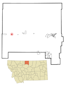
Rudyard, Montana

Last updated

Rudyard, Montana
Hill County Montana Incorporated and Unincorporated areas Rudyard Highlighted.svg
Location of Rudyard, Montana
Coordinates: 48°33′38″N110°33′17″W / 48.56056°N 110.55472°W / 48.56056; -110.55472
Country United States
State Montana
County Hill
Area
[1]
  Total0.92 sq mi (2.37 km2)
  Land0.92 sq mi (2.37 km2)
  Water0.00 sq mi (0.00 km2)
Elevation
3,114 ft (949 m)
Population
 (2020)
  Total270
  Density294.76/sq mi (113.77/km2)
Time zone UTC-7 (Mountain (MST))
  Summer (DST) UTC-6 (MDT)
ZIP code
59540
Area code 406
FIPS code 30-64900
GNIS feature ID0776006

Rudyard is an unincorporated community and census-designated place (CDP) in Hill County, Montana, United States. The population was 258 at the 2010 census. [2]

Contents

The community was established as a switching station on the Great Northern Railway. The post office opened in 1910. It is named after author Rudyard Kipling. [3]

Geography

Rudyard is located western Hill County at 48°33′38″N110°33′17″W / 48.56056°N 110.55472°W / 48.56056; -110.55472 (48.560633, -110.554737). [4] U.S. Route 2 runs along the southern edge of the community, leading east 41 miles (66 km) to Havre, the county seat, and west 62 miles (100 km) to Shelby.

According to the United States Census Bureau, the CDP has a total area of 0.93 square miles (2.4 km2), all land. [2]

Antipodes

Rudyard has the distinction of being the only community in the contiguous United States that sits atop a non-oceanic antipode, that being one of the Kerguelen Islands. [5] [6]

Climate

Climate data for Rudyard 19S, Montana, 1991–2020 normals, 2003-2020 snowfall: 2878ft (877m)
MonthJanFebMarAprMayJunJulAugSepOctNovDecYear
Record high °F (°C)64
(18)
68
(20)
79
(26)
90
(32)
91
(33)
100
(38)
106
(41)
104
(40)
98
(37)
90
(32)
75
(24)
62
(17)
106
(41)
Mean maximum °F (°C)52.5
(11.4)
52.4
(11.3)
63.6
(17.6)
78.6
(25.9)
84.4
(29.1)
90.5
(32.5)
98.2
(36.8)
96.9
(36.1)
90.5
(32.5)
78.6
(25.9)
65.0
(18.3)
53.7
(12.1)
99.6
(37.6)
Mean daily maximum °F (°C)26.1
(−3.3)
31.3
(−0.4)
42.2
(5.7)
54.1
(12.3)
63.4
(17.4)
71.7
(22.1)
82.4
(28.0)
80.8
(27.1)
69.5
(20.8)
54.5
(12.5)
40.2
(4.6)
30.2
(−1.0)
53.9
(12.2)
Daily mean °F (°C)14.9
(−9.5)
19.1
(−7.2)
29.1
(−1.6)
40.4
(4.7)
49.9
(9.9)
58.6
(14.8)
67.0
(19.4)
65.1
(18.4)
54.8
(12.7)
41.2
(5.1)
28.6
(−1.9)
18.8
(−7.3)
40.6
(4.8)
Mean daily minimum °F (°C)3.8
(−15.7)
6.9
(−13.9)
16.0
(−8.9)
26.7
(−2.9)
36.4
(2.4)
45.4
(7.4)
51.6
(10.9)
49.4
(9.7)
40.0
(4.4)
28.0
(−2.2)
16.9
(−8.4)
7.5
(−13.6)
27.4
(−2.6)
Mean minimum °F (°C)−22.8
(−30.4)
−19.9
(−28.8)
−6.0
(−21.1)
13.7
(−10.2)
24.4
(−4.2)
37.0
(2.8)
43.3
(6.3)
39.9
(4.4)
29.8
(−1.2)
13.6
(−10.2)
−4.5
(−20.3)
−17.9
(−27.7)
−32.0
(−35.6)
Record low °F (°C)−41
(−41)
−40
(−40)
−36
(−38)
−8
(−22)
14
(−10)
32
(0)
37
(3)
34
(1)
20
(−7)
−12
(−24)
−24
(−31)
−41
(−41)
−41
(−41)
Average precipitation inches (mm)0.42
(11)
0.32
(8.1)
0.43
(11)
1.15
(29)
1.77
(45)
2.57
(65)
1.24
(31)
1.15
(29)
1.11
(28)
0.83
(21)
0.53
(13)
0.38
(9.7)
11.9
(300.8)
Average snowfall inches (cm)5.6
(14)
3.9
(9.9)
3.1
(7.9)
2.8
(7.1)
1.0
(2.5)
0.0
(0.0)
0.0
(0.0)
0.0
(0.0)
1.3
(3.3)
2.0
(5.1)
3.1
(7.9)
4.5
(11)
27.3
(68.7)
Source 1: NOAA [7]
Source 2: XMACIS (snowfall, temp records & monthly max/mins) [8]
Climate data for Rudyard 21 N, Montana, 1991–2020 normals, 2001-2020 snowfall: 3000ft (914m)
MonthJanFebMarAprMayJunJulAugSepOctNovDecYear
Record high °F (°C)66
(19)
68
(20)
79
(26)
87
(31)
92
(33)
98
(37)
103
(39)
104
(40)
96
(36)
83
(28)
76
(24)
62
(17)
104
(40)
Mean maximum °F (°C)54.5
(12.5)
53.2
(11.8)
64.8
(18.2)
77.0
(25.0)
85.1
(29.5)
90.9
(32.7)
97.5
(36.4)
96.6
(35.9)
91.4
(33.0)
77.1
(25.1)
64.5
(18.1)
53.1
(11.7)
97.1
(36.2)
Mean daily maximum °F (°C)30.0
(−1.1)
32.9
(0.5)
42.9
(6.1)
55.5
(13.1)
66.1
(18.9)
73.1
(22.8)
82.9
(28.3)
82.8
(28.2)
71.3
(21.8)
56.3
(13.5)
40.5
(4.7)
32.4
(0.2)
55.6
(13.1)
Daily mean °F (°C)17.3
(−8.2)
20.2
(−6.6)
29.7
(−1.3)
40.9
(4.9)
51.0
(10.6)
58.6
(14.8)
65.8
(18.8)
64.6
(18.1)
54.9
(12.7)
41.5
(5.3)
28.0
(−2.2)
19.6
(−6.9)
41.0
(5.0)
Mean daily minimum °F (°C)4.6
(−15.2)
7.5
(−13.6)
16.4
(−8.7)
26.3
(−3.2)
35.8
(2.1)
44.2
(6.8)
48.6
(9.2)
46.4
(8.0)
38.5
(3.6)
26.6
(−3.0)
15.5
(−9.2)
6.8
(−14.0)
26.4
(−3.1)
Mean minimum °F (°C)−24.3
(−31.3)
−21.0
(−29.4)
−7.3
(−21.8)
11.0
(−11.7)
22.3
(−5.4)
34.6
(1.4)
39.2
(4.0)
35.8
(2.1)
26.3
(−3.2)
7.1
(−13.8)
−9.2
(−22.9)
−20.2
(−29.0)
−33.3
(−36.3)
Record low °F (°C)−38
(−39)
−38
(−39)
−33
(−36)
−15
(−26)
10
(−12)
29
(−2)
36
(2)
28
(−2)
19
(−7)
−12
(−24)
−32
(−36)
−45
(−43)
−45
(−43)
Average precipitation inches (mm)0.30
(7.6)
0.35
(8.9)
0.41
(10)
0.94
(24)
1.81
(46)
2.37
(60)
1.34
(34)
1.07
(27)
1.12
(28)
0.78
(20)
0.50
(13)
0.35
(8.9)
11.34
(287.4)
Average snowfall inches (cm)5.6
(14)
6.3
(16)
4.8
(12)
3.5
(8.9)
1.8
(4.6)
0.0
(0.0)
0.0
(0.0)
0.0
(0.0)
1.7
(4.3)
3.2
(8.1)
5.9
(15)
5.2
(13)
38
(95.9)
Source 1: NOAA [9]
Source 2: XMACIS (snowfall, temp records & monthly max/mins) [10]

Demographics

Historical population
CensusPop.Note
2020 270
U.S. Decennial Census [11]

As of the census [12] of 2000, there were 275 people, 126 households, and 71 families residing in the CDP. The population density was 295.8 inhabitants per square mile (114.2/km2). There were 155 housing units at an average density of 166.7 per square mile (64.4/km2). The racial makeup of the CDP was 98.18% White, 0.73% Native American, and 1.09% from two or more races. Hispanic or Latino of any race were 0.36% of the population.

There were 126 households, out of which 27.0% had children under the age of 18 living with them, 45.2% were married couples living together, 7.1% had a female householder with no husband present, and 42.9% were non-families. 38.9% of all households were made up of individuals, and 20.6% had someone living alone who was 65 years of age or older. The average household size was 2.18 and the average family size was 2.94.

In the CDP, the population was spread out, with 25.8% under the age of 18, 2.9% from 18 to 24, 25.5% from 25 to 44, 26.2% from 45 to 64, and 19.6% who were 65 years of age or older. The median age was 43 years. For every 100 females, there were 100.7 males. For every 100 females age 18 and over, there were 94.3 males.

The median income for a household in the CDP was $28,393, and the median income for a family was $34,844. Males had a median income of $25,694 versus $15,833 for females. The per capita income for the CDP was $16,889. About 7.2% of families and 9.9% of the population were below the poverty line, including 12.9% of those under the age of 18 and none of those 65 or over.

Transportation

Amtrak’s Empire Builder, which operates between Seattle/Portland and Chicago, passes through the town on BNSF tracks, but makes no stop. The nearest station is located in Havre, 41 miles (66 km) to the east.

Education

North Star High School and middle school are located in Rudyard. [13] They are known as the Knights. [14] North Star Elementary school is located in Gildford.

Related Research Articles

<span class="mw-page-title-main">Hill County, Montana</span> County in Montana, United States

Hill County is a county located in the U.S. state of Montana. As of the 2020 census, the population was 16,309. Its county seat is Havre. It lies along the United States border with Canada, abutting Alberta and Saskatchewan.

<span class="mw-page-title-main">Tonalea, Arizona</span> CDP in Coconino County, Arizona

Tonalea is a census-designated place (CDP) in Coconino County, Arizona, United States. The population was 549 at the 2010 census. It has also been known as Red Lake.

<span class="mw-page-title-main">Fort Shaw, Montana</span> CDP in Montana, United States

Fort Shaw is a census-designated place (CDP) in Cascade County, Montana, United States. The population was 280 at the 2010 census. Named for a former United States military outpost, it is part of the Great Falls, Montana Metropolitan Statistical Area.

<span class="mw-page-title-main">Simms, Montana</span> CDP in Montana, United States

Simms is a census-designated place (CDP) in Cascade County, Montana, United States. The population was 354 at the 2010 census. It is part of the Great Falls, Montana Metropolitan Statistical Area.

<span class="mw-page-title-main">Starr School, Montana</span> Census-designated place in Montana, United States

Starr School is a census-designated place (CDP) in Glacier County, Montana, United States. The population was 252 at the 2010 census.

<span class="mw-page-title-main">Gildford, Montana</span> Census-designated place in Montana, United States

Gildford is an unincorporated community and census-designated place (CDP) in Hill County, Montana, United States. The population was 179 at the 2010 census.

<span class="mw-page-title-main">Hingham, Montana</span> Town in Montana, United States

Hingham is a town in Hill County, Montana, United States. Its economy is largely agricultural. The population was 131 at the 2020 census.

<span class="mw-page-title-main">Inverness, Montana</span> CDP in Montana, United States

Inverness is a census-designated place (CDP) in Hill County, Montana, United States. The population was 55 at the 2010 census. It was named after a city in Scotland.

<span class="mw-page-title-main">Kremlin, Montana</span> Census-designated place in Montana, United States

Kremlin is an unincorporated community and census-designated place (CDP) in Hill County, Montana, United States. The population was 98 at the 2010 census, down from 126 in 2000.

<span class="mw-page-title-main">West Havre, Montana</span> Census-designated place in Montana, United States

West Havre is a census-designated place (CDP) in Hill County, Montana, United States. The population was 316 at the 2010 census, up from 284 in 2000.

<span class="mw-page-title-main">Jefferson City, Montana</span> Census-designated place in Montana, United States

Jefferson City is an unincorporated community and census-designated place (CDP) in Jefferson County, Montana, United States. The population was 472 at the 2010 census. It is part of the Helena Micropolitan Statistical Area.

<span class="mw-page-title-main">Alder, Montana</span> Census-designated place in Montana, United States

Alder is a census-designated place (CDP) in Madison County, Montana, United States. The population was 86 at the 2020 census. The community takes its name from Alder Creek, the site of the second major gold discovery in Montana.

<span class="mw-page-title-main">East Missoula, Montana</span> CDP in Montana, United States

East Missoula is a census-designated place (CDP) in Missoula County, Montana, United States. It is part of the Missoula, Montana Metropolitan Statistical Area'. The population was 2,157 at the 2010 census, an increase from its population of 2,070 in 2000.

<span class="mw-page-title-main">Evaro, Montana</span> CDP in Montana, United States

Evaro is a census-designated place (CDP) in Missoula County, Montana, United States, and part of the Missoula Metropolitan Statistical Area. It is located on the southernmost tip of the Flathead Indian Reservation, approximately 12 miles (19 km) north of downtown Missoula and is served by US Highway 93. In 2010, Evaro had a population of 322, a decrease from 329 in 2000.

<span class="mw-page-title-main">Heart Butte, Montana</span> Census–designated place in Pondera County, Montana

Heart Butte is a census-designated place (CDP) in Pondera County, Montana, United States. The population was 698 at the 2000 census. The town is on the Blackfeet Indian Reservation.

<span class="mw-page-title-main">Ovando, Montana</span> CDP in Montana, United States

Ovando is a census-designated place (CDP) in Powell County, Montana, United States. It is approximately fifty-four miles ENE of Missoula, Montana. The population was 71 at the 2000 census.

<span class="mw-page-title-main">Ballantine, Montana</span> CDP in Montana, United States

Ballantine is a census-designated place (CDP) in Yellowstone County, Montana, United States. It lies approximately nine miles (14 km) northeast of Billings on Interstate 94. The population was 346 at the 2000 census. Ballantine, along with the communities of Pompey's Pillar, Worden, and Huntley, is part of the Huntley Project, an irrigation district created by the United States Bureau of Reclamation. The majority of Ballantine's population lives on scattered farms and ranches surrounding the actual townsite.

<span class="mw-page-title-main">Azure, Montana</span> Census-designated place in Montana, United States

Azure is a census-designated place (CDP) in Hill County, Montana, United States. The population was 286 at the 2010 census.

<span class="mw-page-title-main">Joplin, Montana</span> Unincorporated community in Montana, United States

Joplin is an unincorporated community and census-designated place (CDP) in Liberty County, Montana, United States. The population was 157 at the 2010 census.

Box Elder is an unincorporated community and census-designated place (CDP) in Hill County in the U.S. state of Montana. The population was 87 at the 2010 census. The population was 794 at the 2000 census, but before 2010 the Box Elder CDP was split into the current much-smaller Box Elder CDP, while most of the former CDP area went into the new Rocky Boy West CDP. Box Elder is the headquarters of the Chippewa-Cree tribe.

References

  1. "ArcGIS REST Services Directory". United States Census Bureau. Retrieved September 5, 2022.
  2. 1 2 "Geographic Identifiers: 2010 Census Summary File 1 (G001): Rudyard CDP, Montana". American Factfinder. U.S. Census Bureau. Archived from the original on February 13, 2020. Retrieved August 23, 2017.
  3. "Rudyard". Montana Place Names Companion. Montana Historical Society. Retrieved April 9, 2021.
  4. "US Gazetteer files: 2010, 2000, and 1990". United States Census Bureau. February 12, 2011. Retrieved April 23, 2011.
  5. United States antipodes
  6. "Antipode Map of Shanghai".
  7. "Rudyard 19S, Montana 1991-2020 Monthly Normals" . Retrieved December 28, 2023.
  8. "xmACIS". National Oceanic and Atmospheric Administration. Retrieved December 28, 2023.
  9. "Rudyard 21 N, Montana 1991-2020 Monthly Normals" . Retrieved December 29, 2023.
  10. "xmACIS". National Oceanic and Atmospheric Administration. Retrieved December 29, 2023.
  11. "Census of Population and Housing". Census.gov. Retrieved June 4, 2016.
  12. "U.S. Census website". United States Census Bureau . Retrieved January 31, 2008.
  13. "North Star". North Star Public Schools. Retrieved April 17, 2021.
  14. "Member Schools". Montana High School Association. Retrieved April 19, 2021.