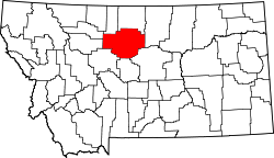
Parker School, Montana | |
---|---|
Coordinates: 48°14′53″N109°44′32″W / 48.24806°N 109.74222°W | |
Country | United States |
State | Montana |
Counties | Hill, Chouteau |
Area | |
• Total | 7.39 sq mi (19.14 km2) |
• Land | 7.39 sq mi (19.14 km2) |
• Water | 0.00 sq mi (0.00 km2) |
Elevation | 4,078 ft (1,243 m) |
Population (2020) | |
• Total | 388 |
• Density | 52.51/sq mi (20.28/km2) |
Time zone | UTC-7 (Mountain (MST)) |
• Summer (DST) | UTC-6 (MDT) |
Area code | 406 |
FIPS code | 30-56650 |
GNIS feature ID | 2409029 [2] |
Parker School is a census-designated place (CDP) in Hill and Chouteau counties in the U.S. state of Montana. The population was 340 at the 2010 census. [3]
Parker School is located in southeastern Hill County and extends south into Chouteau County. The CDP is part of the Rocky Boy Indian Reservation.
According to the United States Census Bureau, the CDP has a total area of 7.4 square miles (19.1 km2), all land. [3]
Census | Pop. | Note | %± |
---|---|---|---|
2020 | 388 | — | |
U.S. Decennial Census [4] |
As of the census [5] of 2000, there were 352 people, 78 households, and 69 families residing in the CDP. The population density was 45.0 inhabitants per square mile (17.4/km2). There were 82 housing units at an average density of 10.5/sq mi (4.0/km2). The racial makeup of the CDP was 97.73% Native American, 1.99% White, and 0.28% Pacific Islander. Hispanic or Latino of any race were 1.70% of the population.
There were 78 households, out of which 60.3% had children under the age of 18 living with them, 57.7% were married couples living together, 16.7% had a female householder with no husband present, and 11.5% were non-families. 10.3% of all households were made up of individuals, and 1.3% had someone living alone who was 65 years of age or older. The average household size was 4.51 and the average family size was 4.84.
In the CDP, the population was spread out, with 47.2% under the age of 18, 10.8% from 18 to 24, 24.4% from 25 to 44, 14.2% from 45 to 64, and 3.4% who were 65 years of age or older. The median age was 20 years. For every 100 females, there were 113.3 males. For every 100 females age 18 and over, there were 118.8 males.
The median income for a household in the CDP was $29,167, and the median income for a family was $37,917. Males had a median income of $18,750 versus $40,500 for females. The per capita income for the CDP was $7,453. About 30.0% of families and 25.0% of the population were below the poverty line, including 24.1% of those under age 18 and 57.1% of those age 65 or over.
Chouteau County is a county located in the North-Central region of the U.S. state of Montana. As of the 2020 census, the population was 5,895. Its county seat is Fort Benton. The county was established in 1865 as one of the original nine counties of Montana, and named in 1882 after Pierre Chouteau Jr., a fur trader who established a trading post that became Fort Benton, which was once an important port on the Missouri River.
Vaughn is a census-designated place (CDP) in Cascade County, Montana, United States. The population was 737 at the 2020 census, compared to 658 at the 2010 census. It is part of the Great Falls, Montana Metropolitan Statistical Area. It is named for Montana pioneer Robert Vaughn, whose homestead on the Vaughn Ranch encompassed part of the town.
Boneau is a census-designated place (CDP) in Chouteau County, Montana, United States. The population was 380 at the 2010 census, up from 190 in 2000.
Carter is a census-designated place (CDP) in Chouteau County, Montana, United States. The population was 58 at the 2010 census.
Highwood is an unincorporated community and census-designated place (CDP) in Chouteau County, Montana, United States. The population was 165 at the 2020 Dicennial Census.
Loma is a census-designated place (CDP) in Chouteau County, Montana, United States. The population was 85 at the 2010 census.
North Browning is a census-designated place (CDP) in Glacier County, Montana, United States. The population was 2,408 at the 2010 census.
South Browning is a census-designated place (CDP) in Glacier County, Montana, United States. The population was 1,785 at the 2010 census. South Browning is a rural village on the Blackfeet Indian Reservation. It is bordered to the north by the town of Browning.
Starr School is a census-designated place (CDP) in Glacier County, Montana, United States. The population was 252 at the 2010 census.
Sangrey is a census-designated place (CDP) in Hill County, Montana, United States. The population was 306 at the 2010 census, up from 263 in 2000.
St. Pierre is a census-designated place (CDP) in Hill County, Montana, United States, within the Rocky Boy Indian Reservation. The population of St. Pierre was 350 at the 2010 census, up from 289 in 2000.
Finley Point is a census-designated place (CDP) in Lake County, Montana, United States. As of the 2010 census the population was 480.
Clinton is an unincorporated community and census-designated place (CDP) in Missoula County, Montana, United States. It is part of the Missoula metropolitan area. The population was 1,018 at the 2020 census.
Orchard Homes is a census-designated place (CDP) in Missoula County, Montana, United States. It is part of the Missoula metropolitan area. The population was 5,377 at the 2020 census.
Wye is an unincorporated community and census-designated place in Missoula County, Montana, United States. It is part of the Missoula metropolitan area. The population was 714 at the 2020 census, up from 511 in 2010. The community is named for the "y"-shaped DeSmet Junction where US 93 and MT 200 met former US 10.
Corvallis is a census-designated place (CDP) in Ravalli County, Montana, United States. The population was 1,125 at the 2020 census.
Paradise is a census-designated place (CDP) in Sanders County, Montana, United States. The population was 166 at the 2020 census.
Dayton is an unincorporated community and census-designated place (CDP) in Lake County, Montana, United States. The population was 84 at the 2010 census.
Mazie is a census-designated place (CDP) in Mayes County, Oklahoma, United States. The population was 91 at the 2010 census.
Pin Oak Acres is a census-designated place (CDP) in Mayes County, Oklahoma, United States. The population was 427 at the 2000 census.