Interstate 57 (I-57) is a north–south Interstate Highway in Missouri and Illinois that parallels the old Illinois Central Railroad for much of its route. It runs from Sikeston, Missouri, at I-55 to Chicago, Illinois, at I-94. I-57 essentially serves as a shortcut route for travelers headed between the Southern U.S. and Chicago, bypassing St. Louis, Missouri, and Springfield, Illinois. Between the junction of I-55 and I-57 in Sikeston and the junction of I-55 and I-90/I-94 in Chicago, I-55 travels for 436 miles (702 km), while the combination of I-57 and I-94 is only 396 miles (637 km) long between the same two points. In fact, both the control cities on the overhead signs and the destination mileage signs reference Memphis along southbound I-57, even as far north as its northern origin at I-94 in Chicago. Likewise, at its southern end, Chicago is the control city listed for I-57 on signs on northbound I-55 south of Sikeston, even though I-55 also goes to Chicago. A southward extension of I-57 from its current southern terminus to Little Rock, Arkansas, is currently in various stages of development.
Interstate 72 (I-72) is an Interstate Highway in the midwestern United States. Its western terminus is in Hannibal, Missouri, at an intersection with U.S. Route 61 (US 61); its eastern terminus is at Country Fair Drive in Champaign, Illinois. The route runs through the major cities of Decatur, Illinois, and Springfield, Illinois. In 2006, the Illinois General Assembly dedicated all of I-72 as Purple Heart Memorial Highway. The stretch between Springfield and Decatur is also called Penny Severns Memorial Expressway, and the section between mile 35 and the Mississippi River is known as the Free Frank McWorter Historic Highway.
Route 100, also named Manchester Road through St. Louis County and Manchester Avenue and Chouteau Avenue through St. Louis City, is a state highway in the U.S. state of Missouri. It runs from Linn, Missouri at U.S. Route 50 to Interstate 55 in St. Louis. The highway is 121 miles (195 km) long.

Route 141, also known as Woods Mill Road in parts of St. Louis County, is a state highway located in the western St. Louis metropolitan area. Its northern terminus is at Route 370 in Bridgeton; its southern terminus is at U.S. Route 61/U.S. Route 67 in Arnold, in Jefferson County. The northern stretches of the highway are often referred to as the Maryland Heights Expressway or Earth City Expressway.

Interstate 370 (I-370) is a 2.54-mile (4.09 km) Interstate Highway spur route off I-270 in Gaithersburg, Maryland, to the western end of the Maryland Route 200 toll road at an interchange that provides access to the park and ride lot at the Shady Grove station on the Red Line of the Washington Metro. Despite the number, I-370 does not connect to I-70 itself. The road continues to the west of I-270 as Sam Eig Highway, a surface road. Along the way, I-370 has interchanges with MD 355 and Shady Grove Road. The freeway was completed in the late 1980s to connect I-270 to the Shady Grove station. I-370 was always part of the planned Intercounty Connector but was the only segment to be built at the time. The opening of MD 200 east of I-370 resulted in the truncation of I-370 to the interchange with MD 200 and the redesignation of the road leading into the Shady Grove station as MD 200A.
The Avenue of the Saints is a 563-mile-long (906 km) highway in the Midwestern United States that connects St. Louis, Missouri, and St. Paul, Minnesota.

Interstate 270 (I-270) is a 34.7-mile (55.8 km) auxiliary Interstate Highway in the U.S. state of Maryland that travels from I-495 just north of Bethesda in Montgomery County north to I-70 in the city of Frederick in Frederick County. It consists of the 32.6-mile (52.5 km) mainline as well as a 2.1-mile (3.4 km) spur that provides access to and from southbound I-495. I-270 is known as the Washington National Pike, and makes up the easternmost stretch of the Dwight D. Eisenhower Highway. Most of the southern part of the route in Montgomery County passes through suburban areas around Rockville and Gaithersburg that are home to many biotech firms. This portion of I-270 is up to 12 lanes wide and consists of a local–express lane configuration as well as high-occupancy vehicle lanes that are in operation during peak travel times. North of the Gaithersburg area, the road continues through the northern part of Montgomery County, passing Germantown and Clarksburg as a six- to eight-lane highway with an HOV lane in the northbound direction only. North of here, I-270 continues through rural areas into Frederick County and toward the city of Frederick as a four-lane freeway.

Interstate 255 (I-255) is a bypass route of I-55 in Greater St. Louis. Along with I-270, it forms a loop around the central portion of the bi-state metro area; a majority of I-255 is located on the Illinois half. It shares its southern terminus with I-270 at the junction with I-55; I-270 and I-255 go to the west and east, respectively. U.S. Route 50 (US 50) joins I-255 at Lemay Ferry Road. It crosses the Mississippi River on the Jefferson Barracks Bridge, enters Illinois, and then turns northeast. There is a junction with I-64, where US 50 breaks off and goes east, and then further north there is a junction with I-55 again, I-70, and US 40, all of which are all cosigned together. The next junction is another one with I-270, which is the northern terminus of I-255. After that, the limited-access freeway continues on as Illinois Route 255 (IL 255). I-255 is 30.82 miles (49.60 km) in length.
Interstate 380 (I-380) is a 73-mile (117 km) auxiliary Interstate Highway in eastern Iowa. The route extends from I-80 near Coralville to Waterloo. I-380 connects the cities of Cedar Rapids and Waterloo, the state's second- and sixth-largest cities, respectively, to the Interstate Highway System. Except for its last 1.5 miles (2.4 km) north of U.S. Highway 20 (US 20), I-380 runs concurrently with Iowa Highway 27 (Iowa 27), which represents Iowa's portion of the 560-mile (900 km) Avenue of the Saints highway connecting Saint Louis, Missouri, with Saint Paul, Minnesota.

Route 364, known locally as the Page Extension, the Page Avenue Freeway, the Page Expressway, or simply the Extension, is a freeway that connects St. Louis County in Maryland Heights with St. Charles County in Lake St. Louis via the Veterans Memorial Bridge over the Missouri River. The highway is a designated auxiliary state route of I-64.

Interstate 229 (I-229) is a 15-mile-long (24 km) auxiliary Interstate Highway that runs through St. Joseph, Missouri. It begins southeast of the city at I-29 and U.S. Route 71 (US 71) and travels to the northwest into the city. In St. Joseph, it runs with US 59. Just north of an interchange with US 36, the two routes travel over a one-mile-long (1.6 km) viaduct on the banks of the Missouri River. The two routes split at the north end of the viaduct. The Interstate ends at another interchange with I-29 and US 71 north of St. Joseph.
Interstate 270 (I-270) makes up a large portion of the outer belt freeway in Greater St. Louis. The counterclockwise terminus of I-270 is at the junction with I-55 and I-255 in Mehlville, Missouri; the clockwise terminus of the freeway is at the junction with I-55 and I-70 north of Troy, Illinois. The entire stretch of I-270 is 50.59 miles (81.42 km).

Route 115 is a highway in the St. Louis, Missouri area. Its western terminus is at exit 237 of Interstate 70 (I-70) in Berkeley near Lambert-St. Louis International Airport. Route 115's eastern terminus is also at I-70, at exit 248A, in St. Louis, near the McKinley Bridge. The road is locally known as Natural Bridge Road, Natural Bridge Avenue, and Salisbury Street. It is one of two Missouri Highways that has an odd-numbered designation, yet runs in an east–west direction.
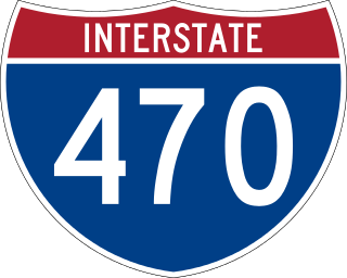
Interstate 470 (I-470) is a 16.72-mile (26.91 km) loop of the Interstate Highway System that serves to link southeast Kansas City to Independence via Lee's Summit in Jackson County, Missouri. The western terminus of the freeway is at the Grandview Triangle interchange with I-49, I-435, U.S. Route 50 (US 50), and US 71 while the northern terminus is a cloverleaf interchange with I-70. The freeway travels west to east through southern Kansas City, curving toward the north at the Lee's Summit Municipal Airport and becoming concurrent with Route 291 as the highway travels north toward Independence.

Interstate 680 (I-680) in Nebraska and Iowa is the northern bypass of the Omaha–Council Bluffs metropolitan area. I-680 spans 16.49 miles (26.54 km) from its southern end in western Omaha, Nebraska, to its eastern end near Crescent, Iowa. The freeway passes through a diverse range of scenes and terrains—the urban setting of Omaha, the Missouri River and its valley, the rugged Loess Hills, and the farmland of Pottawattamie County, Iowa.

Interstate 55 (I-55) in the US state of Missouri runs from the Arkansas state line to the Poplar Street Bridge over the Mississippi River in St. Louis.

Interstate 70 (I-70) in the US state of Missouri is generally parallel to the Missouri River. This section of the transcontinental Interstate begins at the Kansas state line on the Intercity Viaduct, running concurrently with US Route 24 (US 24), US 40, and US 169, and the east end is on the Stan Musial Veterans Memorial Bridge in St. Louis.

Interstate 64 (I-64) passes through the Greater St. Louis area in the US state of Missouri. The entire route is concurrent with U.S. Route 40 (US 40). Because the road was a main thoroughfare in the St. Louis area before the development of the Interstate Highway System, it is not uncommon for locals to refer to the stretch of highway as "Highway 40" rather than "I-64". On December 6, 2009, the portion of the highway running through the city of St. Louis was named the Jack Buck Memorial Highway in honor of the late sportscaster.

Interstate 44 (I-44) in the US state of Missouri runs northeast from the Oklahoma state line near Joplin to I-70 in Downtown St. Louis. It runs for about 293 miles (472 km) in the state, and is the longest Interstate Highway in the state.

U.S. Route 67 is the portion of a north-south highway in Missouri that starts at the Arkansas state line south of Neelyville and ends at the Illinois state line northeast of West Alton.

