Colorado State Highway 470

Last updated

Colorado 470 wide.svg

State Highway 470

Centennial Freeway
Colorado State Highway 470
Map of Denver metropolitan area with C-470 in red and E-470 in green
Route information
Maintained by CDOT
Length27.41 mi [1]  (44.11 km)
Major junctions
West endUS 6.svg US 6 in Golden
Major intersections
East endI-25.svgUS 87.svgE470.svg I-25  / US 87  / E-470 in Lone Tree
Location
Country United States
State Colorado
Counties Jefferson, Arapahoe, Douglas
Highway system
  • Colorado State Highway System
US 450.svg US 450 E470.svg E-470

State Highway 470 (C-470, SH 470) is a freeway located in the southwestern portion of the Denver Metro Area. It is also the southwestern portion of the Denver Metro area's beltway. SH 470 begins at US 6 in Golden and heads south interchanging Interstate 70 and then US 285 outside Morrison. After leaving Morrison, it then heads east passing by Littleton and through Highlands Ranch before interchanging Interstate 25 in Lone Tree, where the freeway continues as a tollway and where the state highway designation ends.

Contents

The highway was originally planned to be a full continuous beltway around Denver and was also proposed to be in the Interstate Highway System and designated as Interstate 470 (I-470) in the 1960s. However, the beltway project was attacked on environmental impact grounds and the interstate beltway was never built. Alternatives to provide faster and easier access to and from Denver for the southwestern suburbs were discussed after plans for a full beltway ceased. As the southwestern suburbs grew in population, a grand parkway known as the Centennial Parkway was proposed and then was later designated as SH 470 after the road was built to freeway standards.

SH 470 is owned and maintained by the Colorado Department of Transportation (CDOT), an agency responsible for building and maintaining state highways, US highways, and Interstate highways across the state of Colorado.

Route description

SH 470 westbound in Highlands Ranch CO 470 WB past Quebec Street.jpeg
SH 470 westbound in Highlands Ranch

SH 470 begins in Golden as an extension of Johnson Road at an intersection with US 6 (6th Avenue) near the Jefferson County government office complex and its adjacent light rail station. The interchange also includes direct ramps to westbound US 6, which continues northwest towards central Golden and east to Denver. SH 470 travels south from the intersection on a four-lane freeway and passes over US 40 before reaching an interchange with I-70 near Tin Cup Hogback Park. The freeway expands to six lanes and continues south along the side of Green Mountain on the western outskirts of Lakewood. It intersects SH 8 at a single-point urban interchange in Morrison near the Bandimere Speedway complex. [2]

From Morrison, SH 470 begins a gradual turn to the southeast as it passes between Mount Glennon and Bear Creek Lake Park. It intersects US 285, a minor freeway that travels east through Lakewood, and continues south with four lanes along the edge of a hogback at the edge of the Denver area's suburban sprawl, served by several exits on the freeway. SH 470 turns east in Ken Caryl near Hildebrand Ranch and intersects SH 121 at the western edge of the Chatfield Reservoir. The freeway turns northeast and dips into Columbine as it skirts the northern edge of the reservoir and its dam before coming to an interchange with US 85. SH 470 gains a parallel multi-use trail for pedestrians and bicycles that follows the freeway as it enters Highlands Ranch in Douglas County. The freeway cuts through the northern edge of Highlands Ranch's residential neighborhoods, intersecting SH 177. SH 470 dips to the south to follow Willow Creek around the Park Meadows shopping mall in Lone Tree, terminating at a stack interchange with I-25. The freeway continues east onto the E-470 tollway, which completes a half-loop around the eastern suburbs of Denver. [2]

History

Proposed I-470

I-470.svg

Interstate 470

LocationFull beltway around the Denver Metro Area

In the 1960s the Colorado Department of Transportation perceived a need for a beltway around the Denver Metro Area and sent a proposal to the Federal Highway Administration. The plan was for the federal government to provide 90% of funds for the project with the state providing the difference. I-470 was added to The Federal-Aid Highway Act of 1968 and was to be part of the Interstate Highway and Defense System. The Denver City Council approved the location and began engineering and environmental impact studies. After a few months the studies went under analysis with negative feedback. The Colorado Department of Health was opposed to the interstate beltway on the grounds that it would violate the Federal Clean Air Act. Other studies compared the proposed I-470 to the I-25 and I-225 freeways suggesting that alternate uses for the land (other than freeways) would be more environmentally friendly.

Alternatives and construction

In response to feedback from the Colorado Department of Health, the governor ordered all efforts to plan and build the beltway to cease. A separate commission was established by Governor Richard Lamm to determine the best course of action. The commission came up with 11 alternatives. The final decision was to use federal highway funds to build a grand parkway known as Centennial Parkway (a partial beltway in the southwest portion of the metro area) and widen existing roads. As the southwestern area grew rapidly, plans for Centennial Parkway evolved to conform to freeway standards. The proposed road was designated State Highway 470. Present-day SH 470 is a freeway that is mostly built to interstate standards. Tolled express lanes along the C-470 portion of the beltway with two westbound toll lanes from Interstate 25 to Colorado Boulevard (no interchange), one westbound toll lane from Colorado Boulevard to State Route 121 (Wadsworth Boulevard), and one eastbound toll lane from just west of the Platte River overpass to Interstate 25 are completed and the state of Colorado began collecting tolls on August 18, 2020. [3]

Modern day expansion

After the completion of C-470 in the southwest, desires for a full beltway persisted in some circles and plans for an extension were created. CDOT did not wish to participate in the building of the freeway extension and left the counties and cities of the metro area to provide funding for the project. The east, north, and northwest portions of the beltway could be built only as tollways. A tollway extension of SH 470 was built to the junction with State Highway 83 (Parker Road) and termed Eastern/Extension 470 or E-470. Subsequently, E-470 was extended to the interchange with I-70 in the east, and later to I-25 in the north. This newly added tollway was built and continues to be administered by a quasi-governmental organization known as the E-470 Public Highway Authority. When freeway interests pushed for the rest of the beltway to be completed, the city of Golden voted to stop all efforts to finish the beltway due to traffic concerns.

The city and county of Broomfield constructed an 11-mile (18 km) continuation of the E-470 tollway from I-25 to an interchange with US 36 (the Denver-Boulder Turnpike) near Flatiron Crossing Mall. This section of the tollway is known as the Northwest Parkway, and is administered, similarly to E-470, by its own quasi-governmental agency. In conjunction with E-470 (47 miles) and SH 470 (27 miles), the Northwest Parkway brings the total length of the completed portion of the beltway around the Denver Metropolitan Area to approximately 85 miles (137 km). The uncompleted portion, from the west end of the Northwest Parkway to the northwest end of SH 470, is 19 miles (31 km) along existing streets. In 2007, the Portuguese company BRISA paid $603 million to operate the road for the following 99 years, until 2106. [4] [5] The lease included a clause restricting a "Competing Transportation Facility. This clause was invoked in an April 30, 2008 letter when Broomfield wished to make changes to 160th Ave.

In August 2003, CDOT made a compromise with the cities of Westminster, Arvada and Golden to do an environmental impact study, the first step in an attempt to complete the beltway by 2020. The last segment of the beltway would be another tollway, tentatively called W-470, and would connect the west end of the Northwest Parkway to the northwest end of SH 470 but was later rejected and cancelled. The same plans to complete the beltway later reemerged and were to call the last section the Jefferson Parkway which is to begin at the Northwest Parkway and end at the west end of SH 470. Jefferson County, Broomfield and Arvada have formed the Jefferson Parkway Public Highway Authority to construct the freeway. If the 20-mile parkway is constructed, Denver will be completely encircled by a "metropolitan beltway." [6] In February of 2020, Broomfield notified Arvada and Jefferson County of plans to exit the Authority. [7] After 12 years of being in the Jefferson Parkway Public Highway Authority, Broomfield opted out after citing an elevated reading of plutonium in the proposed path of the tollway, where the former nuclear weapons manufacturing plant was along the Rocky Flats National Wildlife Refuge. [8] Opposition also grew in Arvada as concerns for excavating decades-old plutonium as well as noise impacts, air and light quality, and debris flying into people's yards from high speed traffic. [9]

Exit list

CountyLocationmi [10] [lower-alpha 1] kmExitDestinationsNotes
Jefferson Golden 0.0000.000West plate.svg
US 6.svg
To plate.svg
Colorado 93.svg
US 6 west (6th Avenue) to SH 93  Boulder
East plate.svg
US 6.svg
US 6 east (6th Avenue)
Western terminus of SH 470
1.212–
0.000
1.951–
0.000
1I-70.svg I-70  Denver, Grand Junction No eastbound access via southbound SH 470; I-70 exit 260; mileposts reset [lower-alpha 2]
1.8422.9642Alameda Parkway Dinosaur Ridge
Morrison 4.2486.8364Colorado 8.svg SH 8 (Morrison Road) Single-point urban interchange
Lakewood 5.5438.921Hampden AvenueWestbound exit and entrance
5.6999.1725US 285.svg US 285  Fairplay, Denver Cloverleaf interchange; signed as exits 5A (southbound) and 5B (northbound)
6.25010.0586Quincy Avenue to Belleview Avenue
7.90112.7157Bowles Avenue
Ken Caryl 10.19216.40210Ken Caryl Avenue
12.44920.03512Kipling Parkway
13.90222.37314Colorado 121 wide.svg SH 121 (Wadsworth Boulevard) Chatfield State Park, Waterton Canyon
Littleton 15.44324.85315North plate.svg
Colorado 75.svg
SH 75 north (Platte Canyon Road)
Westbound exit and entrance
Douglas Highlands Ranch 17.00027.35917US 85.svg US 85 (Santa Fe Drive) Arapahoe Community College Full diamond interchange with flyover freeway access ramp from southbound U.S. 85 to eastbound SH-470
18.45829.70518Lucent Boulevard
19.59931.54219Broadway
21.06933.90721Colorado 177 wide.svg SH 177 (University Boulevard)
Highlands RanchLone Tree line24.14438.85624Quebec Street
Lone Tree 25.57441.15725Yosemite StreetEastbound exit and westbound entrance
26.19542.15726I-25.svg I-25  Colorado Springs, Denver Eastbound exit and westbound entrance; other movements via E-470 exit 1A; I-25 exit 194
North plate.svg
E470.svg
Airport Sign.svg E-470 north Limon
Continuation north; access to Denver International Airport
1.000 mi = 1.609 km; 1.000 km = 0.621 mi

Controversy

The completion of the freeway has been mired in controversy. In 1975 Colorado Governor Dick Lamm vowed to "drive a silver spike" through the plans for the road. [11] In 1989 voters turned down an expansion of the freeway by a four-to-one margin. In the late 1990s a citizens group called Citizens Involved in the Northwest Quadrant (CINQ) was formed to oppose the completion of the freeway. In 2008, a group of Arvada residents sued to try and stop the city from joining the newly formed JPPHA. [12]

Notes

  1. Not every interval between mileposts is exactly a mile, explaining why more exits than expected are at the exact milepost
  2. CDOT recognizes the section from US 6 to I-70 as 470W while road from I-70 to I-25 is inventoried as 470A

See also

Related Research Articles

<span class="mw-page-title-main">Interstate 45</span> Interstate Highway in Texas

Interstate 45 (I-45) is a major Interstate Highway located entirely within the U.S. state of Texas. While most Interstate routes which have numbers ending in "5" are cross-country north–south routes, I-45 is comparatively short, with the entire route located in Texas. Additionally, it has the shortest length of all the interstates that end in a "5". It connects the cities of Dallas and Houston, continuing southeast from Houston to Galveston over the Galveston Causeway to the Gulf of Mexico.

<span class="mw-page-title-main">U.S. Route 290</span> Highway in Texas

U.S. Route 290 is an east–west U.S. Highway located entirely within the state of Texas. Its western terminus is at Interstate 10 southeast of Segovia, and its eastern terminus is at Interstate 610 in northwest Houston. It is the main highway between Houston and Austin and is a cutoff for travelers wanting to bypass San Antonio on Interstate 10. Throughout its length west of Austin, US 290 cuts across mountainous hills comprising the Texas Hill Country and the Edwards Plateau; between Austin and Houston, the highway then travels through gradually hilly grasslands and pine forests comprising the Gulf Coastal Plains.

<span class="mw-page-title-main">Interstate 76 (Colorado–Nebraska)</span> Interstate mostly in Colorado

Interstate 76 (I-76) is an east–west Interstate Highway in the Western United States that runs from I-70 in Arvada, Colorado – near Denver – to an interchange with I-80 near Big Springs, Nebraska. The highway measures 187.29 miles (301.41 km) long, mostly situated in Colorado but approximately three miles (4.8 km) of which is in Nebraska. Along the route, the highway runs concurrent with US Route 6 (US 6), US 85 in the Denver metropolitan area, and US 34 from Wiggins to Fort Morgan. It has no auxiliary Interstates, but it has two business routes that are located in northeastern Colorado. This route is not connected with the other I-76 that spans from Ohio to New Jersey.

<span class="mw-page-title-main">Interstate 225</span> Highway in Colorado

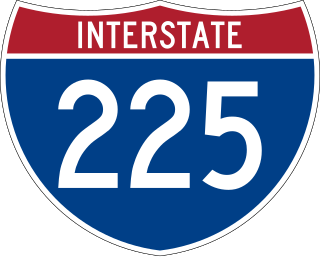
Interstate 225 (I-225) is an auxiliary Interstate Highway in the U.S. state of Colorado. The freeway is a 11.959-mile-long (19.246 km) connector spur route of I-25 that acts as an eastern bypass in the Denver metropolitan area and serves Aurora. It also provides direct access to Denver International Airport for the Denver Tech Center and the southern suburbs of Denver. I-225 is one of the two existing auxiliary Interstate Highways in Colorado and it is the only auxiliary route of I-25, as there are no auxiliary routes for I-25 in New Mexico and Wyoming. The route begins at I-25 in the Denver Tech Center and runs north to I-70 north of Aurora. It interchanges with State Highway 83 (SH 83), SH 30 and I-70 Business/US 40/US 287, known locally as Colfax Avenue. The freeway was first proposed in the 1950s along with the first Interstate Highways within Denver. Construction did not begin until 1964 at the I-70 interchange and proceeded south through Aurora until final completion in early 1976 with the final link to I-25 opening to traffic.

<span class="mw-page-title-main">Texas State Highway Beltway 8</span> Highway in Texas

Beltway 8 (BW8), the Sam Houston Parkway, along with the Sam Houston Tollway, is an 88-mile (142 km) beltway around the city of Houston, Texas, United States, lying entirely within Harris County.

<span class="mw-page-title-main">Texas State Highway Loop 12</span> Highway in Texas

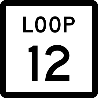
Loop 12 is a state highway that runs mostly within the city limits of Dallas, Texas. The western segment of the loop is named after General Walton Walker, who served and died in South Korea. During the 1950s and 1960s, Loop 12 was the outer beltway in the Dallas area, having since been supplanted by Interstate 635 (I-635), which is itself being supplanted by the President George Bush Turnpike. Loop 12 is, however, the only state highway in Dallas that forms a complete loop.

<span class="mw-page-title-main">Interstate 635 (Texas)</span> Highway in Texas

Interstate 635 (I-635) is a 36.999-mile-long (59.544 km) partial loop around Dallas, Texas, in the United States between I-20 in Balch Springs and State Highway 121 (SH 121) at the north entrance of the Dallas Fort Worth International Airport in Grapevine. It intersects I-35E at exits 27B and 27C but does not connect with I-35W. I-635 and a part of I-20 are collectively designated as the Lyndon B. Johnson Freeway; known locally as the LBJ Freeway, or simply LBJ. The roadway is named after Lyndon B. Johnson, the former U.S. senator from Texas and the 37th vice-president and 36th president of the U.S. Where I-635 ends at I-20, I-20 continues the LBJ Freeway designation heading west. Since the portion of I-20 between Spur 408 to I-635 retains the same names as I-635, the two highways are considered three-quarters of the beltway around Dallas. Together with Spur 408, a portion of Loop 12, and a portion of I-35E, I-635 and I-20 complete the beltway.

<span class="mw-page-title-main">Westpark Tollway</span>

The Westpark Tollway, also Fort Bend Westpark Tollway, is a controlled-access toll road in Texas, serving western Houston and Harris County, and northeastern Fort Bend County. Construction on the facility began in 2001 and portions of the road were opened to traffic in May 2004. Construction of the roadway was completed in August 2005. The Westpark Tollway begins on Westpark Drive just past the South Rice Avenue intersection in the Uptown District of Houston and runs approximately 22 miles (35 km) west to Farm to Market Road 1093 just past Farm to Market Road 723 in Fulshear, Texas. It runs roughly parallel and to the south of Westheimer Road in Harris County and concurrently with FM 1093 in Fort Bend County.

<span class="mw-page-title-main">Fort Bend Parkway</span> Toll highway in Texas

The Fort Bend Parkway Toll Road is the Fort Bend County portion of a controlled-access toll road connecting Sienna in eastern Fort Bend County to US 90A in southwestern Harris County. It is administered by the Fort Bend County Toll Road Authority (FBCTRA). The Harris County Toll Road Authority (HCTRA) administers the Harris County segment of the road — from just south of Beltway 8 at the county line to US 90A — and uses its purple pentagonal shield labeled as Fort Bend Toll Road. It is proposed to reach a northern terminus at the southwestern corner of Interstate 610 in the future, and SH 99 at its southern terminus.

The Harris County Toll Road Authority maintains and operates a 103-mile (165.8 km) toll road system in the Greater Houston area of Texas, United States. Its headquarters are located in Houston's Fairbanks/Northwest Crossing neighborhood.

<span class="mw-page-title-main">Interstate 270 (Colorado)</span> Highway in Colorado

Interstate 270 (I-270) is a seven-mile-long (11 km) auxiliary Interstate Highway located in the northeastern part of the Denver metropolitan area in the US state of Colorado. It overlaps U.S. Highway 36 (US 36) for its entire length and is also a part of the Dwight D. Eisenhower Highway, which spans from I-270 and the Capital Beltway in Bethesda, Maryland, to I-80/US 101 in San Francisco, California. The western terminus of I-270 is at the interchange with I-25 and US 36. It heads eastward to an interchange with I-76, where the mileposts reset because of a previous freeway extension. The freeway heads southeast and comes to meet Vasquez Boulevard, where it enters Commerce City. The road crosses Quebec Street before ending at I-70.

<span class="mw-page-title-main">E-470</span> Highway in Colorado

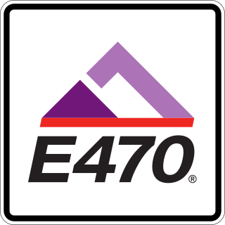
E-470 is a 47-mile-long (76 km) controlled-access toll road that traverses the eastern portion of the Denver metropolitan area in the US state of Colorado. It is the eastern half of the 470 beltway that serves Meridian, Parker, Aurora, Denver International Airport, and Brighton.

<span class="mw-page-title-main">Northwest Parkway</span> Highway in Colorado

Northwest Parkway is a nine-mile (14 km) limited-accesss highway that runs from U.S. Highway 36 (US 36) to the Interstate 25 (I-25)/E-470 interchange. Both termini are in Broomfield, northwest of Denver. In combination with E-470 and State Highway 470, the Northwest Parkway forms a partial beltway of approximately 83 miles (134 km) around the Denver metropolitan area. Some 18 miles (29 km) lie between the west end of Northwest Parkway and the northwest end of SH 470, the opposite end of the beltway.

<span class="mw-page-title-main">Colorado State Highway 121</span> State highway in Colorado, United States

State Highway 121 (SH 121) is a 30.425 mile (48.96 km) long state highway in the U.S. state of Colorado. SH 121's southern terminus is at Waterton Road near Littleton, and the northern terminus is at U.S. Route 287 (US 287) in Broomfield.

<span class="mw-page-title-main">Two-lane expressway</span> Expressway or freeway with only one lane in each direction

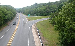
A two-lane expressway or two-lane freeway is an expressway or freeway with only one lane in each direction, and usually no median barrier. It may be built that way because of constraints, or may be intended for expansion once traffic volumes rise. The term super two is often used by roadgeeks for this type of road, but traffic engineers use that term for a high-quality surface road. Most of these roads are not tolled.

<span class="mw-page-title-main">Colorado State Highway 83</span> Highway in Colorado

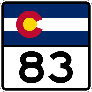
State Highway 83 (SH 83) is a state highway that is located along the Front Range in the U.S. State of Colorado. Spanning about 56.2 miles (90.4 km) from the SH 21 interchange in northern Colorado Springs and SH 2 in Denver, the highway follows a south–north route, paralleling Interstate 25 to the east and serving rural areas. Along with I-25, it is one of the only two routes in the Colorado State Highway System that directly connects Denver and Colorado Springs.

In the US state of Colorado, Interstate 25 (I-25) follows the north–south corridor through Colorado Springs and Denver. The highway enters the state from the north near Carr and exits the state near Starkville. The highway also runs through the cities of Fort Collins, Broomfield, Loveland, and Pueblo. The route is concurrent with U.S. Route 87 (US 87), which is unsigned, through the entire length of the state. I-25 replaced US 87 and most of US 85 for through traffic.

<span class="mw-page-title-main">U.S. Route 36 in Colorado</span> Section of U.S. Highway in Colorado, United States

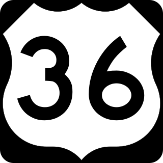
U.S. Route 36 is a United States highway that travels from Rocky Mountain National Park, Colorado to Uhrichsville, Ohio. In Colorado, the highway traverses an east–west route mostly in the northern portion of the Great Plains. At its west end, the road connects several small mountain towns such as Estes Park and Lyons to the larger metropolitan areas of Boulder and Denver. As it continues eastward, it connects to several other small towns and rural highways on the plains before crossing the state line into Kansas.

<span class="mw-page-title-main">Colorado State Highway 74</span> State highway in Colorado, United States

State Highway 74 (SH 74) is a state highway in the U.S. state of Colorado. Running 18 miles (29 km) from Interstate 70 (I-70) in El Rancho to SH 8 in Morrison, the highway roughly follows a hook-shaped path running northwest–southeast. The section of the route north of the town of Evergreen is known as Evergreen Parkway and is a segment with a four- to six-lane roadway, with the section east of Evergreen mostly two lanes. The other section is known as the Bear Creek Canyon Scenic Mountain Drive, or just Bear Creek Road, and primarily parallels Bear Creek, passing through the towns of Kittredge and Idledale. The route, which is on the outskirts of Denver, passes through several of the city's mountain parks, including Bergen, Dedisse and Red Rocks parks.

References

  1. "SH 470 Inventory Form" (PDF). Colorado Department of Transportation . Retrieved January 22, 2022.
  2. 1 2 Google (December 2, 2018). "State Highway 470" (Map). Google Maps . Google. Retrieved December 2, 2018.
  3. Fisher, Tyson (18 August 2020). "Tolling on C-470 express lanes in Colorado begins". Land Line. Land Line Media. Retrieved February 12, 2022.
  4. "Plans to Complete Beltway". Broomfield Enterprise. July 24, 2008.
  5. Lewis, Al (September 2, 2007). "Parkway Lease Fool's Gambit". Denver Post.
  6. "Jefferson Parkway Public Highway Authority". Jefferson Parkway Public Highway Authority. Retrieved 21 August 2014.
  7. Rios, Jennifer (26 February 2020). "Broomfield votes to Leave Jefferson Parkway". Broomfield Enterprise. Retrieved 2 August 2021.
  8. ""Major blow" for Jefferson Parkway as Broomfield withdraws from highway project". The Denver Post . February 26, 2020. Retrieved August 9, 2021.
  9. "Jefferson Parkway plans face opposition from Arvada". The Denver Post. March 16, 2019. Retrieved August 9, 2021.
  10. "Highway Data Explorer". Colorado Department of Transportation. Retrieved April 2, 2022.
  11. Steers, Stuart (June 19, 1997). "The Blacktop Jungle". Westword.
  12. Flynn, Kevin (2008-06-14). "Arvada clears beltway hurdle". Rocky Mountain News.
Template:Attached KML/Colorado State Highway 470
KML is from Wikidata