Missouri Route 141

Last updated

MO-141.svg

Route 141

Missouri Route 141
Route 141 highlighted in red
Route information
Maintained by MoDOT
Length30.902 mi [1]  (49.732 km)
Major junctions
South endUS 61.svgUS 67.svg US 61  / US 67 in Arnold
Major intersectionsI-55.svg I-55 in Arnold
I-44.svgUS 50.svg I-44  / US 50 in Fenton
I-64.svgUS 40.svgUS 61.svg I-64  / US 40  / US 61 in Town & Country
MO-364.svg Route 364 in Maryland Heights
I-70.svg I-70 in Maryland Heights
North endMO-370.svg Route 370 in Bridgeton
Location
Country United States
State Missouri
Counties Jefferson, St. Louis
Highway system
MO-139.svg Route 139 MO-142.svg Route 142

Route 141, also known as Woods Mill Road in parts of St. Louis County, [2] is a state highway located in the western St. Louis metropolitan area. Its northern terminus is at Route 370 in Bridgeton; its southern terminus is at U.S. Route 61/U.S. Route 67 in Arnold, in Jefferson County. The northern stretches of the highway are often referred to as the Maryland Heights Expressway or Earth City Expressway.

Contents

Route description

For the majority of its duration, Route 141 is a divided highway with four to eight lanes. [2]

Jefferson County

In Jefferson County, Route 141 is a four-lane highway. It has a southern terminus at U.S. Route 61/U.S. Route 67 in Arnold. At this point, it is an at-grade route with business driveways and traffic lights. It continues northwest and has a hybrid SPUI and diamond interchange with I-55. After the interchange, it becomes a rural highway with two lanes on each side of a wide grass median. While nearing the Meramec River, the highway has an at-grade intersection with Old Missouri State Road. After this intersection, the grassy median ends and the road is instead separated by a Jersey barrier. The route then has a diamond interchange with the Route 21 freeway. After this interchange, Route 141 again sports a wide grassy median. It continues north and crosses the county line into Fenton in St. Louis County. [2]

St. Louis County

Route 141 enters St. Louis County in Fenton. It has an interchange with Route 30 and widens into a six- to eight-lane divided highway. Heading north, Route 141 passes a plaza to the left that includes various restaurants. After the plaza, Route 141 heads into a suburban area and has at-grade interchanges with several collector roads. The highway heads northeast and has an interchange with Interstate 44 in Valley Park. Shortly after this interchange, Route 141 crosses the Meramec River and the Meramec River Greenway and enters Valley Park. [2]

In Valley Park, Route 141 passes over, and then under, a pair of railroad tracks and has several at-grade intersections with local road. Heading north, the highway passes the Valley Park water tower and abruptly turns northwest. The road then enters Twin Oaks and has a SPUI with Big Bend Road. Shortly after the interchange, Route 141 enters Manchester. The road weaves through suburban areas, and after an at-grade intersection with Carmen Road, Route 141 gains outer roads in both directions. The highway then has a SPUI with Missouri Route 100 (Manchester Road) while heading directly north. After this interchange, Route 141 has an at-grade intersection with a plaza containing a Costco and a Walmart Supercenter. [2]

Past the intersection, Route 141 serves as a border between Missouri River Township and Ballwin. The highway continues to mainly serve suburban areas. The road weaves northeast and enters Town and Country. Route 141 then has a hybrid trumpet interchange with Clayton Road and briefly becomes a controlled-access highway. [2] Woods Mill Road serves as an outer road. The freeway ends at a signalized hybrid interchange with Interstate 64/US 40/US 61. Maryville University is located to the east. Route 141 subsequently clips the eastern edge of Chesterfield and passes St. Luke's Hospital. [2]

Past this point, Route 141 becomes a controlled-access freeway. It has a SPUI with Ladue Road (Route AB). [2] The highway curves northeastwards, passing Parkway Central High School, which is located to the west of the road. Shortly after passing the school, Route 141 curves back northward and heads through a wooded area. Subsequently, Route 141 as a SPUI interchange with Route 340 (Olive Boulevard). Route 141 becomes elevated after the interchange, crossing over Creve Coeur Creek and several other streams, and passing a neighborhood to the west. [2] Route 141 then crosses Waterworks Road and railroad tracks, entering Maryland Heights. The name of the road changes to Maryland Heights Expressway. Shortly after entering Maryland Heights, Route 141 has a SPUI with Route 364, After that, Route 141 passes Hollywood Casino Amphitheatre, and has an interchange with Interstate 70, and the highway splits between north and southbound and reconnecting at Route 180 (St Charles Rock Road) [2]

The highway meets its northern terminus after the interchange with Route 370 at Missouri Bottom Road. [1]

History

Old Highway 141 was a two-lane road built in the 1930s. The idea of an newer, divided highway carrying the Route 141 designation dates to the 1970s, when regional highway planners adopted the idea of an "outer belt" west of I-270. [3] In 1976, Frank Kriz, then the district state highway engineer, called 141 an "old ridge-runner." The highways had traffic jams due to suburban growth. That same year, construction began for a new, four-lane Highway 141 in Jefferson County. Subsequent progress included a new bridge over the Meramec River at Valley Park in 1986 and a new interchange at Manchester Road in 1999. The section of Route 141 between Interstate 64 and the St. Louis County/Jefferson County line was upgraded to six lanes in a project completed in 2003. [3]

Extension

In August 2012, a six-lane realignment opened between Ladue Road and Page Avenue (Route 364), with interchanges at Ladue, Olive (Route 340), and Page. The section between Page and Olive (tentatively titled the Page-Olive Connector), which was constructed by St. Louis County has been turned over to the Missouri Department of Transportation and designated as Route 141. Maryland Heights Expressway (the section from Page north to I-70) and Earth City Expressway (the section from I-70 north to its terminus at Route 370) have also been designated as 141. As such, Route 141 now runs from US 61/67 in Arnold to Route 370 in Bridgeton.

The Missouri Department of Transportation (MoDOT) in cooperation with the St. Louis County Department of Highways and Traffic (DHT) expanded Route 141. 1 between just south of Ladue Road (Route AB) to Olive Boulevard (Route 340). DHT extended Route 141 from Olive Boulevard to the Page Avenue Extension (Route 364) at the Maryland Heights Expressway which links to the Earth City Expressway which continues north to Route 370 where it then turns into Missouri Bottom Road via Aubuchon Road. SPUIs were constructed at Ladue Road and Olive Blvd. There were some construction constraints with the part of the project between Olive and Page. DHT held studies of the environment to decide how to maneuver construction without disturbing some of the native wetlands in the corridor. [4] During heavy rain, the current intersection at Creve Coeur Mill Road and Olive has the potential to flood, and most of the area along Creve Coeur Mill Road are either wetlands or farmland that lies in a flood plain.

St. Louis County Executive Charlie Dooley had called the project "one of St. Louis County's largest and most important infrastructure improvements this decade." The economic impact of the construction project was not nearly as massive as the upgrading and realignment project on Interstate 64/Highway 40. This construction project was estimated to have a $20 billion economic impact and create over 170,000 jobs during the 2010 decade. [5]

Major intersections

CountyLocationmi [1] kmDestinationsNotes
Jefferson Arnold 0.0000.000US 61.svgUS 67.svg US 61  / US 67 (Jeffco Boulevard)Southern terminus at an at-grade intersection
0.3790.610I-55.svg I-55  St. Louis, Cape Girardeau Hybrid interchange (SPUI and diamond); exit 191 on I-55
3.5855.769MO-21.svg Route 21  St. Louis, Hillsboro Diamond interchange
St. Louis Fenton 7.58312.204MO-30.svg Route 30  St. Louis, St. Clair Diamond interchange
11.12717.907I-44.svgUS 50.svg I-44  / US 50  St. Louis, Rolla Exit 272 on I-44 / US 50
11.27818.150North Outer RoadInterchange
Twin Oaks 13.25521.332Big Bend RoadSPUI
Manchester 15.13724.361MO-100.svgLewis and Clark Trail.svg Route 100  / Lewis and Clark Trail (Manchester Road)SPUI built in 1999
Town & Country 17.45628.093MO-supp-HH.svg Route HH (Clayton Road)Hybrid Trumpet Interchange
18.21329.311Salt Mill Road / South Outer 40 DriveInterchange with traffic circles
18.66530.038I-64.svgUS 40.svgAvenue of the Saints banner.svg
US 61.svg
I-64  / US 40  / US 61 (Avenue of the Saints) St. Louis, Wentzville
Exit 22 on I-64 / US 40 / US 61.
Chesterfield 19.97432.145MO-supp-AB.svg Route AB (Ladue Road)SPUI. Northern Extension begins
21.61134.780MO-340.svg Route 340 (Olive Boulevard)SPUI
Maryland Heights 23.56337.921MO-364.svg Route 364  St. Louis, St. Charles Exit 17 on Route 364
27.98345.034I-70.svg I-70  St. Louis, Kansas City Cloverleaf interchange; exit 231 on I-70
Bridgeton 29.70947.812 St. Charles Rock Road At-grade-intersection
30.76349.508MO-370.svg Route 370  St. Louis, St. Charles Northern terminus at a diamond interchange; exit 9 on Route 370
30.90249.732Missouri Bottom Road northContinuation beyond northern terminus
1.000 mi = 1.609 km; 1.000 km = 0.621 mi

Related Research Articles

<span class="mw-page-title-main">Interstate 83</span> Interstate Highway in Pennsylvania and Maryland

Interstate 83 (I-83) is an Interstate Highway located in the states of Maryland and Pennsylvania in the Eastern United States. Its southern terminus is at a signalized intersection with Fayette Street in Baltimore, Maryland; its northern terminus is at I-81 near Harrisburg, Pennsylvania. I-83 runs from Downtown Baltimore north to I-695 near the northern suburb of Timonium on the Jones Falls Expressway before forming a concurrency with I-695. After splitting from I-695, the route follows the Baltimore-Harrisburg Expressway north to the border between Maryland and Pennsylvania. Upon crossing the state line, I-83 becomes the Veterans of Foreign Wars of the United States Memorial Highway and continues north through York toward the Harrisburg area. The route runs along the southern and eastern portion of the Capital Beltway that encircles Harrisburg before reaching its northern terminus.

<span class="mw-page-title-main">Interstate 64</span> East–west Interstate in eastern US

Interstate 64 (I-64) is an east–west Interstate Highway in the Eastern United States. Its western terminus is at I-70, US Route 40 (US 40), and US 61 in Wentzville, Missouri. Its eastern terminus is at an interchange with I-264 and I-664 at Bower's Hill in Chesapeake, Virginia. I-64 connects the major metropolitan areas of St. Louis, Missouri; Louisville and Lexington in Kentucky; Charleston, West Virginia; and Richmond and Hampton Roads in Virginia.

<span class="mw-page-title-main">Interstate 72</span> Interstate Highway in Illinois and Missouri

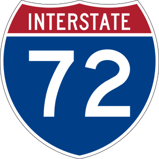
Interstate 72 (I-72) is an Interstate Highway in the midwestern United States. Its western terminus is in Hannibal, Missouri, at an intersection with U.S. Route 61 (US 61); its eastern terminus is at Country Fair Drive in Champaign, Illinois. The route runs through the major cities of Decatur, Illinois, and Springfield, Illinois. In 2006, the Illinois General Assembly dedicated all of I-72 as Purple Heart Memorial Highway. The stretch between Springfield and Decatur is also called Penny Severns Memorial Expressway, and the section between mile 35 and the Mississippi River is known as the Free Frank McWorter Historic Highway.

<span class="mw-page-title-main">Chesterfield, Missouri</span> City in Missouri, United States

Chesterfield is a city in St. Louis County, Missouri, United States. It is a western suburb of St. Louis. As of the 2020 census, the population was 49,999, making it the state's fourteenth-largest city. The broader valley of Chesterfield was originally referred to as "Gumbo Flats", derived from its soil, which though very rich and silty, resembled gumbo when wet.

<span class="mw-page-title-main">Missouri Route 100</span> State highway in Missouri

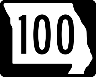
Route 100, also named Manchester Road through St. Louis County and Manchester Avenue and Chouteau Avenue through St. Louis City, is a state highway in the U.S. state of Missouri. It runs from Linn, Missouri at U.S. Route 50 to Interstate 55 in St. Louis. The highway is 121 miles (195 km) long.

<span class="mw-page-title-main">U.S. Route 67</span> Highway in the United States

U.S. Route 67 is a major north–south U.S. highway which extends for 1,560 miles (2,511 km) in the Central United States. The southern terminus of the route is at the United States-Mexico border in Presidio, Texas, where it continues south as Mexican Federal Highway 16 upon crossing the Rio Grande. The northern terminus is at U.S. Route 52 in Sabula, Iowa. US 67 crosses the Mississippi River twice along its routing. The first crossing is at West Alton, Missouri, where US 67 uses the Clark Bridge to reach Alton, Illinois. About 240 miles (390 km) to the north, US 67 crosses the river again at the Rock Island Centennial Bridge between Rock Island, Illinois, and Davenport, Iowa. Additionally, the route crosses the Missouri River via the Lewis Bridge a few miles southwest of the Clark Bridge.

<span class="mw-page-title-main">Cloverleaf interchange</span> A type of interchange using loop ramps

A cloverleaf interchange is a two-level interchange in which all turns are handled by slip roads. To go left, vehicles first continue as one road passes over or under the other, then exit right onto a one-way three-fourths loop ramp (270°) and merge onto the intersecting road. The objective of a cloverleaf is to allow two highways to cross without the need for any traffic to be stopped by traffic lights. The limiting factor in the capacity of a cloverleaf interchange is traffic weaving.

The Avenue of the Saints is a 563-mile-long (906 km) highway in the Midwestern United States that connects St. Louis, Missouri and St. Paul, Minnesota.

<span class="mw-page-title-main">Single-point urban interchange</span> Highway interchange design

A single-point urban interchange, also called a single-point interchange (SPI) or single-point diamond interchange (SPDI), is a type of highway interchange. The design was created in order to help move large volumes of traffic through limited amounts of space safely and efficiently.

<span class="mw-page-title-main">Missouri Route 364</span> State highway in eastern Missouri

Route 364, known locally as the Page Extension, the Page Avenue Freeway, the Page Expressway, or simply the Extension, is a freeway that connects St. Louis County in Maryland Heights with St. Charles County in Lake St. Louis via the Veterans Memorial Bridge over the Missouri River. The highway is a designated auxiliary state route of I-64.

<span class="mw-page-title-main">Missouri Route 30</span> State highway in Missouri

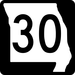
Route 30 is a highway in eastern Missouri, United States. Its eastern terminus is at the Interstate 55/Interstate 44 junction in St. Louis. Its western terminus is at Interstate 44 in St. Clair. In St. Louis, the section between Interstate 44 and Route 366 is part of historic U.S. Route 66 and is marked as such. In the St. Louis area, it is known as Gravois Avenue or Gravois Road. Further south, Gravois Rd is used to mark the old section of the highway where the newer, divided highway rerouted Highway 30.

<span class="mw-page-title-main">Transportation in St. Louis</span>

Transportation in Greater St. Louis, Missouri includes road, rail, ship, and air transportation modes connecting the bi-state St. Louis metropolitan area with surrounding communities throughout the Midwest, national transportation networks, and international locations. The Greater St. Louis region also supports a multi-modal transportation network that includes bus, paratransit, and light rail service in addition to shared-use paths, bike lanes and greenways.

<span class="mw-page-title-main">Interstate 70 in Maryland</span> Section of Interstate Highway in Maryland

Interstate 70 (I-70) is a part of the Interstate Highway System that runs from Cove Fort, Utah, to Baltimore, Maryland. In Maryland, the Interstate Highway runs 93.62 miles (150.67 km) from the Pennsylvania state line in Hancock east to the Interstate's eastern terminus near its junction with I-695 at a park and ride in Baltimore. I-70 is the primary east–west Interstate in Maryland; the Interstate Highway connects Baltimore—and Washington, D.C., via I-270—with Western Maryland. The Interstate serves Frederick and Hagerstown directly and provides access to Cumberland via its junction with I-68 at Hancock. I-70 runs concurrently with its predecessor highway, U.S. Route 40 (US 40), from Hancock to Indian Springs in Washington County and from Frederick to West Friendship in Howard County.

<span class="mw-page-title-main">U.S. Route 29 in Maryland</span> State highway in Maryland, US

U.S. Route 29 is a north–south United States highway that runs for 1,036 miles (1,667 km) from the western suburbs of Baltimore, Maryland, to Pensacola, Florida. In the U.S. state of Maryland, US 29 is a major highway that emerges from Washington, D.C., and runs north into eastern Montgomery County, stretching over 25.859 miles (41.62 km) through the state and terminating at Maryland Route 99 outside of Ellicott City. It serves the cities of Columbia and Ellicott City and provides the westernmost north–south route between Washington, D.C., and Baltimore.

<span class="mw-page-title-main">Interstate 55 in Illinois</span> Section of Interstate Highway in Illinois, United States

Interstate 55 (I-55) is a major north–south Interstate Highway in the US state of Illinois that connects St. Louis, Missouri, to the Chicago metropolitan area. It enters the state from Missouri near East St. Louis, Illinois, and runs to U.S. Route 41 near Downtown Chicago, where the highway ends, a distance of 294.38 miles (473.76 km). The road also runs through the Illinois cities of Springfield, Bloomington, and Joliet. The section in Cook County is officially named the Stevenson Expressway, and in DuPage County its officially named the Joliet Freeway or the Will Rogers Freeway. The section from the south suburbs of Chicago to the area near Pontiac is officially named the Barack Obama Presidential Expressway after the 44th President, Barack Obama, who launched his political career from Illinois.

<span class="mw-page-title-main">Interstate 64 in Missouri</span> Highway in the U.S. state of Missouri

Interstate 64 (I-64) passes through the Greater St. Louis area in the US state of Missouri. The entire route overlaps U.S. Route 40 (US 40). Because the road was a main thoroughfare in the St. Louis area before the development of the Interstate Highway System, it is not uncommon for locals to refer to the stretch of highway as "Highway 40" rather than "I-64". On December 6, 2009, the portion of the highway running through the city of St. Louis was named the Jack Buck Memorial Highway in honor of the late sportscaster.

<span class="mw-page-title-main">Interstate 44 in Missouri</span> Highway in Missouri

Interstate 44 (I-44) in the US state of Missouri runs northeast from the Oklahoma state line near Joplin to I-70 in Downtown St. Louis. It runs for about 293 miles (472 km) in the state, and is the longest Interstate Highway in the state.

<span class="mw-page-title-main">U.S. Route 67 in Missouri</span>

U.S. Route 67 is the portion of a north-south highway in Missouri that starts at the Arkansas state line south of Neelyville and ends at the Illinois state line northeast of West Alton.

References

Template:Attached KML/Missouri Route 141
KML is not from Wikidata
  1. 1 2 3 Missouri Department of Transportation (March 19, 2015). MoDOT HPMAPS (Map). Missouri Department of Transportation. Retrieved March 19, 2015.
  2. 1 2 3 4 5 6 7 8 9 10 Google (2021-11-15). "overview of Missouri Route 141" (Map). Google Maps . Google. Retrieved 2021-11-15.
  3. "Page to Olive Connector Study". St. Louis County Department of Highways and Traffic. Retrieved 2008-10-15.
  4. "Highway 141 project to have $20B economic impact". Bizjournals.com. Retrieved 2021-11-24.