
The Goethals Bridge is the name of a pair of cable-stayed bridge spans connecting Elizabeth, New Jersey, to Staten Island, New York, in the United States. The spans cross a strait known as Arthur Kill, and replaced a cantilever bridge span built in 1928. The bridge is operated by the Port Authority of New York and New Jersey.
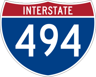
Interstate 494 (I-494) is a bypass route making up part of a beltway of Interstate 94, circling through the southern and western portions of the Minneapolis – Saint Paul metropolitan area in Minnesota. The 43-mile (69 km) road is coupled with Interstate 694 at each end, and composes more than half of the major beltway of the region. I-694 / I-494 also act as loop routes for Interstate 35E and Interstate 35W.

Interstate 694 (I-694) is an east–west auxiliary Interstate Highway located in the Minneapolis – Saint Paul metropolitan area in the U.S. state of Minnesota. The western terminus of the route is at its junction with I-94, I-494, and US 52 in Maple Grove. The eastern terminus of I-694 is at its junction with I-94 and I-494 at the Woodbury–Oakdale city line. I-694 comprises the northern and northeastern portions of a beltway around the Twin Cities, with I-494 forming the remainder of the beltway. The speed limit is 60 miles per hour (95 km/h). Interstate Highways outside of the loop in Minnesota may be signed as high as 70 mph (115 km/h), but can only reach 60 mph (95 km/h) inside the loop.

Interstate 394 (I-394) is a small east–west Interstate Highway spur route in Hennepin County in the U.S. state of Minnesota. It is also commonly referred to by its pre-1991 name, Wayzata Boulevard, and by its other designation, U.S. Highway 12. It runs for 9.8 miles (15.8 km) from downtown Minneapolis to Interstate 494 in the Minneapolis suburb of Minnetonka. At its western terminus, the roadway loses its interstate designation but continues as U.S. Highway 12. I-394 serves as the most direct link for commuters and other drivers who are traveling between downtown Minneapolis and parts of the western Minneapolis – Saint Paul metropolitan area.
E-ZPass Minnesota, formerly MnPass is the brand name associated with a series of high occupancy toll lanes in the Minneapolis-St. Paul Metropolitan Area of Minnesota and is also associated with the electronic toll collection (ETC) system used for those HO/T lanes. The lanes and the ETC system are owned by the Minnesota Department of Transportation (MnDOT) and fully compatible with the multi-state E-ZPass network.

Minnesota State Highway 610 (MN 610) is an east–west freeway in the Twin Cities region of Minnesota. The freeway connects Interstate 94 (I-94), County Road 81, and CR 130 in northern Hennepin County to U.S. Highway 10 (US 10) in southern Anoka County. MN 610 crosses the Mississippi River on the Richard P. Braun Bridge between suburban Brooklyn Park and Coon Rapids. The highway is 12.3 miles (19.8 km) long.
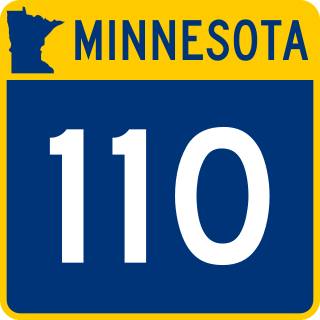
Minnesota State Highway 110 (MN 110) was a short 5+1⁄4-mile-long (8.4 km) connector state highway in Minnesota, which ran from an interchange with MN 55 in Mendota Heights to an interchange with Interstate 494 (I-494) in Inver Grove Heights, south of downtown Saint Paul.

Interstate 35E (I-35E) is an Interstate Highway in the US state of Minnesota, passing through downtown Saint Paul. It is one of two through routes for I-35 through the Twin Cities of Minneapolis and Saint Paul, the other being I-35W through Minneapolis. Thus, both ends of I-35E are shared with I-35W and I-35.

Interstate 35W (I-35W) is an Interstate Highway in the US state of Minnesota, passing through downtown Minneapolis. It is one of two through routes for I-35 through the Twin Cities of Minneapolis and Saint Paul, the other being I-35E through downtown Saint Paul.
The I-90 Mississippi River Bridge, or the Dresbach Bridge, consists of a pair of parallel bridges that traverse the Mississippi River, connecting the La Crosse, Wisconsin area to Dresbach in rural Winona County, Minnesota. The current bridge was fully opened to traffic in October 2016, replacing a previous 1967 plate girder bridge. It is part of the Interstate 90 route. There is another automobile crossing a few miles south of this bridge; the Mississippi River Bridge, a combination of two bridges, and the La Crosse West Channel Bridge, connecting La Crescent, Minnesota and La Crosse, Wisconsin.
The I-694 Bridge is a pair of girder bridges that spans the Mississippi River between the cities of Brooklyn Center and Fridley in Minnesota. The westbound bridge was built in 1963 by the Minnesota Department of Transportation, and widened in 1987 with a new structure above the piers. The eastbound bridge was built in 1988, also by the Minnesota Department of Transportation.
The Daniel Boone Bridge is the name for two bridges carrying Interstate 64, U.S. Route 40 and U.S. Route 61 across the Missouri River between St. Louis County and St. Charles County, Missouri. The older bridge, which carries westbound traffic, is a continuous truss bridge, while the newer bridge, which carries eastbound traffic, is a deck girder bridge.

The I-10 Twin Span Bridge, a nearly 5.5-mile (8.9 km) causeway officially known as the Frank Davis "Naturally N'Awlins" Memorial Bridge, consists of two parallel trestle bridges. These parallel bridges cross the eastern end of Lake Pontchartrain in southern Louisiana from New Orleans to Slidell. The current bridge spans were constructed in the second half of the 2000s after the original bridges were extensively damaged by Hurricane Katrina on August 29, 2005. The first span opened to eastbound traffic on July 9, 2009. On April 7, 2010, the second span was opened to traffic and the old twin spans were permanently closed to traffic.

Interstate 64 (I-64) is an Interstate Highway in the US state of West Virginia. It travels through the state for 184 miles (296 km) passing by the major towns and cities of Huntington, Charleston, Beckley, and Lewisburg.

U.S. Highway 52 enters the state of Minnesota at the unincorporated community of Prosper, north of the town of Burr Oak, Iowa. The route is marked north–south in Minnesota along its independent segment from the Iowa state line to downtown St. Paul. Highway 52 is not signed along the length of its concurrency with Interstate 94 (I-94) from downtown St. Paul to the North Dakota state line at Moorhead and Fargo.

Minnesota State Highway 62 (MN 62) is a highway in the Twin Cities region of Minnesota. The route was part of County Road 62 (CR 62) until 1988, when a portion of the route was inherited by the state. The western terminus of the highway is at Interstate 494 (I-494) in Eden Prairie, where the roadway continues west as CR 62 to CR 101. The eastern terminus of the route is at the junction with I-494 in Inver Grove Heights. Locally, the original portion of the route in Hennepin County is known as "the Crosstown," though signage with this name does not appear on the highway itself, but only on local streets adjacent to the road. It is also used as an alternate name, even by the Minnesota Department of Transportation (MnDOT). The route is 18.6 miles (29.9 km) in length.

The I-35W Saint Anthony Falls Bridge crosses the Mississippi River one-half mile downstream from the Saint Anthony Falls in Minneapolis, Minnesota in the U.S., carrying north–south traffic on Interstate Highway 35W. The ten-lane bridge replaced the I-35W Mississippi River bridge, which collapsed on August 1, 2007. It was planned and is maintained by the Minnesota Department of Transportation (Mn/DOT). The planning, design, and construction processes were completed more quickly than normal because Interstate 35W is a critical artery for commuters and truck freight. The bridge opened September 18, 2008, well ahead of the original goal of December 24.

U.S. Highway 169 (U.S. 169) is a major north–south highway in the U.S. state of Minnesota, connecting the Minnesota River valley with the Twin Cities and the Iron Range. Much of the route is built to expressway or freeway standards.

Interstate 74 (I-74) is the central freeway through the Iowa Quad Cities. It roughly divides Davenport to the west and Bettendorf to the east. The Interstate Highway begins at an interchange with I-80 at the northeastern edge of Davenport and continues into Illinois at the Mississippi River by crossing the I-74 Bridge. The freeway was built in stages during the late 1960s and early 1970s.
The I-35W/US 10/I-694 North Central Corridor Reconstruction Project was a road construction project, conducted under the operations of the Minnesota Department of Transportation (MnDOT). This project involved the partial or complete reconstruction of three major thoroughfares in the northern and eastern Twin Cities metropolitan area, which include Interstate 35W (I-35W), US Highway 10, and I-694. Ramsey County Road 10 (CR 10) was also planned to be partially reconstructed at the intersection with I-35W during this project as well. Several other side projects that tie into this reconstruction include the expansion of the Lexington Avenue bridge in Arden Hills, as well as the reconstruction of the Island Lake overpasses just west of Victoria Street in Shoreview. Cities and communities that are involved with this project include New Brighton, Mounds View, Arden Hills, Shoreview, Little Canada, and Vadnais Heights, Minnesota.


