
Argyll and Bute is one of 32 unitary council areas in Scotland and a lieutenancy area. The current lord-lieutenant for Argyll and Bute is Jane Margaret MacLeod. The administrative centre for the council area is in Lochgilphead at Kilmory Castle, a 19th-century Gothic Revival building and estate. The current council leader is Councillor Jim Lynch.
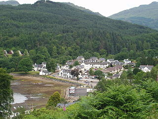
Lochgoilhead is a village on the Cowal peninsula, in Argyll and Bute, Scottish Highlands. It is located within the Loch Lomond and The Trossachs National Park and is widely considered to be one of the most beautiful areas in Argyll and in Scotland as a whole.

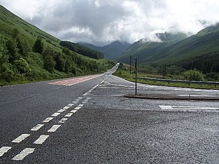
The A83 is a major road in the south of Argyll and Bute, Scotland, running from Tarbet, on the western shore of Loch Lomond, where it splits from the A82, to Campbeltown at the southern end of the Kintyre peninsula. The road is best known for its section across the Rest and be Thankful pass through the Arrochar Alps between the heads of Loch Long and Loch Fyne.
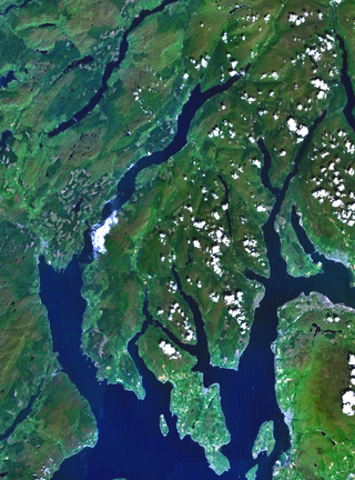
Cowal is a rugged peninsula in Argyll and Bute, on the west coast of Scotland. It is connected to the mainland to the north, and is bounded by Loch Fyne to the west, by Loch Long and the Firth of Clyde to the east, and by the Kyles of Bute to the south.

The Holy Loch is a sea loch, a part of the Cowal peninsula coast of the Firth of Clyde, in Argyll and Bute, Scotland.

Loch Fyne, is a sea loch off the Firth of Clyde and forms part of the coast of the Cowal peninsula. Located on the west coast of Argyll and Bute, Scotland. It extends 65 kilometres (40 mi) inland from the Sound of Bute, making it the longest of the sea lochs in Scotland. It is connected to the Sound of Jura by the Crinan Canal. Although there is no evidence that grapes have grown there, the title is probably honorific, indicating that the river, Abhainn Fìne, was a well-respected river.

Sandbank is a village on the Cowal peninsula in Argyll and Bute, Scotland. It is located 2.5 miles north of Dunoon on the coastal A815 or the inland A885 and sits on the southern shore of the Holy Loch, branching off the Firth of Clyde.
Kilmun is a linear settlement on the north shore of the Holy Loch, on the Cowal peninsula in Argyll and Bute, Scottish Highlands. It takes its name from the 7th-century monastic community founded by an Irish monk, St Munn. The ruin of a 12th-century church still stands beside the Kilmun Parish Church and Argyll Mausoleum.
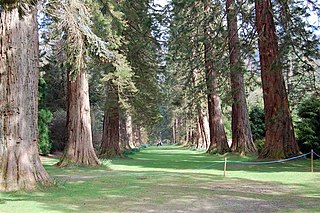
Benmore Botanic Garden is a large botanical garden situated in Strath Eachaig at the foot of Beinn Mhòr, on the Cowal peninsula, in Argyll and Bute, Scotland. The gardens are on the west side of the A815 road from Dunoon, between the Holy Loch and Loch Eck, and include footbridges across the River Eachaig. It is one of the sites of Royal Botanic Garden Edinburgh.
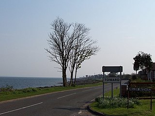
Toward is a village near Dunoon, Scotland, in the south of the Cowal peninsula.

Clachaig is a small settlement in Glen Lean, on the Cowal peninsula in Argyll and Bute, Scotland. It is located on the B836 road between the Holy Loch and Loch Striven, the hamlet is just over a mile long. Clachaig is a Gaelic word meaning 'stone place'.
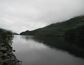
Loch Eck is a freshwater loch located on the Cowal peninsula, north of Dunoon, Argyll and Bute, Scotland. It is seven miles long. It is oriented in a north-south direction. Its main inflow, at the northern end, is the River Cur, and its main outflow, at the southern end, is the River Eachaig, which meanders somewhat within the confines of the broad strath before flowing into the head of Holy Loch, about 5 km further south.
The A815 is a major road located on the Cowal peninsula, in Argyll and Bute, Scotland. It runs for about 35.7 miles (57.5 km) from the A83, near Cairndow, in the north to Toward in the south. It passes beside three lochs, while its final stretch is along the Firth of Clyde.

St Catherines is a village, on the Cowal peninsula in Argyll and Bute, Scottish Highlands. It is located on the banks of Loch Fyne opposite Inveraray and is served by the A815 road.

Glen Lean, in Argyll and Bute, Scotland, is a glacial-formed glen, with near vertical sides along part of the landform. It runs from the head of the Holy Loch in the east to the head of Loch Striven in the west. The only hamlet in the glen is Clachaig. The Little Eachaig River flows out of the glen, joining the River Eachaig and flows into the Holy Loch. The Tarsan Dam is the other notable feature in the glen.
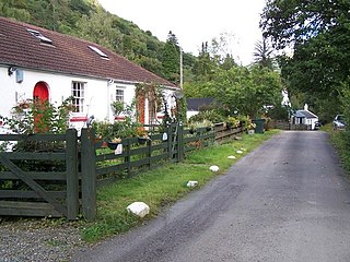
Glenbranter is a hamlet and former estate, once owned by Sir Harry Lauder, on the northwest shore of Loch Eck in the Argyll Forest Park, on the Cowal peninsula, Argyll and Bute in the West of Scotland.
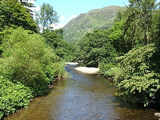
The River Eachaig is a river on the Cowal peninsula, Argyll and Bute, in western Scotland.

Puck's Glen is a river-formed ravine on the Cowal peninsula in Argyll and Bute, Scotland, with a popular scenic walking trail beside the Eas Mòr stream. In 2020 the glen and adjoining trails were closed temporarily due to COVID-19 restrictions, issues of stability of the gorge, and felling of trees infected by larch disease.

Strachur Bay is a coastal embayment, on a 114° orientation, on the eastern coast of the longest sea loch in Scotland, Loch Fyne located in Argyll and Bute, on the west coast of Scotland. Strachur Bay provides good anchorage, for small vessels, when the wind is from the northeast and southeast.
