| Little Hill River | |
|---|---|
 | |
| Location | |
| Country | United States |
| Physical characteristics | |
| Source | |
| • location | Minnesota |
The Little Hill River is a river of Minnesota.
| Little Hill River | |
|---|---|
 | |
| Location | |
| Country | United States |
| Physical characteristics | |
| Source | |
| • location | Minnesota |
The Little Hill River is a river of Minnesota.

Waseca County is a county in the U.S. state of Minnesota. As of the 2020 census, the population was 18,968. Its county seat is Waseca.

Aitkin County is a county in the U.S. state of Minnesota. As of the 2020 census, the population was 15,697. Its county seat is Aitkin. Part of the Mille Lacs Indian Reservation is in the county. The county was created in 1857 and organized in 1871.
The Willow River is a tributary of the Mississippi River, approximately 76 mi (122 km) long, in northern Minnesota in the United States.

Mille Lacs Kathio State Park, also known as Kathio Site, is a Minnesota state park on Mille Lacs Lake. The park preserves habitation sites and mound groups, believed to date between 3000 BC and 1750 AD, that document Dakota Indian culture and Ojibwe-Dakota relationships. The park contains 19 identified archaeological sites, making it one of the most significant archaeological collections in Minnesota. The earliest site dates to the Archaic period and shows evidence of copper tool manufacture. The Dakota lived in this area roughly until the 18th century, when many bands of them were moving southward into the prairies and river areas of southern Minnesota. At the same time, Ojibwe (Anishinaabe) were moving in from the east. Ojibwe oral tradition, published by William Whipple Warren, suggests that there was a battle in which they successfully took control of the area from the Lakota.

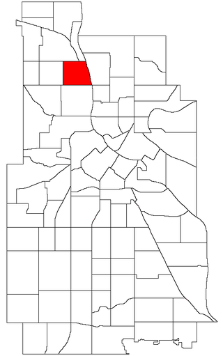
McKinley is a neighborhood in the Camden community of Minneapolis. It is bound to the north by Dowling Avenue North, to the south by Lowry Avenue North, to the west by Dupont Avenue North, and to the east by the Mississippi River. It is part of the larger and located in Ward 4, represented by council member LaTrisha Vetaw.
The Cross River is a river of Minnesota. It is a tributary of the Little Fork River.
The Hill River is a river of Minnesota. It is a tributary of the Willow River.
The Little Knife River (West) is a 7.4-mile-long (11.9 km) river in St. Louis County, Minnesota, United States. It is a tributary of the Knife River. A second Little Knife River flows into the Knife River from the east, in Lake County.
The Little Tamarack River is a tributary of the Tamarack River of Minnesota in the United States. After flowing into the Tamarack River, it flows into the Prairie River and then into the Big Sandy Lake.
The Little Willow River is a 26.2-mile-long (42.2 km) tributary of the Mississippi River in northern Minnesota, United States. It rises in western Aitkin County at the outlet of Esquagamah Lake and flows generally south to its junction with the Mississippi River 3 miles (5 km) northwest of Aitkin.
The Moose River is a river of Minnesota. It is a tributary of the Willow River.
The Prairie River (Big Sandy Lake) is a river of Minnesota. The river is located in northern Minnesota, in northeast Aitkin County and southwest Saint Louis County.
The Rice River is a 57.1-mile-long (91.9 km) tributary of the Mississippi River in northern Minnesota, United States. It rises in southeastern Aitkin County at the outlet of Porcupine Lake and flows generally north into Rice Lake National Wildlife Refuge, where it turns west and flows to the Mississippi 5 miles (8 km) northeast of Aitkin.
The Ripple River is a small river of north-central Minnesota. The stream headwaters are at the outlet of Bay Lake of eastern Crow Wing County and it flows east and north to its confluence with the Mississippi River on the north side of Aitkin in Aitkin County. The river follows a circuitous route, with a total stream length of 42.3 miles (68.1 km); while the direct distance between its source and mouth is approximately 10 miles (16 km).
The Sandy River is a river of Minnesota. It is a tributary of the Mississippi River.
The Tamarack River is a river in Aitkin and Carlton counties, in the U.S. state of Minnesota. The river flows into the Prairie River, which then flows into the Big Sandy Lake.

The West Savanna River is a river of Minnesota, United States.
Hay Creek is a stream in Kanabec County, in the U.S. state of Minnesota. It is a tributary of the Snake River.
Black Brook is a stream in Mille Lacs County, in the U.S. state of Minnesota. It is a tributary of the Rum River.
The Palisade Rail Bridge is a steel through truss bridge, originally built by the Minneapolis, St. Paul and Sault Ste. Marie Railway in 1910 to cross the Mississippi River at Palisade, Minnesota. The rail line was closed in 1985. Today, the bridge is part of the Soo Line North ATV Trail in northern Minnesota.