Little Kentucky River

Last updated

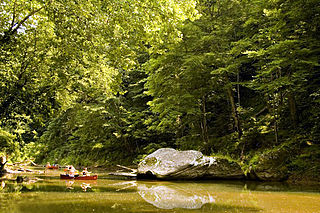
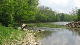
The Little Kentucky River is a tributary of the Ohio River, approximately 37 miles (60 km) long, [1] in northern Kentucky in the United States. [2]

Ohio River river in the midwestern United States

The Ohio River is a 981-mile (1,579 km) long river in the midwestern United States that flows southwesterly from western Pennsylvania south of Lake Erie to its mouth on the Mississippi River at the southern tip of Illinois. It is the second largest river by discharge volume in the United States and the largest tributary by volume of the north-south flowing Mississippi River that divides the eastern from western United States. The river flows through or along the border of six states, and its drainage basin includes parts of 15 states. Through its largest tributary, the Tennessee River, the basin includes several states of the southeastern U.S. It is the source of drinking water for three million people.

Kentucky State of the United States of America

Kentucky, officially the Commonwealth of Kentucky, is a state located in the east south-central region of the United States. Although styled as the "State of Kentucky" in the law creating it, (because in Kentucky's first constitution, the name state was used) Kentucky is one of four U.S. states constituted as a commonwealth. Originally a part of Virginia, in 1792 Kentucky became the 15th state to join the Union. Kentucky is the 37th most extensive and the 26th most populous of the 50 United States.

United States Federal republic in North America

The United States of America (USA), commonly known as the United States or America, is a country comprising 50 states, a federal district, five major self-governing territories, and various possessions. At 3.8 million square miles, the United States is the world's third or fourth largest country by total area and is slightly smaller than the entire continent of Europe's 3.9 million square miles. With a population of over 327 million people, the U.S. is the third most populous country. The capital is Washington, D.C., and the largest city by population is New York City. Forty-eight states and the capital's federal district are contiguous in North America between Canada and Mexico. The State of Alaska is in the northwest corner of North America, bordered by Canada to the east and across the Bering Strait from Russia to the west. The State of Hawaii is an archipelago in the mid-Pacific Ocean. The U.S. territories are scattered about the Pacific Ocean and the Caribbean Sea, stretching across nine official time zones. The extremely diverse geography, climate, and wildlife of the United States make it one of the world's 17 megadiverse countries.

Contents

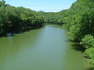
It rises in southwestern Henry County, approximately 30 miles (48 km) northeast of Louisville. It follows a winding course generally north across Trimble and Carroll counties. It joins the Ohio 2 miles (3 km) west of Carrollton, and approximately 1 mile (1.6 km) west of the mouth of the Kentucky River.

Henry County, Kentucky County in the United States

Henry County is a county located in the U.S. state of Kentucky bordering the Kentucky River. As of the 2010 census, the population was 15,416. Its county seat is New Castle, but its largest city is Eminence. The county was founded in 1798 from portions of Shelby County. It was named for the statesman and governor of Virginia Patrick Henry.

Louisville, Kentucky City in Kentucky

Louisville is the largest city in the Commonwealth of Kentucky and the 29th most-populous city in the United States. It is one of two cities in Kentucky designated as first-class, the other being Lexington, the state's second-largest city. Louisville is the historical seat and, since 2003, the nominal seat of Jefferson County, located in the northern region of the state, on the border with Indiana.

Trimble County, Kentucky County in the United States

Trimble County is a county located in the U.S. state of Kentucky. As of the 2010 census, the population was 8,809. Its county seat is Bedford. The county was founded in 1837 and is named for Robert Trimble. Trimble is no longer a prohibition or dry county.

See also

Related Research Articles

Stillwater River (Ohio) tributary of the Great Miami River in Ohio, United States

The Stillwater River is a 69.3-mile-long (111.5 km) tributary of the Great Miami River in western Ohio in the United States. Via the Great Miami and Ohio rivers, it is part of the Mississippi River watershed.

Kentucky River river in the United States of America

The Kentucky River is a tributary of the Ohio River, 260 miles (418 km) long, in the U.S. Commonwealth of Kentucky. The river and its tributaries drain much of the central region of the state, with its upper course passing through the coal-mining regions of the Cumberland Mountains, and its lower course passing through the Bluegrass region in the north central part of the state. Its watershed encompasses about 7,000 square miles (18,000 km2). It supplies drinking water to about one-sixth of the population of the Commonwealth of Kentucky.

Red River (Kentucky River) river in Kentucky, United States

The Red River is a 97.2-mile-long (156.4 km) tributary of the Kentucky River in east-central Kentucky in the United States. Via the Kentucky and Ohio rivers, it is part of the Mississippi River watershed.

Auglaize River river in the United States of America

The Auglaize River is a 113-mile-long (182 km) tributary of the Maumee River in northwestern Ohio in the United States. It drains a primarily rural farming area in the watershed of Lake Erie. The name of the river comes from the French word for glaise (clay). The French called it "rivière à la Grande Glaize".

Flatrock Creek is a 57.2-mile-long (92.1 km) tributary of the Auglaize River in northeastern Indiana and northwestern Ohio in the United States. It drains a primarily rural farming area in the watershed of Lake Erie.

Ottawa River (Lake Erie) river in Ohio and Michigan, United States

The Ottawa River, also known as Ottawa Creek, is a short river, approximately 20 miles (32 km) long, in northwest Ohio and southeast Michigan in the United States. It drains an area on the Ohio-Michigan border along the eastern and northern fringes of the city of Toledo, goes through Ottawa Hills, and empties directly into Lake Erie. It is one of two rivers in northwestern Ohio that share the same name, along with the Ottawa River that is a tributary of the Auglaize River. The upper 4 miles (6 km) of the river in Michigan north of Sylvania, Ohio is called North Tenmile Creek on federal maps, while another branch rising in Fulton County, Ohio, is called Tenmile Creek.

Tradewater River river in the United States of America

The Tradewater River is a tributary of the Ohio River, approximately 136 miles (219 km) long, in western Kentucky in the United States. It drains an area of 932 square miles (2,410 km2) in the limestone hills south of Evansville, Indiana, between the basins of the Cumberland River on the west and the Green River on the east.

Elkhorn Creek (Kentucky) river in the United States of America

Elkhorn Creek is an 18.3-mile-long (29.5 km) stream running through several counties in central Kentucky in the United States. The stream drains an area of 499.5 square miles (1,294 km2). It derives its name from the shape, as seen on a map, of its main stem with its two primary forks.

Little Sandy River (Kentucky) river in the United States of America

The Little Sandy River is a tributary of the Ohio River in northeastern Kentucky in the United States. It is 85.4 miles (137.4 km) long drains an area of 724.2 square miles (1,876 km2). Via the Ohio, it is part of the Mississippi River watershed.

Little Beaver Creek stream in Ohio

The Little Beaver Creek is a wild and scenic area in Ohio. The Little Beaver Creek watershed is located primarily in Columbiana County in eastern Ohio, and in portions of Carroll County, Mahoning County, and western Pennsylvania, draining approximately 605 mi² (1,567 km²), of which 503 mi² (1,303 km²) are in Ohio. The watershed in total size covers an area of approximately 510 square miles, with about 80% of this being situated in Ohio. The great majority land in the watershed is privately owned. Within the watershed are roughly 808 miles of linear streams.

Big Blue River (Indiana) in east-central Indiana, USA

The Big Blue River is an 83.8-mile-long (134.9 km) tributary of the Driftwood River in east-central Indiana in the United States. Via the Driftwood, White, Wabash and Ohio rivers, it is part of the watershed of the Mississippi River.

Little River (Indiana) stream in Allen and Huntington counties, Indiana, United States of America

The Little River is a 22.6-mile-long (36.4 km) stream in Allen and Huntington counties in northeastern Indiana. A tributary of the Wabash River, it is sometimes called the "Little Wabash", which may cause it to be confused with the Little Wabash River of Illinois. The river drains an area of 287.9 square miles (746 km2).

The Pond River is a 90.8-mile-long (146.1 km) tributary of the Green River in western Kentucky in the United States. Via the Green and Ohio rivers, it is part of the watershed of the Mississippi River.

Tygarts Creek is a tributary of the Ohio River in northeastern Kentucky in the United States. It is 88 miles (142 km) long and drains an area of 339.6 square miles (880 km2). Via the Ohio, it is part of the watershed of the Mississippi River. Tygarts Creek is named for early Kentucky explorer Michael Tygart, who eventually drowned in the creek, somewhere near the mouth.

Ohio Brush Creek river in the United States of America

Ohio Brush Creek is a 59.9-mile-long (96.4 km) tributary of the Ohio River in southern Ohio in the United States. Via the Ohio River, it is part of the watershed of the Mississippi River, draining an area of 435 square miles (1,130 km2). According to the Geographic Names Information System, it has also been known historically as "Brush Creek," "Elk Creek," and "Little Scioto River"

Fourteen Mile Creek river in the United States of America

Fourteen Mile Creek, shown as Fourteenmile Creek on federal maps, is a 22.7-mile-long (36.5 km) creek in Clark County, Indiana, close to Charlestown. It is so named because its mouth on the Ohio River is 14 miles (23 km) upstream from the Falls of the Ohio; similar to how Eighteen Mile Island, Twelve Mile Island, and Six Mile Island got their names. It is navigable for 2.9 miles (4.7 km) from the Ohio River. It is a State Heritage Program Site and a popular canoe trail.

The Beech Fork, or Beech Fork River, is a 112-mile-long (180 km) river in central Kentucky in the United States. It is a tributary of the Rolling Fork of the Salt River, with its waters flowing eventually to the Ohio River and ultimately the Mississippi River.

Betsie River river in United States of America

The Betsie River is a 54.0-mile-long (86.9 km) stream in the northwest part of the U.S. state of Michigan. The name is derived from the French la rivière aux Bec-scies, meaning river of sawbill ducks (bec-scie). Other alternate names include Aug-sig-o-sebe, Aux Buscies, Betsey's River, Black Robe, Gay-she-say-ing, Riviere du Pere Marquette, Sawbill Ducks, and Shelldrake Ducks. The river is mostly within Benzie County, although the river rises in southwest Grand Traverse County and flows briefly through northern Manistee County, Michigan.

The New River is a 24.5-mile-long (39.4 km) tributary of the Chattahoochee River in Coweta and Heard counties in the U.S. state of Georgia. Rising 4 miles (6 km) south of the city of Newnan, the New River flows generally southwest, reaching the Chattahoochee at West Point Lake approximately 8 miles (13 km) west of Hogansville.

The Rolling Fork is a 108-mile-long (174 km) river in central Kentucky. The river flows through Marion and Hardin counties, as well as being the border between LaRue and Nelson counties. The Rolling Fork drains much of the land in these counties, and is a key part of life in this area of the Knob Region. The Rolling Fork is a part of the Salt River Basin, and the larger Ohio River Basin.

References

  1. U.S. Geological Survey. National Hydrography Dataset high-resolution flowline data. The National Map Archived 2012-04-05 at WebCite , accessed May 13, 2011
  2. U.S. Geological Survey Geographic Names Information System: Little Kentucky River

Coordinates: 38°41′10″N85°12′08″W / 38.6861733°N 85.2021762°W / 38.6861733; -85.2021762

Geographic coordinate system Coordinate system

A geographic coordinate system is a coordinate system that enables every location on Earth to be specified by a set of numbers, letters or symbols. The coordinates are often chosen such that one of the numbers represents a vertical position and two or three of the numbers represent a horizontal position; alternatively, a geographic position may be expressed in a combined three-dimensional Cartesian vector. A common choice of coordinates is latitude, longitude and elevation. To specify a location on a plane requires a map projection.