
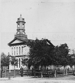
Newaygo County is a county in the U.S. state of Michigan. As of the 2010 United States Census, the population was 48,460. The county seat is White Cloud. The county was created in 1840, and was organized in 1851. It was either named for an Ojibwe leader who signed the Treaty of Saginaw in 1819 or for an Algonquian word meaning "much water".
Muskegon County is a county in the U.S. state of Michigan. As of 2018, the population was 173,588. The county seat is Muskegon.

Hinton Township is a civil township of Mecosta County in the U.S. state of Michigan. As of the 2000 census, the township population was 1,035. John Hinton was the first white settler here in 1855. The township was named for him when it was organized in 1860. A post office named Hinton operated from July 1862 until October 1863.

Muskegon is a city in the U.S. state of Michigan, and is the largest populated city on the eastern shores of Lake Michigan. At the 2010 census the city population was 38,401. The city is the county seat of Muskegon County. It is at the southwest corner of Muskegon Township, but is administratively autonomous.
Croton Township is a civil township of Newaygo County in the U.S. state of Michigan. The population was 3,042 at the 2000 census. Known as the "Party Capital" of Mid-Michigan, Croton lays on the banks of the majestic Muskegon River. Nestled between the Croton Dam and Hardy Dam, an artificial lake is created which plays hosts to world-class fishing, boating, and natural scenery. Often, referred to as "Michigan's Secret Paradise" Croton is lauded as a quiet get away, especially during the warm summer months.

Newaygo is a rural city in Newaygo County in the U.S. state of Michigan. The population was 1,976 at the 2010 census.
Chester Township is a civil township of Ottawa County in the U.S. state of Michigan. As of the 2000 United States Census, the township population was 2,315.
Marne is an unincorporated community in Wright Township of Ottawa County in the U.S. state of Michigan. Township offices are located in the community. Marne is 21.9 sq. miles large.
White Lake is the name of several lakes in the U.S. state of Michigan. The largest one is formed by the White River flowing to its mouth on Lake Michigan in Muskegon County.
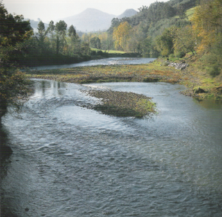
The Pas River is located in the region of Cantabria in the northern part of Spain. The river flows through the autonomous community of Cantabria and empties into the Cantabric Sea.

Area code 616 is the North American Numbering Plan (NANP) area code for the west-central portion of the Lower Peninsula of Michigan. The area code is centered around Grand Rapids, and also includes Holland, Greenville, and Grand Haven. It includes all of Kent and Ottawa counties, and parts of neighboring counties, including the western and central parts of Ionia County.

231 is a North American telephone area code in the U.S. state of Michigan, serving the northwestern portion of the Lower Peninsula. Areas served include Big Rapids, Cadillac, Charlevoix, Cheboygan, Kalkaska, Ludington, Manistee, Mackinaw City, Muskegon, Petoskey, Newaygo, and Traverse City.
WLAW is a radio station broadcasting an country music format. Licensed to Whitehall, Michigan, the station serves the Muskegon, Michigan market. The station's programming was derived from Cumulus Media Networks' Hits & Favorites format until Westwood One took over. It is heard as far as Grand Rapids, Michigan, east of US-131, and it experiences interference from WJIM-FM from Lansing. It is now affiliated with Westwood One's country program.

The Grand Rapids metropolitan area is a triangular shaped Metro Triplex, in West Michigan, which fans out westward from the primary hub city of Grand Rapids, Michigan to the other two metro hubs of Muskegon and Holland. The metropolitan area has an estimated population of 1,059,113 as of 2017. The region, noted in particular for its western edge abutting the Lake Michigan shoreline and its beaches, is a popular tourist and vacation destination during the summer. Noted popular metro area beach towns include Grand Haven, Holland, Muskegon, and Saugatuck.

The Hersey River is a 13.4-mile-long (21.6 km) stream in the Lower Peninsula of the U.S. state of Michigan. It rises in Lincoln Township in northwest Osceola County at the junction of Hersey Creek and the East Branch Hersey Creek at 43°50′55″N85°25′59″W. For approximately the first two miles, the river flows southward just east of U.S. Route 131. US 131 crosses the river near the northern boundary of Richmond Township. The river continues southward into Lake No Sho Mo, formed by a dam just south of Nartron Field airport. The river continues southward under U.S. Route 10 into Reed City and turns to the east, continuing southeastward into the village of Hersey, where it empties into the Muskegon River at Blodgett's Landing Campground.
The Middle Branch River is a 35.1-mile-long (56.5 km) tributary of the Muskegon River in Osceola County, Michigan, in the United States.
The Baldwin River is a 25.2-mile-long (40.6 km) stream in the U.S. state of Michigan.
The Croton Dam Mound Group, also known by the designations 20NE105, 20NE112, and 20NE116, is an archaeological site that was once a ceremonial site located on 2.3 acres near Croton, Michigan. It was listed on the National Register of Historic Places in 2009.


