Related Research Articles

Abersychan is a town and community north of Pontypool in Torfaen, Wales, and lies within the boundaries of the historic county of Monmouthshire and the preserved county of Gwent.

Cwmbran is a town in the county borough of Torfaen in South Wales.

Newport City Council is the governing body for Newport, one of the principal areas of Wales. It consists of 51 councillors, who represent the city's 20 wards.

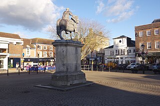
Torfaen is a county borough in the south-east of Wales. Torfaen is bordered by the county of Monmouthshire to the east, the city of Newport to the south, and the county boroughs of Caerphilly and Blaenau Gwent to the south-west and north-west. It is within the boundaries of the historic county of Monmouthshire, and between 1974 and 1996 was a district of Gwent, until it was reconstituted as a principal area in 1996.

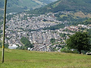
Blaenau Gwent is a county borough in the south-east of Wales. It borders the unitary authority areas of Monmouthshire and Torfaen to the east, Caerphilly to the west and Powys to the north. Its main towns are Abertillery, Brynmawr, Ebbw Vale and Tredegar. Its highest point is Coity Mountain at 1,896 feet (578 m).

North Kesteven is a local government district in Lincolnshire, England. The council is based in Sleaford. The district also contains the town of North Hykeham, which adjoins the neighbouring city of Lincoln, along with numerous villages and surrounding rural areas.
East Hampshire is a local government district in Hampshire, England. Its council is based in the town of Petersfield, although the largest town is Alton. The district also contains the town of Bordon along with many villages and surrounding rural areas.

Gedling is a local government district with borough status in Nottinghamshire, England. The council is based in Arnold. The borough also includes Carlton along with villages and rural areas to the north-east of Nottingham. The main built-up part of the borough around Arnold and Carlton forms part of the Nottingham Urban Area.

Macclesfield was, from 1974 to 2009, a local government district with borough status in Cheshire, England. It included the towns of Bollington, Knutsford, Macclesfield and Wilmslow and within its wider area the villages and hamlets of Adlington, Disley, Gawsworth, Kerridge, Pott Shrigley, Poynton, Prestbury, Rainow, Styal, Sutton and Tytherington.

Torfaen is a constituency in Wales represented in the House of Commons of the UK Parliament since 2015 by Nick Thomas-Symonds, a member of the Labour Party who also serves as the Paymaster General and Minister for the Cabinet Office under the government of Keir Starmer. It was established for the 1983 general election.

Monmouth District was one of five local government districts in the county of Gwent in Wales between 1974 and 1996. In 1988 the district was granted a charter conferring borough status, becoming the Borough of Monmouth.

Pontnewydd is a suburb of Cwmbran in the county borough of Torfaen, south-east Wales. It should not be confused with Pontnewynydd in nearby Pontypool.

Bettws is a large modern housing estate, electoral ward and coterminous community (parish) of the city of Newport, South Wales.
Monmouthshire County Council is the governing body for the Monmouthshire principal area – one of the unitary authorities of Wales.

Powys County Council is the local authority for Powys, one of the 22 principal areas of Wales. The council is based at County Hall in Llandrindod Wells.

Torfaen County Borough Council is the governing body for Torfaen, one of the Principal Areas of Wales.
Blaenau Gwent County Borough Council is the governing body for Blaenau Gwent, one of the Principal Areas of Wales.
Six Bells is an electoral ward and neighbourhood in Abertillery, Blaenau Gwent, Wales. It was originally a village that grew up around the local coal mines. The ward elects two county councillors to Blaenau Gwent County Borough Council.
Llanwenarth Ultra is an electoral ward near Abergavenny, Monmouthshire. The ward elects councillors to Llanfoist Fawr Community Council and Monmouthshire County Council.
Gwent County Council was the upper-tier local authority that governed the county of Gwent in South Wales from its creation in 1974 to its abolition in 1996. For most of its existence, the county council was based in Cwmbran.
References
- ↑ "GB0218.D1277 Llanfrechfa Lower Parish Council". Gwent Archives. Retrieved 15 September 2019.
- ↑ "The Torfaen (Communities) Order 1985" (PDF). legislation.gov.uk. The National Archives. 1 February 1985. Retrieved 15 September 2019.
- ↑ "Gwent County Council Election Results 1973-1993" (PDF). The Elections Centre (Plymouth University). Retrieved 15 September 2019.