Lobeda

Last updated
Lobeda
Wappen Lobeda.png

Lobeda is a former independent city in Thuringia, Germany, which is now a district of Jena known as Lobeda-Old Town. It was incorporated in 1946, has just under 2000 inhabitants on an area of 3.36 square kilometers and is located just under 4.5 kilometers south of the city center.

Contents

Between 1966 and 1986, the Jena prefabricated satellite town of Neulobeda was built southwest of Lobeda, with around 20,000 inhabitants. To better differentiate it from Neulobeda (also a district of Jena), the old Lobeda has been calling itself Lobeda-Old Town (district of Jena) since May 25, 1998. [1]

Geography and Traffic

Panorama to Lobeda from Johannisberg Lobeda Panorama.jpg
Panorama to Lobeda from Johannisberg

Geographical Location Lobeda is located in the middle of the Saale valley, between partly mixed forest-covered shell limestone and colorful sandstone slopes. The settlement area extends between 150 and 220 m above sea level above the Saale floodplain. The heights above Lobeda rise about 220 m above the valley floor, reaching 373 m on Johannisberg and 374 m on Spitzberg, forming the Saale-side edge of the Wöllmisse plateau.

The district of Lobeda

The district of the historic town of Lobeda has essentially been preserved and, in addition to the district of Lobeda-Altstadt, also covers large parts of Neulobeda. Apart from minor deviations, it is limited by the Saale, the Pennickenbach up to the Fürstenbrunnen, the Sommerlinde, the Lobdeburgklause (the Lobdeburg ruins belong to the Drackendorf area), the south-eastern border of the clinic, today's Mediamarkt and the Roda up to the mouth of the Saale. [2] The settlement areas of Wöllnitz and Rutha are left out. The neighboring districts of Jena are Göschwitz, Burgau, Wöllnitz and Drackendorfand the municipality of Sulza, district of Rutha in the Saale-Holzland district. The deserted village of Selzdorf also belongs to the district of Lobeda. [3]

Traffic

Lobeda-Altstadt is located on the BAB 4, 1700 m from exit no. 54 (Jena-Zentrum) and on the federal highway 88 . The nearest train station is Jena-Göschwitz (1300 m) with connections in the direction of Erfurt, Halle, Leipzig, Gera and Saalfeld. Lobeda old town is connected to the surrounding area by public transport with bus lines: Stadtroda-Tälerdörfer-Hermsdorf; Ilmnitz-Bobeck-Hermsdorf and Stadtroda-Neustadt/Orla and Schleiz. Local transport to Jena is via tram lines 4 and 5.

History

Political Affiliation of Lobeda

With the first documentary appearance of Lobeda in the 12th/13th century, Lobeda belonged to the territory of the noble family of the Lobdeburgers, who came from southern Germany and had their first seat in Thuringia at the Lobdeburg. As a result of the Vogtland War of 1354–1357, Lobeda came into the hands of the Wettins in 1358. With the Leipzig division of the Wettin total state in 1485, Lobeda came to the Ernestine Electorate of Saxony. In the division of the Ernestine state of 1572, Lobeda came to the newly formed Duchy of Saxony-Weimar (Ernestine line of the Wettins). In a state division of the Duchy of Saxony-Weimar, Lobeda moved between 1672 and 1690 to the briefly existing Duchy of Saxony-Jena and then came to Saxony-Eisenach. The Saxony-Eisenach line died out in 1741, so the territory with Lobeda fell back to Saxony-Weimar (Saxony-Weimar-Eisenach). After the Congress of Vienna in 1815, the Duchy of Saxony-Weimar-Eisenach became a Grand Duchy. Lobeda remained in the Grand Duchy until the dissolution of the territorial states in 1919. From 1920, Lobeda belonged to the newly formed state of Thuringia and was temporarily (1922 to 1924) incorporated into Jena. Until 1946, Lobeda belonged to the Stadtroda district, and then permanently to Jena as a suburb of Jena-Lobeda (since 1998 Lobeda-Old Town). [4]

Prehistory and Town Founding

Original Parish Evidence of early settlement comes from finds in the Steinchen field (eastern part of the former castle park) from 1928, which were assigned to the late Bronze Age (around 1000 BC).

In 1936, graves from the 3rd to 4th century were uncovered in the Arpersche gravel pit, and in 1965, graves of the corded ware culture (around 2500 BC) were cut into during the development of Neulobeda.

These finds show that Lobeda and its surroundings were at least temporarily settled early on.

Furthermore, Johannisberg is important for the settlement of Lobeda. There are the remains of two significant fortifications from the late Bronze Age and the early Middle Ages. The latter is interpreted both as Slavic and as a Frankish facility, which allegedly lost its importance in 937 with the creation of Kirchberg Castle near Jena. [5]

Possibly the settlement of the Lobedaer Kirchberg then began and the place and the original parish of Lobeda were established. [6]

Less in question is that the original parish of Lobeda already existed in the 10th century. This is indicated by the large territory of this original parish mentioned in a papal document in 1228, which included the subsidiaries Ammerbach, Schlöben, Jägersdorf and Gleina (Schöngleina, the vanished village Gleina near today's Vorwerk Cospoth near Oßmaritz) as well as a chapel Kirchberg and the many rent-paying places scattered over a wide area, such as Rothenstein, which are documented much earlier in some cases.

Another aspect was the establishment of a deanery Lobeda within the archdeaconate of the provostship of Naumburg, which existed alongside the other two deaneries Schkölen and Teuchern until the Reformation. However, the often-cited conclusion that the church of Lobeda was the second basilica of the Burgward Kirchberg and the associated city Lobeda (in a document of Otto II from 976: in Chirihberg basilicas duas cum villa) is not verifiable. [7]

The name Lobeda first appeared with the mention of "Adalbert of Lovethe" in 1156 in a document of Albrecht the Bear. He was a vassal of the Count of Weimar-Orlamünde, which clearly shows that the Lobeda field was not exclusively in one hand. Also significant is the mention of the priest "Hugo of Lobeda" from 1213 in numerous documents.

In 1284, Lobeda was first mentioned as a city: "... Otto and Hartmann, the lords of Lodeburg, ... that we have given a farm, located at the very end of the alley of the city of Lobeda, which leads towards Pennicke on the upper way, ... to the nunnery in Butitz as their own, ..." This phrasing suggests that Lobeda had become a city well before 1284. However, there is no evidence for a specific date. [8]

The origin of the name Lobeda is also unknown. Some historians try to derive it from "louba" (forest mountains, probably referring to the Wöllmisse), while others believe that the noble family of Auhausen, which called itself "von Lobdeburg" from 1166 onwards, derived the name from their former ancestral seat, the Ladenburg on the Neckar. However, this is unlikely, as the city would then also be called Lobdeburg and the suburban settlement before 1166 would have had a different name.

The noble family of Auhausen first appeared in the Lobeda region in 1133 in a document. [9]

From 1166 this family called themselves Lords of Lobdeburg. This period also saw the construction of the Lobdeburg as a castle and residence, which is documented for 1186. [10] The Lobdeburgers acted as colonizers in the Eastern Thuringian region and founded the cities of Jena and Lobeda as well as other places and the Roda Monastery. Lobeda was laid out as a planned city. The foundation of the city of Lobeda probably took place so that the Lobdeburgers could enhance their rule next to Jena with another city and settle craftsmen and servants at the foot of the Lobdeburg.

Related Research Articles

<span class="mw-page-title-main">Thuringia</span> State in Germany

Thuringia, officially the Free State of Thuringia, is a state of central Germany, covering 16,171 square kilometres (6,244 sq mi), the sixth smallest of the sixteen German states. It has a population of about 2.1 million.

<span class="mw-page-title-main">Weimar</span> Town in Thuringia, Germany

Weimar is a city in the state of Thuringia, Germany. It is located in Central Germany between Erfurt in the west and Jena in the east, approximately 80 km (50 mi) southwest of Leipzig, 170 km (106 mi) north of Nuremberg and 170 km (106 mi) west of Dresden. Together with the neighbouring cities of Erfurt and Jena, it forms the central metropolitan area of Thuringia, with approximately 500,000 inhabitants. The city itself has a population of 65,000. Weimar is well-known because of its large cultural heritage and its importance in German history.

<span class="mw-page-title-main">Jena</span> City in Thuringia, Germany

Jena is a city in Germany and the second largest city in Thuringia. Together with the nearby cities of Erfurt and Weimar, it forms the central metropolitan area of Thuringia with approximately 500,000 inhabitants, while the city itself has a population of about 110,000. Jena is a centre of education and research; the university was founded in 1558 and had 18,000 students in 2017 and the Ernst-Abbe-Fachhochschule Jena counts another 5,000 students. Furthermore, there are many institutes of the leading German research societies.

<span class="mw-page-title-main">Saale</span> River in Germany

The Saale, also known as the Saxon Saale and Thuringian Saale, is a river in Germany and a left-bank tributary of the Elbe. It is not to be confused with the smaller Franconian Saale, a right-bank tributary of the Main, or the Saale in Lower Saxony, a tributary of the Leine.

Saale-Holzland is a Kreis (district) in the east of Thuringia, Germany. Neighboring districts are the district Burgenlandkreis in Saxony-Anhalt, the district-free city Gera, the districts Greiz, Saale-Orla, Saalfeld-Rudolstadt, Weimarer Land and the district-free city Jena.

Weimarer Land is a Landkreis (district) in the east of Thuringia, Germany. Neighboring districts are the district Burgenlandkreis in Saxony-Anhalt, the district Saale-Holzland and the district-free city Jena, the district Saalfeld-Rudolstadt, Ilm-Kreis, and the district-free city Erfurt. The district-free city Weimar is completely enclosed by the district.

<span class="mw-page-title-main">House of Wettin</span> German noble and royal family

The House of Wettin was a dynasty of German kings, prince-electors, dukes, and counts that once ruled territories in the present-day German states of Saxony, Saxony-Anhalt and Thuringia. The dynasty is one of the oldest in Europe, and its origins can be traced back to the town of Wettin, Saxony-Anhalt. The Wettins gradually rose to power within the Holy Roman Empire. Members of the family became the rulers of several medieval states, starting with the Saxon Eastern March in 1030. Other states they gained were Meissen in 1089, Thuringia in 1263, and Saxony in 1423. These areas cover large parts of Central Germany as a cultural area of Germany.

<span class="mw-page-title-main">Saxe-Altenburg</span> German duchy

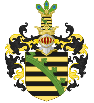
Saxe-Altenburg was one of the Saxon duchies held by the Ernestine branch of the House of Wettin in present-day Thuringia. It was one of the smallest of the German states with an area of 1323 square kilometers and a population of 207,000 (1905) of whom about one fifth resided in the capital, Altenburg. The territory of the duchy consisted of two non-contiguous territories separated by land belonging to the Principality of Reuss-Gera. Its economy was based on agriculture, forestry, and small industry. The state had a constitutional monarchical form of government with a parliament composed of thirty members chosen by male taxpayers over 25 years of age.

<span class="mw-page-title-main">Saxe-Weimar-Eisenach</span> Historical German state from 1809 to 1920

Saxe-Weimar-Eisenach was a German state, created as a duchy in 1809 by the merger of the Ernestine duchies of Saxe-Weimar and Saxe-Eisenach, which had been in personal union since 1741. It was raised to a grand duchy in 1815 by resolution of the Congress of Vienna. In 1903, it officially changed its name to the Grand Duchy of Saxony, but this name was rarely used. The grand duchy came to an end in the German Revolution of 1918–19 with the other monarchies of the German Empire. It was succeeded by the Free State of Saxe-Weimar-Eisenach, which was merged into the new Free State of Thuringia two years later.

<span class="mw-page-title-main">Saxe-Coburg</span> Former duchy in Bavaria, German

Saxe-Coburg was a duchy held by the Ernestine branch of the Wettin dynasty in today's Bavaria, Germany.

<span class="mw-page-title-main">Saxe-Weimar</span> Former duchy in Thuringia, Germany

Saxe-Weimar was one of the Saxon duchies held by the Ernestine branch of the Wettin dynasty in present-day Thuringia. The chief town and capital was Weimar. The Weimar branch was the most genealogically senior extant branch of the House of Wettin.

<span class="mw-page-title-main">Ernestine duchies</span> Set of related states in Germany

The Ernestine duchies, also known as the Saxon duchies, were a group of small states whose number varied, which were largely located in the present-day German state of Thuringia and governed by dukes of the Ernestine line of the House of Wettin.

<span class="mw-page-title-main">Münchenbernsdorf</span> Town in Thuringia, Germany

Münchenbernsdorf is a town in the district of Greiz, in Thuringia, Germany. It is situated approximately 16 km southwest of Gera. The town is seat of a municipal association with eight members.

<span class="mw-page-title-main">Electorate of Saxony</span> State of the Holy Roman Empire (1356–1806)

The Electorate of Saxony, also known as Electoral Saxony, was a territory of the Holy Roman Empire from 1356–1806. It was centered around the cities of Dresden, Leipzig and Chemnitz.

<span class="mw-page-title-main">John Frederick II, Duke of Saxony</span> Duke of Saxony

John Frederick II of Saxony, was Duke of Saxony (1554–1566).

<span class="mw-page-title-main">Weimar–Gera railway</span> Railway line in Germany

The Weimar–Gera railway is a line in the German state of Thuringia, connecting the city of Weimar via Jena, Stadtroda and Hermsdorf to Gera. It was built by the Weimar-Gera Railway Company, which was founded in June 1872, and the line was officially accepted into operation in June 1876.

<span class="mw-page-title-main">Wöllmisse</span>

The Wöllmisse is a high plateau which rises east of the Saale Valley in the State of Thuringia, Germany. The densely wooded Wöllmisse borders the Roda Valley in the South, the Saale Valley to the West, the Gembdenbachtal in the North, and the town of Bürgel and the Gleistal Valley in the East. In Bürgel, it is connected via a saddle with the formation of Jenzig-Hufeisen-Alte Gleisberg.

<span class="mw-page-title-main">Nikolaus Gromann</span>

Nikolaus Gromann was an architect of the German Renaissance who served at the court of John Frederick I, Elector of Saxony. He also worked for John Frederick's descendants residing in the cities of Weimar, Gotha and Altenburg, thus spending more than 30 years in the service of the House of Wettin.

<span class="mw-page-title-main">Fredericka Elisabeth of Saxe-Eisenach</span> Duchess consort of Saxe-Weisselfels

Fredericka Elisabeth of Saxe-Eisenach, was a German noblewoman member of the House of Wettin and by marriage Duchess of Saxe-Weissenfels.

<span class="mw-page-title-main">Johannisberg (Jena-Lobeda)</span> Johannisberg is a prominent ridge of the Wöllmisse

Johannisberg is a prominent ridge of the Wöllmisse, a Muschelkalk plateau east of Jena. The steeply sloping spur of land to the Saale Valley north of the district of Alt-Lobeda bears the remains of two important fortifications from the late Bronze Age and the early Middle Ages. Due to several archaeological excavations and finds recovered since the 1870s, they are among the few investigated fortifications from these periods in Thuringia. Of particular interest in archaeological and historical research is the early medieval castle. Due to its location directly on the eastern bank of the Saale, its dating and interpretation were and are strongly linked to considerations of the political-military eastern border of the Frankish empire. It is disputed whether it was a fortification of independent Slavic rulers or whether it was built under Frankish rule. According to a recent study, it may have been built in the second half of the 9th century in connection with the establishment of the limes sorabicus under Frankish influence.

References

  1. Amtsblatt der Stadt Jena, Nr. 21/1998, S. 225.
  2. Hauptsatzung der Stadt Jena 2003.
  3. Uwe Lorenz: Untersuchungen zur Besiedlung der Wüstung Selzdorf bei Jena-Lobeda. In: Ausgrabungen und Funde. Band 19 (1974), S. 280–285.
  4. (1) Herbert Koch: Geschichte der Stadt Lobeda. (in zwei Teilen bis 1649), Jena 1939 und 1941; (2) Reinhard Jonscher: Von Ammerbach bis Zwätzen – Geschichte der Jenaer Vororte. Jena 2012, S. 213–248.
  5. Roman Grabolle: Die frühmittelalterliche Burg auf dem Johannisberg bei Jena-Lobeda. In: Zeitschrift für Burgenforschung und Denkmalpflege. Band 48, 2007, S. 135–143.
  6. Reinhard Spehr: Zur spätfränkischen Burg „Kirchberg“ auf dem Johannisberg über Lobeda In: Burgen und Schlösser in Thüringen. Glaux-Verlag, Jena 1997, S. 21–38.
  7. Ottogerd Mühlmann: Die tausendjährige Tradition der Kirche in Lobeda. In: Herbert von Hintzenstern (Hrsg.): Aus zwölf Jahrhunderten – Einundzwanzig Beiträge zur Thüringern Kirchengeschichte. Berlin 1971, S. 45 ff.
  8. Christian Schöttgen, Georg Christoph Kreysig: Diplomataria et Scriptores Historiae Germanicae Medii Aevi : Cum Sigillis Aeri Incisis. Altenburg 1754, S. 380/381.
  9. Otto Dobenecker: Regesta diplomatica necnon epistolaria historiae Thuringiae. 4 Bde., Jena 1896–1939, Band I, S. 1271.
  10. Otto Dobenecker: Regesta diplomatica necnon epistolaria historiae Thuringiae. 4 Bde., Jena 1896–1939, Band II, S. 762.

50°53′35″N11°36′32″E / 50.89306°N 11.60889°E / 50.89306; 11.60889