Halkirk is a village on the River Thurso in Caithness, in the Highland council area of Scotland. From Halkirk the B874 road runs towards Thurso in the north and towards Georgemas in the east. The village is within the parish of Halkirk, and is said by locals to be Scotland's first planned village.

Caithness is a historic county, registration county and lieutenancy area of Scotland.

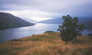
Loch Katrine is a freshwater loch in the Trossachs area of the Scottish Highlands, east of Loch Lomond, within the historic county and registration county of Perthshire and the contemporary district of Stirling. The loch is about 8 miles (13 km) long and 1 mile (1.6 km) wide at its widest point, and runs the length of Strath Gartney. It is within the drainage basins of the River Teith and River Forth.

Loch Rannoch is a freshwater loch in Perth and Kinross, Scotland. It is over 15 kilometres (9.3 mi) long in a west–east direction with an average width of about 1.2 kilometres (0.75 mi), and is deepest at its eastern end, reaching a depth of 130 metres (440 ft). The River Tummel begins at its eastern end, where the small village of Kinloch Rannoch can be found, whilst the wild expanse of Rannoch Moor extends to the west of the loch. The area surrounding Loch Rannoch, along with Rannoch Moor itself, was formerly part of the native Caledonian Forest that stretched across much of Northern Scotland. Native forest is now largely absent from much of the area, due partly to logging, and partly to the climate becoming wetter, and Loch Rannoch is now largely surrounded by commercial forestry and open hillsides, although a small area remains at the Black Wood of Rannoch on the southern shore of the loch.
Loch Burn is a stream that flows out of the eastern end of Loch Watten in Caithness, in the Highland area of Scotland, at a height of around 17 metres (55 ft) and about one kilometre north/northeast of the village of Watten. Less than a kilometre east of its source at Loch Watten the burn flows into Wick River.

The River Thurso has Loch Rumsdale in Caithness as its source, about 26 kilometres (16 mi) south and 14 kilometres (8.7 mi) west of the burgh of Thurso, Caithness, and about 2 kilometres (1.2 mi) south of the railway line linking the burghs of Thurso and Wick with Inverness. At its source and until it reaches Loch More the river is known also as Strathmore Water. Caithness is in the Highland area of Scotland.

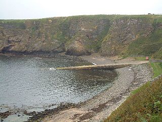
Forss Water, known also as Forss River, has its source at the northern end of Loch Shurrey, at grid reference ND042568. About 13 kilometres north of its source the river flows into Crosskirk Bay and the Atlantic Ocean at ND029700. Crosskirk Bay is on the north coast of Great Britain and about 8 kilometres west of the burgh of Thurso, Caithness, in Highland, Scotland. The river marked the eastern extent of the Clan Mackay raid in the Sandside Chase of 1437.

The Loch of Stenness is a large brackish loch on Mainland, Orkney, Scotland and is named for the parish of Stenness. It is 2 miles northeast of the town of Stromness, lies immediately to the south of the Loch of Harray and is close to the World Heritage neolithic sites of the Stones of Stenness and Ring of Brodgar. In Old Norse its name was Steinnesvatn.

Brough /brɒx/ is a small village in Caithness on the far north coast of mainland Scotland. It is the most northerly village of mainland Great Britain. It is 10 miles east of Thurso, 20 miles north-west of Wick, 200 miles north of Edinburgh, and 500 miles north of London. It is on the southern shore of the Pentland Firth, the sea channel between Caithness and the Orkney Islands, notorious for strong tidal currents and exceptionally violent sea conditions. Brough is located on the B855 single-track road, 2.5 miles south east of Dunnet Head Lighthouse, the most northerly lighthouse and point on mainland Britain. The neighbouring village of Dunnet and the wide sandy beaches of Dunnet Bay lie 1.6 miles to the south. Brough is within the civil parish of Dunnet. John o' Groats, the north-easterly point of the mainland, lies 10 miles to the east.

Loch Langavat is the name of several freshwater lochs in the Outer Hebrides of Scotland. The name is a Gaelic rendition of Old Norse lang "long" and vatn, meaning "lake".

Loch Calder is a lowland freshwater loch lying approximately 5 mi (8.0 km) south west of Thurso in the Scottish Highlands. The loch is large with an irregular shape and has perimeter of 12.8 km (8.0 mi). It is approximately 2.33 mi (3.75 km) long, has an average depth of 21 ft (6.4 m) and is 85 ft (26 m) at its deepest. The loch was surveyed on 6 October 1902 by John Parsons and T.R.H. Garrett and later charted as part of Sir John Murray's Bathymetrical Survey of Fresh-Water Lochs of Scotland 1897-1909.

Yarrow is a place and parish in the Scottish Borders area of Scotland and in the former county of Selkirkshire.The name "Yarrow" may derive from the Celtic word garw meaning "rough" or possibly share a derivation with the English name "Jarrow".

Loch Shurrery is a small, shallow, lowland freshwater loch lying approximately 8 mi (13 km) south west of Thurso in the Scottish Highlands. The loch has a somewhat elliptical shape with a perimeter of 7.4 km (4.6 mi). It is approximately 1.25 mi (2.01 km) long, has an average depth of 4.5 ft (1.4 m) and is 7 ft (2.1 m) at its deepest. The loch was surveyed on 6 October 1902 by John Parsons and T.R.H. Garrett and later charted as part of Sir John Murray's Bathymetrical Survey of Fresh-Water Lochs of Scotland 1897-1909. A dam lies to the north end of the loch.

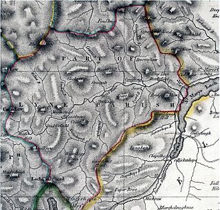
Megget is a former chapelry or parish containing the valley of Megget Water, now forming the westernmost part of the parish of Yarrow, Selkirkshire in the Scottish Borders area of Scotland. The centre of the valley is 19 miles west of Selkirk.

The single name Lochan na h-Earba is applied to two lochs to the south of Loch Laggan in Highland, Scotland, close to the historic boundary between Lochaber and Badenoch. It is thought that the two lochs once formed a single loch, but became separated by the build up alluvial deposits from the Moy Burn, which now joins the short watercourse that connects the two lochs. Ordnance Survey maps of the area show a single name printed across both lochs. They occupy a narrow glen running southwest to northeast, and roughly parallel with Loch Laggan, from which they are separated by the Binnein Shuas range of hills. The Munros of Geal Charn and Creag Pitridh are the highest peaks of the hills to the southeast.

Eela Water is a freshwater loch (lake) in Northmavine, part of the mainland of Shetland in Scotland. Besides being a freshwater fishing location, the site supplies clean water for the mainland of Shetland, and is one of the largest lochs on the mainland. The loch is 3.2 kilometres (2 mi) west of Ollaberry, and only 1.62 miles (2.61 km) to the sea (westwards).

Loch More is a 4 miles (6.4 km) long freshwater loch in Sutherland, Scotland, about 10 miles east of Scourie. It is part of a series of inter-connecting lochs and rivers that empty into Loch Laxford, which is a sea loch, the "ford" in the name meaning a firth not a ford This drainage area, named the Laxford basin, lies in the southern part of the civil parish of Eddrachillis.

Loch Heilen is a loch in the civil parish of Dunnet in Caithness, Scotland. St. John's Loch and Loch Heilen are the two largest lochs in the parish. It is about two miles inland from Dunnet Bay to the west, which is on the north coast of Scotland. The town of Thurso is about eight miles to the west.

St. John's Loch is a loch in the civil parish of Dunnet, in Caithness, Highland, Scotland. Loch Heilen and St. John's Loch are the two largest lochs in the parish. It is about two-thirds mile inland in a north-easterly direction from Dunnet Bay on the north coast of Scotland.

Kilninian and Kilmore is a civil parish on the Isle of Mull in the county of Argyll, Scotland, part of the Argyll and Bute council area. It is one of three parishes on the island and extends over the north-western part. It is bordered by the parish of Torosay in the south-east. It extends about 15 miles north-west to south-east and is 13 miles wide.


