
Loch Maree is a loch in Wester Ross in the Northwest Highlands of Scotland. At 21.7 km (13.46 mi) long and with a maximum width of four kilometres, it is the fourth-largest freshwater loch in Scotland; it is the largest north of Loch Ness. Its surface area is 28.7 km2 (11.08 sq mi).

Loch Shiel is a freshwater loch situated 20 kilometres (12 mi) west of Fort William in the Highland council area of Scotland. At 28 kilometres long it is the 4th longest loch in Scotland, and is the longest to have retained a natural outflow without any regulation of its water level, being 120 m (393 ft) deep. Its nature changes considerably along its length, being deep and enclosed by mountains in the north east and shallow surrounded by bog and rough pasture in the south west, from which end the 4 km River Shiel drains to the sea in Loch Moidart near Castle Tioram.

The Isle of Ewe is a small Scottish island on the west coast of Ross and Cromarty. The island is inhabited by a single extended family, the Grants, who have lived at the current settlement on the leeward NE side of the island since the 19th century.
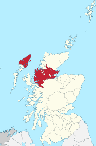
Ross-shire, or the County of Ross, was a county in the Scottish Highlands. It bordered Sutherland to the north and Inverness-shire to the south, as well as having a complex border with Cromartyshire, a county consisting of numerous enclaves or exclaves scattered throughout Ross-shire's territory. The mainland had a coast to the east onto the Moray Firth and a coast to the west onto the Minch. Ross-shire was named after and covered most of the ancient province of Ross, and also included the Isle of Lewis in the Outer Hebrides. The county town was Dingwall.

Aultbea is a small coastal fishing village in the North-West Highlands of Scotland. It is situated on the southeast shore of Loch Ewe, about 30 kilometres (19 mi) west of Ullapool. The village has a primary school and a small post office.

Sròn a’ Choire Ghairbh is a Scottish mountain situated on the northern side of Loch Lochy, 13 kilometres north of Spean Bridge in the Highland Council area.

Meall na Teanga is a Scottish mountain located in the Highland council area, 11 km (7 mi) north of Spean Bridge.

Loch Ewe is a sea loch in the region of Wester Ross in the Northwest Highlands of Scotland. The shores are inhabited by a traditionally Gàidhlig-speaking people living in or sustained by crofting villages, the most notable of which, situated on the north-eastern shore, is the Aultbea settlement.

Càrn Mairg is a mountain in the Breadalbane region of the Scottish Highlands, with a height of 1,042 metres (3,419 ft). It stands in a group of four Munro mountains known as the 'Càrn Mairg group', on the north side of Glen Lyon, Perthshire.

Chno Dearg is a mountain in the Lochaber area of the Scottish Highlands. It overlooks Glen Spean to the north and Loch Treig to the west. With a height of 1,046 metres (3,432 ft), it is classed as a Munro.

A' Bhuidheanach Bheag is a Scottish mountain situated on the eastern side of the Pass of Drumochter, some 24 km WNW of Blair Atholl. The mountain straddles the border between Highland and Perth and Kinross council areas although the actual summit is in the latter.

Loch a' Bhraoin, Loch Broom, is a freshwater loch, located in Wester Ross, in Ross-shire, on the west coast of Scotland.
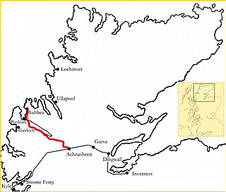
The Loch Maree and Aultbea Railway was one of several branch railway-lines proposed for the North-West Highlands of Scotland in the early 1890s. Although a full survey was conducted in 1892 and a Private Bill was submitted to the Westminster Parliament on 18 November 1892, the necessary Act to permit construction did not receive approval and the plan was dropped.

Loch Lurgainn is a large remote and deep freshwater loch with a crescent shape with its concave side turned to the south. It is located in the Coigach peninsula in Lochbroom, Wester Ross. Loch Lurgainn is located 8 miles north of Ullapool and two miles south of Loch Sionascaig and is 3.5 miles southeast of Enard Bay. The scenic qualities of Coigach, along with neighbouring Assynt, have led to the area being designated as the Assynt-Coigach National Scenic Area, one of 40 such areas in Scotland. The main settlement in the area, located directly to the north-west is Achiltibuie.
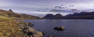
Loch Bad a' Ghaill is a small remote and deep freshwater loch that is located 10 miles north of Ullapool and immediately north west of Loch Lurgainn. It is located in the Coigach peninsula in Lochbroom, Wester Ross. The scenic qualities of Coigach, along with neighbouring Assynt, have led to the area being designated as the Assynt-Coigach National Scenic Area, one of 40 such areas in Scotland. The main settlement in the area, located directly to the north-west is Achiltibuie.

Loch Clair is a small remote shallow low-altitude freshwater loch, located within the Coulin Forest, some three miles to the south-west of Kinlochewe in Wester Ross. Loch Clair is the lower of two lochs in the same valley and is aligned on a southeast-northwest bearing. The other loch is Loch Coulin which is fed by the River Coulin, the waters of which in turn flow out of Loch Coulin through a short unnamed river into Loch Clair. A small lochan, Loch Bharranch, is located a mile to the west and drains into the western end of Loch Clair through an unnamed burn.

Loch Coulin is a small remote shallow low-altitude freshwater lochan, located within the Coulin Forest, some four miles to the south-west of Kinlochewe in Wester Ross. It is fed by the river Coulin from the south and its outflow is into Loch Clair in the north-west. Loch Coulin is within Beinn Eighe National Nature Reserve.

Loch Kernsary also known as Loch na h-Airde Bige is a small remote shallow low-altitude freshwater loch, located directly southeast of Poolewe in Kinlochewe, Wester Ross. It is fed by the river Coulin from the south and its outflow is into Loch Clair in the north-west. The Kernsary River drains into the loch from the south and in turn is drained through a tiny lochan Loch Poll Uidge à Chrò. The Lochan drains into the Inveran River, that drains a short distance into Loch Maree directly to the south-east.


