Maasbracht is a town in the southeastern Netherlands. It was a separate municipality until January 1, 2007, when it became a part of the new municipality of Maasgouw. Football player Mark van Bommel was born in Maasbracht.

Pannerden is a village in the Dutch province of Gelderland. It is located in the municipality of Rijnwaarden.

Nigtevecht is a town in the province of Utrecht, Netherlands with a population of 1,395. Formerly part of the municipality of Loenen; it has been part of the newly-formed municipality of Stichtse Vecht since 2011. It is situated about 9 km (5.6 mi) west of Bussum along the Vecht River in the Vechtstreek.
Borgharen is a town in the Dutch province of Limburg. It is a part of the municipality of Maastricht, and lies about 3 km north of Maastricht. Until 1970, it was a separate municipality.
Loenen is a town in the Dutch province of Utrecht. It was the main town in the former municipality of Loenen. Since 2011 it has made part of the new formed municipality of Stichtse Vecht. It lies about 10 km west of Hilversum.

Eesergroen is a town in the Dutch province of Drenthe. It is a part of the municipality of Borger-Odoorn, and lies about 16 km northwest of Emmen.
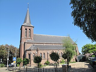
Terhorst is a little hamlet of 33 houses and part of the village of Banholt, which is in the municipality of Eijsden-Margraten in the province of Limburg, Netherlands. In the middle of the village, Terhorst has its own little chapel built in 1949 and every year in August there is the traditional annual Chapel party (kapelfeest). There are several old farmhouses originally built in the 18th century and is a popular area for walking. From Terhorst one can reach Banholt, Noorbeek, Mheer, Reijmerstok, Terlinden and Hoogcruts.

Kaľamenová is a village and municipality in Turčianske Teplice District in the Žilina Region of northern central Slovakia.
Loenen-Kronenburg was a Dutch municipality from 1817 to '19. Its former territory is now part of Loenen in the province of Utrecht.

Herveld is a village in the Dutch province of Gelderland. It is located in the municipality of Overbetuwe.

Herwen is a village in the Dutch province of Gelderland. It is located in the municipality of Rijnwaarden.

Loenen is a village in the Dutch province of Gelderland. It is located in the municipality of Apeldoorn, about 10 km southeast of that city.

Jesus María is a town and municipality in the Santander Department in northeastern.

Giessen is a village in the Dutch province of North Brabant. It is located in the municipality of Woudrichem, about 7 km southeast of Gorinchem.

Dubbeldam is a former village in the Dutch province of South Holland. It was located to the east of the city of Dordrecht. It is now a part of that city.
Hofwegen is a hamlet in Molenwaard, which is a municipality in the Dutch province of South Holland. It is located on the south bank of the small river Graafstroom. It is now considered to be part of the village of Bleskensgraaf, which lies on the opposite bank.
Langebakkersoord is a former municipality in the Dutch province of South Holland. It was located northwest of Hoogvliet, on the confluence of the Oude Maas and Nieuwe Maas rivers.
Zuidwijk is a former municipality in the Dutch province of South Holland. It was located southeast of the center of Boskoop.
Pozuelo de Tábara is a municipality located in the province of Zamora, Castile and León, Spain. According to the 2004 census (INE), the municipality has a population of 213 inhabitants. Although it may have changed by now.

Slijk-Ewijk is a village in the municipality of Overbetuwe in the province of Gelderland, the Netherlands. Slijk-Ewijk has 460 inhabitants (2014).