| Lofa | |
|---|---|
 | |
 | |
| Location | |
| Countries | Guinea and Liberia |
| Physical characteristics | |
| Source | |
| • location | Macenta Prefecture in Guinea |
| • elevation | 940 m (3,080 ft) |
| Mouth | |
• location | Atlantic Ocean south of Robertsport at |
• coordinates | 6°34′26″N11°3′38″W / 6.57389°N 11.06056°W |
• elevation | 0 m (0 ft) |
| Length | 410 km (250 mi) |
| Basin size | 10,446 km2 (4,033 sq mi) [1] |
| Discharge | |
| • location | Near mouth |
| • average | (Period: 1979–2015) 18.63 km3/a (590 m3/s) [1] |
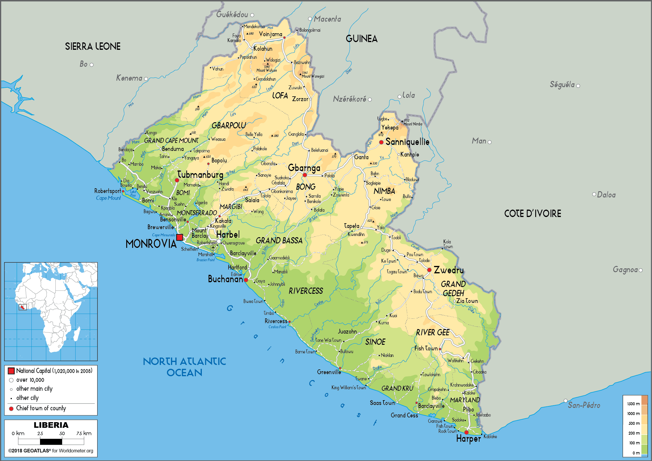
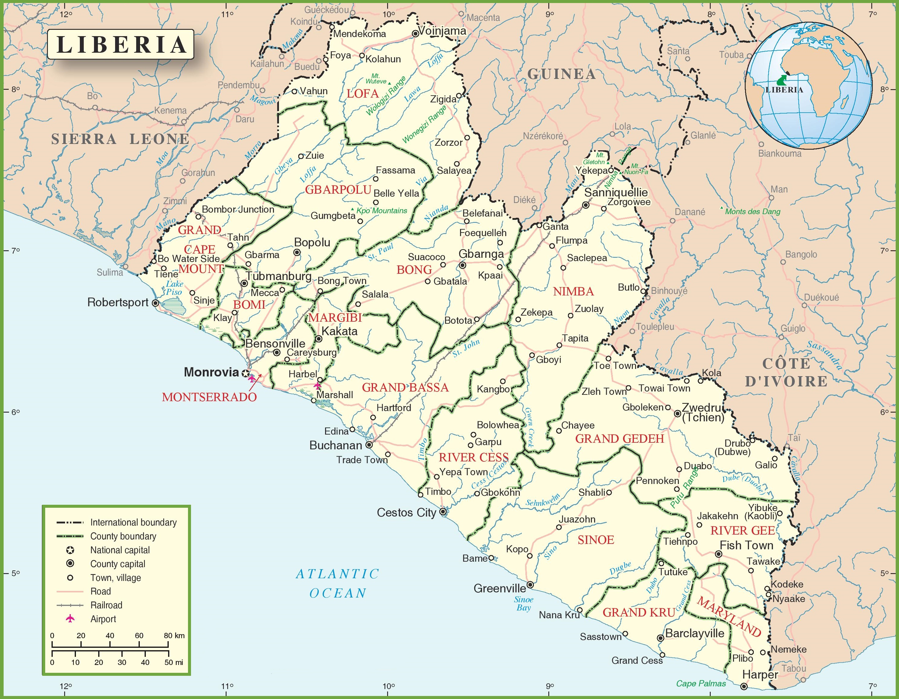
The Lofa or Loffa is a river whose headwaters originate in eastern Guinea northeast of Macenta. The river runs southwest through northeastern Liberia before draining into the North Atlantic Ocean. [2] Historically it has also been known as the Little Cape Mount River. [3] The Lawa River enters the Lofa River in Liberia's Lofa County. [2]
Indigenous species include the pygmy hippopotamus. [4] Several diamond mining concessions along the Lofa River were granted in the late 1950s and early 1960s. [5]