You can help expand this article with text translated from the corresponding article in German. (November 2010)Click [show] for important translation instructions.
|
This article needs additional citations for verification .(February 2017) |
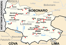
Lolotoe is a town in Bobonaro District, Timor-Leste. It is the capital of Lolotoe subdistrict, which has 7,021 inhabitants. [1] Most of them are cultivating coffee.
The subdistrict is subdivided into seven sucos: Deudet, Gildapil (Gilapil), Guda, Lebos, Lontas, Lupai (Lupal) and Opa.
Lolotoe suffered a lot under violent clashes of 1999 by Timorese pro-Indonesia militias and Indonesian army.