Indian Creek is a wealthy village in Miami-Dade County, Florida, United States. Within the village boundaries are 41 residential home sites and the Indian Creek Country Club. The population was 86 at the 2010 census and as of 2000, was the 5th highest-income place in Florida.

Townville is a borough in Crawford County, Pennsylvania, United States. The population was 323 at the 2010 census. It was established in 1831.

Marlin, or MarLin is a census-designated place (CDP) in Schuylkill County, Pennsylvania, United States. The population was 640 at the 2000 census. It is a village of Norwegian Township. The village is the seat of government for the township.
Leander Lake is an unorganized territory in Saint Louis County, Minnesota, United States; located near Britt and Great Scott Township. The population was 119 at the 2000 census.

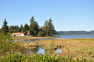
The Alsea River flows 48.5 miles (78.1 km) from Alsea, an unincorporated community in the coastal mountains of the U.S. state of Oregon, to the Pacific Ocean near the city of Waldport. It begins at the confluence of the North Fork Alsea River and the South Fork Alsea River and ends in Alsea Bay, a wide estuary at Waldport. The river flows generally west-northwest in a winding course through the mountains of southern Benton and Lincoln counties, passing near the unincorporated community of Tidewater and through the Siuslaw National Forest. Its drainage basin extends into Lane County, along the headwaters of the South Fork Alsea River.

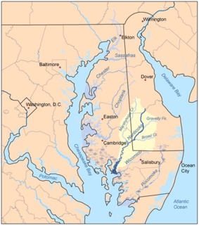
Marshyhope Creek is a 37.0-mile-long (59.5 km) tributary of the Nanticoke River on the Delmarva Peninsula. It rises in Kent County, Delaware, and runs through Caroline County, Maryland, and Dorchester County, Maryland.
Pukeashun Provincial Park is a provincial park in British Columbia, Canada, located north of the community of Scotch Creek, near the city of Salmon Arm. The park is named for Pukeashun Mountain which is within its boundaries and a major local landmark. It protects part of the Adams Plateau, the southeastern portion of the Shuswap Highland.

Brower's Spring is a spring in the Centennial Mountains of Montana that was marked by a surveyor in 1888 as the ultimate headwaters of the Missouri River and thus the fourth longest river in the world, the 3,902-mile (6,280 km)-long Mississippi-Missouri River.

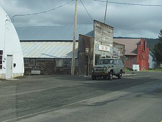
Fox is an unincorporated community in Grant County, Oregon, United States, on U.S. Route 395 south of Long Creek.
The West River is a 6-mile-long (9.7 km) tidal tributary of Chesapeake Bay in southern Anne Arundel County, Maryland. It is south of the Rhode River, which is one of its tributaries, and north of Herring Bay.

Ritter is an unincorporated community in Grant County, Oregon, United States, ten miles down the Middle Fork John Day River from U.S. Route 395, between Dale and Long Creek. At one time the locale was also known as Ritter Hot Springs.

Rois-bheinn is the joint highest hill in the Scottish region of Moidart, a title it shares with its neighbour Beinn Odhar Bheag.

La Vera is a comarca in Extremadura, western Spain. The largest town is Jaraíz de la Vera.
Hamilton is an unincorporated community in Grant County, Oregon, United States. It is located on Oregon Route 402 east of Monument and west of Long Creek. As of 1993, the community had no businesses and only three houses.

Colville Air Force Station is a closed United States Air Force General Surveillance Radar station. It is located 14.7 miles (23.7 km) east-northeast of Colville, Washington. It was closed in 1961.
Sheep Creek is a geographical place name. With variations, the name is given to hundreds of bodies of water, roads, canals, reservoirs and populated areas in the United States and other countries. It is the name of a tributary to Lockyear Creek in Queensland, Australia, and the name of at least three bodies of water in Canada. The U.S. state of Montana has 85 different locales that bear that name or a derivation. The U.S. state of Idaho has 92 natural and man-made areas that incorporate Sheep Creek into their names. Nature areas that include trails named Sheep Creek can be found in Canada's Yukon Territory, Colorado's Larimer County and in Utah's Bryce Canyon National Park.

Pisgah Mountain or Pisgah Ridge is a long ridgeline 12.5 miles (20.1 km) Tamaqua to Jim Thorpe oriented NNE-to-SSW whose northside valley is followed by U.S. Route 209 from river gap to river gap. The ridge is a succession of peaks exceeding 1,440 feet (438.9 m) looming 300–540 feet (91–165 m) above the towns of Lansford, Coaldale, Summit Hill, and Tamaqua in the Panther Creek valley. Near Summit Hill was the 'Sharpe Mountain' (peak), where in 1791 Phillip Ginter is documented as having discovered Anthracite leading to the formation of the Lehigh Coal Mine Company. In 1818 the Lehigh Coal Company took over the mines and the mining camp gradually became a settlement and grew into Summit Hill.

McArthur Lake is a reservoir in Boundary County, Idaho, USA. It gives its name to the McArthur Lake Wildlife Corridor, which provides a bridge for wildlife to migrate between two mountainous areas. The reservoir and surrounding wetlands are rich in bird life, and are protected by the McArthur Lake Wildlife Management Area. There has been discussion about removing the dam that impounds the reservoir, which would improve the wetlands so they would support larger numbers of game birds, and would also improve the quality of water downstream.
Arroyo Burro or Arroyo Burro Creek is a stream in Santa Barbara County, California.


