Related Research Articles

Whitesburg is a town in Carroll County, Georgia, United States. The population was 596 in 2020.

Luthersville is a city in Meriwether County, Georgia, United States. The population was 776 at the 2020 census, down from 874 in 2010.
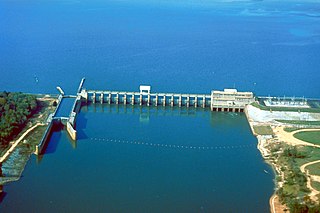
The Flint River is a 344-mile-long (554 km) river in the U.S. state of Georgia. The river drains 8,460 square miles (21,900 km2) of western Georgia, flowing south from the upper Piedmont region south of Atlanta to the wetlands of the Gulf Coastal Plain in the southwestern corner of the state. Along with the Apalachicola and the Chattahoochee rivers, it forms part of the ACF basin. In its upper course through the red hills of the Piedmont, it is considered especially scenic, flowing unimpeded for over 200 miles (320 km). Historically, it was also called the Thronateeska River.

Noonday Creek is a 20.2-mile-long (32.5 km) stream in Cobb and Cherokee counties in the U.S. state of Georgia. The stream begins near Kennesaw Mountain and ends at Lake Allatoona.

Peachtree Creek is a major stream in Atlanta. It flows for 7.5 miles (12.1 km) almost due west into the Chattahoochee River just south of Vinings.
Sweetwater Creek is a 45.6-mile-long (73.4 km) stream in the U.S. state of Georgia, west of Atlanta. It begins in southwestern Paulding County, flowing generally eastward into southwestern Cobb County, then turning south into eastern Douglas County. It is a tributary of the Chattahoochee River, and near its end it is the centerpiece of Sweetwater Creek State Park.
Kinchafoonee Creek is a creek in southwest Georgia. It originates near Buena Vista and flows southeasterly for 91.8 miles (147.7 km) to the Flint River near Albany, Georgia.

The Little River is a 29.3-mile-long (47.2 km) tributary of the Etowah River in the U.S. state of Georgia in the United States.

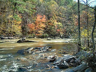
The Cartecay River is a 19.1-mile-long (30.7 km) river that runs into Ellijay, Georgia, in Gilmer County. It is the site of a class II whitewater run.

Overhill Cherokee was the term for the Cherokee people located in their historic settlements in what is now the U.S. state of Tennessee in the Southeastern United States, on the western side of the Appalachian Mountains. This name was used by 18th-century European traders and explorers from British colonies along the Atlantic coast, as they had to cross the mountains to reach these settlements.
Camp Creek is a 14.1-mile-long (22.7 km) tributary of the Chattahoochee River in Fulton County, Georgia. Rising in College Park, the creek flows west to join the Chattahoochee northeast of Campbellton.
The Buffalo River is a 4.5-mile-long (7.2 km) tidal river northwest of Brunswick, Georgia. It is part of the Brunswick River network of tidal channels along the Atlantic coast of the U.S. state of Georgia.
The Bull River is an 8.1-mile-long (13.0 km) tidal river in the U.S. state of Georgia, running through Chatham County east of Savannah. At its north end it connects via St. Augustine Creek and the Wilmington River with the Savannah River. Its south end is at Wassaw Sound, leading to the Atlantic Ocean. The Bull River flows between Wilmington Island to the west and McQueens Island and Little Tybee Island to the east. The river is crossed by one bridge, carrying U.S. Route 80 between the communities of Wilmington Island and Tybee Island.

The Little Satilla River is a 28.4-mile-long (45.7 km) freshwater tributary of the Satilla River in the U.S. state of Georgia. It should not be confused with the tidal Little Satilla River that is 20 miles (32 km) to the southeast and is an inlet of the Atlantic Ocean.

Spring Creek is a 76.5-mile-long (123.1 km) tributary of the Flint River in southwest Georgia in the United States.

The Towaliga River is a 52.3-mile-long (84.2 km) tributary of the Ocmulgee River in central Georgia. The Towaliga begins in Henry County and passes through High Falls State Park in northwestern Monroe County, then traverses the county and joins the Ocmulgee near the town of Juliette. The river begins north of Cole Reservoir in Henry County where it is joined by multiple creeks, including Thompson Creek, Troublesome Creek in Spalding County, Long Branch, and Lee Creek to gain size. The river is fairly muddy above High Falls Lake, but it clears once below the falls where most of the river is rock bottomed. This region is about 50 miles (80 km) south of Atlanta and about 35 miles (56 km) north of Macon.
Walnut Creek is a 30-mile-long (48 km) tributary of the South River in the U.S. state of Georgia. It originates in the city of Hampton in Henry County and flows into South River, which is a branch of the Ocmulgee River.
Walnut Creek is a 25-mile-long (40 km) tributary of the Ocmulgee River in the U.S. state of Georgia. It originates in the city of Gray in Jones County and flows into the Ocmulgee River in Macon at the southern corner of Ocmulgee National Monument.
Line Creek is a stream in Coweta, Fayette, Fulton, Meriwether, Spalding and Troup counties in the U.S. state of Georgia. It is a tributary to the Flint River.
References
- ↑ U.S. Geological Survey Geographic Names Information System: Long Island Creek
- 1 2 Krakow, Kenneth K. (1975). Georgia Place-Names: Their History and Origins (PDF). Macon, GA: Winship Press. p. 135. ISBN 0-915430-00-2.
33°52′42″N84°26′33″W / 33.87833°N 84.44250°W