Related Research Articles

Todd County is a county in the U.S. state of Minnesota. As of the 2010 United States Census, the population was 24,895. Its county seat is Long Prairie.
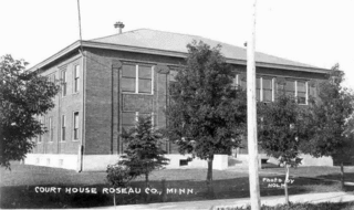
Roseau County is a county in the U.S. state of Minnesota, along the Canada–US border. As of the 2010 United States Census, the population was 15,629. Its county seat is Roseau. It is south of the border with Manitoba.

Rice County is a county located in the south central portion of the U.S. state of Minnesota. As of the 2010 census, the population was 64,142. Its county seat is Faribault.

Lake of the Woods County is a county in the U.S. state of Minnesota. As of the 2010 United States Census, the population was 4,045, making it the second-least populous county in Minnesota. Its county seat is Baudette.

Koochiching County is a county in the U.S. state of Minnesota. As of the 2010 census, the population was 13,311. Its county seat is International Falls. A portion of the Bois Forte Indian Reservation is in the county. A small part of Voyageurs National Park extends into its boundary, with Lake of the Woods County to its northwest.

Beltrami County is a county in the northern part of the U.S. state of Minnesota. As of the 2010 United States Census, the population was 44,442. Its county seat is Bemidji. The county's name comes from Italian adventurer Giacomo Beltrami from Bergamo, who explored the area in 1825. The county was created in 1866 and organized in 1896.

The Northwest Angle, known simply as the Angle by locals, and coextensive with Angle Township, is a part of northern Lake of the Woods County, Minnesota. Except for minor surveying errors, it is the only place in the contiguous United States north of the 49th parallel, which forms the border between the U.S. and Canada from the Northwest Angle westward to the Strait of Georgia. The land area of the Angle is separated from the rest of Minnesota by Lake of the Woods, but shares a land border with Canada. It is one of only six non-island locations in the 48 contiguous states that are practical exclaves of the U.S. It is the northernmost township in Minnesota and contains the northernmost point in the contiguous 48 states. The unincorporated community of Angle Inlet is in the Northwest Angle.

The Territory of Wisconsin was an organized incorporated territory of the United States that existed from July 3, 1836, until May 29, 1848, when an eastern portion of the territory was admitted to the Union as the State of Wisconsin. Belmont was initially chosen as the capital of the territory. In 1837, the territorial legislature met in Burlington, just north of the Skunk River on the Mississippi, which became part of the Iowa Territory in 1838. In that year, 1838, the territorial capital of Wisconsin was moved to Madison.

The Rainy River is a river, approximately 137 kilometres (85 mi) long, forming part of the Canada–United States border separating northern Minnesota and Northwestern Ontario.
The Border Route Trail is a 65-mile (105 km) long hiking trail that crosses the Boundary Waters Canoe Area Wilderness (BWCAW) in the far northeast corner of Minnesota (Arrowhead) and follows the international border between Minnesota and Ontario, Canada. It connects with the Superior Hiking Trail on its eastern terminus and with the Kekekabic Trail on its western end at the Gunflint Trail. In addition to the eastern and western termini, the Border Route Trail can be accessed through several spur and connecting trails, allowing for hiking trips ranging from short day-hikes to multiday backpacking expeditions.
Border irregularities of the United States, particularly panhandles and highway incursions into other jurisdictions, are shown here. Often they are a result of borders which do not conform to geological features.
The Chub River is a river of Minnesota.
The Crocodile River (Minnesota) is a river of Minnesota.
The Cross River is a river of Minnesota.
The Lower Stump River is a 5.2-mile-long (8.4 km) tributary of the Stump River in northern Minnesota, the United States.

The Onion River is a 6.1-mile-long (9.8 km) stream in northeastern Minnesota, the United States, flowing directly into Lake Superior.
The Sea Gull River is a river of Minnesota.
The Tucker River is a river of Minnesota.
The Two Island River is a 15.0-mile-long (24.1 km) river in northeastern Minnesota, the United States. It flows into Lake Superior at Taconite Harbor.
References
- Minnesota Watersheds
- USGS Hydrologic Unit Map - State of Minnesota (1974)
| This article related to a river or creek in Minnesota is a stub. You can help Wikipedia by expanding it. |