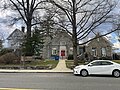
Lower Merion Library System

Last updated
Lower Merion Library System
Ludington Library.jpg
Ludington Library in Bryn Mawr.
Lower Merion Library System
Location Lower Merion Township, PA
Established1899 (1899)
Branches6
Collection
Size447,368 items
Access and use
Circulation969,559 items
Population served60,000
Members41,392
Other information
Budget$ 4,963,517
DirectorDavid L. Belanger
Website www.lmls.org

The Lower Merion Library System (LMLS) is the public library system of the township of Lower Merion, in Pennsylvania. It is among the largest public library systems in Pennsylvania. [1] While Lower Merion accounts for 7% of the population of Montgomery County, it accounts for 20% of its library circulation. [2] [3] The library is ranked in the top 2% of public libraries for circulation per capita. [2]

Contents

History

There are six neighborhood branches throughout the township. The first branch to open was the Ardmore Free Library in 1899, [3] and Belmont Hills being the newest, opening in 1935. The largest branch is the Ludington Library with almost 168,000 items in circulation. The smallest branch is Belmont Hills, with almost 17,000 items available. [3] Lower Merion Library System's governing board is the Board of Directors, consisting of 14 members, some of whom serve ex-officio due to being commissioners on the Lower Merion Board of Commissioners. [3]

The Lower Merion Library is one of the independent public library systems in Montgomery County. All cardholders can borrow and utilize library systems from any other library in the Montgomery County library system. In addition, cardholders can request access to Access Pennsylvania which allows for privileges at many other library systems throughout the Commonwealth, including the Free Library of Philadelphia in neighboring Philadelphia. Lower Merion Library System cardholders can also utilize Overdrive, Zinio and Hoopla for e-books, magazines and video-recordings. [4] Approximately 85% of LMLS' funding comes from Lower Merion, with the remainder coming from the State and individual branch libraries funding efforts. [3]

No.NameAddressZip CodeWebsiteEstablished
1 Ardmore 108 Ardmore Ave19003 http://www.lmls.org/locations-hours/ardmore-library/ 1899
2 Bala Cynwyd 131 Old Lancaster Road19004 http://www.lmls.org/locations-hours/bala-cynwyd-library/ 1915
3 Belmont Hills 120 Mary Watersford Road19004 http://www.lmls.org/locations-hours/belmont-hills-library/ 1935
4 Gladwyne 362 Righters Mill Road19035 http://www.lmls.org/locations-hours/gladwyne-library/ 1931
5 Ludington 5. S. Bryn Mawr Avenue19010 http://www.lmls.org/locations-hours/ludington-library/ 1916
6 Penn Wynne 130 Overbrook Parkway19096 http://www.lmls.org/locations-hours/penn-wynne-library/ 1929

Related Research Articles

<span class="mw-page-title-main">Montgomery County, Pennsylvania</span> County in Pennsylvania, United States

Montgomery County, colloquially referred to as Montco, is a county in the Commonwealth of Pennsylvania. As of the 2020 census, the population of the county was 856,553, making it the third-most populous county in Pennsylvania after Philadelphia and Allegheny counties.

<span class="mw-page-title-main">Bryn Mawr, Pennsylvania</span> Census-designated place in Pennsylvania, United States

Bryn Mawr, is a census-designated place (CDP) located across three townships: Radnor Township and Haverford Township in Delaware County and Lower Merion Township in Montgomery County, Pennsylvania, United States. It is located just west of Philadelphia along Lancaster Avenue, also known as U.S. Route 30.

<span class="mw-page-title-main">Philadelphia County, Pennsylvania</span> County in Pennsylvania, United States

Philadelphia County is the most populous county in Pennsylvania and the 24th-most populous county in the nation. As of the 2020 census, the county had a population of 1,603,797. Its county seat is Philadelphia, the nation's sixth-largest city.

<span class="mw-page-title-main">Lower Merion Township, Pennsylvania</span> Township in Pennsylvania, United States

Lower Merion Township is a township in Montgomery County, Pennsylvania, United States. It is part of the Philadelphia Main Line. The township's name originates with the county of Merioneth in north Wales. Merioneth is an English-language transcription of the Welsh Meirionnydd.

<span class="mw-page-title-main">Narberth, Pennsylvania</span> Borough in Montgomery County, Pennsylvania

Narberth is a borough in Montgomery County, Pennsylvania. It is one of many neighborhoods on the historic Philadelphia Main Line. The population was 4,282 at the 2010 census.

<span class="mw-page-title-main">Penn Wynne, Pennsylvania</span> Census-designated place in Pennsylvania, United States

Penn Wynne is a census-designated place (CDP) in Montgomery County, Pennsylvania, United States. It is part of Lower Merion Township, and the mailing address is Wynnewood. The population was 5,697 at the 2010 census. It is mainly a residential area. The main arteries are Haverford Road and Manoa Road.

<span class="mw-page-title-main">Ardmore, Pennsylvania</span> Census-designated place in Pennsylvania, United States

Ardmore is an unincorporated community and census-designated place (CDP) spanning the border between Delaware and Montgomery counties in the U.S. state of Pennsylvania. The population was 12,455 at the time of the 2010 census and had risen to 13,566 in the 2020 census.

<span class="mw-page-title-main">Merion Station, Pennsylvania</span> Unincorporated community in Pennsylvania, United States

Merion Station, also known as Merion, is an unincorporated community in Montgomery County, Pennsylvania. It borders Philadelphia to its west and is one of the communities that make up the Philadelphia Main Line. Merion Station is part of Lower Merion Township, Montgomery County. The community is known for its grand mansions and for the wealth of its residents.

<span class="mw-page-title-main">Philadelphia Main Line</span> Collection of suburban communities in Pennsylvania, United States

The Philadelphia Main Line, known simply as the Main Line, is an informally delineated historical and social region of suburban Philadelphia, Pennsylvania. Lying along the former Pennsylvania Railroad's once prestigious Main Line, it runs northwest from Center City Philadelphia parallel to Lancaster Avenue, also known as U.S. Route 30.

<span class="mw-page-title-main">Bala Cynwyd, Pennsylvania</span> Community in Pennsylvania, United States

Bala Cynwyd is a community in Lower Merion Township, Pennsylvania, United States. It is located on the Philadelphia Main Line in Southeastern Pennsylvania and borders the western edge of Philadelphia at U.S. Route 1. The present-day community was originally two separate towns, Bala and Cynwyd, but was united as a singular community largely because the U.S. Post Office, the Bala Cynwyd branch, served both towns using ZIP Code 19004. The community was long known as hyphenated Bala-Cynwyd. Bala and Cynwyd are currently served by separate stations on SEPTA's Cynwyd Line of Regional Rail.

<span class="mw-page-title-main">Wynnewood, Pennsylvania</span> Place in Pennsylvania, United States

Wynnewood is a suburban unincorporated community, located west of Philadelphia, straddling Lower Merion Township in Montgomery County, Pennsylvania and Haverford Township in Delaware County, Pennsylvania, United States.

<span class="mw-page-title-main">Philadelphia and Columbia Railroad</span>

Philadelphia and Columbia Railroad (P&CR) (1834) was one of the earliest commercial railroads in the United States, running 82 miles (132 km) from Philadelphia to Columbia, Pennsylvania, it was built by the Pennsylvania Canal Commission in lieu of a canal from Columbia to Philadelphia; in 1857 it became part of the Pennsylvania Railroad. It is currently owned and operated by Amtrak as its electrified Keystone Corridor. The Philadelphia and Columbia Railroad's western terminus was located near the former ferry site known as Wright's Ferry, in the town once of that name, but now Columbia in Lancaster County. There the P&CR met with the Pennsylvania Canal—navigations and improvements on the Susquehanna River east bank approximately 30 miles (48.3 km) south of Harrisburg, Pennsylvania. Most of its right-of-way was obtained by the actions of the Pennsylvania Canal Commission which operated the railroad under the various enabling acts of the Pennsylvania legislature known as the Main Line of Public Works in support of a far sighted plan to link the whole state by canals. With an engineering study reporting back a finding that obtaining sufficient waters to flood the intended 80+ mile canal from Philadelphia to Columbia, the Canal Commission and legislature authorized the railway on the right of way intended for the canal.

<span class="mw-page-title-main">Villanova, Pennsylvania</span> Village in Pennsylvania

Villanova is a suburb of Philadelphia, Pennsylvania, United States. It straddles Lower Merion Township in Montgomery County and Radnor Township in Delaware County. It is located at the center of the Philadelphia Main Line, a series of Philadelphia suburbs located along the original east–west railroad tracks of the Pennsylvania Railroad. It is served by the SEPTA Paoli/Thorndale Line regional rail train and the Norristown High Speed Line.

<span class="mw-page-title-main">Gladwyne, Pennsylvania</span> Unincorporated community in Pennsylvania, United States

Gladwyne is a suburban community in Lower Merion Township, Montgomery County, Pennsylvania, United States along the historic Philadelphia Main Line. In 2018, Gladwyne was ranked the sixth richest ZIP Code in the country in a study by Bloomberg BusinessWeek. The population was 4,071 at the 2010 US census. As Gladwyne is neither an incorporated area nor a census-designated place, all data are for the ZIP Code 19035, with which the community is coterminous.

<span class="mw-page-title-main">Lower Merion School District</span> School district in Pennsylvania

Lower Merion School District, or LMSD, is a public school district located in Montgomery County, Pennsylvania. The school district includes residents of both Lower Merion Township and the Borough of Narberth. Established in 1836, LMSD is one of the oldest districts in Pennsylvania. It is the wealthiest school district in the state, and one of the wealthiest school districts in the country.

<span class="mw-page-title-main">Lower Merion High School</span> Public school in Ardmore, Pennsylvania, United States

Lower Merion High School is a public high school in Ardmore, Pennsylvania in the Main Line suburbs of Philadelphia. It is one of two high schools in the Lower Merion School District; the other one is Harriton High School. Lower Merion serves both Lower Merion Township and the Borough of Narberth.

<span class="mw-page-title-main">Penn Valley, Pennsylvania</span> Unincorporated community in Pennsylvania, United States

Penn Valley is an unincorporated community located within Lower Merion Township, Pennsylvania, United States. Penn Valley residents share a zip code with Merion, Narberth, or Wynnewood because the community does not have its own post office. However, Penn Valley is a distinct community whose civic association demarcates its boundaries with iconic signs featuring William Penn and a farmhouse in blue or red on white, dating from 1930.

<span class="mw-page-title-main">Belmont Hills, Pennsylvania</span> Town near Philadelphia

Located in Lower Merion Township, Montgomery County, Pennsylvania, United States, Belmont Hills is a suburb of Philadelphia. Belmont Hills is a neighborhood within the village of Bala Cynwyd. It is a distinct community with its own public elementary school, public pool, fire department and public library. Belmont Hills is known for its hilly terrain. Belmont means "Beautiful Mountain" so its literal name is "Beautiful Mountain Hills".

<span class="mw-page-title-main">Merion Cricket Club</span> United States historic place

Merion Cricket Club is a private club which is located in Haverford, Pennsylvania. It was founded in 1865.

<span class="mw-page-title-main">Mill Creek (Lower Merion, Pennsylvania)</span>

Mill Creek is a 6.6-mile-long (10.6 km) tributary of the Schuylkill River in Lower Merion Township, Montgomery County, Pennsylvania, United States.

References

  1. "2013 Public Library Statistics". State Library of Pennsylvania.
  2. 1 2 "Library Statistics – Lower Merion Library System". Lmls.org. 2016-04-07. Archived from the original on 2016-03-28. Retrieved 2016-04-20.
  3. 1 2 3 4 5 "2015 LMLS Annual Report - Final". Lower Merion Library System. Retrieved July 10, 2022.
  4. "OneClick Digital". Lower Merion Library System. 2008.

40°00′06″N75°14′21″W / 40.001728°N 75.239069°W / 40.001728; -75.239069