Related Research Articles

High frequency (HF) is the ITU designation for the band of radio waves with frequency between 3 and 30 megahertz (MHz). It is also known as the decameter band or decameter wave as its wavelengths range from one to ten decameters. Frequencies immediately below HF are denoted medium frequency (MF), while the next band of higher frequencies is known as the very high frequency (VHF) band. The HF band is a major part of the shortwave band of frequencies, so communication at these frequencies is often called shortwave radio. Because radio waves in this band can be reflected back to Earth by the ionosphere layer in the atmosphere – a method known as "skip" or "skywave" propagation – these frequencies can be used for long-distance communication across intercontinental distances and for mountainous terrains which prevent line-of-sight communications. The band is used by international shortwave broadcasting stations (3.95–25.82 MHz), aviation communication, government time stations, weather stations, amateur radio and citizens band services, among other uses.
The X band is the designation for a band of frequencies in the microwave radio region of the electromagnetic spectrum. In some cases, such as in communication engineering, the frequency range of the X band is rather indefinitely set at approximately 7.0–11.2 GHz. In radar engineering, the frequency range is specified by the Institute of Electrical and Electronics Engineers (IEEE) as 8.0–12.0 GHz. The X band is used for radar, satellite communication, and wireless computer networks.
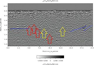
Ground-penetrating radar (GPR) is a geophysical method that uses radar pulses to image the subsurface. It is a non-intrusive method of surveying the sub-surface to investigate underground utilities such as concrete, asphalt, metals, pipes, cables or masonry. This nondestructive method uses electromagnetic radiation in the microwave band of the radio spectrum, and detects the reflected signals from subsurface structures. GPR can have applications in a variety of media, including rock, soil, ice, fresh water, pavements and structures. In the right conditions, practitioners can use GPR to detect subsurface objects, changes in material properties, and voids and cracks.

Over-the-horizon radar (OTH), sometimes called beyond the horizon radar (BTH), is a type of radar system with the ability to detect targets at very long ranges, typically hundreds to thousands of kilometres, beyond the radar horizon, which is the distance limit for ordinary radar. Several OTH radar systems were deployed starting in the 1950s and 1960s as part of early-warning radar systems, but airborne early warning systems have generally replaced these. OTH radars have recently been making a comeback, as the need for accurate long-range tracking has become less important since the ending of the Cold War, and less-expensive ground-based radars are once again being considered for roles such as maritime reconnaissance and drug enforcement.
Radiolocation, also known as radiolocating or radiopositioning, is the process of finding the location of something through the use of radio waves. It generally refers to passive uses, particularly radar—as well as detecting buried cables, water mains, and other public utilities. It is similar to radionavigation, but radiolocation usually refers to passively seeking a distant object rather than actively finding one's own position; both are types of radiodetermination. Radiolocation is also used in real-time locating systems (RTLS) for tracking valuable assets.
A scatterometer or diffusionmeter is a scientific instrument to measure the return of a beam of light or radar waves scattered by diffusion in a medium such as air. Diffusionmeters using visible light are found in airports or along roads to measure horizontal visibility. Radar scatterometers use radio or microwaves to determine the normalized radar cross section of a surface. They are often mounted on weather satellites to find wind speed and direction, and are used in industries to analyze the roughness of surfaces.

An underwater glider is a type of autonomous underwater vehicle (AUV) that employs variable-buoyancy propulsion instead of traditional propellers or thrusters. It employs variable buoyancy in a similar way to a profiling float, but unlike a float, which can move only up and down, an underwater glider is fitted with hydrofoils that allow it to glide forward while descending through the water. At a certain depth, the glider switches to positive buoyancy to climb back up and forward, and the cycle is then repeated.

The NASA QuikSCAT was an Earth observation satellite carrying the SeaWinds scatterometer. Its primary mission was to measure the surface wind speed and direction over the ice-free global oceans via its effect on water waves. Observations from QuikSCAT had a wide array of applications, and contributed to climatological studies, weather forecasting, meteorology, oceanographic research, marine safety, commercial fishing, tracking large icebergs, and studies of land and sea ice, among others. This SeaWinds scatterometer is referred to as the QuikSCAT scatterometer to distinguish it from the nearly identical SeaWinds scatterometer flown on the ADEOS-2 satellite.

Ocean acoustic tomography is a technique used to measure temperatures and currents over large regions of the ocean. On ocean basin scales, this technique is also known as acoustic thermometry. The technique relies on precisely measuring the time it takes sound signals to travel between two instruments, one an acoustic source and one a receiver, separated by ranges of 100–5,000 kilometres (54–2,700 nmi). If the locations of the instruments are known precisely, the measurement of time-of-flight can be used to infer the speed of sound, averaged over the acoustic path. Changes in the speed of sound are primarily caused by changes in the temperature of the ocean, hence the measurement of the travel times is equivalent to a measurement of temperature. A 1 °C (1.8 °F) change in temperature corresponds to about 4 metres per second (13 ft/s) change in sound speed. An oceanographic experiment employing tomography typically uses several source-receiver pairs in a moored array that measures an area of ocean.
In physical oceanography, the significant wave height (SWH, HTSGW or Hs) is defined traditionally as the mean wave height (trough to crest) of the highest third of the waves (H1/3). It is usually defined as four times the standard deviation of the surface elevation – or equivalently as four times the square root of the zeroth-order moment (area) of the wave spectrum. The symbol Hm0 is usually used for that latter definition. The significant wave height (Hs) may thus refer to Hm0 or H1/3; the difference in magnitude between the two definitions is only a few percent. SWH is used to characterize sea state, including winds and swell.

A multibeam echosounder (MBES) is a type of sonar that is used to map the seabed. It emits acoustic waves in a fan shape beneath its transceiver. The time it takes for the sound waves to reflect off the seabed and return to the receiver is used to calculate the water depth. Unlike other sonars and echo sounders, MBES uses beamforming to extract directional information from the returning soundwaves, producing a swathe of depth soundings from a single ping.

Coastal ocean dynamics applications radar (CODAR) is a type of portable, land-based, high frequency (HF) radar developed between 1973 and 1983 at NOAA's Wave Propagation Laboratory in Boulder, Colorado. CODAR is a noninvasive system that can measure and map near-surface ocean currents in coastal waters. It is transportable and can produce ocean current maps on site in near real time. Moreover, using CODAR it is possible to measure wave heights and produce an indirect estimate of local wind direction.

Wave radar is a type of radar for measuring wind waves. Several instruments based on a variety of different concepts and techniques are available, and these are all often called. This article, gives a brief description of the most common ground-based radar remote sensing techniques.
Bistatic sonar is a sonar configuration in which transmitter and receiver are separated by a distance large enough to be comparable to the distance to the target. Most sonar systems are monostatic, in that the transmitter and receiver are located in the same place. A configuration with multiple receivers is called multistatic.
Microwave engineering pertains to the study and design of microwave circuits, components, and systems. Fundamental principles are applied to analysis, design and measurement techniques in this field. The short wavelengths involved distinguish this discipline from electronic engineering. This is because there are different interactions with circuits, transmissions and propagation characteristics at microwave frequencies.
Bio-radiolocation is a technology for remote detection and diagnostics of biological objects by means of radar, even behind optically opaque obstacles. Devices based on this method are called bio-radars.
Atmospheric lidar is a class of instruments that uses laser light to study atmospheric properties from the ground up to the top of the atmosphere. Such instruments have been used to study, among other, atmospheric gases, aerosols, clouds, and temperature.
Mahta Moghaddam is an Iranian-American electrical and computer engineer and William M. Hogue Professor of Electrical Engineering in the Ming Hsieh Department of Electrical and Computer Engineering at the University of Southern California Viterbi School of Engineering. Moghaddam is also the president of the IEEE Antennas and Propagation Society and is known for developing sensor systems and algorithms for high-resolution characterization of the environment to quantify the effects of climate change. She also has developed innovative tools using microwave technology to visualize biological structures and target them in real-time with high-power focused microwave ablation.
Akira Ishimaru is a Japanese-American electrical engineer and professor emeritus at Department of Electrical and Computer Engineering at University of Washington. He is best known for his contributions to the theory of wave scattering in random media.

Yang Hao is a British electrical engineer, academic, and author most known for his research in wireless connectivity and metamaterials. He is the holder of the QinetiQ/Royal Academy of Engineering (RAE) Research Chair, and serves as the Director of both the EPSRC Research Centre on Future Wireless Connectivity and the EPSRC Centre for Transformation Optics and Metamaterials. He is also a Professor of Antennas and Electromagnetics, and Deputy Vice Principal for Strategic Research at Queen Mary University of London (QMUL). He is a Co-Founder and Director of AOTOMAT, and co-founded a satellite communication company called Isotropic Systems.
References
- ↑ "Preface for the IEEE JOURNAL OF OCEANIC ENGINEERING Special Issue on HF/VHF Ocean Surface Radar". IEEE Journal of Oceanic Engineering. 31 (4): 739.
- ↑ Wyatt, Lucy (2000). "Limits to the Inversion of HF Radar Backscatter for Ocean Wave Measurement". Journal of Atmospheric and Oceanic Technology. 17 (12): 1651–1666. Bibcode:2000JAtOT..17.1651W. doi: 10.1175/1520-0426(2000)017<1651:LTTIOH>2.0.CO;2 .
- ↑ Wyatt, L.R.; Green, J.J.; Middleditch, A (2011). "HF radar data quality requirements for wave measurement". Coastal Engineering. 58 (4): 327–336. Bibcode:2011CoasE..58..327W. doi:10.1016/j.coastaleng.2010.11.005.
- ↑ Wang, W; Wyatt, L.R. (2011). "Radio frequency interference cancellation for sea-state remote sensing by high-frequency radar". IET Radar, Sonar & Navigation. 5 (4): 405–415. doi:10.1049/iet-rsn.2010.0041.
- ↑ Robinson, A.M.; Wyatt, L.R.; Howarth, M.J. (2013). "HF Radar data availability and measurement accuracy in Liverpool Bay before and after the construction of Rhyl-Flats wind farm". Journal of Operational Oceanography. 6 (2): 1–12. Bibcode:2013JOO.....6....1R. doi: 10.1080/1755876X.2013.11020144 .