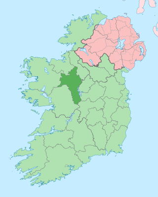
County Roscommon is a county in Ireland. It is part of the province of Connacht and the Northern and Western Region. It is the 11th largest Irish county by area and 27th most populous. Its county town and largest town is Roscommon. Roscommon County Council is the local authority for the county. The population of the county was 69,995 as of the 2022 census.

County Longford is a county in Ireland. It is in the province of Leinster. It is named after the town of Longford. Longford County Council is the local authority for the county. The population of the county was 46,634 at the 2022 census. The county is based on the historic Gaelic territory of Annaly (Anghaile), formerly known as Teffia (Teathbha).

Carrick-on-Shannon is the county town of County Leitrim in Ireland. It is the largest town in the county of Leitrim. A smaller part of the town lies in County Roscommon. As of the 2022 census, the population of the town was 4,743. It is situated on a strategic crossing point of the River Shannon. The Leitrim part of the town is in the civil parish of Kiltoghert which is in the ancient barony of Leitrim.

Roosky, Ruskey, or Rooskey is a village on the River Shannon in the northern midlands of Ireland, near the point where counties Leitrim, Longford, and Roscommon meet. The N4 road from Dublin to Sligo passes by the Leitrim side of the village.
Monasteraden is a village in County Sligo, Ireland. The village is located on the shores of Lough Gara. St Aiden's church is the village's church. Other sites include Lough Gara Lodge, Slí na Croí's Roundhouse Ecolodge, Drury's pub and the general store.

Drumsna is a village in County Leitrim, Ireland. It is situated 6 km east of Carrick-on-Shannon on the River Shannon and is located off the N4 National primary route which links Dublin and Sligo. The harbour dates to 1817 and was a hive of commercial waterway activity until the more northern navigation canal to Carrick-on-Shannon was opened in 1850. Today, the waterway is busy with anglers and tourist pursuits in the summer months.

Costello is one of the ancient baronies of Ireland. Unusually for an Irish barony, it straddles two counties: County Mayo and County Roscommon. It comprises the modern day districts of Kilkelly, Kilmovee, Killeagh, Kilcolman, and Castlemore.

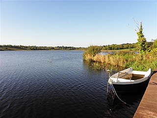
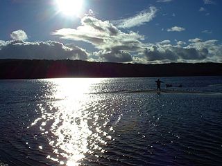
Lough Gara is a lake in Counties Sligo and Roscommon, Ireland. It is an Important Bird Area protecting 1,788 ha of which most is covered by a Ramsar Site.

The Boyle River is a river in Ireland. Forming part of the Shannon River Basin, it flows from Lough Gara on the Sligo/Roscommon county border and thence through the town of Boyle to Lough Key. From there is continues eastwards through the village of Knockvicar to the River Shannon at Lough Drumharlow, near Carrick-on-Shannon. The length of the Boyle River is 64.4 km (40mi). The area of its basin is 725 km2.

Lough Scur is a freshwater lake in south County Leitrim, northwest Ireland. It is part of the Shannon–Erne Waterway. There have been Human settlements here since the New Stone Age. Modern features include quays and moorings. Protected features are Castle John, three Crannogs, and the causeway into Rusheen Island, though "Jail Island" is not protected. The ecology of Lough Scur, and indeed all county Leitrim lakes, is threatened by pollution and invasive species such as curly waterweed, zebra mussel, and freshwater clam.
Lough Boderg is a lake on the River Shannon in County Roscommon and County Leitrim, Ireland.

Lough Graney is a lake in County Clare, Ireland. The lake's outlet is the short River Graney, which flows through Lough O'Grady and past the town of Scarriff into the west side of Lough Derg.
Kilglass Lough is a freshwater lake in the west of Ireland. It is located in north County Roscommon.

Lough Bofin is a lake on the River Shannon on the County Roscommon–County Leitrim border in Ireland.

Urlaur Lough is a freshwater lake in the west of Ireland. It is located in east County Mayo and is one of the Urlaur Lakes.
Cavetown Lough is a freshwater lake in the west of Ireland. It is located in County Roscommon in the catchment of the upper River Shannon.

Lisacul is a village in County Roscommon, Ireland.
Carrickaport lough is a freshwater lake in Kiltubrid parish, south County Leitrim, Ireland. Drumcong village, and Lough Scur, lie nearby. Carrickaport lough is known for quality bream and pike fishing. The ecology of Carrickaport lough, and other county waterways, is threatened by curly waterweed, zebra mussel, and freshwater clam invasive species.
Keshcarrigan Lough is a mesotrophic freshwater lake near Keshcarrigan in County Leitrim, Ireland. Known for quality coarse fishing, the lake allows bank fishing from concrete stands on the northern shore, two with wheelchair access. The ecology of Keshcarrigan Lough, and other county waterways, is threatened by curly waterweed, zebra mussel, and freshwater clam invasive species.

The Rag River is a river in County Cavan, Ireland. It rises in Mullaghdoo Lough, in the townland of Aghnacreevy, parish of Kildallan, and flows in a north-easterly direction through the lakes of Clonty Lough, Togher Lough, Lough Rud, Aghavoher Lough, Killywilly Lough, Cuillaghan Lough, Tomkinroad Lough, Lough Tee Lower and Corraback Lough. It discharges into the Shannon–Erne Waterway in the townland of Corraback. It has a fish population of pike, bream, rudd, roach, gudgeon and perch. Archaeological finds in the river include dugout canoes, socketed bronze axes and Irish elk antlers. The structures of interest along the river include Ardlougher Bridge, Greenville Corn Mill, Togher Bridge, Cranaghan Bridge, Killywilly Cavan & Leitrim Railway Level Crossing, Killywilly Corn Mill, Killywilly Bleach Mill, Killywilly Bridge, Tomkinroad Cavan & Leitrim Railway Bridge, Tomkinroad Cavan & Leitrim Railway Station & Level Crossing, Tomkinroad Creamery, Drumrush Corn Mill & Weir, Droghill Bridge, Feedarragh Bridge & Stepping Stones.


