Lurgan is a town in County Armagh, Northern Ireland, near the southern shore of Lough Neagh. Lurgan is about 18 miles (29 km) south-west of Belfast and is linked to the city by both the M1 motorway and the Belfast–Dublin railway line. It had a population of about 28,634 at the 2021 UK census and is within the Armagh, Banbridge and Craigavon district. For some purposes, Lurgan is treated as part of the "Craigavon Urban Area" along with neighbouring Craigavon and Portadown.

Craigavon is a town in northern County Armagh, Northern Ireland. Its construction began in 1965 and it was named after the first Prime Minister of Northern Ireland: James Craig, 1st Viscount Craigavon. It was intended to be the heart of a new linear city incorporating Lurgan and Portadown, but this plan was mostly abandoned and later described as having been flawed. Among local people today, "Craigavon" refers to the area between the two towns. It is built beside a pair of artificial lakes and is made up of a large residential area (Brownlow), a second smaller one (Mandeville), plus a central area (Highfield) that includes a substantial shopping centre, a courthouse and the district council headquarters. The area around the lakes is a public park and wildlife haven made up of woodland with walking trails. There is also a watersports centre, golf course and ski slope in the area. In most of Craigavon, motor vehicles are completely separated from pedestrians, and roundabouts are used extensively. It hosted the headquarters of the former Craigavon Borough Council.

County Cavan is a county in Ireland. It is in the province of Ulster and is part of the Northern and Western Region. It is named after the town of Cavan and is based on the historic Gaelic territory of East Breffny (Bréifne). Cavan County Council is the local authority for the county, which had a population of 81,201 at the 2022 census.

Stradone is a village located in County Cavan, Ireland. It is situated in the civil parish of Laragh six miles from Cavan, near the N3 road between Cavan and Virginia. Stradone is classified as a 'small village' in the Cavan County Council Development Plan 2014-2020.
A registration district in the United Kingdom is a type of administrative region which exists for the purpose of civil registration of births, marriages, and deaths and civil partnerships. It has also been used as the basis for the collation of census information.

Ballyjamesduff is a town in County Cavan, Ireland. A former market town, it was the winner of the 1966 and 1967 Irish Tidy Towns Competition.
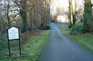
Munterconnaught is a civil and ecclesiastical parish of County Cavan, Ireland. It is located between the southern shores of Lough Ramor and the county boundary with County Meath.

Killeshandra or Killashandra, is a village and civil parish in County Cavan, Ireland. It is 20 kilometres (12 mi) west of Cavan Town in the centre of County Cavan's lakeland and geopark region and the Erne catchment environment of rivers, lakes, wetlands and woodland. Together with the Lough Oughter Special Protected Area (SPA), it has been recognised by the EU programme for wildlife Natura 2000 since 2010. Killeshandra is noted by Fáilte Ireland as an "Angling Centre of Excellence", and as a hub for the Cavan Walking Festival which takes place in May each year. There are several looped walking and cycling trails in Killykeen Forest Park. The town is also home to Killeshandra Gaelic Football Club, known locally as the Killeshandra Leaguers. Rockfield Lake, which is popular with anglers, is a few kilometres southwest of the town.

Kinsealy is an outer suburb of Dublin in Fingal, Ireland. Kinsealy is on the northside of the city, about 7 km from the city centre, on the Malahide Road, in the former green belt between the suburbs of Balgriffin, Portmarnock and Malahide.

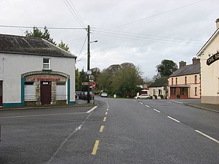
Crossdoney is a village and townland in County Cavan, Ireland. The village is on the R154 regional road where it terminates at a junction with the R198. Peculiarly, all buildings in the village sit on one side of the road, and this gives rise to the widely used local expression: "All to one side like Crossdoney".
Mountnugent, or Mount Nugent, historically known as Dalysbridge, is a village and townland in southern County Cavan, Ireland. The village is on the R154 regional road, at a river crossing near Lough Sheelin.
Mullahoran is a townland in southern County Cavan, bordering County Longford, Ireland. It is also the name of a Roman Catholic parish. It is a constituent part of the electoral division and civil parish of Drumlumman.
Broadford is a village in the west of County Limerick in Ireland. It is part of the Roman Catholic parish of Dromcollogher-Broadford. In the 2016 census, the resident population of Broadford village was 276, and the population of the Broadford electoral division was 960.

Carrickfergus is a barony in County Antrim, Northern Ireland. It is bounded on the south-east by Belfast Lough, and otherwise surrounded by the barony of Belfast Lower. It is coextensive with the civil parish of Carrickfergus or St Nicholas and corresponds to the former county of the town of Carrickfergus, a county corporate encompassing Carrickfergus town.

Ballymcgovern is a village and townland in County Cavan, Ireland. It lies on the border with County Leitrim, within the parish of Templeport and barony of Tullyhaw on the Ballinamore to Ballyconnell road, the regional R205 road (Ireland).

Clogh is a village, and namesake of an electoral district in County Kilkenny, Ireland. It is also a townland in the civil parish of Castlecomer in the ancient barony of Fassadinin.
Cavan–Monaghan is a parliamentary constituency represented in Dáil Éireann, the lower house of the Irish parliament or Oireachtas. The constituency elects five deputies on the system of proportional representation by means of the single transferable vote (PR-STV).

Milltown is a small village in County Cavan, Ireland. The population as at 2021 was around 100. During a nineteenth century O'Donavan townlands survey of County Cavan it was noted that the Milltown area was traditionally referred to as Bellanaleck, there are no other records with this name. The Archaeological Inventory of County Cavan notes (507) Derrygeeraghan, a raised circular Rath area with two substantial earthen banks and a wide deep fosse dating from earlier medieval times. The present Milltown Electoral Division and catchment area comprises several neighboring townlands within an ancient Barony of Loughtee Lower, County Cavan and Drumlane Civil Parish in County Cavan.

Killimer is a village in County Clare, Ireland, in a civil parish of the same name. It is located on the northern bank of the Shannon and the N67 which passes through the village.

Ramor United are a Gaelic football club from Virginia, County Cavan in Ireland. They are affiliated to Cavan GAA.
