Luxoro Atlas

Last updated

The Tammar Luxoro Atlas, or Atlante Luxoro, is an anonymous collection of Italian portolan charts from the early 15th century, currently held at the Biblioteca Civica Berio in Genoa, Italy. The author is unknown, although believed to have been made by Francesco de Cesanis of Venice.

Italy republic in Southern Europe

Italy, officially the Italian Republic, is a country in Southern Europe. Located in the middle of the Mediterranean Sea, Italy shares open land borders with France, Switzerland, Austria, Slovenia and the enclaved microstates San Marino and Vatican City. Italy covers an area of 301,340 km2 (116,350 sq mi) and has a largely temperate seasonal and Mediterranean climate. With around 61 million inhabitants, it is the fourth-most populous EU member state and the most populous country in Southern Europe.

Portolan chart

Portolan or portulan charts are ancient nautical charts, first made in the 13th century in the Mediterranean basin and later expanded to include other regions, which have been noted for their high cartographic accuracy. The word portolan comes from the Italian portulano, meaning "related to ports or harbors", and which since at least the 17th century designates "a collection of sailing directions".

Biblioteca Civica Berio

The Biblioteca Civica Berio of Genoa, Italy, is a public library founded by Carlo Giuseppe Vespasiano Berio. Around 1998 it moved into the former Seminario arcivescovile di Genova in the Carignano quartiere. Among its collections is the library of Demetrio Canevari.

Contents

Background

The Luxoro Atlas is named after Tammar Luxoro, a 19th-century Genoese artist and collector, who once owned it. It was acquired by the city of Genoa in 1899, and is currently held at the Biblioteca Civica Berio in Genoa, Italy.

Tammar Luxoro Italian painter

Tammar Luxoro was an Italian painter, mainly painting landscapes on site.

Genoa Comune in Liguria, Italy

Genoa is the capital of the Italian region of Liguria and the sixth-largest city in Italy. In 2015, 594,733 people lived within the city's administrative limits. As of the 2011 Italian census, the Province of Genoa, which in 2015 became the Metropolitan City of Genoa, counted 855,834 resident persons. Over 1.5 million people live in the wider metropolitan area stretching along the Italian Riviera.

The Luxoro Atlas was once believed to originate from the early 14th century, and sometimes said to have been authored by the Genoese cartographer Pietro Vesconte. [1] However, according to more recent scholars, the Luxoro Atlas was probably made by the Venetian cartographer Francesco de Cesanis, probably a little time before 1421. [2]

Pietro Vesconte Italian cartographer from Genoa

Pietro Vesconte was a Genoese cartographer and geographer. A pioneer of the field of the portolan chart, he influenced Italian and Catalan mapmaking throughout the fourteenth and fifteenth centuries. He appears to have been the first professional mapmaker to sign and date his works regularly.

Venice Comune in Veneto, Italy

Venice is a city in northeastern Italy and the capital of the Veneto region. It is situated on a group of 118 small islands that are separated by canals and linked by over 400 bridges. The islands are located in the shallow Venetian Lagoon, an enclosed bay that lies between the mouths of the Po and the Piave rivers. In 2018, 260,897 people resided in the Comune di Venezia, of whom around 55,000 live in the historical city of Venice. Together with Padua and Treviso, the city is included in the Padua-Treviso-Venice Metropolitan Area (PATREVE), which is considered a statistical metropolitan area, with a total population of 2.6 million.

Features

The atlas is composed of eight sheets of nautical charts. With each sheet at 11 cm x 16 cm, making it the smallest portolan chart from the period still extant. [3] It is believed to have been designed for on-board use. [4] The style is very much that of the Italian school of portolan charts.

The eight sheets are separate nautical charts, together covering the "normal portolan" range.

  1. north Atlantic (oriented with South on top, depicting southern England, French coasts, northern Spain)
  2. west Mediterranean (oriented E on top, depicting southern Spain, Balearic islands and northwest Africa)
  3. central-west Mediterranean (oriented N, depicting southern France, Corsica, Sardinia, Tunisia)
  4. central-east Mediterranean (oriented N, with southern Italy, Sicily, western Greece and Tripolitana)
  5. Adriatic Sea (oriented S)
  6. Aegean Sea (oriented N)
  7. East Mediterranean (oriented W, Nile delta, Levantine coast, southern Anatolia)
  8. Black Sea (oriented E)

Unlike many earlier charts, the Luxoro Atlas makes no attempt to depict any Atlantic islands (not even the Canary Islands), ending the west African coast around Salé, Morocco.

Salé City in Rabat-Salé-Kénitra, Morocco

Salé is a city in north-western Morocco, on the right bank of the Bou Regreg river, opposite the national capital Rabat, for which it serves as a commuter town. Founded in about 1030 by Arabic-speaking Berbers, the Banu Ifran, it later became a haven for pirates in the 17th century as an independent republic before being incorporated into Alaouite Morocco.

Related Research Articles

Visconte Maggiolo Italian cartographer

Visconte Maggiolo, also spelled Maiollo and Maiolo, was an Italian cartographer and sailor.

Angelino Dulcert, probably also the same person known as Angelino de Dalorto, and whose real name was probably Angelino de Dulceto or Dulceti or possibly Angelí Dolcet, was an Italian-Majorcan cartographer.

Abraham Cresques cartographer from Palma, Majorca

Abraham Cresques, whose real name was Cresques (son of) Abraham, was a 14th-century Jewish cartographer from Palma, Majorca. In collaboration with his son, Jehuda Cresques, Cresques is credited with the authorship of the celebrated Catalan Atlas of 1375.

Battista Agnese Italian cartographer

Battista Agnese was a cartographer from the Republic of Genoa, who worked in the Venetian Republic.

Maritime republics group of city-states, mostly in Italy, prosperous in the Middle ages

The maritime republics of the Mediterranean Basin were thalassocratic city-states which flourished in Italy and Dalmatia during the Middle Ages. The best known among the maritime republics are Venice, Genoa, Pisa, and Amalfi. Less known are Ragusa, Gaeta, Ancona, and Noli.

Majorcan cartographic school

"Majorcan cartographic school" is the term coined by historians to refer to the collection of predominantly Jewish cartographers, cosmographers and navigational instrument-makers and some Christian associates that flourished in Majorca in the 13th, 14th and 15th centuries until the expulsion of the Jews. The label is usually inclusive of those who worked in Catalonia. The Majorcan school is frequently contrasted with the contemporary Italian cartography school.

Carta Pisana

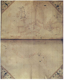
The Carta Pisana is a map probably made at the end of the 13th century, about 1275-1300. New research suggests that it was made a century later. It was found in Pisa, hence its name. It shows the whole Mediterranean, the Black Sea and a part of the atlantic coast, from the north of present-day Morocco to the present-day Netherlands, but the accuracy of the map is mostly limited to the Mediterranean. It is the oldest surviving nautical chart. It is a portolan chart, showing a detailed survey of the coasts, and many ports, but bears no indication on the topography or toponymy of the inland. On the map, North is on the top, in contrast to other maps of the same period such as the Hereford Mappa Mundi, where East is on the top.

Giovanni da Carignano Priest and cartographer

Giovanni da Carignano, or Johannes de Mauro de Carignano was a priest and a pioneering cartographer from Genoa.

Domenico and Francesco Pizzigano, known as the Pizzigani brothers, were 14th-century Venetian cartographers. Their surname is sometimes given as Pizigano in older sources.

Medici-Laurentian Atlas

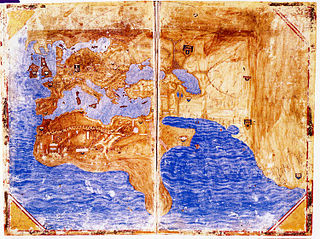
The Medici-Laurentian Atlas, also known simply as the Medici Atlas, is an anonymous 14th-century set of maps, probably composed by a Genoese cartographer and explicitly dated 1351, although most historians believe it was composed, or at least retouched, later. The atlas is currently held by the Biblioteca Medicea Laurenziana in Florence, Italy.

Guillem Soler

Guillem Soler, sometimes given as Guillelmus Soleri, Guillermo Soler and Guglielmo Soleri, was a Majorcan cartographer of the 15th century.

Battista Beccario Italian cartographer

Battista Beccario, also known as Baptista Beccharius, was a 15th-century Genoese cartographer.

The Corbitis Atlas is a late 14th-century atlas of four portolan charts, composed by an anonymous Venetian cartographer, and currently held by the Biblioteca Nazionale Marciana in Venice, Italy.

Pinelli–Walckenaer Atlas

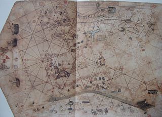
The Pinelli–Walckenaer Atlas is a late 14th-century atlas of portolan charts, explicitly dated 1384, primarily composed by an anonymous Venetian cartographer, and held by the British Library.

Bodleian-Douce Atlas Portolan maps of countries bordering the Mediterranean

The Bodleian-Douce Atlas is an early 15th-century nautical atlas by an anonymous Italian cartographer, currently held by the Bodleian Library in Oxford, UK.

Cornaro Atlas

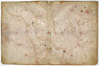
The Cornaro Atlas is an extensive Venetian collection of nautical charts and tracts, currently held by the British Library.

A rutter is a mariner's handbook of written sailing directions. Before the advent of nautical charts, rutters were the primary store of geographic information for maritime navigation.

References

  1. e.g. Canale (1866: p.436)
  2. Campbell (2011)
  3. See Campbell "Census of pre-sixteenth-century portolan charts: Corrections and updates" (2011: entry 81)
  4. Exhibition note, on the Portolano Atlante Luxoro at e-corpus

Sources