Lyndhurst Hall, Kentish Town

Last updated

Lyndhurst Hall, Kentish Town a year before its demolition Lyndhurst Hall, Warden Road - Before Demolition 2005.jpg
Lyndhurst Hall, Kentish Town a year before its demolition

Lyndhurst Hall was a Victorian mission hall built by Hampstead's Lyndhurst Road Congregational Church. [1] Located in Warden Road, Kentish Town, it was later sold on and used as a community hall, before being demolished in 2006 to make way for flats.

Contents

Construction and early use

The hall was built in 1891 under the leadership of Dr Robert Forman Horton, then minister of the Lyndhurst Road, Hampstead church. The foundation stone was laid by local MP Samuel Smith on 29 July 1891 and the building formally opened to the public on 14 March 1892. [2] [3] It was extended in 1911, with a new memorial stone laid on 8 April 1911 by Dr Horton, and the official opening took place on 30 October 1911. [4] [5] Funding for the building and extension was provided by members of the Hampstead Church congregations. [6] The architects for the extension were Spalding and Spalding who were connected with the Lyndhurst Road Church (and were probably responsible for the original building). [7] [8]

Lyndhurst Hall was a resource for the local community a time of general poverty in Kentish Town – Charles Booth poverty maps (1898–99) describe the locality as: "very poor, casual, chronic want". [9] It hosted a range of events, including clubs for boys, girls, men and women, bible classes and Sunday services, as well as entertainment and legal and financial advice. [10] During World War I it was an emergency shelter and operation centre for voluntary aid detachments. [11] Similarly, in World War II it was used as a shelter. It was itself hit by a bomb, which shattered most of the glass in the building. [12]

Later use

During the 1950s, community activities in the hall included the Boys' Brigade, Sunday schools, youth club and children's nursery. [13] The youth club was taken over by the Christian Teamwork Trust from 1958, with activities run by the club's membership and minimal input from the Trust – a controversial management style for the time. [14] [ self-published source? ] Hampstead's Lyndhurst Road Congregational Church sold the building to Metropolitan Borough of St Pancras (later to become part of Camden Council) in 1963, and it reopened as a community centre two years later. [15] It was available for hire for private functions — such as the 1972 and 1973 editions of Comic Mart [16] [17] — and was also home of St Pancras Amateur Boxing Club (SPABC). [18] In the mid 1980s, most of the first floor was taken over and run by Camden Workers Social Club. [19] [ self-published source? ] SPABC moved into alternative premises in 1984 and the youth club closed in 1989. [20] [21] By early 2000, Camden Council had decided to close and sell the premises. [22] The building was finally sold in 2005 and demolished a year later, with anger being expressed by some residents about loss of facilities and a mural inside the building. [23] [24] A block of flats now stands on the site, and the 1911 memorial stone has been incorporated into the foundations and can be seen at street level in Warden Road. [25] [ self-published source? ] Hampstead's Lyndhurst Road Congregational Church, founder and original owner of the Kentish Town mission hall, closed in the 1970s and is now a recording facility for Air Studios.

Related Research Articles

<span class="mw-page-title-main">Bloomsbury</span> District in West End, London

Bloomsbury is a district in the West End of London. It is considered a fashionable residential area, and is the location of numerous cultural, intellectual, and educational institutions.

<span class="mw-page-title-main">Chalk Farm</span> Human settlement in England

Chalk Farm is a small urban district of north London, lying immediately north of Camden Town, in the London Borough of Camden.
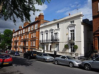
<span class="mw-page-title-main">Highgate</span> Human settlement in England

Highgate is a suburban area of north London at the northeastern corner of Hampstead Heath, 4+12 miles north-northwest of Charing Cross.

<span class="mw-page-title-main">Kentish Town</span> Human settlement in England

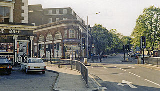
Kentish Town is an area of northwest London, England in the London Borough of Camden, immediately north of Camden Town. Less than four miles north of central London, Kentish Town has good transport connections and is situated close to the open spaces of Hampstead Heath.

<span class="mw-page-title-main">St Pancras, London</span> Area of central London, England

St Pancras is a district in north London. It was originally a medieval ancient parish and subsequently became a metropolitan borough. The metropolitan borough then merged with neighbouring boroughs and the area it covered now forms around half of the modern London Borough of Camden. The area of the parish and borough includes the sub-districts of Camden Town, Kentish Town, Gospel Oak, Somers Town, King's Cross, Chalk Farm, Dartmouth Park, the core area of Fitzrovia and a part of Highgate.

<span class="mw-page-title-main">King's Cross, London</span> Area of central London in England

Kings Cross is a district on either side of Euston Road, in north London, England, 1.5 miles (2.4 km) north of Charing Cross. It is bordered by Barnsbury to the north, Clerkenwell and Islington to the east, Holborn to the south and Euston to the west. It is served by two major rail termini, St Pancras and King's Cross. King's Cross station is the terminus of one of the major rail routes between London and the North.

Somers Town is an inner-city district in North West London. It has been strongly influenced by the three mainline north London railway termini: Euston (1838), St Pancras (1868) and King's Cross (1852), together with the Midland Railway Somers Town Goods Depot (1887) next to St Pancras, where the British Library now stands.

<span class="mw-page-title-main">Metropolitan Borough of St Pancras</span> Metropolitan borough of England

St Pancras was a civil parish and metropolitan borough in London, England. It was an ancient parish in the county of Middlesex, governed by an administrative vestry. The parish was included in the area of responsibility of the Metropolitan Board of Works in 1855 and became part of the County of London in 1889. The parish of St Pancras became a metropolitan borough in 1900, following the London Government Act 1899, with the parish vestry replaced by a borough council. In 1965 the borough was abolished and its former area became part of the London Borough of Camden in Greater London.

<span class="mw-page-title-main">Gospel Oak</span> Human settlement in England

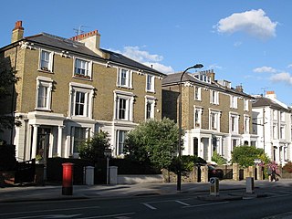
Gospel Oak is an inner urban area of north west London in the London Borough of Camden at the very south of Hampstead Heath. The neighbourhood is positioned between Hampstead to the north-west, Dartmouth Park to the north-east, Kentish Town to the south-east, and Belsize Park to the south-west. Gospel Oak lies across the NW5 and NW3 postcodes and is served by Gospel Oak station on the London Overground. The North London Suburb, Gospel Oak, has many schools around it.

Robert Forman Horton, British Nonconformist divine, was born in London.

<span class="mw-page-title-main">Holborn and St Pancras (UK Parliament constituency)</span> Parliamentary constituency in the United Kingdom, 1983 onwards

Holborn and St Pancras is a parliamentary constituency in Greater London that was created in 1983. It has been represented in the House of Commons of the Parliament of the United Kingdom since 2015 by Sir Keir Starmer, the current Leader of the Labour Party and Leader of the Opposition.

<span class="mw-page-title-main">Haverstock</span> Human settlement in England

Haverstock is an area of the London Borough of Camden: specifically the east of Belsize Park, north of Chalk Farm and west of Kentish Town. It is centred on Queens Crescent and Malden Road. Gospel Oak is to the north, Camden Town to the south.

The London Borough of Camden was created in 1965 from the former area of the metropolitan boroughs of Hampstead, Holborn, and St Pancras, which had formed part of the County of London. The borough was named after Camden Town, which had gained its name from Charles Pratt, 1st Earl Camden in 1795. Since the 17th century, many famous people have lived in its various districts and neighbourhoods.

<span class="mw-page-title-main">London Borough of Camden</span> Borough in United Kingdom

The London Borough of Camden is a London borough in Inner London. Camden Town Hall, on Euston Road, lies 1.4 mi (2.3 km) north of Charing Cross. The borough was established on 1 April 1965 from the area of the former boroughs of Hampstead, Holborn, and St Pancras—which together, prior to that date, had comprised part of the historic County of London.

<span class="mw-page-title-main">Camden London Borough Council</span>

Camden London Borough Council is the local authority for the London Borough of Camden in Greater London, England. It is a London borough council, one of 32 in the United Kingdom capital of London. Camden is divided into 18 wards, each electing three councillors.

Alfred William Stephens Cross (1858–1932) was a British architect.

<span class="mw-page-title-main">Coat of arms of the London Borough of Camden</span>

The coat of arms of the London Borough of Camden were granted on 10 September 1965. The borough was formed by the merger of three former boroughs, namely the Metropolitan Borough of Hampstead, the Metropolitan Borough of Holborn and the Metropolitan Borough of St. Pancras, from whose arms elements were utilised in the arms of the new borough.

Roy Edwin Shaw was a Labour Party politician in London, England. He was the Leader of Camden London Borough Council from 1975 to 1982, serving on Camden Council and its predecessor councils continuously for 51 years until just before his death, making him the longest-serving councillor in the UK. Shaw was known nationally as an expert on local government.

References

  1. "'Hampstead: Protestant Nonconformity', A History of the County of Middlesex: Volume 9: Hampstead, Paddington (1989)". British History Online. Retrieved 19 February 2014.
  2. Lyndhurst Road Church Manual. Camden Local Studies and Archive Centre, Holborn Library, London: Lyndhurst Road Church. 1891. pp. Kentish Town Mission Building Report.
  3. "Lyndhurst Hall". The Times. 17 March 1892.
  4. Lyndhurst Road Church Newsletter. Camden Local Studies and Archive Centre, Holborn Library, London: Lyndhurst Road Church. July 1911. pp. Kentish Town Mission Report.
  5. Lyndhurst Road Church Newsletter. Camden Local Studies and Archive Centre, Holborn Library, London: Lyndhurst Road Church. October 1911. pp. Kentish Town Mission – The New Buildings.
  6. Horton, Robert Forman (1917). Robert Forman Horton Autobiography. George Allen and Unwin, London. pp.  66.
  7. Lyndhurst Road Church Newsheet. Camden Local Studies and Archive Centre, Holborn Library, London: Lyndhurst Road Church. January 1911. pp. Brochure for Buildings Enlargement.
  8. Horton, Robert Forman (1917). Robert Forman Horton Autobiography. George Allan and Unwin, London. pp.  246.
  9. "Charles Booth Poverty Maps". London School of Economics. Retrieved 15 January 2014.
  10. Lyndhurst Road Church Manual. Camden Local Studies and Archive Centre, Holborn Library, London: Lyndhurst Road Church. 1919. pp. Report for Kentish Town Mission.
  11. Lyndhurst Road Church Newsletter. Camden Local Studies and Archive Centre, Holborn Library, London: Lyndhurst Road Church. January 1916. pp. Kentish Town Report.
  12. Lyndhurst Road Church Newsletter. Camden Local Studies and Archive Centre, Holborn Library, London: Lyndhurst Road Church. December 1944. pp. Kentish Town Mission Report.
  13. Lyndhurst Hall Brochure. Camden Local Studies and Archive Centre, Holborn Library, London: Lyndhurst Hall. 1954.
  14. Dyos, Christine A. (14 March 2022). A Penny For a Brick - A History of Lyndhurst Hall, Warden Road, Kentish Town, 1891 -2006. Caersws: Independent Publishing Network. p. 51. ISBN   9781800499461.
  15. "Re-opening of Lyndhurst Hall". Hampstead and Highgate Express and News. 2 April 1965.
  16. Burton, Richard. "Meditorial," Comic Media News #29 (Jan./Feb. 1977).
  17. "The February Comic Mart," Comic Media & The Comic Reader UK Edition Newsletter #3 (Feb. 1973).
  18. "New Home for Local Boxers". Camden and St Pancras Chronicle. 1 October 1965.
  19. Dyos, Christine A. (14 March 2022). A Penny For A Brick - A History of Lyndhurst Hall, Warden Road, Kentish Town, 1891-2006. Caersws: Independent Publishing Network. p. 78. ISBN   9781800499461.
  20. "St Pancras Amateur Boxing Club Move". Camden New Journal. May 1984.
  21. MacGeorge, Anne (8 October 2004). "Letter re Closure of Youth Club". Hampstead and Highgate Express.
  22. Carver and Barham, Dan and Eleanor (29 July 2004). "£8 Million Jewel in the Crown for Sale". Camden New Journal.
  23. Osley, Richard. "Youth club plea as hall faces bulldozers". Camden New Journal. Retrieved 19 February 2014.
  24. MacDonald, Mairi (31 August 2006). "Anger at Mural's End". Camden New Journal.
  25. Dyos, Christine A. (14 March 2022). A Penny For A Brick - A History of Lyndhurst Hall, Warden Road, Kentish Town, 1891-2006. Caersws: Independent Publishing Network. p. 90. ISBN   9781800499461.

External sources

Coordinates: 51°32′54″N0°08′56″W / 51.5484°N 0.1490°W / 51.5484; -0.1490