Lynnwood, Fayette County, Pennsylvania

Last updated

Lynnwood is a place located in Fayette County, Pennsylvania in the United States of America. Its latitude is 40°7'27" North, longitude 79°50'37" West.
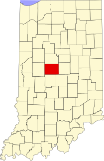
Fayette County, Pennsylvania County in the United States

Fayette County is a county of the U.S. state of Pennsylvania. Fayette County is located in southwestern Pennsylvania, adjacent to Maryland and West Virginia. As of the 2010 census, the population was 136,606. Its county seat is Uniontown. The county was created on September 26, 1783, from part of Westmoreland County and named after the Marquis de Lafayette.

United States Federal republic in North America

The United States of America (USA), commonly known as the United States or America, is a country comprising 50 states, a federal district, five major self-governing territories, and various possessions. At 3.8 million square miles, the United States is the world's third or fourth largest country by total area and is slightly smaller than the entire continent of Europe's 3.9 million square miles. With a population of over 327 million people, the U.S. is the third most populous country. The capital is Washington, D.C., and the largest city by population is New York City. Forty-eight states and the capital's federal district are contiguous in North America between Canada and Mexico. The State of Alaska is in the northwest corner of North America, bordered by Canada to the east and across the Bering Strait from Russia to the west. The State of Hawaii is an archipelago in the mid-Pacific Ocean. The U.S. territories are scattered about the Pacific Ocean and the Caribbean Sea, stretching across nine official time zones. The extremely diverse geography, climate, and wildlife of the United States make it one of the world's 17 megadiverse countries.

North one of the four cardinal directions

North is one of the four compass points or cardinal directions. It is the opposite of south and is perpendicular to east and west. North is a noun, adjective, or adverb indicating direction or geography.

Midget League Football

Lynnwood was home to the now defunct Lynnwood Eagles. The Eagles were a part of the Belle Vernon Midget Football League. Their last league title came in 1998 under a team led by local legend Rick Van Pool.

Coordinates: 40°07′27″N79°50′36″W / 40.12417°N 79.84333°W / 40.12417; -79.84333

Geographic coordinate system Coordinate system

A geographic coordinate system is a coordinate system that enables every location on Earth to be specified by a set of numbers, letters or symbols. The coordinates are often chosen such that one of the numbers represents a vertical position and two or three of the numbers represent a horizontal position; alternatively, a geographic position may be expressed in a combined three-dimensional Cartesian vector. A common choice of coordinates is latitude, longitude and elevation. To specify a location on a plane requires a map projection.


Related Research Articles

Union, Eau Claire County, Wisconsin Town in Wisconsin, United States

Union is a town in Eau Claire County, Wisconsin, United States. The population was 2,663 at the 2010 census. The unincorporated communities of Truax and Union are located in the town.

Lynnwood-Pricedale, Pennsylvania Census-designated place in Pennsylvania, United States

Lynnwood-Pricedale is a census-designated place (CDP) in Fayette and Westmoreland counties in the commonwealth of Pennsylvania, United States. The population was 2,031 at the 2010 census, down from 2,168 at the 2000 census. The community of Lynwood is located in Fayette County's Washington Township, while Pricedale is part of Westmoreland County's Rostraver Township.

Puno Province Province in Puno, Peru

Puno is a province in the Puno Region, in southeastern Peru. It borders the provinces of Huancane, San Román, El Collao and the Moquegua Region's province of General Sánchez Cerro. Its capital is the city of Puno, which is located at the edge of Lake Titicaca, the world's highest navigable lake. It is the economic powerhouse of the region.

Twin Bridges, California Unincorporated community in California, United States

Twin Bridges is a small unincorporated community on U.S. Route 50 near the Desolation Wilderness in El Dorado County, California. It is located 5 miles (8 km) west of Echo Summit, at an elevation of 6,115 feet (1,864 m). It has a population of 14 people according to census figures, however, as of 2008 the road sign lists the population at 10. Right after the town, the U.S. 50 eastbound starts a steep ascent to Echo Summit passing Sierra-at-Tahoe ski resort shortly before the summit.

Úrbel del Castillo is a municipality located in the province of Burgos, Castile and León, Spain. According to the 2004 census (INE), the municipality has a population of 100 inhabitants.

Pike, Indiana Unincorporated community in Indiana, United States

Pike is an unincorporated community in Washington Township, Boone County, Indiana.

Hardscrabble, Indiana Unincorporated community in Indiana, United States

Hardscrabble is a small unincorporated community in Green Township, Madison County, Indiana.

Salem, Jay County, Indiana Unincorporated community in Indiana, United States

Salem is an unincorporated community in Madison Township, Jay County, Indiana.

Romayor is an unincorporated community in Liberty County, Texas, United States. According to the Handbook of Texas, the community had an estimated population of 96 in 2000.

Chevelon Creek river in the United States of America

Chevelon Creek is located in the Mogollon Rim area of the state of Arizona. The closest town Heber is 18 miles away. The facilities are maintained by Apache-Sitgreaves National Forest division of the USDA Forest Service.

TB Crossroads is an unincorporated community in Northampton County, Virginia, United States.

Deer View, California Unincorporated community in California, United States

Deer View is an area within the Eldorado National Forest in El Dorado County, California. It is located 7.25 miles (12 km) northwest of Pollock Pines, at an elevation of 3323 feet.

Cochran is an unincorporated community located in Brunswick County, in the U.S. state of Virginia.

James I Land land area on the northwestern part of Spitsbergen, Svalbard

James I Land is a land area on the northwestern part of Spitsbergen, Svalbard. It is named after King James I of England and Scotland. The 30 kilometer long glacier Sveabreen divides James I Land from Oscar II Land.

Picnic Point, Washington CDP in Washington, United States

Picnic Point is a CDP located in Snohomish County, Washington. The population was 8,809 at the 2010 census. It was formerly part of the Picnic Point-North Lynnwood CDP.

Middleton is an unincorporated community in Columbiana County, in the U.S. state of Ohio.

Spring Grove Heights, Indiana Unincorporated community in Indiana, United States

Spring Grove Heights is an unincorporated community in Wayne Township, Wayne County, in the U.S. state of Indiana.

Waukon is an unincorporated community in Lincoln County, in the U.S. state of Washington.

Aqqum Place in Aktobe, Kazakhstan

Aqqum is a town in Aktobe Region, west Kazakhstan. It lies at an altitude of 175 m (574 ft).

Dutch Mountain is a mountain summit in Tooele County, Utah. It reaches an elevation of 7,693 feet / 2,345 meters. Dutch Mountain summit is the northeasternmost of the summits found on the ridge of Dutch Mountain from Woodman Peak, at 7,260 feet, lowest of these summits, on the extreme southwest of the ridge. Dutch Mountain summit lies 4 miles north of Gold Hill, Utah.