Ōhira was a town located in Shimotsuga District, Tochigi Prefecture, Japan.

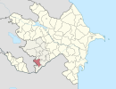
This is a list of the extreme points of Azerbaijan, the points that are farther north, south, east or west than any other location.

Pusztamérges is a village in Csongrád county, in the Southern Great Plain region of southern Hungary.
German submarine U-479 was a Type VIIC U-boat built for Nazi Germany's Kriegsmarine for service during World War II. She was laid down at the Deutsche Werke in Kiel on 19 November 1942 as yard number 310, launched on 14 August 1943 and was commissioned on 27 October 1943 with Oberleutnant zur See Hans-Joachim Förster, a Knights Cross winner, in command. He was replaced shortly afterwards by Oberleutnant Friedrich-Wilhelm Sons.

Esira is a town and commune in Madagascar, in the southern part of the island. It belongs to the district of Amboasary Sud, which is a part of Anosy Region. The population of the commune was estimated to be approximately 10,000 in 2001 commune census.

Bârsănești is a commune in Bacău County, Romania. It is composed of four villages: Albele, Bârsănești, Brătești and Caraclău.

Şuşulu is a village in the Shusha Rayon of Azerbaijan.
Qeybalı is a village in the Khojali Rayon of Azerbaijan.

Kijany is a village in the administrative district of Gmina Spiczyn, within Łęczna County, Lublin Voivodeship, in eastern Poland. It lies approximately 2 kilometres (1 mi) south of Spiczyn, 9 km (6 mi) north-west of Łęczna, and 17 km (11 mi) north-east of the regional capital Lublin.
Şükürlü is a village and municipality in the Jalilabad Rayon of Azerbaijan. It has a population of 385.
Bedağar is a village in the municipality of Qazma in the Balakan Rayon of Azerbaijan.
Hetovlar is a village in the municipality of Talalar in the Balakan Rayon of Azerbaijan.
Bəylər is a village and municipality in the Saatly Rayon of Azerbaijan. It has a population of 1,495.
Bảo Sơn is a commune (xã) and village in Lục Nam District, Bắc Giang Province, in northeastern Vietnam.
Mikekarácsonyfa is a village in Zala County, Hungary.
Sauaru is a village in Saaremaa Parish, Saare County in western Estonia.
Krasnaya Zarya is the name of several rural localities in Russia.
Kozmodemyansk is the name of several inhabited localities in Russia.