Uitenhage, officially renamed Kariega, is a South African town in the Eastern Cape Province. It is well known for the Volkswagen factory located there, which is the biggest car factory on the African continent. Along with the city of Port Elizabeth and the small town of Despatch, it forms the Nelson Mandela Bay Metropolitan Municipality.

The Nelson Mandela Bay Municipality is one of eight metropolitan municipalities in South Africa. It is located on the shores of Algoa Bay in the Eastern Cape province and comprises the city of Gqeberha, the nearby towns of Uitenhage and Despatch, and the surrounding rural area.

The R75 is a provincial route in Eastern Cape, South Africa that connects Graaff-Reinet with Gqeberha via Despatch, Kariega and Jansenville.

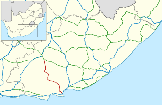
The R334 is a Regional Route in the Nelson Mandela Bay Metropolitan Municipality of South Africa that connects the N2 west of Gqeberha to the N2 at Coega north of Gqeberha via Uitenhage. The middle section of the route is also designated as the M20 metropolitan route.
The M19 is a metropolitan route in the Nelson Mandela Bay Municipality in South Africa that connects Swartkops with Uitenhage via Despatch.
The M10 is a metropolitan route in the Nelson Mandela Bay Municipality in South Africa that connects Gqeberha and Uitenhage.

Gqeberha, formerly known as Port Elizabeth and colloquially referred to as P.E., is a major seaport and the most populous city in the Eastern Cape province of South Africa. It is the seat of the Nelson Mandela Bay Metropolitan Municipality, South Africa's second-smallest metropolitan municipality by area. It is the sixth-most populous city in South Africa and is the cultural, economic and financial hub of the Eastern Cape.

The N2 is a national route in South Africa that runs from Cape Town through George, Gqeberha, East London, Mthatha, Port Shepstone and Durban to Ermelo. It is the main highway along the Indian Ocean coast of the country. Its current length of 2,255 kilometres (1,401 mi) makes it the longest numbered route in South Africa.
Despatch is a small town in the Eastern Cape Province of South Africa situated between Port Elizabeth and Uitenhage with an estimated population of 40 000. It forms part of the Nelson Mandela Bay Metropolitan Municipality which includes Port Elizabeth and Uitenhage, and has collectively a population of over 1.3 million.
iBhayi is a large township near Port Elizabeth, South Africa. It is the largest township in the Eastern Cape province and the ninth largest in South Africa after Mitchells Plain near Cape Town in the Western Cape.
Motherwell is a fast growing township in the Eastern Cape province of South Africa. It forms part of the Nelson Mandela Bay Metropolitan Municipality which is the metropolitan area comprising Gqeberha, Despatch, Uitenhage and other surrounding towns.
Swartkops is a village in Nelson Mandela Bay in the Eastern Cape province of South Africa.

Summerstrand is a seaside suburb of Port Elizabeth, South Africa. It is located 6 km (3.7 mi) south-east of the Port Elizabeth city centre. It is primarily a residential suburb along with shopping and business facilities. It is also home to three Nelson Mandela University campuses.

The M4 is a long metropolitan route in the City of Cape Town Metropolitan Municipality in South Africa. It connects the Cape Town CBD with the Cape of Good Hope via Wynberg, Muizenberg and Fish Hoek. Originally, it was the main route connecting the Cape Town CBD with the Southern Suburbs and is thus named Main Road for much of its length. From the CBD to Kirstenhof, it is parallel to the M3 Freeway.
The M18 road is a long metropolitan route in Gauteng, South Africa. It connects Pretoria with Thembisa via Centurion and Olifantsfontein.
The M6 road is a long metropolitan route in the City of Tshwane in Gauteng, South Africa. It connects Pretoria West with a rural area east of Pretoria via Pretoria CBD, Brooklyn, Lynnwood and Wapadrand.
The M2 road is a metropolitan route in the City of Tshwane in Gauteng, South Africa. It connects the N1 and N4 highways at the Proefplaas Interchange with Proclamation Hill via Hatfield, Pretoria CBD and Pretoria West.
The M7 road is a metropolitan route in the City of Tshwane in Gauteng, South Africa. It connects Proclamation Hill with Queenswood via Pretoria Industrial, Groenkloof, Brooklyn and Hatfield.
The M31 road is a metropolitan route in the City of Tshwane in Gauteng, South Africa. It connects the southern suburbs of Centurion, from the Rietvlei Nature Reserve to Rooihuiskraal via Irene and Highveld.
The M3 road is a short metropolitan route in the City of Tshwane in Gauteng, South Africa. It consists of only one road in the Pretoria CBD.


