Pawai, Nepal पावै | |
|---|---|
 | |
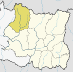
| Country | Nepal |
| Zone | Sagarmatha Zone |
| District | Solukhumbu District |
| Population (1991) | |
• Total | 2,180 |
| Time zone | UTC+5:45 (Nepal Time) |
Pawai, Nepal is a village development committee in Solukhumbu District in the Sagarmatha Zone of north-eastern Nepal. At the time of the 1991 Nepal census it had a population of 2180 people living in 425 individual households. [1]
It is mainly inhabitant by Rai, Sherpa, Gurung.