Macabu River

Last updated
Macabu River
Rio Macabu encachoeirado.jpg
Location
Country Brazil
Physical characteristics
Source 
  location Rio de Janeiro state

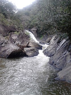
The Macabu River is a river of Rio de Janeiro state in southeastern Brazil.

See also

Related Research Articles

<span class="mw-page-title-main">Rio de Janeiro</span> Second-most populous city in Brazil

Rio de Janeiro, or simply Rio, is the capital of the state of the same name, Brazil's third most populous state, and the second most populous city in Brazil, after São Paulo. Listed by the GaWC as a beta global city, Rio de Janeiro is the sixth most populous city in the Americas. Part of the city has been designated as a World Heritage Site, named "Rio de Janeiro: Carioca Landscapes between the Mountain and the Sea", on 1 July 2012 as a Cultural Landscape.

<span class="mw-page-title-main">Rio de Janeiro (state)</span> State of Brazil

Rio de Janeiro is one of the 27 federative units of Brazil. It has the second largest economy of Brazil, with the largest being that of the state of São Paulo. The state, which has 8.2% of the Brazilian population, is responsible for 9.2% of the Brazilian GDP.

<span class="mw-page-title-main">Volta Redonda</span> Municipality in Southeast, Brazil

Volta Redonda is the name of a municipality in the Rio de Janeiro state of Brazil with an area of 182.81 km2, located from 350m to 707m above the sea level and with a population of 273,988 inhabitants. The area around the city has nearly 700,000 km2. Its name is due to the round shape of a curve in the Paraíba do Sul river around which the city was built.

<span class="mw-page-title-main">Estádio São Januário</span> Football stadium in Vasco da Gama, Rio de Janeiro, Brazil

Estádio Vasco da Gama, also known as Estádio São Januário, owing to its location on a street of the same name, is the home ground of Club de Regatas Vasco da Gama. Its facade is listed by the National Historical and Artistic Heritage.

<span class="mw-page-title-main">Southeast Region, Brazil</span> Region in Brazil

The Southeast Region of Brazil is composed of the states of Espírito Santo, Minas Gerais, Rio de Janeiro and São Paulo. It is the richest region of the country, responsible for approximately 60% of the Brazilian GDP, as São Paulo, Rio de Janeiro, and Minas Gerais are the three richest states of Brazil, the top three Brazilian states in terms of GDP. The Southeast of Brazil also has the highest GDP per capita among all Brazilian regions.

<span class="mw-page-title-main">Governador Valadares, Minas Gerais</span> Municipality in Minas Gerais, Brazil

Governador Valadares is a Brazilian municipality in the countryside of Minas Gerais. In 2020, its population was 281,046 inhabitants, thus being the ninth most populated city in the state. It is an economical axis of the middle valley of the Doce River, having a significant influence on the east and northeast portion of Minas Gerais and local authorities of the state of Espírito Santo. Governador Valadares sits on the bank of the Doce River, 324 km from Belo Horizonte, the state's capital. Governador Valadares has an area of about 2 342 km2, being only 58 km2 of urban area.

<span class="mw-page-title-main">Nova Iguaçu</span> Municipality in Southeast, Brazil

Nova Iguaçu is a municipality in Rio de Janeiro state in Brazil.

<span class="mw-page-title-main">Campos dos Goytacazes</span> Municipality in Southeast, Brazil

Campos dos Goytacazes is a municipality located in the northern region of Rio de Janeiro State, Brazil, with a population of 471,737 inhabitants.

<span class="mw-page-title-main">Espera Feliz</span> Brazilian municipality in the state of Minas Gerais

Espera Feliz is a municipality in southeastern Minas Gerais state, Brazil. The altitude is 2,430 m above sea level. Located at 20°39′00″S41°54′25″W, its neighboring cities are Caiana to the south, Dores do Rio Preto to the east, Divino to the west, Alto Caparaó and Caparaó to the north and Carangola to the southwest.

<span class="mw-page-title-main">Baixada Fluminense</span>

The Baixada Fluminense is a region in the state of Rio de Janeiro, in southeastern Brazil. It is located on Guanabara Bay, between Rio de Janeiro to the south and the Serra dos Órgãos range of hills to the north.

Rio Negro is a municipality located in the Brazilian state of Mato Grosso do Sul. Its population was 4,793 (2020) and its area is 1,808 km².

<span class="mw-page-title-main">Bom Jesus do Itabapoana</span> Municipality in Southeast, Brazil

Bom Jesus do Itabapoana is a municipality in the Brazilian state of Rio de Janeiro. It had a population of 37,203 as of 2020, and has an area of 598,8 km2. It was founded in 1939, after being separated from the municipality of Itaperuna.

<span class="mw-page-title-main">Federal Rural University of Rio de Janeiro</span>

The Federal Rural University of Rio de Janeiro is a public university located in Seropédica in the State of Rio de Janeiro, Brazil. It possesses the largest campus among Latin American universities and is known for being the first university to offer agriculture related courses in Brazil.

<span class="mw-page-title-main">Carangola River</span> River in Brazil

The Carangola River is a river of Minas Gerais and Rio de Janeiro states in southeastern Brazil.

The Bela Joana River is a river of Rio de Janeiro state in southeastern Brazil.

The Dois Rios River is a river of Rio de Janeiro state in southeastern Brazil.

The Imboacica River is a river of Rio de Janeiro state in southeastern Brazil.

The Macabuzinho River is a river of Rio de Janeiro state in southeastern Brazil.

Presidente Dutra is a municipality in the state of Bahia in the North-East region of Brazil.

References

Coordinates: 21°59′13″S41°26′18″W / 21.98694°S 41.43833°W / -21.98694; -41.43833