Maharaja Agrasen College is a college of the University of Delhi, located in Vasundhara Enclave, National Capital Region of Delhi.

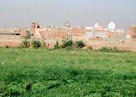
Agroha is a town in Haryana state of northern India. It is situated in Hisar district in between Hisar city and Fatehabad on NH 09. Ancient structures, pot-shards, coins and seals have been found in archaeological excavations at the Agroha Mound. The Agrawal and Agrahari communities claim origin from Agroha. According to their legends, Agroha was the capital of their founder Agrasena.

University College of Medical Sciences (UCMS) is a medical college in Delhi, India, affiliated with the University of Delhi. It is associated with Guru Teg Bahadur Hospital, which serves as the teaching hospital.

Agrasen ki Baoli, designated a protected monument by the Archaeological Survey of India (ASI) under the Ancient Monuments and Archaeological Sites and Remains Act of 1958, is a 60-meter long and 15-meter wide historical step well on Hailey Road near Connaught Place, Jantar Mantar in New Delhi, India. Although there are no known historical records to prove who built Agrasen ki Baoli, it is believed that it was originally built by the legendary king Agrasen, and rebuilt in the 14th century by the Agrawal community which traces its origin to Maharaja Agrasen. The Baoli is open for all days of the weeks. The visiting time to the baoli is 9 AM to 5 PM.

Kalsia was a princely state in Punjab, British India, one of the former Cis-Sutlej states. It was founded by Maharaja Gurbaksh Singh Sandhu in 1760. After India's independence, it was included in PEPSU and later in the Indian East Punjab after the States Reorganisation Act, 1956. The area of Kalsia is now located in the modern day Indian states of Punjab and Haryana. In 1940 the population of Kalsia was 67,393.
Maharaja Agrasen Hospital is a hospital in Bangalore, India, situated in 15 Main, 17 Cross, Padmanabhanagar, South Bangalore - 560070.
Maharaja Agrasen Hospital may refer to:

Padmanabhanagar is a residential locality in Bangalore, India, covering an area of 1.68 km2 It's one of the zones of BBMP. It is situated in the south of the city, very close to the highway leading to Kanakapura. It is surrounded by Kumaraswamy Layout, Gowdanapalya, Chennamanakere, Kathriguppe, Kadirenahalli, Uttarahalli and Chikkakalasandra.

Faridkot State was a self-governing princely state outside British India during the British Raj period in the Indian sub-continent. Patiala was one of the Phulkian States.It was a Brar Jat sikh state. It was one of the princely states which immediately merged with Independent India.

Maharaja Agrasen Institute of Technology (MAIT) is a private engineering college, located in Rohini, Delhi, India. Established in 1999 by Maharaja Agrasen Technical Education Society, the institute is approved by AICTE and affiliated to Guru Gobind Singh Indraprastha University.
Agrawal P.G. College is a college in Jaipur city of Rajasthan state in India, offering undergraduate and postgraduate courses. It is managed by Shri Agrawal Shiksha Samiti. The college is situated at Agrasen Katla, Maharaja Agrasen Marg, Agra Road Jaipur.

Palam is a major suburb and residential colony in South West Delhi. The Indira Gandhi International Airport, formerly known as Palam Airport, the main airport of National Capital Region is situated here. It is one of 70 Vidhan Sabha constituencies of the Delhi National Capital Territory in northern India.
Kuchchal or Kuchchhal or Kuchhal is an Indian clan of the Rajvanshi and Agrawal community. Agrasen established 18 Gotras for each of his 18 Ganadhipati based on the names of their Guru and divided his empire among them.
Nand Kishore Garg is a senior social worker and was MLA of Delhi from Trinagar constituency. He is a National Executive of Bhartiya Janta Party.

Maharaja Agrasen University is a private university located at the HIMUDA Education Hub, near the village Kallujhanda, Solan district, Himachal Pradesh, India. It was founded by Nand Kishore Garg in the town of Barotiwala in 2013. Maharaja Agrasen University was inaugurated by Shri Pranab Mukherjee, President of India on 25 May 2013. The university established under Maharaja Agrasen Act, 2012 is in the picturesque backdrop of Kasauli Hills.
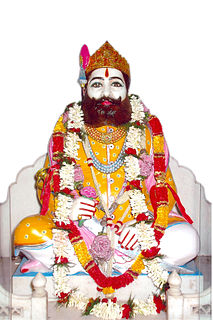
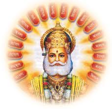
Agrasen Jayanti is the birth anniversary celebrations of a legendary Hindu king Agrasen Maharaj. He was king of Agroha, and it was from him that Agrawal originated. Agrasen Jayanti is observed on the fourth day of Ashwin month of Hindu calendar.
Ram Niwas Goel is an Indian politician who has been a member of the Delhi Legislative Assembly since 2015. He is a member of the Aam Aadmi Party and represents the Shahdara constituency of Delhi & Currently is a Speaker of Sixth Legislative Assembly of Delhi since 2015