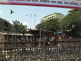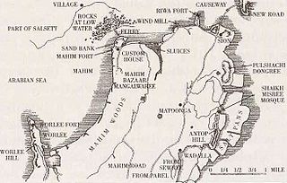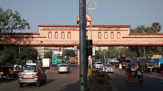
Dadar ([d̪aːd̪əɾ]) is a densely populated residential and shopping neighbourhood in Mumbai. It is also a prominent railway and bus service hub with local and national connectivity. Dadar holds the distinction of being Mumbai’s first planned area and it is also a hub for the city's Marathi culture. It includes the Dadar West area.
Matunga is a locality in the heart of Mumbai City towards downtown Mumbai. It is serviced by the Matunga Road station on the Western line, Matunga station on the Central Line and King's Circle station on the Harbour Line.

Kurla is a suburb of East Mumbai, India. It is the headquarters of the Kurla taluka of Mumbai Suburban district. The neighbourhood is named after the eponymous East Indian village that it grew out of. It falls under Zone 5, Ward 'L' of the Bombay Municipal Corporation. Its railway station, spelt as Coorla until 1890, is one of the busiest on the Mumbai suburban railway on the central and harbour railway lines of Mumbai as is the Lokmanya Tilak Terminus (LTT) for out-station passenger/express trains.

Sewri is a locality along the eastern edge of South Mumbai, in Maharashtra, India. It is also the name of a railway station on the Central Railway Harbour Line.
Byculla is an area of South Mumbai.

Wadala is a neighborhood in Mumbai. Wadala Road is a station on the Harbour Line of Mumbai's railway network.

Maharastra State Highway 42, commonly referred to as Ghodbunder Road or G.B. Road, runs entirely through the district of Thane. It is one of the major roads leading out of Thane city and connects to the Eastern Express Highway coming from south at Kapurbawdi, which later becomes National Highway 3 at this junction travels North-East. It also connects to the Western Express Highway coming from south at Ghodbunder village, which later becomes National Highway 8 at this junction traveling North-ward's towards Gujarat.

New Panvel is a residential, commercial and educational node of Navi Mumbai, Maharashtra and comes under the Konkan division. New Panvel was developed on marshy land and was previously a Mango cultivated area. New Panvel is divided into two parts: New Panvel (E), on the eastern side of Panvel railway station and Khanda Colony or New Panvel (W) on the western side of it. Both parts of New Panvel are connected by a flyover bridge also known as Khanda Colony Flyover. New Panvel (W) is also popularly called Khanda Colony by the local villagers, as the city is adjacent to two small villages Dhakta Khanda and Motha Khanda.

The Bandra Kurla Complex is a business and residential district in the city of Mumbai, India. It is a prominent upscale commercial hub which commands some of the highest property rates in the country. According to MMRDA, the complex is the first of a series of "growth centres" created to "arrest further concentration" of offices and commercial activities in eastern parts of Mumbai. It has aided to decongest the CBD in South Mumbai while seeding new areas of planned commercial real estate in the metropolitan region.

The Sion Hillock Fort is a fort in Mumbai (Bombay), India. It was built under the regime of the English East India Company, between 1669 and 1677, atop a conical hillock when Gerard Aungier was the Governor of Bombay. It was notified in 1925 as a Grade I Heritage structure. When it was built, the fort marked the boundary between British-held Parel island and the Portuguese held Salsette Island that lay to the north across the creek.

Seawoods–Darave or simply Seawoods is a newly developed railway station on the Harbour line of the Mumbai Suburban Railway and is a sub-node in Nerul node. The railway station derives its name from the famous Seawoods NRI complex developed by CIDCO especially for high income and economically well to do groups. The area has developed rapidly in recent years compared to any other nodes in Navi Mumbai due to its strategic location, having Vashi, Mumbai & Thane towards its north and Ulwe, Uran, JNPT & upcoming international airport towards is south and CBD Belapur, Kharghar & Panvel towards its east. The station is located adjacent to Sector 40 & 42, few kilometers away from Seawoods NRI complex.

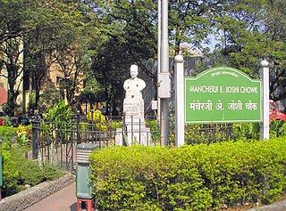
Dadar Parsi Colony is an upper class Parsi colony in midtown South Mumbai. It is situated in the locality of Dadar-Matunga. Unlike the other Parsi colonies it is not surrounded by a wall or fence and is not isolated from its surroundings. The colony houses the famous Five Gardens created by Mancherji Joshi, a renowned Parsi.

The Chatrapati Shivaji Maharaj Park Residential Zone is a precinct consisting of 187 residential buildings that were built as part of the Chatrapati Shivaji Maharaj Park scheme in Dadar, Mumbai. Most of the buildings in this residential locality were constructed in the early 1900s during British colonial rule in India, as a result of which many buildings here exhibit aspects of British architecture.
Park is considered an upscale real estate cluster in Mumbai, and for long has been considered to be a desirable locality particularly among the Maharashtrian community, with numerous prominent Marathi personalities such as Madhav Manohar, Veer Savarkar and Bal Thackeray having resided here. It is also home to the Kataria Colony, locally known as Sindhi colony, which houses Bhagnari people of Balochi descent.

The Eastern Express Highway, abbreviated to EEH, is a 23.55 km (14.63 mi) city express highway serving the cities of Mumbai and Thane. It is one of the busiest and most important roads in the Mumbai Metropolitan Area and is a part of the National Highway 48. It is a north–south artery of Mumbai connecting the city proper to the eastern suburbs and to the metropolitan area of Thane. For most of its course, it is 6 lanes wide with over a dozen flyovers/grade separators.
The Sion Panvel Expressway is a 25 km Indian highway located entirely in the state of Maharashtra, that connects Sion in Mumbai with Panvel, via Navi Mumbai. It is one of the busiest and most important roads in the Mumbai Metropolitan Region (MMR) and connects Mumbai with the city of Pune. The National Highway 4 and Mumbai-Pune Expressway begin at the eastern end of the expressway, at Kalamboli junction, near Panvel. The highway is also used by vehicles traveling towards Mumbai from Konkan and Goa.
Kannamwar Nagar is a locality situated in Vikhroli east, on eastern express highway. Kannamwar Nagar is on the eastern side of the Vikhroli railway station and is known for buildings built by MHADA. It is considered as one of the biggest housing colonies in India and one of the biggest workers housing colonies in Asia.

King's Circle is a railway station on the Harbour line of the Mumbai Suburban Railway network. King's Circle and Matunga stations are next to each other albeit the latter is on the Central line. It is named after the King's Circle Park, which was named after George V, the King-Emperor. The trains passing through King's Circle station are only the ones going to Bandra, Andheri and Goregaon from CSMT or Panvel and vice versa.

Lal Bahadur Shastri Marg, commonly known by its abbreviation LBS Marg, is a 21 km long, major arterial road connecting the neighbouring city of Thane with Sion in Mumbai. It passes through heavily populated areas of the Eastern Suburbs in Mumbai and is heavily congested. Approximately, 3 lakh vehicles use this road daily. The road is named after Lal Bahadur Shastri, the second Prime Minister of India.
Kherwadi is a middle class, developing neighborhood, situated on the eastern side of Bandra railway station, Mumbai. Its name is derived from the first chief minister of Bombay State, B. G. Kher. It is surrounded by the CBD of BKC to the east, Mahim to the south, Khar to the north and S.V. Road to the west. It is well connected to all the parts of Mumbai, Navi Mumbai and Thane. Western Expressway passes through Kherwadi junction, a signal intersection situated in Kherwadi.


