
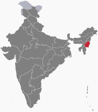
Manipur is a state in northeast India, with the city of Imphal as its capital. It is bounded by the Indian states of Nagaland to the north, Mizoram to the south and Assam to the west. It also borders two regions of Myanmar, Sagaing Region to the east and Chin State to the south. The state covers an area of 22,327 km2 (8,621 sq mi). The official and most widely spoken language is the Meitei language. Native to the Meitei people, it is also used as a lingua franca by smaller communities, who speak a variety of other Tibeto-Burman languages. Manipur has been at the crossroads of Asian economic and cultural exchange for more than 2,500 years. This exchange connects the Indian subcontinent and Central Asia to Southeast Asia, East Asia, Siberia, regions in the Arctic, Micronesia and Polynesia enabling migration of people, cultures and religions.

Imphal is the capital city of the Indian state of Manipur. It is the second largest city in Northeast India after Guwahati. The metropolitan centre of the city contains the ruins of Kangla Palace, the royal seat of the former Kingdom of Manipur, surrounded by a moat. Spread over parts of the districts of Imphal West and Imphal East, the former contains the majority of the city's area and population. Imphal is part of the Smart Cities Mission under the Ministry of Housing and Urban Affairs. Being a mega commercial hub, Imphal is known for its weaving, brass-ware, bronze-ware, and other cottage industries. Meitei language is the most widely spoken language in the city.
Kakching is a town in the southeastern part of the Indian state of Manipur. It serves as the headquarters of Kakching district and is a major commercial hub in the state. In 2018, Kakching was declared as the cleanest city in North East India by the Swachh Bharat Mission of the Indian government.
Nambol is a Town of Manipur, India. It Stretches across one of the major heartline of Highway Known as Tiddim Road.The General functionalities are under administration of Nambol municipal council Most part of Nambol comes under Bishnupur district, While some parts of Nambol belongs to Imphal west District. Nambol as a whole is known to be a Sub- Division. Nambol is one of the educational hubs of Bishnupur district as well as of Manipur. Its market, known as Nambol Bazaar is the second most busiest market, after Khwairamband Bazaar( also known as 'IMA market' ) in Manipur. It is Famous for the local snacks known as Nambol Bora.It is also the birth place of Lairenjam Dhanashyam.
Ningthoukhong is a town and a Municipal Council having 14 wards in Bishnupur district in the Indian state of Manipur.
The Imphal River, also known as the Turel Achouba, is a major river in Manipur state, northeastern India which originates from the northern side of Kangpokpi district. It is a tributary of the Manipur River, joining it in Thoubal district. It flows past Loktak Lake and the city of Imphal and joins the Lilong River, some 10 kilometres (6.2 mi) to the south. It flows towards Myanmar (Burma), marking the end point at 23°59'49.2"N 93°44'29.7"E. It then goes south meeting Myittha River at 22°53'24.19"N, 94° 5'1.79"E. Myittha river flows towards north and meets Chindwin River at 23°11'36.82"N, 94°18'38.28"E. Chindwin river then meets Irrawaddy River at 21°25'23.85"N, 95°16'47.56"E. Irrawaddy river then flows south till it ends at Andaman Sea, adjoining the Bay of Bengal and thereby connecting Imphal city to the sea. Imphal River was used by Japanese soldiers in boats to reach Imphal in World War II.

The Manipur Kingdom was an ancient kingdom at the India–Burma frontier. Historically, Manipur was an independent kingdom ruled by a Meitei dynasty. But it was also invaded and ruled over by Burmese kingdom at various point of time. It became a protectorate of the British East India Company from 1824, and a princely state of British Raj in 1891. It bordered Assam Province in the west and British Burma in the east, and in the 20th century covered an area of 22,327 square kilometres and contained 467 villages. The capital of the state was Imphal.
The Insurgency in Manipur is an ongoing armed conflict between India and a number of separatist rebel groups, taking place in the state of Manipur. The Insurgency in Manipur is part of the wider Insurgency in Northeast India; it displays elements of a national liberation war as well as an ethnic conflict.
The Sacred Jackfruit Tree is a historical site in the Indian state of Manipur where a jackfruit tree growing on the small hill of Kaina was used to carve images of Hindu god Krishna. Rajarshi Bhagya Chandra, earlier known as Shree Jai Singh Maharaja, the King of Manipur in the 18th century, had a dream in which he received instructions from Krishna to carve His images from this tree. Accordingly, seven images of Krishna were carved from the jackfruit tree and installed in various temples in Manipur and in the neighboring state of Assam. One such temple is the Shree Govindajee Temple at Imphal.
The following outline is provided as an overview of and topical guide to Manipur:
Thangjing Hill , is a mountain peak in the Indian state of Manipur. It is in the Churachandpur district, to the west of Moirang. The north-south-running mountain range on which it sits is also called Thangjing range or Thangjing Hills. The range forms part of the western border of the Imphal Valley.
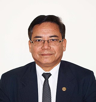
Thangjam Dhabali Singh is an Indian pathologist, entrepreneur and the chairman and managing director of BABINA Healthcare and Hospitality Industries Pvt Ltd, a company based in Imphal, Manipur with business activities in healthcare and hospitality industry. The government of Japan conferred to him the Order of the Rising Sun, Gold and Silver Rays 2020 for his work on the promotion of ties between India and Japan.

My Japanese Niece is a 2015 Japanese-Meitei bilingual film, directed by Mohen Naorem. It stars Junichi Kajioka and Yu Asada in lead roles.
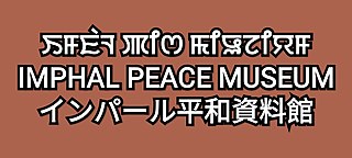
The Imphal Peace Museum (IPM) (Meitei: Imphal Aying-Achik Pukei Lankei Shanglen, Japanese: インパール平和資料館, romanized: Inpāru heiwa shiryōkan) is a World War II museum at the foothills of the Red Hills (Maibam Lokpa Ching) in Manipur, India. It is a living memory of the Battle of Imphal (Anglo-Japanese war) and other World War II battles (March–July 1944) fought in Manipur. It is supported by the non profit grant making Nippon Foundation (TNF), collaborating with the Manipur Tourism Forum and the Government of Manipur. Notably, in a poll conducted by the British National Army Museum, the Battle of Imphal and Kohima was bestowed as Britain's Greatest Battle.

The Manipur State Museum is an institution displaying a collection of artistic, cultural, historical and scientific artefacts and relics in Imphal, Manipur, India. It has galleries housing materials of natural history, ethnology and archeology.
The Nongmaiching Ching, also known as the Selloi Langmai Ching, is a mountain in Imphal Valley, Manipur. It has an altitude of around 5,133 feet (1,565 m). It is a holy pilgrimage site for the Meitei people. In Meitei mythology and religion (Sanamahism), it is a sacred mountain and the abode of God Nongpok Ningthou and Goddess Panthoibi. In Meitei folklore, the Nongmaiching is described as the hill that produces "the seven days of a week".

The Lainingthou Sanamahi Temple Board (LSTB) is a temple development board of the Lainingthou Sanamahi Temple, Haying Khongban Uphong Yumpham, Imphal West district of Kangleipak (Meitei for 'Manipur'). It is dedicated not only to God Lainingthou Sanamahi and Goddess Leimarel Sidabi of Sanamahism, but also to the other ancient Meitei gods and goddesses of the traditional Meitei religion.

Japanese people and Meitei people have a long history of sharing and interacting with each other's art and cultural heritages, including but not limited to cinema, music, mythology, language, literature and theatre.