Franconia Notch State Park is located in the White Mountains in northern New Hampshire, United States, and straddles 8 miles (13 km) of Interstate 93 as it passes through Franconia Notch, a mountain pass between the Kinsman Range and Franconia Range. Attractions in the state park include the Flume Gorge and visitor center, the Old Man of the Mountain historical site, fishing in Echo Lake and Profile Lake, and miles of hiking, biking and ski trails. The northern part of the park, including Cannon Mountain and Echo and Profile lakes, is in the town of Franconia, and the southern part, including Lonesome Lake and the Flume, is in Lincoln.
The Western Maine Mountains region spans most of Maine's western border with New Hampshire. A small part of the scenic White Mountain National Forest is located in this area. This is essentially all of Oxford County, Androscoggin and northern Franklin, York and Cumberland Counties. The largest cities in the region are Lewiston and Auburn. Notable towns include Bethel, Bridgton, Oxford, Rangeley, and Rumford. Many of the state's highest peaks are located in the region, although the highest, Mount Katahdin, is not.

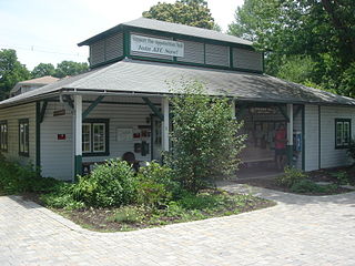
The Appalachian Trail Conservancy (ATC) is a nonprofit organization dedicated to the conservation of the Appalachian Trail, a route in the eastern United States that runs from Maine to Georgia. Founded in 1925, the ATC works to protect the trail's 2,190 miles (3,520 km), 250,000 acre (1,000 km²) greenway, and coordinates the work of some thirty hiking clubs performing trail maintenance.

Glencliff is an unincorporated community within the White Mountain National Forest in the town of Warren in Grafton County, New Hampshire, United States. The village consists of fewer than one hundred residents and some forty man-made structures, including the Willing Workers Hall, the Glencliff Community Chapel, the old firefighter's garage, the Glencliff Improvement Cooperative, the post office and the Glencliff Home for the Elderly.
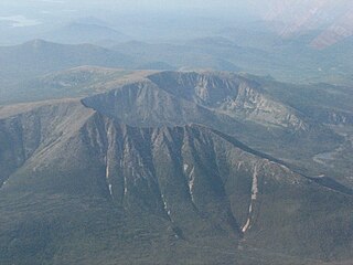
The Mahoosuc Range, a northern extension of the White Mountains, straddles the border between New Hampshire and Maine. The range's highest peak, 4,170 feet (1,270 m) Old Speck Mountain, is the fourth-highest peak in Maine. Substantial parts of the range are publicly owned as parts of the National Park Service Appalachian Trail corridor and Grafton Notch State Park in Maine.
The Appalachian National Scenic Trail spans fourteen U.S. states during its roughly 2,200 miles (3,500 km)-long journey: Georgia, North Carolina, Tennessee, Virginia, West Virginia, Maryland, Pennsylvania, New Jersey, New York, Connecticut, Massachusetts, Vermont, New Hampshire, and Maine. It begins at Springer Mountain, Georgia, and follows the ridgeline of the Appalachian Mountains, crossing many of its highest peaks and running with only a few exceptions almost continuously through wilderness before ending at Mount Katahdin, Maine.

Wildcat Mountain is a mountain located in Coos County, northern New Hampshire, United States. The mountain is part of the Carter-Moriah Range of the White Mountains, on the east side of Pinkham Notch. Wildcat Mountain faces Carter Dome across Carter Notch to the northeast, and Mount Washington across Pinkham Notch to the west.

Mount Carrigain is a mountain located in Grafton County, New Hampshire. The mountain is named after Phillip Carrigain, NH Secretary of State (1805–10), and is on the south side of the Pemigewasset Wilderness, the source of the East Branch of the Pemigewasset River in the heart of the White Mountains, between Franconia Notch and Crawford Notch. Carrigain is flanked to the northeast beyond Carrigain's Vose Spur by Mount Anderson and Mount Lowell across Carrigain Notch, and to the southwest by Mount Hancock. It has a fire tower at the summit, providing 360 degree views of the surrounding wilderness.

Sunday River Whitecap is a 3,335 ft (1,017 m) mountain located in Oxford County, Maine, United States. It is flanked to the west by Slide Mountain, and to the southeast by Stowe Mountain.

Mount Zealand, or Zealand Mountain, is a mountain located in the White Mountains, in Grafton County, New Hampshire. Zealand stands on a spur ridge northeast of Mount Guyot, and facing Whitewall Mountain to the east across Zealand Notch.

Mount Garfield is a mountain located in Grafton County, New Hampshire. The mountain is part of the White Mountains. Mt. Garfield is flanked to the east by South Twin Mountain, and to the southwest along Garfield Ridge by Mount Lafayette.

Galehead Mountain is a mountain located in Grafton County, New Hampshire. The mountain is part of the Twin Range of the White Mountains. Galehead is flanked to the east by South Twin Mountain, and to the west by Mount Garfield. The summit is reached by the Frost Trail which departs from Galehead Hut. There are several ways to reach the hut from one's car, the Gale River Trail from the northwest being the most direct.

Old Speck Mountain, also known as Old Speckle Mountain, is a mountain located in Oxford County, Maine, United States. The mountain, the fourth-highest in the state, is the northeasternmost and highest of the Mahoosuc Range, the northeasternmost part of the White Mountains. Old Speck is flanked to the southwest by Mahoosuc Arm, and faces Baldpate Mountain to the northeast across Grafton Notch.

Baldpate Mountain is a mountain located in Oxford County, Maine. Baldpate has two prominent peaks; West Peak has 3,662 feet (1,116 m) of elevation, and stands 222 feet (68 m) above the col between them.

Puzzle Mountain is a mountain located in Oxford County, Maine, and is one of the easternmost mountains in the Mahoosuc Range. The mountain also has a false peak to the north-northwest of the true summit, known as Little Puzzle Mountain. Puzzle Mountain is in the watershed of the Androscoggin River.

Grafton Notch State Park is a public recreation area in Grafton Township, Oxford County, Maine. The state park occupies 3,129 acres (1,266 ha) surrounding Grafton Notch, the mountain pass between Old Speck Mountain and Baldpate Mountain. The park is abutted by the eastern and western sections of the Mahoosuc Public Reserved Land, which total 31,807 acres (12,872 ha). The park is managed by the Department of Agriculture, Conservation and Forestry.

The Kinsman Range, also known as the Cannon–Kinsman Range, is located in the White Mountains of New Hampshire in the United States. The highest point in the north-south range is 4,358-foot-high (1,328 m) Kinsman Mountain, followed by the 4,293-foot (1,309 m) North Peak of Kinsman, and 4,080-foot (1,240 m) Cannon Mountain, one of the richest in rock climbing routes in the Whites. All are official "Four-thousand footers". 3,478-foot (1,060 m) Mount Wolf is on the crest of the range south of Kinsman Mountain. Rounding out the range is 2,470-foot (750 m) Bald Peak on the west side of Kinsman Mountain.


